Showing most recent first, in descending order
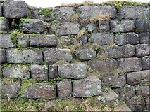
3 images in cluster Wall in SD9527
Image clustering - assigning images labels - is an automated process, based on the image title/description. It's not totally accurate, and can sometimes assign images to odd clusters
in SD9527, near Blackshaw Head
Explore these images in the Browser or Explore matching images including in surrounding squares (if any!)
Other Automatic clusters in SD9527
- Landcover: Improved grassland
- Badger Lane
- Hippins Bridge
- Blackshaw Head Methodist Church
- Landcover: Suburban
- Badger Lane and Old Shaw Lane
- Blackshaw Head Chapel
- Road Junction
- Grade II Listed
- Landcover: Acid grassland
- Hippins Clough
- Milestone
- Stone Bridge
- Landcover: Heather grassland
- Methodist Chapel
- Hebden Bridge
- Hamer Cottage
- Shoulder of Mutton
- Dated 1770
- Doorway
- East
- Farm
- Wall
- Elizabeth II Postbox on the Long Causeway
- North
- Grazing
- Calderdale Way