Showing most recent first, in descending order
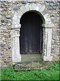
2 images in cluster Wall of St Oswald's Church in TR1939
Image clustering - assigning images labels - is an automated process, based on the image title/description. It's not totally accurate, and can sometimes assign images to odd clusters
in TR1939, near Arpinge, taken Sunday, 7 September, 2008, by Nick Smith
Explore these images in the Browser or Explore matching images including in surrounding squares (if any!)
All images  © Nick Smith and licensed for reuse under this Creative Commons Licence
Other Automatic clusters in TR1939
- Road
- St Oswald's Church
- Cat Custard Pot
- Farm Outbuildings
- Parsonage Farm
- Lane
- Path Leading to Paddlesworth
- Farm does not Feature on the Website
- Near Arpinge
- Looking
- Paddlesworth Village Sign
- Footpath
- Field
- Wall
- Small
- Sea
- Location
- Junction
- Highest Pub in Kent
- Highest Church in Kent
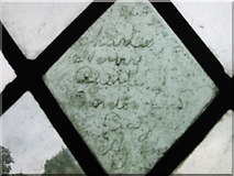
- Font
- Distance
- Cheriton Hill
- Wall of St Oswald's Church