|
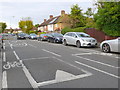
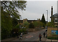
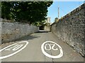
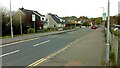
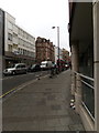
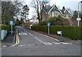
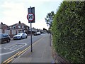
Speed Bumps, Douglas Rd
by Nigel Mykura
geograph for square TQ1968
This view north up Douglas Road from close to its junction with King Henry Road... (more)
|
|
Brownlow Road, N11
by Christopher Hilton
geograph for square TQ3091
|
|
Beech Croft Road and Baptist Church, North Oxford
by Christopher Hilton
geograph for square SP5008
|
|
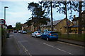
Moreton Road, North Oxford
by Christopher Hilton
geograph for square SP5008
|
|
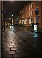
Cambridge: Bateman Street
by Christopher Hilton
geograph for square TL4557
Seen from the top deck of a bus heading out to the Trumpington Park and Ride.
|
|
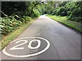
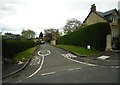
Temporary road closure on High Street, Glinton
by Paul Bryan
geograph for square TF1505
High Street in Glinton was temporarily closed near the post office and Nisa... (more)
|
|
The drive to Newstead Abbey
by David Lally
geograph for square SK5454
Rising up through Swinecotte Dale. The driver of the car in the distance had,... (more)
|
|
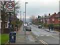
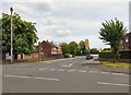
Looking down Clarence Avenue from Kings Avenue
by Christopher Hilton
geograph for square TQ3074
|
|
Oakengates town centre, from the railway
by Christopher Hilton
geograph for square SJ6910
|
|
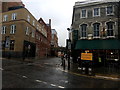
Camden High Street
by Malc McDonald
geograph for square TQ2983
Camden High Street is a one-way street. Road markings indicate that a 20mph... (more)
|
|
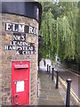
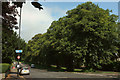
Elm Row, Hampstead, NW3
by Christopher Hilton
geograph for square TQ2686
|
|
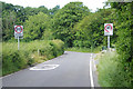
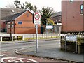
Oliver Meadows
by Humphrey Bolton
geograph for square SE1121
The council is short of money, and yet has put up 20 mph speed limit signs at... (more)
|
|
Clifton Drive, Blacon
by Stephen McKay
geograph for square SJ3867
Despite giving the appearance of a country lane, Clifton Drive connects busy... (more)
|
|
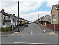
St Lawrence Road
by Gerald England
geograph for square SJ9295
Off Stockport Road. In an effort to discourage motorists using it as a... (more)
|
|
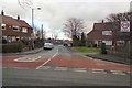
Manor Road
by Gerald England
geograph for square SJ9394
Leading to the St John Fisher RC Primary School.
|
|
20 20 on Kirk Street
by Richard Sutcliffe
geograph for square NS9886
There is a 20MPH speed limit on Kirk Street. The tall wall on the right runs... (more)
|
|
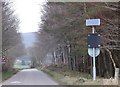
Tullichewan Road, Balloch
by Stephen Armstrong
geograph for square NS3981
Twenty's Plenty. The railway station is down to the right.
|
|
Thornley Lane South
by Gerald England
geograph for square SJ8994
Leading to Dane Bank Primary School (formerly Cromwell Special School).
|
|
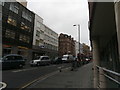
Looking along Warner Street. Clerkenwell
by Christopher Hilton
geograph for square TQ3182
Warner Street, running along the bottom of a valley, marks the line of the... (more)
|
|
Clerkenwell Road, looking west from the Farringdon Road crossroads
by Christopher Hilton
geograph for square TQ3182
|
|
Clerkenwell Road, looking west from the Farringdon Road crossroads
by Christopher Hilton
geograph for square TQ3182
|
|
Approach to Crathes School
by Stanley Howe
geograph for square NO7398
On a minor road from the south. Solar-powered speed restriction sign may be... (more)
|
|
Signs at the end of Osborne Road
by Gerald England
geograph for square SJ9594
At the junction with Stockport Road. Zion Congregational Church is opposite.
|
|
Pencoed Avenue, Cefn Fforest, Blackwood
by Jaggery
geograph for square ST1697
Looking north across Waun Borfa Road.
|
|
Craigmillar Avenue
by Richard Sutcliffe
geograph for square NS5575
A private road - residents access only. At the junction with Tannoch Drive.
|
|
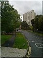
Allander Road
by Richard Sutcliffe
geograph for square NS5574
|
|
Woodlands Street
by Richard Sutcliffe
geograph for square NS5574
Living up to its name, with plenty of trees in evidence.
|
|
No Through Road
by Richard Sutcliffe
geograph for square NS5574
Barloch Road is a short straight road off Baldernock Road, serving just a few houses.
|
|
Harcombe Road
by Gerald England
geograph for square SJ8592
|
|
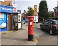
GR Postbox (FY4 264D)
by Gerald England
geograph for square SD3433
On the corner of Branstree Road and Langdale Road, Mereside.
|
|
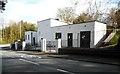
Electricity Sub-station
by Richard Sutcliffe
geograph for square NS5572
At the junction of Kilmardinny Avenue and Milngavie Road. The building was... (more)
|
|
GR Postbox (SK5 251)
by Gerald England
geograph for square SJ8992
|
|
Gloucester Street, Bristol
by Derek Harper
geograph for square ST5973
A short street connecting Newfoundland Street and Brunswick Square. One of at... (more)
|
|
Drapers, Earl Street
by E Gammie
geograph for square SP3378
The attractively designed building which formerly housed a restaurant known as... (more)
|
|
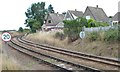
The railway line to Lowestoft
by Christine Johnstone
geograph for square TG4202
Curving round the west side of the former Reedham triangle.
|
|
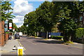
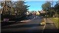
Hobson Road junction with Banbury Road
by Roger Templeman
geograph for square SP5009
|
|
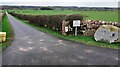
Entrance road to Holme View, Plumpton Hall and The Mill from west side of A6
by Roger Templeman
for square NY4935
|
|
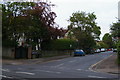
Redland Grove
by Derek Harper
geograph for square ST5874
At the crossroads with Kensington Road (left) and South Road. On the right,... (more)
|
|
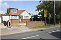
#25 Silverdale Road
by Roger Templeman
geograph for square SU7571
|