Public Tags
Tag: 30·Mph·Sign
Showing latest 50 of 130 images tagged with 30 Mph Sign tag.
|
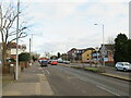
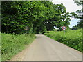
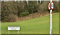
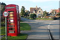
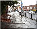
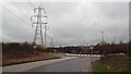
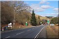
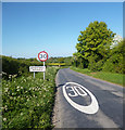
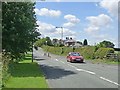
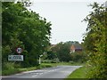
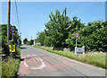
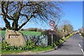
Moor Lane, Chessington
by Malc McDonald geograph for square TQ1864 Moor Lane is a dual-carriageway in Chessington, in the outer suburbs of south... (more)
Tags:
30 Mph Sign
30 Mph SignsX
30 Mph Speed Limit SignX
30 Mph Speed Limit SignsX
30mph LimitX
road sign:30mph Speed LimitX
30mph Speed Limit SignsX
place:ChessingtonX
Dual CarriagewayX
road:Dual CarriagewayX
Dual Carriageway RoadX
type:GeographX
Road Signs 30mphX
top:Roads, Road TransportX
place:South West LondonX
Speed Limit 30mphX
Start of the 30mph Speed LimitX
subject:SuburbX
SuburbX
top:Suburb, Urban FringeX
Suburban RoadX
|
|
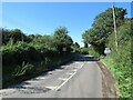
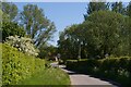
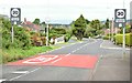
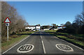
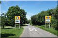
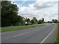
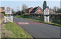
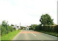
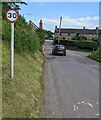
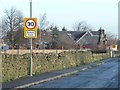
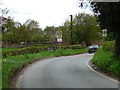
Eynsford Road, near Crockenhill
by Malc McDonald geograph for square TQ5167 Eynsford Road approaching the village of Crockenhill in Kent. Road markings and... (more)
Tags:
30 Mph Sign
30 Mph SignsX
30 Mph Speed Limit SignX
30 Mph Speed Limit SignsX
road sign:30mph Speed LimitX
30mph Speed Limit SignX
30mph Speed Limit SignsX
near:CrockenhillX
near:EynsfordX
type:GeographX
county:KentX
Minor RoadX
road:Minor RoadX
subject:RoadX
top:Roads, Road TransportX
Rural RoadX
Speed Limit 30mphX
Speed Limit SignsX
near:SwanleyX
|
|
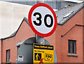
30 mph speed limit sign, Chichester Street, Belfast (January 2016)
by Albert Bridge for square J3474 See J3474 : 20 mph speed limit sign, Gloucester Street, Belfast (January 2016) and J3473 : 20 mph speed limit sign, May Street, Belfast (January 2016). A 30 mph sign, leaving the city centre 20 mph... (more)
|
|
Entering Ballyhalbert
by Rossographer geograph for square J6463 Arriving at the village of Ballyhalbert from Victoria Road.
|
|
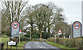
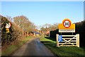
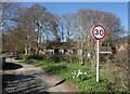
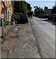
Hullbrook Lane, Shamley Green
by Malc McDonald geograph for square TQ0243 Hullbrook Lane entering the village of Shamley Green in Surrey. Here, the speed... (more)
Tags:
30 Mph Sign
30 Mph SignsX
30 Mph Speed Limit SignX
30 Mph Speed Limit SignsX
30mph Speed Limit SignX
30mph Speed Limit SignsX
type:GeographX
near:GuildfordX
subject:LaneX
Minor RoadX
National Cycle NetworkX
National Cycle RouteX
National Cycle Route 22X
NCNX
NCN22X
Road Signs 30mphX
top:Roads, Road TransportX
place:Shamley GreenX
Speed Limit 30mphX
Start of the 30mph Speed LimitX
county:SurreyX
|
|
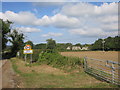
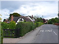
Lane into Cretingham from the north
by Christopher Hilton geograph for square TM2260 |
|
30mph speed limit sign, Ballygawley
by Rossographer geograph for square H6257 Approaching Ballygawley from the Grange Road and the speed limit sign on... (more)
|
|
The Loughries Road
by Rossographer geograph for square J5272 The Loughries Road at Loughries.
|
|
30 and 40 mph signs, Belfast (March 2018)
by Albert Bridge for square J3876 30 and 40 mph signs at the Holywood Road end of the Garnerville Road. Almost... (more)
Tags:
30 Mph Sign
40 Mph SignX
place:BelfastX
type:Close LookX
KnocknagoneyX
Road SignsX
top:Roads, Road TransportX
subject:SignX
Speed Limit SignsX
|
|
30 mph signs and road markings, Gilnahirk, Belfast - June 2015(1)
by Albert Bridge geograph for square J4072 30 mph signs and road markings, on the Gilnahirk Road, at the start of built-up... (more)
Tags:
30 Mph SignsX
place:BelfastX
subject:RoadX
RoadX
Road MarkingsX
Road SignsX
top:Roads, Road TransportX
Speed LimitX
Speed Limit 30mphX
|
|
30 mph signs, Lower Ballinderry (March 2016)
by Albert Bridge geograph for square J1367 The start of the 30 mph zone, approaching Lower Ballinderry along the Lower... (more)
|
|
30 mph signs, Ballyclare (March 2016)
by Albert Bridge geograph for square J2990 The start of the 30 mph zone, entering Ballyclare from Belfast, along the Hillhead Road.
|
|
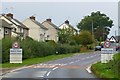
Centre of Charney Bassett
by Graham Horn geograph for square SU3794 This is the junction of New Road, left, and Main Street, right. The telephone... (more)
|
|
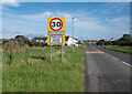
30 mph in East Boldre
by Des Blenkinsopp geograph for square SU3601 Slowing down from the mandatory 40 mph which is in force all over the forest on... (more)
|
|
Village sign for Llanymynech
by David Smith geograph for square SJ2720 Since the Google Streetview picture in 2010, the speed limit has been reduced... (more)
Tags:
30 Mph Sign
top:Roads, Road TransportX
subject:VillageX
Village SignX
top:Village, Rural SettlementX
|
|
30 mph limit, Hawton Lane
by Christine Johnstone geograph for square SK8051 Dropping down from 40 mph, at the western edge of Balderton.
|
|
Ashton New Road, Clayton
by Gerald England geograph for square SJ8798 The A662 towards Manchester. The lamppost carries a sign reminding drivers they... (more)
|
|
30 mph through Hannington Wick
by Des Blenkinsopp geograph for square SU1794 Speed limit signs outside Box Hedge Farm. This is the southernmost of the seven... (more)
Tags:
30 Mph SignsX
type:GeographX
top:Roads, Road TransportX
Village Name SignsX
top:Village, Rural SettlementX
|
|
30 mph in Wyck Rissington
by Des Blenkinsopp geograph for square SP1921 The name sign at the southern end of the village.
|
|
Entering Moulsoe
by David Lally geograph for square SP9041 |
|
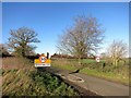
Slip road at Grantham
by Malc McDonald geograph for square SK8934 This slip road links the A1 trunk road with the A607 on the outskirts of Grantham.
|
|
Main road entering Cowbit
by Christine Johnstone geograph for square TF2518 The 30 mph sign is reinforced with a speed camera warning.
|
|
30 mph in Chaddleworth
by Des Blenkinsopp geograph for square SU4077 |
|
30 mph in Brightwalton
by Des Blenkinsopp geograph for square SU4377 |
|
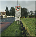
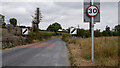
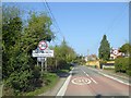
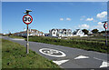
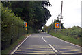
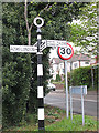
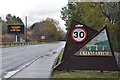
Approaching Carlops from the south
by Jim Barton geograph for square NT1655 The A702 about to enter the 30 mph limit in Carlops. The triangular summit of... (more)
Tags:
30 Mph SignsX
road:A RoadX
type:GeographX
Pentland HillsX
top:Roads, Road TransportX
Village OutskirtsX
top:Village, Rural SettlementX
|
|
Entering West Hanney
by Graham Horn geograph for square SU4092 Many counties have adopted this type of village entrance arrangement, with mock... (more)
|
|
30 mph into Upton
by Des Blenkinsopp geograph for square SS2004 Along the coast road into Bude from the south.
|
|
30 mph in Ipsden
by Des Blenkinsopp geograph for square SU6385 Looking northwards with the village hall behind the trees.
|
|
30 mph in Brightwell Baldwin
by Des Blenkinsopp geograph for square SU6594 The Brightwell part of the name is ancient, going back to Saxon times, and is... (more)
|
|
30 sign facing the wrong way, Gileston
by Jaggery geograph for square ST0167 In September 2019 the 30mph speed limit sign faces traffic leaving Gileston.
A... (more)
Tags:
30 Mph Sign
type:GeographX
top:Roads, Road TransportX
Sign Facing Wrong WayX
top:Village, Rural SettlementX
|
|
30 MPH area on B3139
by J.Hannan-Briggs geograph for square ST3847 |
|
30 mph in Haugh of Urr
by Ann Cook geograph for square NX8166 |
|
Eastern approach to Nedderton
by Oliver Dixon geograph for square NZ2382 On the B1331. The central refuge reinforces the 30 mph limit.
|
|
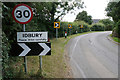
Entering Idbury
by Bill Boaden geograph for square SP2320 In addition to entering a 30 mph zone, the bend will slow motorists down.
Tags:
30 Mph Sign
BendX
type:GeographX
top:LowlandsX
top:Roads, Road TransportX
top:Village, Rural SettlementX
|
|
Old road sign on the Dartford bypass
by Stephen Craven geograph for square TQ5473 Category: Road signs This 'pre-Worboys' sign - see discussion at... (more)
|
|
Obscured speed limit sign, Mork Road, St Briavels
by Jaggery geograph for square SO5504 The 30 sign alongside a perimeter wall of the village churchyard
is partly... (more)
Tags:
30 Mph Sign
type:GeographX
Obscured SignX
top:Roads, Road TransportX
top:Village, Rural SettlementX
|
|
Burton Fleming, Please drive carefully
by Christine Johnstone geograph for square TA0871 Sign on the Grindale road, just before the junction with the Rudston Road.
|
|
30 sign, Longtown, Herefordshire
by Jaggery geograph for square SO3229 Speed limit sign alongside the main road through the village.
The car is... (more)
|
|
30 sign alongside Passage Road, Arlingham
by Jaggery geograph for square SO7010 Speed limit sign alongside the main road through Arlingham.
|
|
Houses in Haselor
by Nigel Mykura geograph for square SP1257 These half timbered cottages are on the main street of the village opposite the... (more)
|
|
30 through Field Assarts
by Des Blenkinsopp geograph for square SP3113 A companion picture for SP3113 : Entering Field Assarts which shows a similar view at the other end... (more)
|
|
Birds Edge School Zone
by Christine Johnstone geograph for square SE2007 View down Birds Edge Lane past the playground towards Birds Edge First School.
|
|
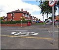
Corner of Clumber Road and Hyde Road
by Gerald England geograph for square SJ8995 Clumber Road has speed limit of 20mph whilst Hyde Road, the A57, has a 30mph... (more)
Tags:
20 Mph ZoneX
30 Mph Sign
road:A57X
Bus StopX
top:CommunicationsX
type:GeographX
postbox:GRX
top:Roads, Road TransportX
|
|
Crianlarich village sign
by Jim Barton geograph for square NN3825 A pictorial sign on the A85.
Tags:
30 Mph Sign
road:A RoadX
type:GeographX
top:Roads, Road TransportX
Traffic Information BoardX
Village SignX
top:Village, Rural SettlementX
|
|
Paxton village sign
by Jim Barton geograph for square NT9352 The road approaching Paxton from the south. The sign states... (more)
Tags:
30 Mph Sign
type:GeographX
top:Roads, Road TransportX
Village SignX
top:Village, Rural SettlementX
|
|
Dinting Road
by Gerald England geograph for square SK0294 Approaching Dinting Station. The sharp bend and 30mph sign are obscured by foliage.
|
|
Moor Lane, at the northern edge of Murton
by Christine Johnstone geograph for square SE6552 There is a 16 metre spot height at the 30mph sign.
Tags:
30 Mph Sign
30mph Speed Limit SignX
type:GeographX
subject:LaneX
lane:Moor LaneX
place:MurtonX
top:Roads, Road TransportX
Spot HeightX
Start of the 30mph Speed LimitX
Village EdgeX
Village Name Road SignX
|
|
30 For The Bend
by Des Blenkinsopp geograph for square SU8071 The wide put your foot down slope from off a bridge made by motorway engineers... (more)
Tags:
30 Mph SignsX
top:Roads, Road TransportX
|
|
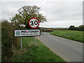
Entering Meltonby on minor road
by Martin Dawes geograph for square SE8052 Meltonby Hall farm to the right of sign
|
|
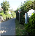
Lodge Hotel at Lincoln Road / Lime Tree Avenue junction
by Roger Templeman geograph for square TL1999 There is an OS benchmark TL1999 : Benchmark on Lodge Hotel, Lime Tree Avenue face on the near corner of the hotel right of... (more)
|