Public Tags
Tag: A4139
Other tags: road:A4139
Showing images tagged with A4139 tag.
|
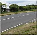
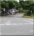
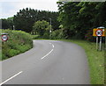
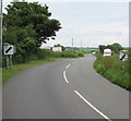
Bier Cross junction direction signs, Manorbier
by Jaggery geograph for square SS0698 The signs are alongside the A4139, facing the B4585 junction.
Left along the... (more)
|
|
Directions sign facing the A4139, Manorbier
by Jaggery geograph for square SS0698 Stay on the A4139 for Tenby or turn right into the B4585 for (the centre of) Manorbier.
Tags:
A4139
road:A4139
Directions SignX
type:GeographX
top:Roads, Road TransportX
top:Village, Rural SettlementX
|
|
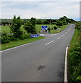
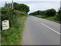
Start of the 50 zone on the A4139, Manorbier
by Jaggery geograph for square SS0698 Near the Station Road junction, the National Speed Limit on the A4139 drops to... (more)
|
|
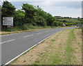
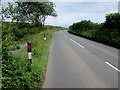
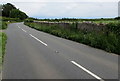
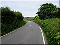
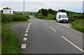
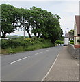
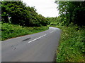
A4139 west of Lydstep
by Jaggery geograph for square SS0898 The A4139 heads west away from Lydstep, a hamlet in the south of Pembrokeshire.... (more)
|
|
Approach to Whitewell Holiday Park near Lydstep Beach
by Jaggery geograph for square SS0998 Along the A4139 towards the holiday park entrance.... (more)
|
|
Two-tone road towards Penally
by Jaggery geograph for square SS1098 The A4139 east of Crackwell railway bridge. Link
Tags:
A4139
road:A4139
type:GeographX
top:Roads, Road TransportX
Two-Tone RoadX
top:Village, Rural SettlementX
|
|
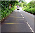
Change in road surface colour on the A4139 near Penally
by Jaggery geograph for square SS1098 On the approach to this Link railway bridge.
|
|
Oncoming vehicles in the middle of the road warning sign west of Penally
by Jaggery geograph for square SS1098 The sign faces eastbound traffic on the A4139. Approaching high vehicles may be... (more)
Tags:
road:A4139
A4139
type:GeographX
Oncoming Vehicles in Middle of RoadX
top:Roads, Road TransportX
top:Village, Rural SettlementX
|
|
Black, white and red roadside markers near Penally
by Jaggery geograph for square SS1098 On the north side of the A4139 in rural Pembrokeshire, east of Lydstep.
|
|
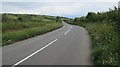
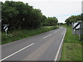
A4139 towards Penally
by Jaggery geograph for square SS1098 A road in rural Pembrokeshire, east of Lydstep.
|
|
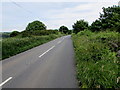
East along the A4139 towards Penally
by Jaggery geograph for square SS0998 In rural Pembrokeshire.
|
|
Bed and Breakfast Next Left near Bubbleton
by Jaggery geograph for square SS0998 The notices faces eastbound traffic on the A4139 in rural Pembrokeshire.
|
|
Stone wall in rural Pembrokeshire
by Jaggery geograph for square SS0998 At a field perimeter on the south side of the A4139 between Lydstep and Penally.
Tags:
road:A4139
A4139
type:GeographX
top:Roads, Road TransportX
Stone WallX
top:Village, Rural SettlementX
|
|
Eastern approach to Crackwell railway bridge, Pembrokeshire
by Jaggery geograph for square SS1098 The A4139 from Penally approaches this Link... (more)
|
|
This way to Lydstep Beach Village
by Jaggery geograph for square SS0998 The sign faces eastbound traffic on the A4139 in rural Pembrokeshire.
Tags:
road:A4139
A4139
Direction SignX
type:GeographX
top:Roads, Road TransportX
top:Village, Rural SettlementX
|
|
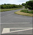
A4139 passes a minor road junction in rural Pembrokeshire
by Jaggery geograph for square SS0998 On the approach to Lydstep Beach Village.
Tags:
road:A4139
A4139
type:GeographX
Road JunctionX
top:Roads, Road TransportX
top:Village, Rural SettlementX
|
|
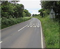
Change in road markings on the A4139 east of Lydstep
by Jaggery geograph for square SS0998 On the approach to a bend.
|
|
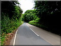
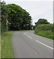
Bend in the road towards Lydstep
by Jaggery geograph for square SS0898 The A4139 on the eastern approach to Lydstep in rural Pembrokeshire.
|
|
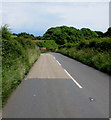
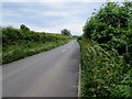
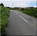
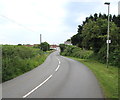
Quiet A road in rural Pembrokeshire
by Jaggery geograph for square SS0898 The A4139 east of Lydstep.
|
|
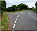
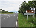
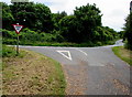
Bier Cross junction, Manorbier
by Jaggery geograph for square SS0698 On the right, the B4585 towards the centre of Manorbier diverges from the A4139... (more)
Tags:
road:A4139
road:B4585X
B4585X
type:GeographX
Road JunctionX
top:Roads, Road TransportX
top:Village, Rural SettlementX
|
|
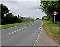
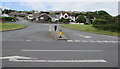
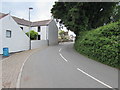
Junction of Station Road and the A4139, Manorbier
by Jaggery geograph for square SS0698 The speed limit drops to 20mph on Station Road on the approach
to Manorbier... (more)
Tags:
A4139
road:A4139
type:GeographX
Road JunctionX
top:Roads, Road TransportX
top:Village, Rural SettlementX
|
|
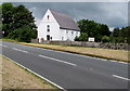
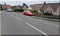
Penuel Baptist Chapel, Manorbier
by Jaggery geograph for square SS0698 Viewed across the A4139. This is the 1883 rebuild of the original Penuel Baptist... (more)
Tags:
A4139
road:A4139
Baptist ChapelX
type:GeographX
top:Religious SitesX
top:Roads, Road TransportX
top:Village, Rural SettlementX
|
|
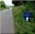
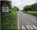
Turn left here for Penalun/Penally and Brambles Lodge B&B
by Jaggery geograph for square SS1198 On the south side of the A4139, opposite this... (more)
Tags:
A4139
road:A4139
Direction SignX
type:GeographX
top:Roads, Road TransportX
top:Village, Rural SettlementX
|
|
This way to Penally Heights
by Jaggery geograph for square SS1198 Viewed across the A4139 at the edge of Penally, a village near Tenby in coastal... (more)
Tags:
road:A4139
A4139
type:GeographX
Road JunctionX
top:Roads, Road TransportX
top:Village, Rural SettlementX
|
|
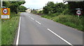
Start of the 30 zone on the approach to Lydstep
by Jaggery geograph for square SS0898 The National Speed Limit on the A4139 from Tenby via Penally drops to 30mph.
Tags:
road:A4139
A4139
type:GeographX
top:Roads, Road TransportX
Start of the 30mph Speed LimitX
top:Village, Rural SettlementX
|
|
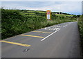
Two laybys northeast of Lydstep
by Jaggery geograph for square SS0898 Alongside the A4139.
Tags:
A4139
road:A4139
type:GeographX
LaybysX
top:Roads, Road TransportX
top:Village, Rural SettlementX
|
|
Main road into Lydstep
by Jaggery geograph for square SS0898 The A4139 from Tenby via Penally approaches Lydstep.
The Welcome to Lydstep... (more)
|
|
Yet another bend in the A4139 in the Lydstep area
by Jaggery geograph for square SS0898 A sign Link 500 metres behind the camera... (more)
Tags:
road:A4139
A4139
Bend in RoadX
type:GeographX
top:Roads, Road TransportX
top:Village, Rural SettlementX
|
|
End of the 30 zone on the A4139 beyond Lydstep
by Jaggery geograph for square SS0898 The 30mph speed limit through Lydstep, a hamlet in south Pembrokeshire,... (more)
Tags:
A4139
road:A4139
End of 30mphX
type:GeographX
National Speed LimitX
top:Roads, Road TransportX
top:Village, Rural SettlementX
|
|
Bend in the A4139, Lydstep
by Jaggery geograph for square SS0898 The road passes the edge of Celtic Haven. Link
Tags:
road:A4139
A4139
Bend in RoadX
Bend in the RoadX
type:GeographX
top:Roads, Road TransportX
top:Village, Rural SettlementX
|
|
Roadside trees, Lydstep
by Jaggery geograph for square SS0898 Viewed across the A4139 in Lydstep, a hamlet in south Pembrokeshire.
Tags:
A4139
road:A4139
type:GeographX
top:Roads, Road TransportX
Roadside TreesX
top:Village, Rural SettlementX
top:Wild Animals, Plants and MushroomsX
|
|
Bus shelter and postbox, Lydstep
by Jaggery geograph for square SS0898 On the north side of the A4139. This side of the road for buses to Penally and Tenby.
Tags:
A4139
road:A4139
Bus ShelterX
top:CommunicationsX
type:GeographX
PostboxX
top:Roads, Road TransportX
top:Village, Rural SettlementX
|
|
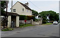
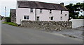
East side of Manor Farm, Lydstep
by Jaggery geograph for square SS0898 Viewed across the A4139.
|
|
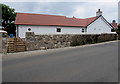
Lavender Cottage, Lydstep
by Jaggery geograph for square SS0898 On the south side of the A4139.
Tags:
A4139
road:A4139
CottageX
type:GeographX
top:Housing, DwellingsX
top:Roads, Road TransportX
top:Village, Rural SettlementX
|
|
Road towards Lydstep Haven
by Jaggery geograph for square SS0898 Heading SE away from the A4139 in Lydstep.
|
|
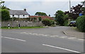
Houses in The Green, Lydstep
by Jaggery geograph for square SS0898 Viewed across the A4139. The name on the house on the right is THE GREEN.
Tags:
A4139
road:A4139
type:GeographX
top:Housing, DwellingsX
top:Roads, Road TransportX
top:Village, Rural SettlementX
|
|
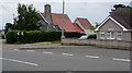
Lydstep bungalows
by Jaggery geograph for square SS0898 On the south side of the A4139. Originally, bungalow was used in English for a... (more)
Tags:
road:A4139
A4139
BungalowsX
type:GeographX
top:Housing, DwellingsX
top:Roads, Road TransportX
top:Village, Rural SettlementX
|
|
Bends warning sign on the approach to Lydstep
by Jaggery geograph for square SS0898 The bilingual (Welsh/English) text shows that there are bends on the A4139 for... (more)
Tags:
A4139
road:A4139
type:GeographX
top:Roads, Road TransportX
top:Village, Rural SettlementX
Warning Sign Bends in RoadX
|
|
End of the 30mph speed limit at the western edge of Lydstep
by Jaggery geograph for square SS0898 The 30mph speed limit on the A4139 through Lydstep increases to the National... (more)
Tags:
A4139
road:A4139
type:GeographX
National Speed LimitX
top:Roads, Road TransportX
top:Village, Rural SettlementX
|
|
Start of the 30 zone at the western edge of Lydstep
by Jaggery geograph for square SS0898 The National Speed Limit on the A4139 drops to 30mph at the western edge of... (more)
Tags:
A4139
road:A4139
type:GeographX
top:Roads, Road TransportX
Start of the 30mph Speed LimitX
top:Village, Rural SettlementX
|
|
Junction of a minor road and the A4139 northeast of Lydstep
by Jaggery geograph for square SS0998 The Give Way sign faces the minor road.
Tags:
road:A4139
type:GeographX
Give Way SignX
Road JunctionX
top:Roads, Road TransportX
top:Village, Rural SettlementX
|
|
Bend in the A4139 east of Lydstep
by Jaggery geograph for square SS0998 This way for Penally and Tenby.
|
|
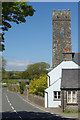
Lamphey
by Stephen McKay geograph for square SN0100 The A4139 passes through the village of Lamphey with two right angle bends... (more)
Tags:
road:A4139
Church TowerX
ClockX
type:GeographX
top:Religious SitesX
top:Roads, Road TransportX
subject:VillageX
top:Village, Rural SettlementX
|
|
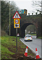
Ferry Lane, Pembroke Dock
by Stephen McKay geograph for square SM9703 A Pembroke Dock - Swansea train has just started on its 2hour 10 minute journey,... (more)
Tags:
40mph Speed Restriction SignX
road:A4139
subject:BridgeX
type:GeographX
Railway BridgeX
top:RailwaysX
Road Narrows SignX
top:Roads, Road TransportX
Traffic ConesX
|