Public Tags
Tag: AB31
Showing latest 50 of 832 images tagged with AB31 tag.
|
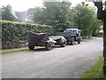
A preserved WW2 Light Gun Combination
by Stanley Howe geograph for square NJ6201 In William Street, Torphins. Comprising tow vehicle, ammunition trailer and gun.
|
|
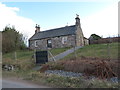
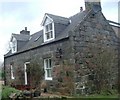
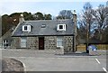
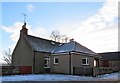
Briggs Cottage
by Stanley Howe geograph for square NO6998 Raemoir, Crathes, BANCHORY AB31 4EU.
Tags:
postcode area:AB31
subject:CottageX
Country CottageX
type:GeographX
top:Housing, DwellingsX
Junction of A-Road and Minor RoadX
place:RaemoirX
top:Roads, Road TransportX
top:Village, Rural SettlementX
|
|
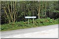
Signpost at junction near Sunnyview
by Stanley Howe geograph for square NO6497 Seen as arriving from Glassel.
The present unclassified Bridge of Canny to... (more)
Tags:
postcode area:AB31
AB31
place:Bridge of CannyX
Former North Deeside RoadX
type:GeographX
top:Historic Sites and ArtefactsX
Minor RoadX
subject:RoadX
top:Roads, Road TransportX
WoodlandX
top:Woodland, ForestX
|
|
Old Schoolhouse
by Stanley Howe geograph for square NJ5703 Roadside of Lumphanan.
Tags:
postcode area:AB31
top:Educational SitesX
type:GeographX
place:LumphananX
Minor RoadX
Old School HouseX
Postcode Area AB31X
top:Roads, Road TransportX
subject:SchoolX
|
|
Entrance to Candyglirach
by Stanley Howe geograph for square NJ7500 Category: Driveway From the Hirn road.
Tags:
postcode area:AB31
|
|
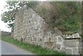
Old railway bridge abutment, Wester Beltie
by Stanley Howe for square NJ6102 Category: Railway (disused) On Learney road
Tags:
postcode area:AB31
|
|
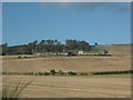
Tillycroy
by Stanley Howe geograph for square NO6193 Category: Farmhouse Viewed from B976.
Tags:
postcode area:AB31
|
|
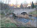
Bridgefoot bridge over Burn of Canny
by Stanley Howe geograph for square NO6696 Category: Bridge Double-arch stone bridge over the burn.
Tags:
postcode area:AB31
Road Bridge Over BurnX
|
|
A novelty 'delivery receptacle' for Upper Tillylair
by Stanley Howe geograph for square NJ5401 Category: Postal delivery A rolled up newspapaper fits nicely inside the pipe; and fortuitously the local... (more)
|
|
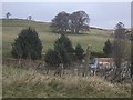
South flank of Mortlich
by Stanley Howe geograph for square NJ5301 Category: Hillside |
|
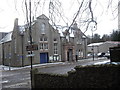
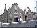
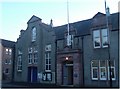
Banchory Town Hall
by Stanley Howe geograph for square NO6995 Category: Town Hall Viewed from St Ternan's Church.
|
|
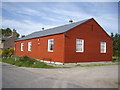
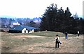
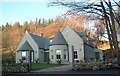
Glassel Village Hall (2010)
by Stanley Howe geograph for square NO6599 Category: Village hall |
|
Banchory Town Hall
by Stanley Howe geograph for square NO6995 Category: Town Hall Seen from St Ternan's Episcopal Church entrance, across High Street (A93), Banchory.
|
|
Macbeth's Cairn
by Stanley Howe geograph for square NJ5705 Category: Cairn In copse of beech trees; beyond Howburn. Link
|
|
Access to Annesley Park
by Stanley Howe geograph for square NJ6201 Category: Access road From Inchley Terrace.
|
|
A980 north of Balwearie
by Stanley Howe geograph for square NO6899 Category: A road (Classified A) Boundary wall of Raemoir House estate is on the right.
|
|
Road to Torphins sewage works
by Stanley Howe geograph for square NJ6201 Category: Road |
|
Torphins Golf Club (1978)
by Stanley Howe geograph for square NJ6202 Category: Clubhouse Former club house at village end of course.
|
|
Upstream Thistleycrook Burn
by Stanley Howe geograph for square NJ6402 Category: Burn From Campfield road towards Thistleycrook farm.
|
|
View west from near Cothill/Hirpletillum
by Stanley Howe geograph for square NJ6302 Category: View Morven in far distance.
|
|
Approach to Balwearie
by Stanley Howe for square NO6898 Category: Lane From the north, off the A980. Balwearie Wood to the right; Scolty Hill in background.
|
|
Banchory Town Hall
by Stanley Howe for square NO6995 Category: Town Hall Viewed from car park on opposite side of A93.
|
|
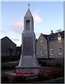
Banchory war memorial
by Stanley Howe geograph for square NO6995 Category: War Memorial Opposite Town Hall.
|
|
St Columba's church, Banchory
by Stanley Howe geograph for square NO6995 Category: Church Catholic parish church.
|
|
House on A93
by Stanley Howe geograph for square NO6597 Category: House Across the Burn of Canny from Waulkmill.
|
|
South Footie farmhouse
by Stanley Howe for square NJ6101 Category: Farmhouse House sign with a mallard.
|
|
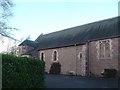
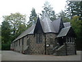
Parish church, Torphins
by Stanley Howe geograph for square NJ6202 Category: Church Church of Scotland.
|
|
Craigmyle House
by Stanley Howe for square NJ6302 Category: Entrance Entrance gate from Campfield road
|
|
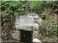
Macbeth Well, Lumphanan
by Stanley Howe geograph for square NJ5703 Category: Well, fountain or water spout Dated AD1057.
|
|
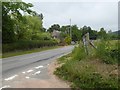
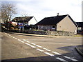
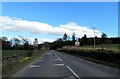
Entering Kirkton of Durris
by Stanley Howe geograph for square NO7796 On the B9077 from the west. Speed limit signs 50mph.
Tags:
50mph Speed Limit SignsX
postcode area:AB31
B9077X
Blue Sky White CloudsX
Dry Stone WallX
type:GeographX
place:Kirkton of DurrisX
subject:RoadX
top:Roads, Road TransportX
top:Village, Rural SettlementX
|
|
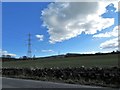
Overhead power lines near Kirkton of Durris
by Stanley Howe geograph for square NO7696 Seen from the B9077 as approaching the village from the west. Clouds gathering... (more)
Tags:
postcode area:AB31
B9077X
Blue Skies White CloudsX
top:Energy InfrastructureX
type:GeographX
place:Kirkton of DurrisX
subject:Power LineX
Power PylonsX
top:Roads, Road TransportX
top:Village, Rural SettlementX
|
|
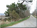
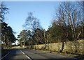
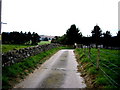
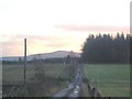
Minor Road from A980 towards Hawthorn Wood
by Stanley Howe geograph for square NO6998 Stone wall and pine trees just east of C19 Briggs Cottage. A... (more)
Tags:
A Cotton-Wool Cloud in a Clear Blue SkyX
postcode area:AB31
top:Air, Sky, WeatherX
type:GeographX
Hawthorn WoodX
Pine TreesX
place:RaemoirX
subject:RoadX
top:Roads, Road TransportX
Stone Wall with GateX
top:Woodland, ForestX
|
|
Renovated cottage policy 2019
by Stanley Howe geograph for square NJ6201 On Craigour Road (A980); seen from a junction across the A980.
Tags:
A980X
postcode area:AB31
Cottage RenovationX
type:GeographX
top:Housing, DwellingsX
Junction of A-Road and a Cul-De-SacX
top:Roads, Road TransportX
place:TorphinsX
subject:VillageX
top:Village, Rural SettlementX
|
|
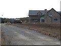
New build and access track near Birley
by Stanley Howe geograph for square NJ6200 Off B993 at Mid-Beltie.
Tags:
postcode area:AB31
subject:BuildingX
Building (Under Construction)X
type:GeographX
New Build PropertyX
Not Yet MappedX
place:TorphinsX
top:Village, Rural SettlementX
|
|
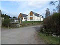
New Villa in Church Wood
by Stanley Howe geograph for square NJ6301 Near Gallowcairn, Torphins.
Tags:
postcode area:AB31
Church WoodX
subject:DwellingX
type:GeographX
top:Housing, DwellingsX
top:Roads, Road TransportX
place:TorphinsX
Triple GarageX
building type:VillaX
top:Village, Rural SettlementX
|
|
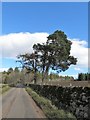
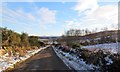
Minor road between Wartle and Loanhead
by Stanley Howe geograph for square NJ5404 Stone walled edging on both sides of road; with a gorse bank and water course on the left.
Tags:
postcode area:AB31
type:GeographX
Gorse BankX
Low Stone WallX
place:LumphananX
Minor RoadX
subject:RoadX
top:Roads, Road TransportX
|
|
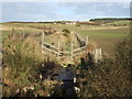
Field access gate
by Stanley Howe geograph for square NJ5404 A 6-bar steel gate sited at a dogleg bend in the minor road between Wartle and Loanend.
Tags:
6-Bar Steel GateX
postcode area:AB31
top:Farm, Fishery, Market GardeningX
Field GatewayX
subject:GatewayX
type:GeographX
place:LumphananX
Minor RoadX
top:Roads, Road TransportX
|
|
View north towards Wartle
by Stanley Howe geograph for square NJ5404 From the minor road below.
Tags:
postcode area:AB31
top:Farm, Fishery, Market GardeningX
FarmsteadX
FieldX
type:GeographX
place:LumphananX
Minor RoadX
Post and Wire FenceX
top:Roads, Road TransportX
subject:ViewX
|
|
Looking upstream of a headwater near Wartle
by Stanley Howe geograph for square NJ5404 - - which (fed by drains) ultimately finds its way (via several confluences)... (more)
Tags:
postcode area:AB31
type:GeographX
HeadwaterX
place:LumphananX
Minor RoadX
top:Rivers, Streams, DrainageX
top:Roads, Road TransportX
subject:StreamX
Upstream ViewX
|
|
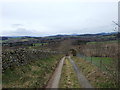
Road downhill; south of Wartle
by Stanley Howe geograph for square NJ5404 The ridge of wooded hills ahead isolates this upper glen's minor road from... (more)
Tags:
postcode area:AB31
type:GeographX
place:LumphananX
Minor RoadX
subject:RoadX
top:Roads, Road TransportX
top:UplandsX
Wooded RidgeX
|
|
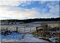
Access to fields SE of Wartle Farm
by Stanley Howe geograph for square NJ5404 Off the minor road; on a frosty day with a bright blue sky.
Tags:
postcode area:AB31
top:Air, Sky, WeatherX
type:GeographX
place:LumphananX
Minor RoadX
top:Roads, Road TransportX
subject:WeatherX
|
|
Farmhouse at Wartle
by Stanley Howe geograph for square NJ5404 As seen from the minor road passing through the farmyard.
Tags:
postcode area:AB31
top:Farm, Fishery, Market GardeningX
FarmhouseX
subject:FarmhouseX
type:GeographX
place:LumphananX
Minor RoadX
top:Roads, Road TransportX
|
|
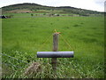
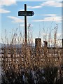
Finger post sign at start of Footpath from near Wartle to Tarland
by Stanley Howe for square NJ5404 Routed via Lochmanse.
Tags:
postcode area:AB31
type:Close LookX
Footpath FingerpostX
Junction of Footpath and Minor RoadX
place:LumphananX
subject:PathX
top:PathsX
top:Roads, Road TransportX
|
|
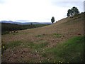
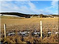
A longrange view towards the farmyard at Whitehouse
by Stanley Howe geograph for square NJ5404 From near the dogleg bend in the minor road north of Wartle.
Tags:
postcode area:AB31
type:GeographX
place:LumphananX
Minor RoadX
top:Roads, Road TransportX
subject:ViewX
View Down ValleyX
|
|
Approach to Wartle from Tulloch
by Stanley Howe geograph for square NJ5404 A footpath signed to Tarland on the right.
Tags:
postcode area:AB31
top:Farm, Fishery, Market GardeningX
Footpath SignX
type:GeographX
place:LumphananX
Minor RoadX
subject:RoadX
top:Roads, Road TransportX
Snow PatchesX
|
|
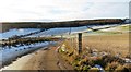
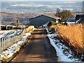
Minor road WNW from Whitehouse
by Stanley Howe geograph for square NJ5504 Towards Tulloch. Craiglich on skyline ahead.
|
|
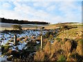
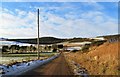
Farmyard at Whitehouse
by Stanley Howe geograph for square NJ5504 Farm equipment and outbuilding by minor road to Tulloch.
Tags:
postcode area:AB31
subject:Farm EquipmentX
Farm EquipmentX
top:Farm, Fishery, Market GardeningX
type:GeographX
place:LumphananX
Minor RoadX
OutbuildingX
top:Roads, Road TransportX
SnowsceneX
|
|
Farmstead at Whitehouse
by Stanley Howe geograph for square NJ5504 By minor road to Wartle.
Tags:
postcode area:AB31
Farm BuildingsX
top:Farm, Fishery, Market GardeningX
subject:FarmyardX
type:GeographX
place:LumphananX
Minor RoadX
top:Roads, Road TransportX
|
|
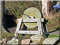
An historic whetstone at Whitehouse
by Stanley Howe for square NJ5504 Hand-powered device for sharpening cutting implements. This one now appears to... (more)
Tags:
postcode area:AB31
type:Close LookX
subject:Farm EquipmentX
top:Farm, Fishery, Market GardeningX
Garden OrnamentX
top:Historic Sites and ArtefactsX
place:LumphananX
Minor RoadX
top:Roads, Road TransportX
WhetstoneX
|
|
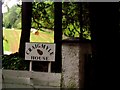
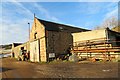
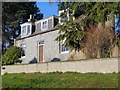
The farmhouse called WHITEHOUSE
by Stanley Howe geograph for square NJ5504 On the SW flank of Blelack Hill; by the minor road between Blelack and Tulloch.
Tags:
postcode area:AB31
Farm Name SignsX
top:Farm, Fishery, Market GardeningX
subject:FarmhouseX
Farmhouse Name SignX
type:GeographX
place:LumphananX
Minor RoadX
top:Roads, Road TransportX
|