|
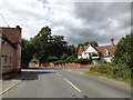
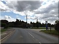
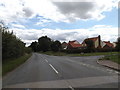
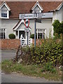
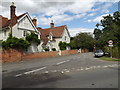
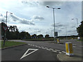
B1070 Heath Road, East Bergholt
by Geographer
geograph for square TM0735
At the junction with Quintons Road & B1070 Gaston End
|
|
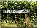
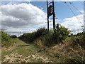
Putticks Lane sign
by Geographer
for square TM0835
On Putticks Lane at the junction with the B1070 Heath & Mill Roads
|
|
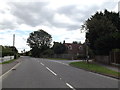
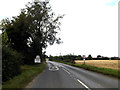
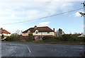
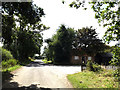
B1070 Hadleigh Road, Holton St.Mary
by Geographer
geograph for square TM0636
At the junction with Rose Acre
|
|
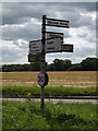
Roadsign on the B1070 Hadleigh Road
by Geographer
geograph for square TM0537
At the junction with Sandpits Lane
|
|
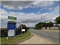
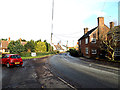
B1070 Hadleigh Road, Holton St.Mary
by Geographer
geograph for square TM0537
At the entrance to Holton Park Business Centre
|
|
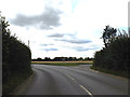
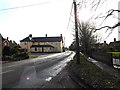
B1070 Hadleigh Road, Holton St.Mary
by Geographer
geograph for square TM0537
At the junction with Sandpits Lane
|
|
B1070 Hadleigh Road, Holton St.Mary
by Geographer
geograph for square TM0537
At the entrance to Holton Park Business Centre
|
|
B1070 Hadleigh Road, Holton St.Mary
by Geographer
geograph for square TM0537
At the junction with Sandpits Lane
|
|
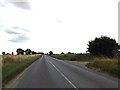
Entering Holton St.Mary on the B1070 Hadleigh Road
by Geographer
geograph for square TM0537
|
|
B1070 Hadleigh Road & footpath
by Geographer
geograph for square TM0537
|

|
Holton St.Mary Village sign
by Geographer
geograph for square TM0636
On the B1070 Hadleigh Road at the junction with Rose Acre
|
|
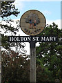
Holton St.Mary Village sign
by Geographer
for square TM0636
On the B1070 Hadleigh Road at the junction with Rose Acre
(Close up)
|
|
B1070 Hadleigh Road & Holton St.Mary Village sign
by Geographer
geograph for square TM0636
At the junction with Rose Acre
|
|
Holton St.Mary Village Name sign on the B1070 Hadleigh Road
by Geographer
geograph for square TM0636
Near Four Sisters Farm
|
|
Entering Holton St.Mary on the B1070 Hadleigh Road
by Geographer
geograph for square TM0636
Near Four Sisters Farm
|

|
Under the A12 Ipswich Road on the B1070 Hadleigh Road
by Geographer
for square TM0636
|
|
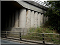
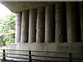
Patterns in concrete of Four Sisters Bridge
by Geographer
for square TM0636
Off the B1070
|

|
B1070 Hadleigh Road & Four Sisters Bridge
by Geographer
geograph for square TM0636
Carrying the A12 Ipswich Road
|
|
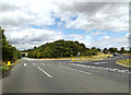
B1070 Hadleigh Road, Holton St.Mary
by Geographer
geograph for square TM0636
At the junction with the A12 slip road at the Four Sisters junction
|
|
Roadsign on the B1070 Hadleigh Road
by Geographer
for square TM0636
|

|
Track/Field entrance off the B1070 Hadleigh Road
by Geographer
geograph for square TM0636
|

|
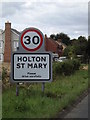
Holton St.Mary Village Name sign
by Geographer
for square TM0636
On the B1070 Hadleigh Road
|
|
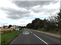
Entering Holton St.Mary on the B1070 Hadleigh Road
by Geographer
geograph for square TM0636
|
|
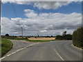
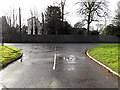
B1070 Gaston End, East Bergholt
by Geographer
geograph for square TM0735
Looking towards East Bergholt at the junction with Hadleigh Road
|
|
B1070 Gaston End, East Bergholt
by Geographer
geograph for square TM0635
Looking towards East Bergholt Village Name sign at the junction with Hadleigh Road
|
|
B1070 Gaston End, East Bergholt
by Geographer
geograph for square TM0635
At the junction with Hadleigh Road
|
|
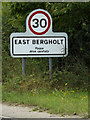
East Bergholt Village Name sign
by Geographer
for square TM0635
On the B1070 Gaston End
(Close up)
|
|
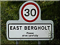
East Bergholt Village Name sign
by Geographer
for square TM0635
On the B1070 Gaston End
|
|
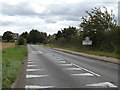
Entering East Bergholt on the B1070 Gaston End
by Geographer
geograph for square TM0635
|
|
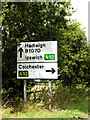
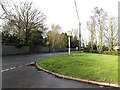
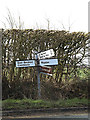
Roadsign on the B1070 Heath Road
by Geographer
geograph for square TM0735
At the junction with Quintons Road & B1070 Gaston End
|

|
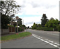
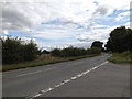
B1070 Mill Road, East Bergholt
by Geographer
geograph for square TM0835
At the junction with Putticks Lane
|

|
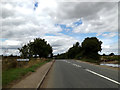
B1070 Heath Road, East Bergholt
by Geographer
geograph for square TM0835
At the junction with Putticks Lane
|
|
Noaks Road, Raydon
by Geographer
geograph for square TM0538
At the junction with the B1070 The Street
|
|
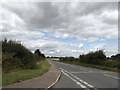
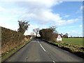
B1070 The Street, Raydon
by Geographer
geograph for square TM0438
Looking towards Woodlands Road near St.Mary's Church
|
|
B1070 The Street, Raydon
by Geographer
geograph for square TM0438
Looking towards Noaks Road near St.Mary's Church
|

|
Raydon Village sign
by Geographer
for square TM0538
On the B1070 The Street at the junction with Rectory Close
(Close up)
|
|
B1070 The Street & Raydon Village sign
by Geographer
geograph for square TM0538
At the junction with Rectory Close
|
|
Rectory Close, Raydon
by Geographer
geograph for square TM0538
At the junction with the B1070 The Street
|
|
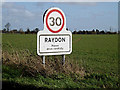
Raydon Village Name sign
by Geographer
geograph for square TM0537
On the B1070 Hadleigh Road
|
|
Entering Raydon on the B1070 Hadleigh Road
by Geographer
geograph for square TM0537
|
|
Roadsign on the B1070 Hadleigh Road
by Geographer
for square TM0537
At the junction with Acacia Road
|
|
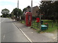
B1070 Hadleigh Road & Holton St.Mary Postbox
by Geographer
geograph for square TM0536
Postbox No.CO7 201
|
|
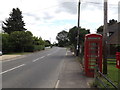
Telephone Box & Holton St.Mary Postbox
by Geographer
geograph for square TM0536
On the B1070 Hadleigh Road
Postbox No.CO7 201
|
|
Concrete Bridge Supports under Four Sisters Bridge
by Geographer
for square TM0636
|
|
Quintons Road, East Bergholt
by Geographer
geograph for square TM0735
At the junction with the B1070 Heath Road & Gaston End
|

|
Puttucks Lane, East Bergholt
by Geographer
geograph for square TM0835
At the junction with the B1070 Heath & Mill Roads
|
|
Footpath off Putticks Lane
by Geographer
geograph for square TM0835
At the junction with the B1070 Heath & Mill Roads
|
|
Putticks Lane, East Bergholt
by Geographer
geograph for square TM0835
At the entrance to Wheelers Yard approaching the B1070 Heath & Mill Roads... (more)
|
|
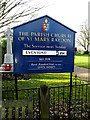
St.Mary's Church sign
by Geographer
for square TM0438
Off the B1070 The Street
(Close up)
Link |
|
Bergholt Road, Cattawade
by Geographer
geograph for square TM1033
At the junction with the A137 Brantham Hill & B1070 Bergholt Road
|