Public Tags
Tag: Bilberry
Showing latest 50 of 62 images tagged with Bilberry tag.
|
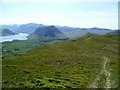
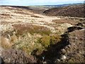
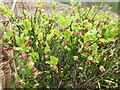
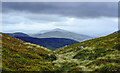
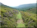
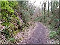
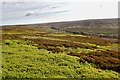
Bilberry, Sourfoot Fell
by Michael Graham geograph for square NY1323 Spring foliage of Bilberry gives the fells an acid green hue. Crummock Water and... (more)
|
|
The beauty of Druim Eadar Dà Choire a bilberry adorned boulder
by Mick Garratt geograph for square NG5325 Amidst the rugged terrain of Druim Eadar Dà Choire, a lone boulder, adorned with... (more)
|
|
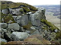
New bilberry growth around gritstone boulders
by Trevor Littlewood geograph for square NY9832 The rocks, surrounded by the fresh greenery of new season bilberry lie to the... (more)
Tags:
top:Air, Sky, WeatherX
Bilberry
type:GeographX
Gritstone BouldersX
top:MoorlandX
top:Rocks, Scree, CliffsX
top:UplandsX
top:Wild Animals, Plants and MushroomsX
|
|
Bilberry (Vaccinium myrtillus) in Sherwood Forest
by Phil Champion geograph for square SK6167 According to a sign nearby this area of the Sherwood Forest has traditionally... (more)
Tags:
plant:BilberryX
place:EdwinstoweX
ForestX
subject:ForestX
type:GeographX
top:LowlandsX
National Nature ReserveX
RSPBX
SherwoodX
Sherwood ForestX
place:Sherwood ForestX
Vaccinium MyrtillusX
top:Wild Animals, Plants and MushroomsX
top:Woodland, ForestX
|
|
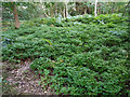
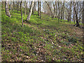
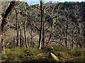
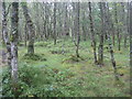
Bilberry understorey
by Trevor Littlewood geograph for square NO2985 A carpet of new-growth bilberry in woodland close to the Allt-na-guibhsaich and... (more)
Tags:
Bilberry
Coniferous WoodlandX
type:GeographX
top:Wild Animals, Plants and MushroomsX
top:Woodland, ForestX
|
|
Bilberry at the foot of Carman Hill
by Lairich Rig for square NS3779 (Vaccinium myrtillus)
Carman Hill itself appears in the background. Bilberry... (more)
|
|
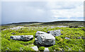
Bilberries growing on Moorland near Cregrina, Powys
by Christine Matthews for square SO1451 In some areas where there was less heather there were a number of these bilberry plants.
|
|
Bilberry, Brimham Rocks
by Derek Harper for square SE2065 Bilberry flowers against the sun. Perhaps the commonest plant among the rocks.
Tags:
Access LandX
plant:BilberryX
top:LowlandsX
top:Rocks, Scree, CliffsX
top:Wild Animals, Plants and MushroomsX
|
|
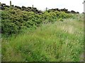
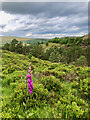
Bilberry patch above Hey Clough
by Christine Johnstone geograph for square SE0806 Quite a change from all the heather. Emley TV mast is on the far horizon.
Tags:
plant:BilberryX
Bilberry
top:Heath, ScrubX
plant:HeatherX
Heather MoorX
Heather MoorlandX
MoorlandX
Moorland StreamX
top:UplandsX
|
|
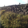
Bilberry patch along the bridleway
by Christine Johnstone geograph for square SE0537 On the north-facing side of a drystone wall.
|
|
Bilberry (Vaccinium myrtillus) in Sherwood Forest
by Phil Champion geograph for square SK6167 According to the sign this area of the Sherwood Forest has traditionally been... (more)
Tags:
plant:BilberryX
place:EdwinstoweX
ForestX
subject:ForestX
type:GeographX
top:LowlandsX
National Nature ReserveX
Robin Hood WayX
RSPBX
SherwoodX
Sherwood ForestX
place:Sherwood ForestX
Vaccinium MyrtillusX
top:Wild Animals, Plants and MushroomsX
top:Woodland, ForestX
|
|
Bilberry Flowers
by Michael Graham for square NY2126 On the top of Barf
|
|
Flowering bilberry, Harland Moor
by Jonathan Thacker for square SE6792 |
|
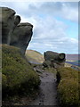
Gritstone outcrop, The Edge
by Andrew Hill geograph for square SK0889 Rocks just west of Nether Red Brook. Mainly bilberry among the rocks with... (more)
|
|
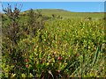
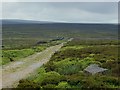
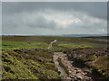
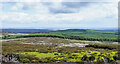
Looking east over the moor above Laund Pasture Plantation
by Ian Greig geograph for square SE0757 There is an abundant crop of ripe bilberries
|
![SH6713 : On Craig -las [Tyrrau Mawr] by Michael Graham](https://s0.geograph.org.uk/geophotos/02/41/48/2414852_47cd70c3_120x120.jpg)
|
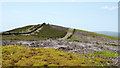
On Craig -las [Tyrrau Mawr]
by Michael Graham geograph for square SH6713 Looking along the ridge at the steep Bilberry covered crags.
|
|
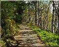
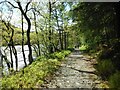
The Loch Drunkie Trail
by Richard Sutcliffe geograph for square NN5404 The trail from Loch Drunkie Car Park follows the shore of Loch Drunkie for just... (more)
Tags:
plant:BilberryX
shrub:BlaeberryX
type:GeographX
top:Lakes, Wetland, BogX
Loch DrunkieX
subject:PathX
top:PathsX
top:Wild Animals, Plants and MushroomsX
top:Woodland, ForestX
Zoomed PictureX
|
|
The Loch Drunkie Trail
by Richard Sutcliffe geograph for square NN5404 The trail from Loch Drunkie Car Park follows the shore of Loch Drunkie for just... (more)
Tags:
plant:BilberryX
shrub:BlaeberryX
type:GeographX
top:Lakes, Wetland, BogX
Loch DrunkieX
subject:PathX
top:PathsX
top:Wild Animals, Plants and MushroomsX
top:Woodland, ForestX
|
|
The Loch Drunkie Trail
by Richard Sutcliffe geograph for square NN5404 The trail from Loch Drunkie Car Park follows the shore of Loch Drunkie for just... (more)
|
|
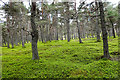
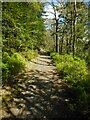
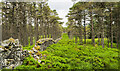
Conifer plantation
by Richard Sutcliffe geograph for square NN5304 A mature conifer plantation beside the Loch Drunkie Trail. The plants in the... (more)
|
|
The path through Beestones Wood, Stainland
by Humphrey Bolton geograph for square SE0619 The path passes open areas with various different vegetation. Here there is... (more)
|
|
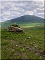
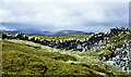
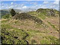
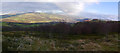
Col south-west of summit of Creag Leacach
by Trevor Littlewood geograph for square NO1574 Creag Leacach is a Munro on the eastern side of Gleann Beag. The col is a gap... (more)
|
|
Low heath and wall at col north-east of Creag Leacach
by Trevor Littlewood geograph for square NO1675 A carpet of bilberry in front of the wall crossing the col between Creag Leacach... (more)
Tags:
Bilberry
BouldersX
top:Boundary, BarrierX
ColX
top:Derelict, DisusedX
type:GeographX
top:Heath, ScrubX
top:Rocks, Scree, CliffsX
Ruined Dry Stone WallX
top:UplandsX
subject:WallX
|
|
Partly ruined wall on Drummond Hill
by Trevor Littlewood geograph for square NN7445 The wall follows the crest of the ground for virtually the whole length of the... (more)
Tags:
Bilberry
top:Boundary, BarrierX
Coniferous WoodlandX
type:GeographX
Semi-Ruinous Dry Stone WallX
top:UplandsX
subject:WallX
top:Wild Animals, Plants and MushroomsX
top:Woodland, ForestX
|
|
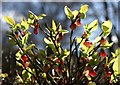
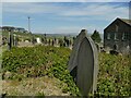
Burials and blueberries
by Stephen Craven geograph for square SE0223 The burial ground of Steep Lane Baptist Chapel has large clumps of bilberry... (more)
Tags:
plant:BilberryX
Burial GroundX
top:Burial Ground, CrematoriumX
type:GeographX
top:Wild Animals, Plants and MushroomsX
|
|
Bridleway down the Olchon valley
by Oliver Dixon geograph for square SO2634 Below the steep step, the bridleway levels off to a smooth grassy surface... (more)
|
|
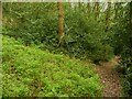
Path through Backhouse Bank Wood
by Trevor Littlewood geograph for square NZ0641 The wood on the east side of Tunstall Reservoir is managed by Durham Wildlife... (more)
Tags:
Bilberry
Deciduous WoodlandX
FootpathX
type:GeographX
subject:PathX
top:PathsX
UnderstoreyX
top:Woodland, ForestX
|

|
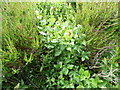
Moss, lichen, grass and bilberry on log
by Andrew Hill for square SN9557 A diverse community formed on felled log left in situ.
|
|
Bilberry plants in Shipley Glen
by Stephen Craven geograph for square SE1239 This looks like a great spot for picking the berries in late summer.
|
|
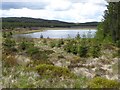
South shore of Kingside Loch
by Oliver Dixon geograph for square NT3413 A remote loch in the middle of the forest. Bilberries are growing in the foreground.
Tags:
BilberriesX
ForestX
type:GeographX
top:Lakes, Wetland, BogX
subject:LochX
LochX
top:Woodland, ForestX
|
|
Dry stone wall and bilberry bushes, Hangingstone Farm above Danebridge
by Robin Stott geograph for square SJ9765 |
|
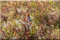
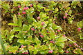
Early fruit on bilberry
by Humphrey Bolton for square SE0808 View direction arbitrary - I didn't remember to make a note of it.
|
|
Dukes Road by Hurkling Edge
by Andrew Hill geograph for square SK2394 The old wall is a landmark by the track across wide open moorland. A mixture of... (more)
|
|
On Guise Cliff
by Derek Harper geograph for square SE1663 A ravine filled with trees, heather and bilberry seen from the Nidderdale Way.
Tags:
plant:BilberryX
top:Heath, ScrubX
plant:LingX
top:LowlandsX
long distance path:Nidderdale WayX
top:Rocks, Scree, CliffsX
TreesX
top:Woodland, ForestX
|
|
Holloway Lane
by Derek Harper geograph for square SX9182 Kenton Bridleway 13 becoming a sunken lane as it drops down the Haldon scarp.... (more)
|
|
Duke's Road crossing Rushy Dike
by Andrew Hill geograph for square SK2294 Heather and bilberry moorland with a well marked track providing easy access to... (more)
|
|
Footpath by rocky outcrop, Blackden Edge
by Andrew Hill geograph for square SK1288 When going from east to west, this is the most imposing rock formation so far... (more)
|
|
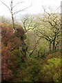
Town Wood
by Derek Harper geograph for square SX7173 Looking southwest from the spot where SX7173 : Town Wood was taken, with the steep wood... (more)
|
|
Town Wood
by Derek Harper geograph for square SX7173 Bilberry plants carpet these woods. This view is from a path that drops from... (more)
|
|
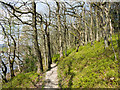
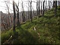
Birch woodland in the Pass of Leny
by M J Richardson geograph for square NN5908 With a good growth of ferns and bilberries in the understorey.
|
|
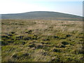
On Kennon Hill
by Derek Harper geograph for square SX6489 Category: Moorland A square dominated by the very gentle dome of Kennon Hill close to the northeast... (more)
|
|
Moorland above Rosedale
by Peter Church geograph for square SE7095 Category: Moorland This view is due north and the hamlet of Thorgill is hidden by the heather... (more)
|
|
Path on Muncaster Fell
by Adrian Taylor geograph for square SD1399 There are many small paths along the ridge of Muncaster Fell.
Scafell is... (more)
|
|
An Slochd Beag, Where Roads and Rails Converge
by Mick Garratt geograph for square NH8523 |
|
Moorland ridge of Islington Hill
by Trevor Littlewood geograph for square NZ0030 The broad east ridge of Islington Hill extending towards the western edge of... (more)
|
|
Citron Seat
by Trevor Littlewood geograph for square NY9710 Citron Seat is a minor but abrupt rise along a moorland ridge above Gilmonby... (more)
Tags:
Bilberry
top:Boundary, BarrierX
Dry Stone WallX
type:GeographX
Heather MoorlandX
subject:HillX
HillX
top:Historic Sites and ArtefactsX
top:LowlandsX
top:MoorlandX
|
|
Badger Gill from Black Hill
by Mick Garratt geograph for square SE6099 |
|
The Gritstone Trail at Mow Cop
by Stephen Craven geograph for square SJ8657 From a local summit of 325m altitude, looking roughly north along the ridge... (more)
Tags:
plant:BilberryX
top:Boundary, BarrierX
County BoundaryX
type:GeographX
ldp:Gritstone TrailX
top:LowlandsX
|

|
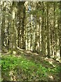
Footpath through coniferous trees
by Trevor Littlewood geograph for square NJ0315 As marked on OS maps the path might be considered to be a forest road but is... (more)
|
|
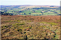
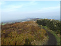
Panoramic view towards Mytholmroyd from above Wood Hey Clough
by Phil Champion geograph for square SD9925 Looking down into the valley from an area of open heath and scattered birch... (more)
Tags:
Bilberry
Birch WoodlandX
top:GrasslandX
Haven WoodX
top:Heath, ScrubX
MytholmroydX
PanoramaX
top:UplandsX
subject:ViewX
Wood HeyX
Wood Hey CloughX
top:Woodland, ForestX
|