Public Tags
Tag: Bottom
Showing latest 50 of 75 images tagged with Bottom tag.
|
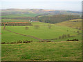
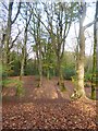
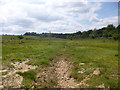
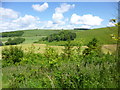
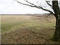
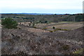
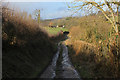
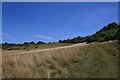
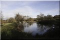
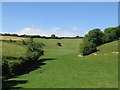
Handley Bottom
by Trevor Rickard geograph for square SK2369 View north-west from Handley Lane overlooking the flat farmland of Handley... (more)
|
|
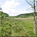
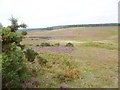
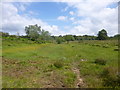
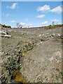
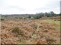
Dibden Bottom
by Mike Faherty geograph for square SU4006 One of two arms of the bottom: a shallow valley with mire; bog asphodel, bog... (more)
|
|
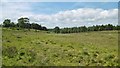
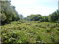
Hill Top, bottom
by Mike Faherty geograph for square SU3904 A shallow bottom with brook draining into Crabhat Inclosure (ahead).
|
|
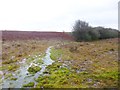
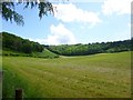
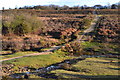
Stoney Cross, Withybed Bottom
by Mike Faherty geograph for square SU2511 The northern end of the bottom, with the beginnings of Long Brook.
|
|
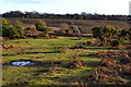
Bramshaw, Two Beeches Bottom
by Mike Faherty geograph for square SU2516 Looking down into the bottom, or at least an arm of it; unusually for the New... (more)
|
|
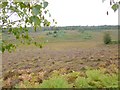
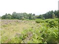
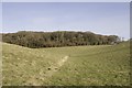
Deadman Bottom
by Mike Faherty geograph for square SU2016 Dry heathland on the slopes; humid in the bottom, distinguished by brown... (more)
|
|
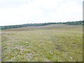
Watergreen Bottom
by Mike Faherty geograph for square SU2012 Looking down from the shallow sides of the bottom. Round-leaved Sundew and... (more)
|
|
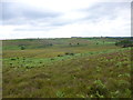
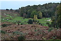
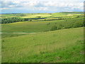
Brogenslade Bottom
by Mike Faherty geograph for square SU1711 Looking down from the ridge of Dorridge Hill. Bottoms are shallow valleys, often... (more)
|
|
Claypits Bottom looking South-West
by Mike Faherty geograph for square SU2216 Looking towards the wider, lower end of the bottom.
|
|
Claypits Bottom looking North
by Mike Faherty geograph for square SU2216 Looking North to the shallower top of the bottom.
|
|
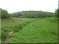
Bourne Bottom
by Mike Faherty geograph for square SZ0594 A shallow valley along Bourne Stream. For much of its length, the bottom forms... (more)
|
|
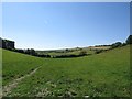
Littlecombe Bottom
by Mike Faherty geograph for square ST8717 Looking across a harvested silage field to the head of the bottom.
|
|
Fontmell Magna, Littlecombe Bottom
by Mike Faherty geograph for square ST8816 Looking from ST8816 : Fontmell Magna, path across the bottom, with Fontmell Down in the distance.
|
|
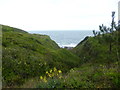
Winspit Bottom
by Mike Faherty geograph for square SY9776 The southern end of the bottom, shortly before it merges with the coast.
|
|
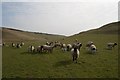
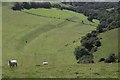
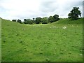
Sheep and lambs in Compton Bottom
by Becky Williamson geograph for square SY5993 They followed me all the way through the bottom!
|
|
Bratton, bottom
by Mike Faherty geograph for square ST9251 Luccombe Bottom, at the foot of Salisbury Plain.
|
|
Hill Top, bottom
by Mike Faherty geograph for square SU4202 Down the bottom flows a tributary of Stock Water.
|
|
Hale, bottom
by Mike Faherty geograph for square SU1917 Looking down into the apparently unnamed bottom that shows further South-west as... (more)
|
|
A View over Dengrove Bottom
by Chris Heaton geograph for square ST9224 |
|
Blackwell Common, bottom
by Mike Faherty geograph for square SU4302 A shallow valley draining into Dark Water. Wetland plants on show include bog... (more)
|
|
Shatterford Bottom
by Mike Faherty geograph for square SU3305 |
|
Ringwood Ford Bottom
by Mike Faherty geograph for square SU2610 A shallow valley with brook feeding into Mill Stream.
|
|
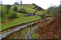
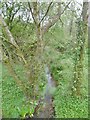
Footbridge in Withybed Bottom
by David Martin geograph for square SU2510 |
|
Track into Withybed Bottom
by David Martin geograph for square SU2510 |
|
Alderhill Bottom
by Mike Faherty geograph for square SU2013 Currently dry, after a dry summer.
|
|
Seacombe, footbridge
by Mike Faherty geograph for square SY9877 Simple plank bridge over the brook in Seacombe Bottom.
|
|
Seacombe Bottom
by Mike Faherty geograph for square SY9877 A shallow-sided valley with brook, rising at Eastington Farm and joining the... (more)
|
|
View over Shappen Bottom
by David Martin geograph for square SU2102 |
|
View into Brogenslade Bottom
by David Martin geograph for square SU1711 |
|
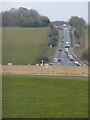
Stonehenge: the A303 approaches from the east
by Chris Downer geograph for square SU1242 The busy A303 comes down Stonehenge Bottom and meets the A344 joining it just in... (more)
|
|
Horsecombe Bottom
by Trevor Rickard geograph for square SU0267 View north-west from the ridgeway with Cherhill Down on the right, topped by the... (more)
|
|
A303, Chicklade Bottom
by Chris Heaton geograph for square ST9134 As seen from the Wessex Ridgeway, after crossing the A303
Tags:
A Road (Classified A)X
Bottom
type:GeographX
top:Roads, Road TransportX
long distance footpath:Wessex RidgewayX
|
|
Wessex Ridgeway in Dengrove Bottom
by Chris Heaton geograph for square ST9224 |
|
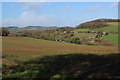
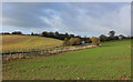
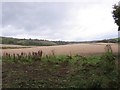
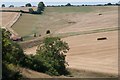
Yelcombe Bottom
by Becky Williamson geograph for square ST6701 Yelcombe Drove (an old droving track) is the green hedgerow centre left.
Tags:
subject:AgricultureX
Arable LandX
Bottom
county:DorsetX
top:Farm, Fishery, Market GardeningX
FarmlandX
type:GeographX
|
|
Kingrove Bottom
by Becky Williamson geograph for square SY6999 |
|
Park Mead Bottom
by Becky Williamson geograph for square ST6500 |
|
Crete Bottom
by Becky Williamson geograph for square SY6497 |
|
Crete Bottom
by Becky Williamson geograph for square SY6597 Bushes Barn centre left of photo.
|
|
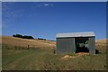
Barn in Pond Bottom
by Becky Williamson geograph for square SY6498 |
|
Bottom of Harry's Bank
by Mick Garratt geograph for square SK1254 |
|
Lake in Knight's-in-the-Bottom
by Becky Williamson geograph for square SY5399 Despite trying, I have not been able to find the origin of this wonderful name.
|
|
Westcombe Coppice
by Becky Williamson geograph for square ST5201 From the bridleway through the delightfully named Burnt Bottom.
|
|
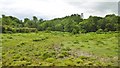
Coombe Bottom
by Becky Williamson geograph for square SY5493 An attractive and steep-sided valley near Eggardon Hill in Dorset.
|
|
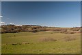
Lytchett Minster, Pit Bottom
by Mike Faherty geograph for square SY9694 A shallow valley with stream that drains into Sherford River; looking downstream.
|
|
Francombe Bottom, near Cerne Abbas
by Becky Williamson geograph for square SY6799 |
|
Bramble Bottom, near Cerne Abbas
by Becky Williamson geograph for square SY6799 |
|
Crundale Bottom
by Christine Johnstone geograph for square NY6921 A dry valley south of, and parallel to, the valley of Frith Beck. At the head of... (more)
|
|
Lyscombe Bottom
by Becky Williamson geograph for square ST7301 |
|
Tarrant Gunville, marker
by Mike Faherty geograph for square ST8912 On the bridleway through Handcock's Bottom towards Ashmore Wood.
|
|
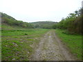
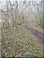
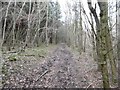
Tarrant Gunville, bridleway
by Mike Faherty geograph for square ST8912 Through woodland in Handcock's Bottom, on the way to Ashmore Wood.
|