|
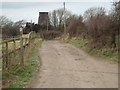
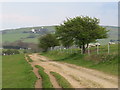
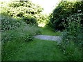
Public footpath near Clayton
by Malc McDonald
geograph for square TQ3013
This track near Clayton is a public footpath, leading off the South Downs Way.... (more)
|
|
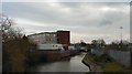
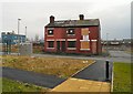
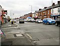
Ashton Canal and Clayton Police Station
by Gerald England
geograph for square SJ8798
|
|
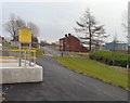
Behind Clayton Hall Tram stop
by Gerald England
geograph for square SJ8798
Behind the tram stop at Clayton Hall is an access ramp. In the background are... (more)
|
|
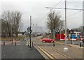
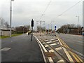
Metrolink crossing Clayton Lane
by Gerald England
geograph for square SJ8798
After Clayton Hall stop the metrolink extension from Droylsden (and eventually... (more)
|
|
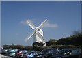
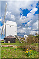
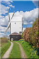
Jill Windmill
by Paul Gillett
geograph for square TQ3013
Category: Windmill
|
|
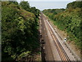
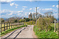
Railway at Clayton
by Peter Trimming
geograph for square TQ2914
Seen from the road bridge (A273) just north of the Clayton Tunnel.
|
|
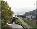
Clayton Lock
by Gerald England
geograph for square SJ8798
Viewed from Ashton New Road. The lock, which dates from 1792-99, is Grade II... (more)
|
|
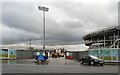
Football Academy Site Entrance
by Gerald England
geograph for square SJ8798
Site entrance to the City Football Academy under construction on former... (more)
|
|
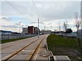
Metrolink at Clayton
by Gerald England
geograph for square SJ8798
The line of the metrolink extension to Droylsden (and eventually Ashton under... (more)
|
|
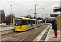
Clayton Hall Tram Stop
by Gerald England
geograph for square SJ8798
Metrolink Tram #3020 bound for Droylsden at Clayton Hall tram stop.
|
|
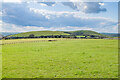
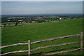
Near New Barn Farm
by Ian Capper
geograph for square TQ3013
Field near New Barn Farm. In the background is Jack, one of the two windmills... (more)
|
|
Jill
by Ian Capper
geograph for square TQ3013
One of the two windmills at Clayton, this one dating originally from 1821 and... (more)
|
|
Jill
by Ian Capper
geograph for square TQ3013
One of the two windmills at Clayton, this one dating originally from 1821 and... (more)
|
|
Jack
by Ian Capper
geograph for square TQ3013
Looking down a track towards Jack, one of the two windmills at Clayton, this one... (more)
|
|
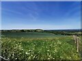
Crops, Clayton Hill
by PAUL FARMER
geograph for square TQ3013
|
|
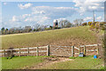
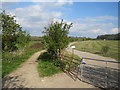
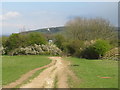
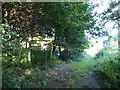
Footpath near Clayton
by Malc McDonald
geograph for square TQ2814
A public footpath to the left, and a private track to the right, in farmland... (more)
|
|
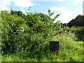
Bridleway on the South Downs, near Pyecombe
by Malc McDonald
geograph for square TQ2813
A bridleway on the South Downs ridge.
A pair of windmills, known as Jack and... (more)
|
|
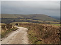
Bridleway near Pyecombe
by Malc McDonald
geograph for square TQ2913
A public bridleway on the South Downs ridge, near Pyecombe.
Visible on the... (more)
|
|
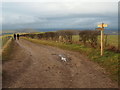
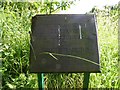
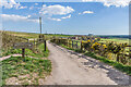
South Downs Way near Clayton
by Malc McDonald
geograph for square TQ3013
A view westwards along the South Downs Way, near Clayton.
A darkening sky... (more)
|
|
South Downs Way near Clayton
by Malc McDonald
geograph for square TQ3112
A view westwards along the South Downs Way, near Clayton.
|
|
South Downs Way near Clayton
by Malc McDonald
geograph for square TQ3112
A view westwards along the South Downs Way, near Clayton. The signpost... (more)
|
|
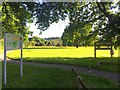
Ferndown LNR
by Jonathan Hutchins
geograph for square SJ8542
|
|
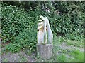
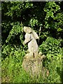
Ferndown LNR: dragonfly carving
by Jonathan Hutchins
for square SJ8542
|
|
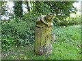
Ferndown LNR: rabbit carving
by Jonathan Hutchins
geograph for square SJ8542
|
|
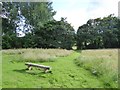
Path on Ferndown LNR
by Jonathan Hutchins
geograph for square SJ8542
|
|
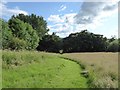
Entry to west side of Ferndown LNR
by Jonathan Hutchins
geograph for square SJ8542
|
|
Ferndown LNR: Diamond Jubilee trees plaque
by Jonathan Hutchins
for square SJ8542
Transcription of plaque:
TREES PLANTED TO
CELEBRATE
THE DIAMOND JUBILEE OF... (more)
|
|
Ferndown LNR: Diamond Jubilee trees
by Jonathan Hutchins
geograph for square SJ8542
Transcription of plaque:
TREES PLANTED TO
CELEBRATE
THE DIAMOND JUBILEE OF... (more)
|
|
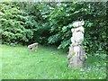
Ferndown LNR: hare carving
by Jonathan Hutchins
for square SJ8542
|
|
Ferndown LNR: frog carving
by Jonathan Hutchins
geograph for square SJ8542
|
|
Ferndown LNR
by Jonathan Hutchins
geograph for square SJ8542
|
|
Ferndown LNR
by Jonathan Hutchins
geograph for square SJ8542
|
|
Clayton Hall Tramstop
by Gerald England
geograph for square SJ8898
The metrolink tramstop at Clayton Hall is on the south side of the A662 Ashton New Road.
|
|
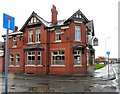
Grove Inn
by Gerald England
geograph for square SJ8798
A Holts pub on the corner of Ashton New Road and Linfield Road, Clayton.... (more)
|
|
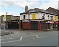
Spicy Mango (former Derby Arms)
by Gerald England
geograph for square SJ8798
|
|
The last houses on Eccleshall Street
by Gerald England
geograph for square SJ8898
All the houses on Eccleshall Street and the streets off it have been demolished... (more)
|
|
Ashton New Road
by Gerald England
geograph for square SJ8898
Category: A road (Classified A)
The A662 from Droylsden to Clayton and Manchester.
|
|
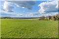
Near New Barn Farm
by Ian Capper
geograph for square TQ3012
Looking across the plateau at the top of The South Downs, near Clayton, with... (more)
|
|
Near New Barn Farm
by Ian Capper
geograph for square TQ3012
Looking across the plateau at the top of The South Downs, near Clayton, with New... (more)
|
|
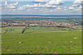
Towards Keymer
by Ian Capper
geograph for square TQ3013
Looking down on to Keymer from by the Clayton windmills. On the far right is... (more)
|
|
South Downs Way
by Ian Capper
geograph for square TQ3013
The South Downs Way where it turns sharply from north to southeast near the... (more)
|
|
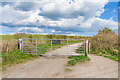
South Downs Way
by Ian Capper
geograph for square TQ3013
A gate on the South Downs Way where it turns sharply from north to southeast... (more)
|
|
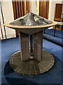
Font in St James the Great, Clayton
by Jonathan Hutchins
for square SJ8543
|
|
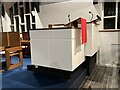
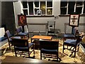
Lectern and pulpit in St James the Great, Clayton
by Jonathan Hutchins
for square SJ8543
|
|
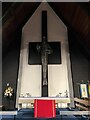
Altar and cross in St James the Great, Clayton
by Jonathan Hutchins
for square SJ8543
|
|
Prayer corner in St James the Great, Clayton
by Jonathan Hutchins
for square SJ8543
|
|
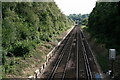
Brighton Line
by Peter Trimming
geograph for square TQ3014
Looking towards the south-southwest, with the Clayton Tunnel just visible in the distance.
|
|
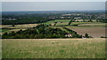
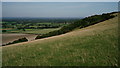
South Downs
by Peter Trimming
geograph for square TQ3013
Looking across the village of Clayton, from the ridge close to Jack and Jill windmills.
|
|
South Downs
by Peter Trimming
geograph for square TQ3013
Looking towards Clayton Holt, from the ridge close to Jack and Jill windmills.
|
|
Windmill Spotted
by Peter Trimming
geograph for square TQ3013
The couple is looking towards the mill north-west of Ditchling. However, to the... (more)
|