Public Tags
Tag: Enford
Showing images tagged with Enford tag.
|
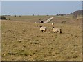
Downland, Enford
by Andrew Smith geograph for square SU1753 With sheep grazing on the eastern side of Littlecott Down.
|
|
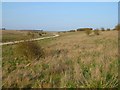
Downland, Enford
by Andrew Smith geograph for square SU1752 With a military track (bridleway) approaching Littlecott Down from the western... (more)
|
|
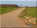
Track and grassland, Enford
by Andrew Smith geograph for square SU1751 Looking towards the southern end of Dreweatt's Clump from the crossroads on... (more)
|
|
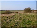
Downland, Enford
by Andrew Smith geograph for square SU1654 A view across a shallow dry valley with Upavon Down rising to the right.
|
|
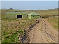
Grassland and barns, Enford
by Andrew Smith geograph for square SU1653 Grassland and Chisenbury Field Barns, now used by the army for military purposes.
|
|
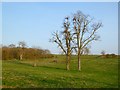
Pasture, Enford
by Andrew Smith geograph for square SU1651 Ashes standing besise the former site of Coombe Field Barn.
|
|
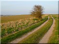
Track and farmland, Enford
by Andrew Smith geograph for square SU1551 The bridleway approaching Dreweatt's Barn from the west through farmed MOD land.
|