|
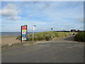
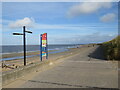
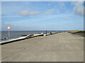
Promenade at Fleetwood
by Malc McDonald
geograph for square SD3248
The promenade along the seafront at Fleetwood, on the Lancashire coast, is... (more)
|
|
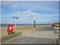
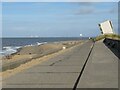
Promenade at Fleetwood
by Malc McDonald
geograph for square SD3248
This promenade along the seafront at Fleetwood is shared by pedestrians and... (more)
|
|
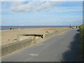
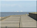
Promenade at Fleetwood
by Malc McDonald
geograph for square SD3248
The promenade along the seafront at Fleetwood forms part of the route of two... (more)
|
|
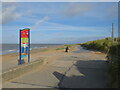
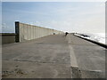
Promenade at Fleetwood
by Malc McDonald
geograph for square SD3148
A promenade along the Lancashire coastline at Fleetwood. The promenade is on... (more)
|
|
Promenade at Fleetwood
by Malc McDonald
geograph for square SD3148
A promenade along the Lancashire coastline at Fleetwood. The promenade forms... (more)
|
|
Promenade at Rossall Point, Fleetwood
by Malc McDonald
geograph for square SD3147
The promenade along the seafront at Rossall Point, near Fleetwood. The building... (more)
|
|
Promenade at Rossall Point, Fleetwood
by Malc McDonald
geograph for square SD3147
The promenade along the seafront at Rossall Point, near Fleetwood. Straight... (more)
|
|
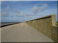
Promenade at Fleetwood
by Malc McDonald
geograph for square SD3147
The promenade near Fleetwood has recently been rebuilt. It forms part of the... (more)
|
|
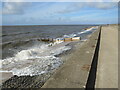
Waves break against the promenade, Fleetwood
by Malc McDonald
geograph for square SD3147
Waves breaking against the promenade at Fleetwood, on the Lancashire coast. The... (more)
|
|
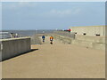
Seafront promenade, Fleetwood
by Malc McDonald
geograph for square SD3147
Cyclists on the promenade at Fleetwood, on the Lancashire coast. The promenade... (more)
|
|
Seafront promenade, Fleetwood
by Malc McDonald
geograph for square SD3146
The promenade along the seafront at Fleetwood, on the Lancashire coast. The... (more)
|
|
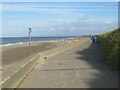
Promenade near Fleetwood
by Malc McDonald
geograph for square SD3145
A promenade along the seafront on the Lancashire coast, between Cleveleys and... (more)
|
|
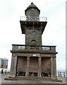
Lower Lighthouse, Fleetwood
by Malc McDonald
geograph for square SD3348
The Lower Lighthouse on the seafront at Fleetwood. A second, taller lighthouse... (more)
|
|
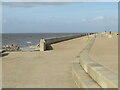
Promenade at Fleetwood
by Malc McDonald
geograph for square SD3148
This promenade on the Lancashire coast is on the route of the Wyre Way and... (more)
|
|
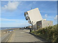
Rossall Point lookout, Fleetwood
by Malc McDonald
geograph for square SD3147
The lookout tower at Rossall Point, on the Lancashire coast. It is open to the... (more)
|
|
Promenade at Rossall Point, Fleetwood
by Malc McDonald
geograph for square SD3147
At Rossall Point, the direction of the coastline gradually turns from north to... (more)
|
|
Rossall Point, Fleetwood
by Malc McDonald
geograph for square SD3147
At Rossall Point, the direction of the coastline gradually turns from north to... (more)
|
|
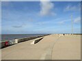
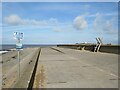
Promenade and slipway near Fleetwood
by Malc McDonald
geograph for square SD3145
The promenade forms part of National Cycle Network route 62 and also two long... (more)
|
|
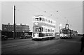
The last day of trams on Dickson Road -9
by Alan Murray-Rust
geograph for square SD3348
Dickson Road was the last section of traditional street tramway in Blackpool.... (more)
|
|
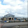
Fleetwood Lifeboat Station
by Gerald England
geograph for square SD3348
The first lifeboat station in Fleetwood was established in 1859. For a full... (more)
|
|
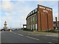
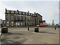
North Euston Hotel, Fleetwood
by Malc McDonald
geograph for square SD3348
The North Euston Hotel, on the seafront at Fleetwood, dates from 1841. It takes... (more)
|
|
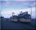
Two Blackpool Trams at Fleetwood Ferry
by David Hillas
geograph for square SD3348
Taken in September 1970, this photo shows 611 and 661 in Queen's Terrace... (more)
|
|
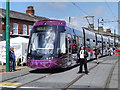
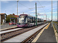
Bombardier Flexity 2, Lord Street
by David Dixon
geograph for square SD3347
Blackpool has long been famed as the home of the coastal tram line that ran for... (more)
|
|
The top of the Wyre Light
by Gerald England
for square SD3251
The Wyre Light was built in 1840 and was designed by the blind Irish Engineer... (more)
|
|
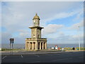
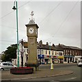
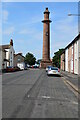
Rowntree Clock Tower
by Gerald England
geograph for square SD3347
The clock tower on the roundabout at Albert Square is known as the Rowntree... (more)
|
|
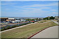
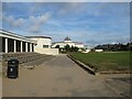
Fleetwood Town FC Stadium
by David Dixon
geograph for square SD3247
The entrance to Fleetwood Town's football stadium, from Memorial Park.
|
|
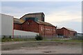
Fleetwood's Abandoned Port
by Gerald England
geograph for square SD3447
Once busy with the famous Fleetwood fishing fleet the port of Fleetwood is now... (more)
|
|
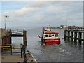
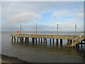
Entrance to Fleetwood Ferry
by Malc McDonald
geograph for square SD3348
The entrance to the ferry pier at Fleetwood, in Lancashire. The ferry crosses... (more)
|
|
Ferry leaving Fleetwood
by Malc McDonald
geograph for square SD3448
A ferry crosses the Wyre estuary, from Fleetwood to Knott End on the opposite... (more)
|
|
North Euston Hotel, Fleetwood
by Malc McDonald
geograph for square SD3348
The North Euston Hotel at Fleetwood. The hotel was opened in 1841. At the... (more)
|
|
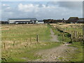
Public footpath near Fleetwood
by Malc McDonald
geograph for square SD3145
A public footpath leading away from the seafront near Fleetwood. This path... (more)
|
|
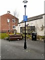
Pocket Park
by Gerald England
geograph for square SD3348
Pocket Park is on the corner of North Albert Street and Victoria Street.
The... (more)
|
|
Tram at Lindel Road
by David Dixon
geograph for square SD3246
Blackpool has long been famed as the home of the coastal tram line that ran for... (more)
|
|
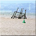
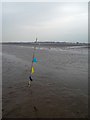
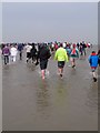
Wreck trek marker flag with Fleetwood ahead
by Steve Fareham
for square SD3249
Organised by the Fleetwood RNLI this escorted walk is out on the sands to the... (more)
|
|
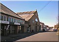
The Packaged Ice Company, Fleetwood
by Chris Allen
geograph for square SD3347
As Fleetwood was once a major fishing port, this company probably started out... (more)
|
|
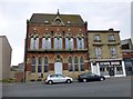
Former Fleetwood Museum and Public Library
by Rude Health
geograph for square SD3447
The former museum and public library on Dock Street was built in 1863 to a... (more)
|
|
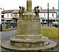
Fleetwood War Memorial: West Side
by Gerald England
geograph for square SD3347
|
|
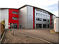
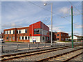
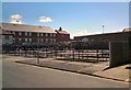
Fleetwood Community Fire Station
by David Dixon
geograph for square SD3247
The fire station at the corner of Peel Road and Radcliffe Road in Fleetwood.
|
|
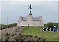
The Fisherman's friend roundabout, welcome to Fleetwood
by Steve Fareham
geograph for square SD3245
Named after the iconic cough sweet made in Fleetwood, the statue looks like Eros... (more)
|
|
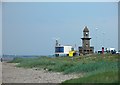
Fleetwood lower light
by Steve Fareham
geograph for square SD3348
The Lower Lighthouse was designed in 1840 by Sir Decimus Burton, the architect... (more)
|
|
Wreck Trek Fleetwood 2012
by Steve Fareham
for square SD3249
Organised by the Fleetwood RNLI this escorted walk is out on the sands to the... (more)
|
|
Fleetwood Open Market
by Gerald England
geograph for square SD3448
|
|
Fleetwood Market
by Gerald England
geograph for square SD3348
Fleetwood Market was opened in 1840 off Victoria Street. The present market... (more)
|
|
Beach Lighthouse
by Gerald England
geograph for square SD3348
The Lower (Beach) Lighthouse at Fleetwood was designed in 1839 by Decimus... (more)
|
|
View looking north from The Mount, Fleetwood towards Heysham
by Rod Grealish
geograph for square SD3348
The view looking north from The Mount, Fleetwood towards Heysham where the... (more)
|
|
View of Marine Hall, Fleetwood and across to Lake District
by Rod Grealish
geograph for square SD3348
View taken from the Mount of Marine Hall, Fleetwood and across Morecambe Bay to... (more)
|
|
Pharos or Upper Lighthouse Fleetwood
by Rod Grealish
geograph for square SD3348
Opened in 1840 together with the Lower Lighthouse. The lights from each... (more)
|
|
Jetty at Fleetwood
by Malc McDonald
geograph for square SD3448
A concrete jetty at the mouth of the River Wyre, in the Lancashire town of Fleetwood.
|
|
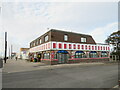
Amusement arcade, Fleetwood
by Malc McDonald
geograph for square SD3448
An amusement arcade in the Lancashire coastal town of Fleetwood.
|
|
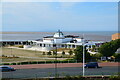
Marine Hall and Gardens, Fleetwood
by Malc McDonald
geograph for square SD3348
Marine Hall is an entertainment venue built in the 1930s on the seafront at... (more)
|