Public Tags
Tag: M55
Other tags: motorway:M55
Showing images tagged with M55 tag.
|
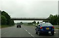
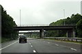
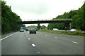
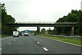
Farm track over the M55
by Steve Daniels geograph for square SD4034 Heading west on the M55.
|
|
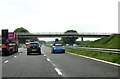
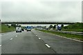
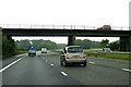
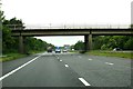
A farm track crosses the M55
by Steve Daniels geograph for square SD4234 Heading west on the M55.
|
|
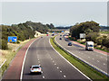
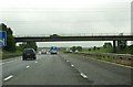
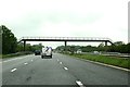
M55 Motorway
by David Dixon geograph for square SD4034 The M55 motorway, looking towards junction 3, from Bradshaw Lane.
|
|
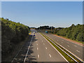
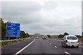
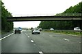
M55 Towards Blackpool
by David Dixon geograph for square SD4134 Looking westwards along the M55, from the A585 at junction 3.
|
|
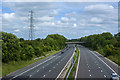
The M55 heading east
by Steve Daniels geograph for square SD3633 The M55 runs from Blackpool to the M6 near Preston.
|
|
Joining the M55 by Peel Hill
by Steve Daniels geograph for square SD3533 The M55 runs from Blackpool to the M6 near Preston.
|
|
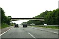
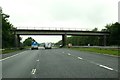
Weeton Road crosses the M55
by Steve Daniels geograph for square SD3834 Heading west on the M55.
|
|
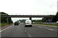
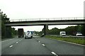
Bradshaw Lane crosses the M55
by Steve Daniels geograph for square SD3934 Heading west on the M55.
|
|
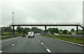
Fleetwood Road crosses the M55 at Junction 3
by Steve Daniels geograph for square SD4134 Heading west on the M55.
|
|
White Carr Lane crosses the M55
by Steve Daniels geograph for square SD4334 Heading west on the M55.
|
|
Moorside crosses the M55
by Steve Daniels geograph for square SD4334 Heading west on the M55.
|
|
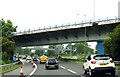
Church Road crosses the M55
by Steve Daniels geograph for square SD4434 Heading west on the M55.
|
|
Blue Moor crosses the M55
by Steve Daniels geograph for square SD4534 Heading west on the M55.
|
|
Dagger Road crosses the M55
by Steve Daniels geograph for square SD4634 Heading west on the M55.
|
|
Salwick Road crosses the M55
by Steve Daniels geograph for square SD4634 Heading west on the M55.
|
|
Blackleach Lane crosses the M55
by Steve Daniels geograph for square SD4734 Heading west on the M55.
|
|
Rosemary Lane crosses the M55
by Steve Daniels geograph for square SD4834 Heading west on the M55.
|
|
Lightfoot Green Lane crosses the M55
by Steve Daniels geograph for square SD5133 Heading west on the M55.
|
|
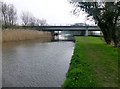
M55 Crosses The Lancaster Canal
by Rude Health geograph for square SD4634 A view down the towing path as the M55 crosses above the Lancaster canal.
Tags:
top:CanalsX
Lancaster CanalX
top:LowlandsX
motorway:M55
top:PathsX
top:Roads, Road TransportX
Towing PathX
|
|
Footbridge over the M55
by Steve Daniels geograph for square SD4934 The footpath runs from Lower Bartle to Swillbrook.
|
|
Footbridge over the M55
by Steve Daniels geograph for square SD5033 The footpath runs from Nog Tow to Woodplumpton.
|
|
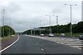
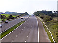
The M55 heading west
by Steve Daniels geograph for square SD5334 The slip road from the southbound M6 runs over the flyover bridge.
|
|
The M55 near Lower Bartle
by Ian Greig geograph for square SD4933 Tags:
motorway:M55
top:Roads, Road TransportX
|
|
M55 Motorway
by David Dixon geograph for square SD3934 Looking west (towards Blackpool) from Bradshaw Lane.
|
|
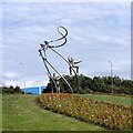
Helter-Skelter Roundabout
by Gerald England geograph for square SD3433 This roundabout at the end of the exit road from the M55 is known as the... (more)
Tags:
date:1995X
type:GeographX
motorway:M55
Public ArtworkX
top:Roads, Road TransportX
RoundaboutX
Roundabout SculptureX
|
|
Sandy Lane crosses the M55
by Steve Daniels geograph for square SD4933 |
|
Tabley Lane crosses the M55
by Steve Daniels geograph for square SD5033 |
|
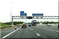
Turn off to the A6 from the M55
by Steve Daniels geograph for square SD5334 |
|
The M55 leaving the M6 heading north
by Steve Daniels geograph for square SD5434 |
|
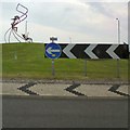
Helter Skelter roundabout
by Gerald England for square SD3433 This roundabout on the A5230 near the end of the M55 is known as the... (more)
Tags:
date:1995X
road:A5230X
motorway:M55
Public ArtworkX
top:Roads, Road TransportX
RoundaboutX
Roundabout SculptureX
|