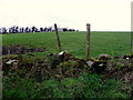
|
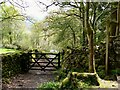
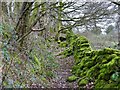
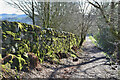
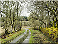
Mossy entrance to a bridleway
by Marika Reinholds
geograph for square NY1700
Not a 'green lane' but a bridleway, that leads to the Eskdale parish... (more)
|
|
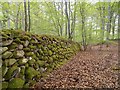
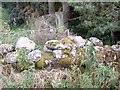
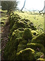
Dry Stone Wall in Darnaway Forest
by valenta
geograph for square NH9954
An old dry stone wall covered in moss, probably part of the nearby Darnaway... (more)
|
|
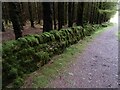
Dry Stone Wall in Darnaway Forest
by valenta
for square NH9954
An old dry stone wall covered in moss, probably part of the nearby Darnaway... (more)
|
|
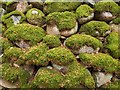
Moss-covered dry stone wall, Achnabreck Forest
by Mick Garratt
geograph for square NR8590
|
|
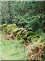
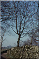
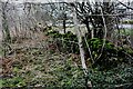
Moss covered dry-stone wall at Backtown
by Kenneth Allen
geograph for square H3295
Pictured along Inchenny Road
|
|
A moss covered dry stone wall
by Stanley Howe
for square NJ7601
|
|
Moss encrusted dry stone wall
by Russel Wills
geograph for square NY7483
Beside the path to the bothy.
|
|
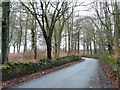
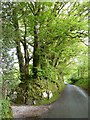
Lane past Grove Farm, Stanshope
by Christopher Hilton
geograph for square SK1254
|
|
Wood Lane bending out of the woods
by Christine Johnstone
geograph for square SE1811
Joy Wood to the left, Boothroyd Wood to the right.
|
|
Wood Lane passing through the woods
by Christine Johnstone
geograph for square SE1811
Boothroyd Wood on the left, Joy Wood on the right and a spot height in the middle.
|
|
Green wall and path
by Ian Paterson
geograph for square NX9565
The lower section of the path which leads to the Waterloo Monument features a... (more)
|
|
Mendip velvet
by Neil Owen
geograph for square ST5257
The area is crossed with dry limestone walling and in the more sheltered places... (more)
|
|
Footpath by a mossy wall
by Ian Calderwood
geograph for square SK0843
|
|
Moss covering the wall by the road at Tors Park
by David Smith
geograph for square SX6193
A testimony to the damp and clean atmosphere here
|
|
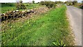
Dry stone wall and verge on north side of minor road outside Highfield
by Roger Templeman
geograph for square NY5961
Ordnance Survey documents indicate that a benchmark levelled at 197.474m above... (more)
|
|
B6478 passing to south of Hole House Plantation
by Roger Templeman
geograph for square SD7956
|
|
Path from Moffat
by Jim Barton
geograph for square NT0805
A path through farmland south of Gallow Hill.
|
|
Scrub area between carriageways on A66 at Baron's Hill
by Roger Templeman
geograph for square NY4728
Ordnance Survey records show that a bench mark was levelled at 724.551 feet... (more)
|
|
Becks Brow (B6478) on south side of North Hill Plantation
by Roger Templeman
geograph for square SD8056
Ordnance Survey documents indicate that in 1960 a benchmark was levelled at... (more)
|
|
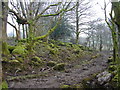
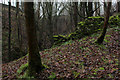
Redundant Wall in Lob Wood
by Chris Heaton
geograph for square SE0652
Very steep sided wood, sliding into a chasm with a stream at the bottom. The... (more)
|
|
Road heading north beyond Lochgilphead
by Trevor Littlewood
geograph for square NR8689
Monydrain Road heads north from Lochgilphead passing through modern housing... (more)
|
|
Cotswold Way near Stanway
by Derek Harper
geograph for square SP0632
Along with the Winchcombe Way, leaving the hamlet along Stanway footpath 4. A... (more)
|
|
Path by Swinsty Reservoir
by Derek Harper
geograph for square SE1953
|
|
Silverdale Road by Rainscar
by Chris Heaton
geograph for square SD8472
The road passes a small copse beside the buildings at Rainscar, and thus passes... (more)
|
|
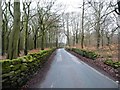
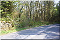
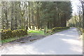
Road Outside Lawkland Hall
by Chris Heaton
geograph for square SD7765
The road leading from the A65 near Austwick, leading towards Lawkland Green.
|