Public Tags
Tag: Mountain·Side
Showing images tagged with Mountain Side tag.

|
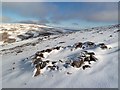
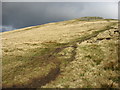
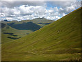
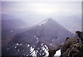
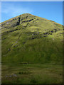
Slopes of Beinn a'Chruinnich
by Oliver Dixon geograph for square NJ2413 The slopes of this mountain adjacent to the Lecht Ski Centre are traversed by... (more)
Tags:
ChairliftX
top:MoorlandX
MoorlandX
subject:MountainX
Mountain Bike TrailX
Mountain Side
top:Sport, LeisureX
top:UplandsX
|
|
The north side of Ben Macdui
by Walter Baxter geograph for square NN9899 This dilapidated circlular stone shelter is at the 1280m contour on the north... (more)
Tags:
Mountain Side
top:UplandsX
|
|
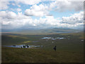
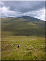
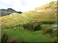
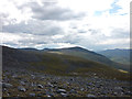
Descending off Beinn na Lap towards Loch Ossian
by Karl and Ali geograph for square NN3668 What a tedious (apart from the view) way to walk up the mountain this must be.... (more)
|
|
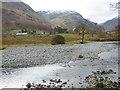
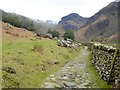
Stonethwaite Beck
by Oliver Dixon geograph for square NY2514 Looking downstream at a big bend on the Beck. The hamlet of Longthwaite can be... (more)
|
|
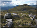
Boulders and outcrops, west side of Geal Charn
by Karl and Ali geograph for square NN4981 Looking towards Creag Pitridh (924m).
Tags:
BouldersX
Minor Rock OutcropsX
top:MoorlandX
Mountain Side
MountainsX
MunrosX
top:Rocks, Scree, CliffsX
top:UplandsX
|
|
The west slopes of Great Rigg
by David Purchase geograph for square NY3510 The path is the direct route from Grasmere village to Great Rigg and Fairfield.
|
|
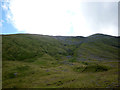
Heading for the Allt Coire Pitridh
by Karl and Ali geograph for square NN4780 Descending the long, tussocky moorland slope to reach the good stalkers track... (more)
|
|
The slopes of Coire Pitridh
by Karl and Ali geograph for square NN4880 |
|
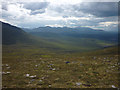
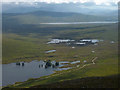
At the head of An Caorann Mòr
by Karl and Ali geograph for square NH0715 The track is now just a boggy squelch over an indeterminate bealach but is... (more)
|
|
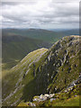
The north flank of Coire Odhar
by Karl and Ali geograph for square NH0817 Looking towards the great mountain of Sgurr nan Ceathreamhnan (1151m) rising out... (more)
|
|
Steep ground above Strath Nethy
by Walter Baxter geograph for square NJ0105 This was viewed from the 1130m contour on the north side of the summit of Cnap... (more)
Tags:
Mountain Side
top:UplandsX
|
|
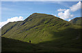
The west slopes of Side Pike
by David Purchase geograph for square NY2805 With the Langdale Pikes beyond.
|

|
Rakerigg
by David Purchase geograph for square NY2804 Seen from the path between Side Pike and Blea Tarn.
|
|
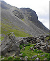
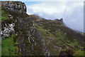
Hollow Stones
by Ian Taylor geograph for square NY2007 Black Crag, on the north side of Scafell, is in the background.
|
|
On Ben More looking towards A'Chioch
by Russel Wills geograph for square NM5233 Note the hard rime on rocks in foreground. A cold day!
Tags:
Mountain Side
top:UplandsX
|
|
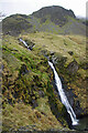
Waterfall below Dalehead Crags
by Ian Taylor geograph for square NY2216 Newlands Beck falls 250m from Dale Head Tarn in about 1km horizontal distance.... (more)
Tags:
type:GeographX
Mountain Side
Newlands BeckX
top:Rivers, Streams, DrainageX
top:UplandsX
subject:WaterfallX
|
|
Ben Tianavaig
by Ian Taylor geograph for square NG5140 Looking north from the south ridge. Mist is swirling on the eastern (seaward) flank.
|
|
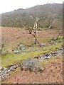
Woodland below Lingy End
by Oliver Dixon geograph for square NY2613 A dead tree in the foreground below the woodland clinging to the mountainside... (more)
Tags:
Dead TreeX
Mountain Side
RocksX
top:Rocks, Scree, CliffsX
subject:TreeX
top:UplandsX
WoodlandX
top:Woodland, ForestX
|
|
Cumbria Way at Stonethwaite
by Oliver Dixon geograph for square NY2613 Stony bridleway alongside Stonethwaite Beck leading at the head of the valley to... (more)
|
|
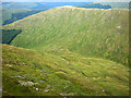
Shallow corrie, west flank of Geal Charn
by Karl and Ali geograph for square NN4980 Looking towards Beinn a' Chlachair.
Tags:
Boulder FieldX
CorrieX
top:MoorlandX
Mountain Side
MunrosX
top:Rocks, Scree, CliffsX
top:UplandsX
|
|
The southern flanks of Geal Charn
by Karl and Ali geograph for square NN5080 |
|
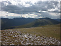
The southern slopes of Beinn na Lap
by Karl and Ali geograph for square NN3768 Looking down on the head of Loch Ossian.
|
|
The slopes of Am Bathach
by Karl and Ali geograph for square NH0714 As seen from the rather boggy track in upper An Caorann Mor.
|
|
The western flank of A' Chraileag
by Karl and Ali geograph for square NH0815 Steep and uninviting slopes of grass and scree above the An Caorann Mor glen.
|
|
The north face of Carn Ghluasaid
by Karl and Ali geograph for square NH1412 Looking into the deep glen of Coire Sgreumh now disfigured by a vehicle track,... (more)
Tags:
top:Air, Sky, WeatherX
Cloud ShadowX
CoireX
CragsX
Mountain Side
top:PathsX
top:Rocks, Scree, CliffsX
SunshineX
top:UplandsX
Vehicle TrackX
|
|
Allt Coire an Lochain
by Karl and Ali geograph for square NN2627 A feeder of the Allt an Rund which descends the northern flank of Ben Lui from a... (more)
|