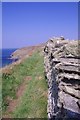
|
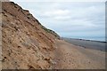
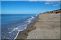
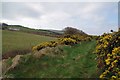
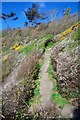
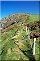
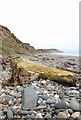
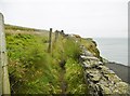
Towards Shellag Point on the Raad ny Foillan
by Glyn Baker
geograph for square SC4599
Here the cliffs are eroding so fast the sea can't prevent there being a bit... (more)
|
|
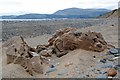
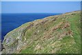
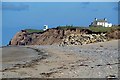
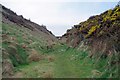
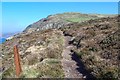
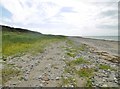
Rocks on the Raad ny Foillan
by Glyn Baker
geograph for square SC4599
Looking back along the Raad ny Foilan... (more)
|
|
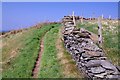
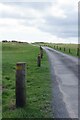
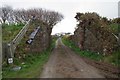
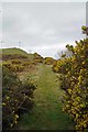
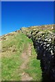
Parallel Paths & Dry Stone Wall
by Glyn Baker
geograph for square SC2381
The Raad ny Foillan... (more)
|
|
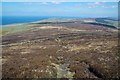
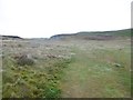
Raad ny Foillan on Cronk ny Arrey Laa
by Glyn Baker
geograph for square SC2274
|
|
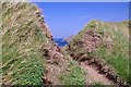
Lichen Covered Wall
by Glyn Baker
geograph for square SC2381
Looking Peel bound on the Raad ny Foillan... (more)
|
|
Raad ny Foillan at Ellan ny Maaughol
by Glyn Baker
geograph for square SC2281
Looking peel bound on the coastal path... (more)
|
|
Raad ny Foillan Crossing Castletown Links
by Glyn Baker
geograph for square SC2867
The Manx coastal path... (more)
|
|
Gap in the Earth Bank
by Glyn Baker
geograph for square SC2281
This gap allows the Raad ny Foillan... (more)
|
|
Towards Ballasalla
by Glyn Baker
geograph for square SC3497
Moving anti clockwise on the Raad ny Foillan... (more)
|
|
Raad ny Foillan on the Beach
by Glyn Baker
geograph for square SC3396
Part of the Coastal Path... (more)
|
|
Vehicle Tracks on The Raad ny Foillan
by Glyn Baker
geograph for square NX3701
On the beach at Cronk Y Bing... (more)
|
|
The Way to Ballacarnane
by Glyn Baker
geograph for square SC2988
The abutments of the former railway bridge and an unmade road. The Blue &... (more)
|
|
Raad ny Foillan Near Ballacarnane
by Glyn Baker
geograph for square SC2988
The Manx coastal path... (more)
|
|
Towards Kirk Michael
by Glyn Baker
geograph for square SC3089
|
|
Ascent to the Northern Railway
by Glyn Baker
geograph for square SC3089
Part of the Raad ny Foillan... (more)
|
|
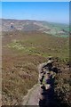
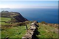
The Descent From Bradda Hill
by Glyn Baker
geograph for square SC1971
Part of the Raad ny Foillan... (more)
|
|
Steep Path Near Port Erin
by Glyn Baker
geograph for square SC1969
Part of the Raad ny Foillan... (more)
|
|
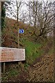
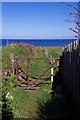
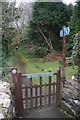
A Raad ny Foillan Gate
by Glyn Baker
geograph for square SC2176
Looking back towards Niarbiyl on the coastal Path... (more)
|
|
The Descent to Glen Maye
by Glyn Baker
geograph for square SC2279
Part of the Raad ny Foillan... (more)
|
|
A27/Raad ny Foillan in Dalby
by Glyn Baker
geograph for square SC2178
At this point the coastal path... (more)
|
|
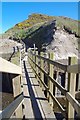
Footbridge Across Glen Trunk
by Glyn Baker
geograph for square SC3192
The bridge carries the Raad ny Foillan... (more)
|
|
Gate on the Raad ny Foillan
by Glyn Baker
geograph for square SC3192
|
|
Raad ny Foillan at Blue Point
by Glyn Baker
geograph for square NX3902
I am not sure if the path through the dunes is the official track of the coastal... (more)
|
|
Bridge to the Cliftop
by Glyn Baker
geograph for square SC2886
This bridge over the former Northern Railway now carries a public footpath over... (more)
|
|
Old Cutting Near Lynague
by Glyn Baker
geograph for square SC2886
The Raad ny Foillan... (more)
|
|
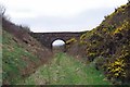
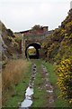
Tunnel Under the A4
by Glyn Baker
geograph for square SC2988
The Raad ny Foillan... (more)
|
|
Primrose & Footbridge Near Ballaquine
by Glyn Baker
geograph for square SC2988
On the Raad ny Foillan... (more)
|
|
Remains of The Northern Railway
by Glyn Baker
geograph for square SC3089
The Southbound Raad ny Foillan... (more)
|
|
Gate to Glen Mooar
by Glyn Baker
geograph for square SC3089
The Raad ny Foillan... (more)
|
|
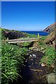
Footbridge on the Raad ny Foillan
by Glyn Baker
geograph for square SC2071
This footbridge near Fleshwick Bay carries the Manx Coastal Path... (more)
|
|
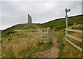
Looking Back to Millner's Tower
by Glyn Baker
geograph for square SC1970
The Raad ny Foillan... (more)
|
|
Wall by the Raad ny Foillan
by Glyn Baker
geograph for square SC1970
Northbound on the coastal path... (more)
|
|
Fence Above Creg Harlot
by Glyn Baker
geograph for square SC1870
Beside the Raad ny Foillan coastal path... (more)
|
|
Rust and Raad ny Foillan
by Glyn Baker
geograph for square SC1870
The fence has long since passed into history!... (more)
|
|
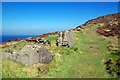
Ruin Near The Nay
by Glyn Baker
geograph for square SC1870
A Ruin beside the Raad ny Foillan... (more)
|
|
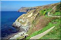
Cliff Path to Bradda Point
by Glyn Baker
geograph for square SC1969
Part of the Raad ny Foillan... (more)
|
|
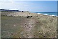
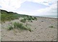
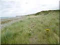
Driftwood and Dog Mills Beach
by Glyn Baker
geograph for square SC4597
Part of the Raad ny Foillan... (more)
|
|
Ballahen, Raad ny Foillan
by Mike Faherty
geograph for square NX3802
The Manx long-distance coastal path, running 95 miles around or near the coast.... (more)
|
|
Blue Point, Raad ny Foillan
by Mike Faherty
geograph for square NX3902
The Manx long distance coastal path, running around 95 miles of the coast.... (more)
|
|
Jurby, Raad ny Foillan
by Mike Faherty
geograph for square NX3600
"Way of the Gull", the Manx long-distance coastal path:... (more)
|
|
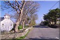
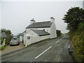
Ballaragh, cottage
by Mike Faherty
geograph for square SC4585
This section of road, once the Douglas to Ramsey route, forms part of the Raad... (more)
|
|
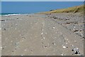
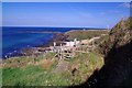
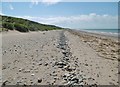
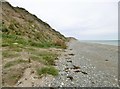
The Dog Mills, Raad ny Foillan
by Mike Faherty
geograph for square SC4598
The Manx 95 mile coastal path, "Way of the Gull". OS recommends... (more)
|
|
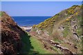
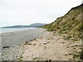
The Dog Mills, Raad ny Foillan
by Mike Faherty
geograph for square SC4597
"Way of the Gulls", the 95 mile Manx coastal path; seen here between... (more)
|
|
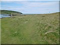
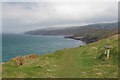
The Cronk, Raad ny Foillan
by Mike Faherty
geograph for square SC3396
The Manx long-distance coastal path; not clearly defined on the northern coast.... (more)
|
|
Port Erin, Raad ny Foillan
by Mike Faherty
geograph for square SC1868
Above Port Erin, the Manx long-distance coastal path, on its way towards Calf of... (more)
|
|
Calf Sound, Raad ny Foillan
by Mike Faherty
geograph for square SC1766
"Road of the Gull", the 95 mile long-distance coastal path; left, a... (more)
|
|
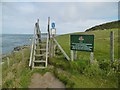
Calf Sound, stile
by Mike Faherty
geograph for square SC1766
On Raad ny Foillan, the long-distance coastal path. As the sign indicates, this... (more)
|
|
Bradda, Raad ny Foillan
by Mike Faherty
geograph for square SC1870
The Manx long-distance coastal path, heading towards Fleshwick Bay:... (more)
|
|
Bradda, gate
by Mike Faherty
geograph for square SC1869
Heading towards Bradda Head on Raad ny Foillan, the Manx long-distance coastal... (more)
|
|
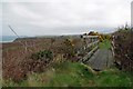
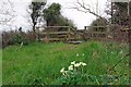
A Place to Sit & Ponder
by Glyn Baker
geograph for square SC2585
Beside the Raad na Foillan... (more)
|