Public Tags
Showing images tagged with Westway tag.
|
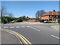
Farsley Westway Car Park
by David Goodall
geograph for square SE2135
Photograph showing a free car parking area adjacent to Farsley Westway, next to... (more)
|
|
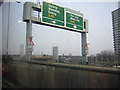
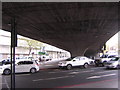
Approaching the Westway, from the West London Line
by Christopher Hilton
geograph for square TQ2380
Traffic here climbs towards the elevated roundabout giving access to the... (more)
|
|
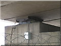
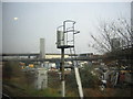
Instrumentation on Westway bridge pier
by David Hawgood
for square TQ2581
|
|
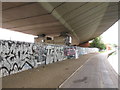
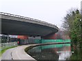
Westway overpass from below by canal
by David Hawgood
geograph for square TQ2581
A40 Westway elevated overpass curves around between White City and Paddington,... (more)
|
|
Underneath the Westway, Edgware Road
by Christopher Hilton
geograph for square TQ2781
|
|
Westway from an underground train west of Ladbroke Grove
by Christopher Hilton
geograph for square TQ2481
|
|
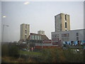
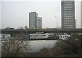
High-rise blocks, from the West London Line
by Christopher Hilton
geograph for square TQ2380
Taken from the train, hence the reflections in the sky. In the foreground the... (more)
|
|
Travellers' site under the Westway, from the West London Line
by Christopher Hilton
geograph for square TQ2381
This travellers' site has been here for many years, despite the... (more)
|
|
Travellers' site under the Westway, from the West London Line
by Christopher Hilton
geograph for square TQ2381
This travellers' site has been here for many years, despite the... (more)
|
|
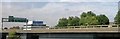
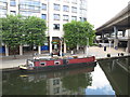
Lady Carole of Nantwich - narrowboat in Paddington Basin
by David Hawgood
geograph for square TQ2681
The roads on the right are the A40 Westway above, Harrow Road below.
|
|
Westway and railway bridge, Westbourne Park
by Christopher Hilton
geograph for square TQ2481
|
|
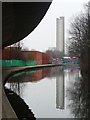
Reflection of Trellick Tower
by Christine Johnstone
geograph for square TQ2581
On the Paddington Branch of the Grand Union Canal, under the Westway.
|
|
Crossing, but not connecting
by Christine Johnstone
geograph for square TQ2581
The Westway [A40] above the Paddington Branch of the Grand Union Canal.
|
|
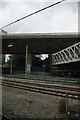
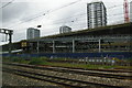
Crossrail works, west of Paddington
by Christopher Hilton
geograph for square TQ2581
|