|
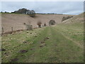
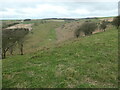
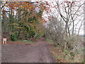
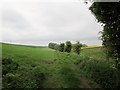
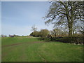
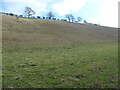
Protected saplings in Thixen Dale
by Christine Johnstone
geograph for square SE8459
Alongside the Yorkshire Wolds Way, a public bridleway. The Yorkshire Wolds is... (more)
|
|
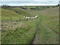
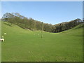
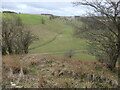
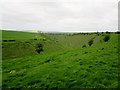
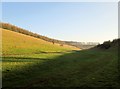
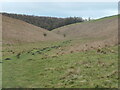
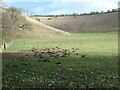
Descent to Vessey Pasture Dale
by Christine Johnstone
geograph for square SE8362
Public bridleway, part of the Yorkshire Wolds Way. The Yorkshire Wolds is the... (more)
|
|
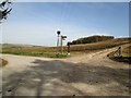
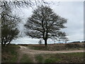
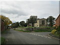
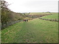
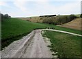
Junction on the Yorkshire Wolds
by Martin Dawes
geograph for square SE8250
A lot happens here, the minor road coming in then going out on the left is from... (more)
|
|
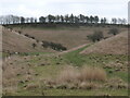
Yorkshire Wolds Way, Cow Wold
by Christine Johnstone
geograph for square SE8361
The large-scale OS maps of both 1851 and 1951 show the track going straight... (more)
|
|
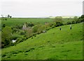
Wharram Percy Farm from North Plantation
by Martin Dawes
for square SE8463
Cross square. A view over the head of Deep Dale to Wharram Percy Farm showing... (more)
|
|
Warren Dale Yorkshire Wolds
by Martin Dawes
geograph for square SE8350
From the access road to Low Warrendale Farm, route of the Yorkshire Wolds Way
|
|
Cotton Dale Slack Staxton Wold
by Martin Dawes
geograph for square TA0277
Route of the Yorkshire Wolds Way and the Centenary Way, both worth walking, but... (more)
|
|
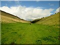
Lone walker in Thixen Dale
by Christine Johnstone
geograph for square SE8459
The line coming down the valley side is a public bridleway and the route of the... (more)
|
|
Dew pond in Water Dale
by Christine Johnstone
geograph for square SE8361
The Yorkshire Wolds is the northernmost chalk landscape in Britain. The chalk is... (more)
|
|
Tree at the junction above Toisland Wold
by Christine Johnstone
geograph for square SE8362
Straight on / west for the Centenary Way, Left / south for the Yorkshire Wolds... (more)
|
|
The Dale from the Yorkshire Wolds Way
by Martin Dawes
geograph for square SE9042
A side dale running down from Weighton Wold into Goodmanham Dale. On its right... (more)
|
|
The Bungalow Yorkshire Wolds Way
by Martin Dawes
geograph for square SE8349
The footpath leaves the access road to Wold Farm and turns right at the... (more)
|
|
Little Wold Plantation
by Martin Dawes
geograph for square SE9232
The Yorkshire Wolds Way goes straight on
|
|
Dew pond in Thixen Dale
by Christine Johnstone
geograph for square SE8361
The Yorkshire Wolds is the northernmost chalk landscape in Britain. The chalk is... (more)
|
|
View of the Yorkshire Wolds from Great Givendale
by David Hillas
geograph for square SE8153
This photo shows the Yorkshire Wolds looking south from Givendale Road where the... (more)
|
|
The climb up out of Swin Dale
by Martin Dawes
geograph for square SE9436
A bit of a pull on the route of the Yorkshire Wolds Way
|
|
Yorkshire Wolds Way through Holm Dale
by Martin Dawes
geograph for square SE8757
|
|
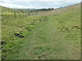
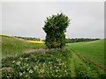
Molehills on the Yorkshire Wolds Way
by Christine Johnstone
geograph for square SE8362
East of Vessey Pasture.
|
|
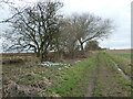
Snowdrops along the Yorkshire Wolds Way
by Christine Johnstone
geograph for square SE8462
At the west end of North Plantation.
|
|
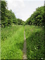
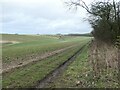
Public bridleway heading east from North Plantation
by Christine Johnstone
geograph for square SE8462
Part of the Yorkshire Wolds Way.
|
|
Uncleby Top, from the north-west
by Christine Johnstone
geograph for square SE8259
The distant buildings are Uncleby Wold Barn. A major boundary runs along the... (more)
|
|
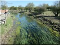
Gypsey Race, Wold Newton
by Christine Johnstone
geograph for square TA0472
The biggest watercourse on the Yorkshire Wolds. Looking downstream from the... (more)
|
|
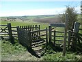
Yorkshire Wolds Way above Lang Dale
by Christine Johnstone
geograph for square TA0477
At a 153 metre spot height. Also on the Centenary Way. The kissing gate has been... (more)
|
|
Footpaths crossing, Lang Dale
by Christine Johnstone
geograph for square TA0477
The Centenary Way and the Yorkshire Wolds Way crossing the public footpath... (more)
|
|
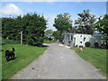
Main Street Goodmanham and All Saints Parish Church
by Martin Dawes
geograph for square SE8943
The road to the right is Wateringdike Lane, on the route of the Yorkshire Wolds Way
|
|
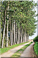
L Plantation
by Andy Stephenson
geograph for square SE9174
Pine trees by the side of the Yorkshire Wolds Way.
|
|
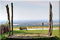
Yorkshire Wolds Way walker
by Andy Stephenson
geograph for square SE8974
Looking through part of the art installation "Enclosure Rites" by Jony Easterby.
|
|
The Yorkshire Wolds Way in Swin Dale
by Andy Stephenson
geograph for square SE9336
A winter view.
|
|
Yorkshire Wolds Way in Stocking Dale
by Martin Dawes
geograph for square TA0677
It follows this field edge then through the woods to The Camp where it joins up... (more)
|
|
Looking back to the trees in Stocking Dale
by Martin Dawes
geograph for square TA0677
The field edge path to the left is the Yorkshire Wolds Way
|
|
The Yorkshire Wolds Way through Stocking Dale
by Martin Dawes
geograph for square TA0677
Path has come out of the wood, the trees in the distance are Long Plantation
|
|
Yorkshire Wolds Way dropping into Deep Dale
by Martin Dawes
geograph for square SE8564
The remains of St Martin's Church Wharram Percy is on the footpath
|
|
Deep Dale from the footpath above
by Martin Dawes
geograph for square SE8562
The Yorkshire Wolds Way and Centenary Way both enjoy this view
|
|
Field track and walking highway
by Martin Dawes
geograph for square SE8462
This is on the route of both the Yorkshire Wolds Way, 79 miles and the Centenary... (more)
|
|
Yorkshire Wolds Way approaching Warren Farm
by Martin Dawes
geograph for square SE8452
Warren Farm is in the trees at the end of this field, the path along the left... (more)
|
|
Farm access track from Warren Farm (2)
by Martin Dawes
geograph for square SE8451
The Yorkshire Wolds Way crosses the track and goes left, the farm dog was having... (more)
|
|
Getting a noisy reception at Warren Farm
by Martin Dawes
geograph for square SE8451
The finger post on the left is for the Yorkshire Wolds Way which crosses this... (more)
|
|
Access road to Low Warrendale Farm
by Martin Dawes
geograph for square SE8350
Route of the Yorkshire Wolds Way
|
|
Yorkshire Wolds Way toward Low Warrendale Farm
by Martin Dawes
geograph for square SE8350
Field track through winter cereals
|
|
Field edge footpath takes a right
by Martin Dawes
geograph for square SE8350
Not for long, it follows the field edge to Low Warrendale Farm which can be seen... (more)
|
|
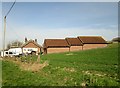
Hessey Barn no more
by Martin Dawes
geograph for square SE8448
Yorkshire Wolds Way straight ahead. The flat area beyond the gate on the right... (more)
|
|
Winter sun casts shadows in Lavender Dale
by Martin Dawes
geograph for square SE8852
The Yorkshire Wolds are a wonderful place to walk but they are off the beaten... (more)
|
|
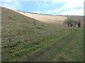
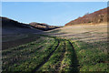
Footpath going down Comber Dale
by Martin Dawes
geograph for square SE9332
Route of the Yorkshire Wolds Way
|
|
Yorkshire Wolds Way passes Trig Point
by Martin Dawes
geograph for square SE9238
Sober Hill wind farm beyond
|
|
Harper Dale Yorkshire Wolds
by Martin Dawes
geograph for square SE8957
The farm track goes right to the eastern end of Harper Dale,the footpath goes... (more)
|
|
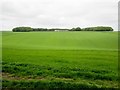
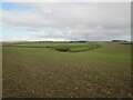
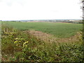
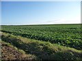
Large crop field south of the Wold Newton road
by Christine Johnstone
geograph for square TA0876
The sky stretches for ever on the top of the Yorkshire Wolds.
|
|
Bradeham Dale
by Christine Johnstone
geograph for square SE8458
Heading south-west from the upper end of Thixen Dale. The Yorkshire Wolds is the... (more)
|
|
Open access land, Pluckham Dale
by Christine Johnstone
geograph for square SE8458
Looking south-east from the upper end of Thixen Dale. The Yorkshire Wolds is the... (more)
|
|
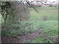
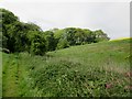
The eastern side of Thixen Dale
by Christine Johnstone
geograph for square SE8459
The Yorkshire Wolds is the northernmost chalk landscape in Britain. The chalk is... (more)
|
|
Molehills in Thixen Dale
by Christine Johnstone
geograph for square SE8459
Proof that the topsoil is deeper in the valley bottom. The Yorkshire Wolds is... (more)
|