|
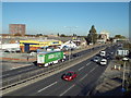
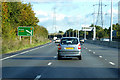
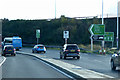
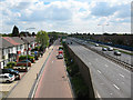
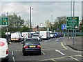
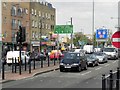
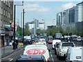
Alfred's Way (Barking By-Pass) near Barking
by Malc McDonald
geograph for square TQ4483
Sunday afternoon traffic on the A13 (Barking By-Pass) on a sunny October day.
|
|
Alfred's Way (Barking By-Pass) near Barking
by Malc McDonald
geograph for square TQ4483
A view west along the A13, looking towards Canary Wharf and the City of London.... (more)
|
|
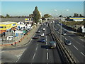
Alfred's Way (Barking By-Pass) near Barking
by Malc McDonald
geograph for square TQ4483
Sunday afternoon traffic on the Barking By-Pass, taken from a footbridge over... (more)
|

|
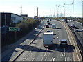
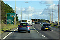
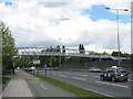
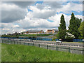
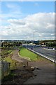
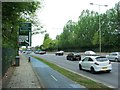
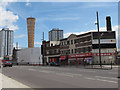
A13 at North Stifford
by Malc McDonald
geograph for square TQ6080
The A13 trunk road at North Stifford.
|
|
A13, Stifford Interchange
by David Dixon
geograph for square TQ6080
|
|
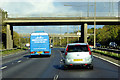
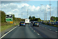
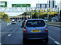
Eastbound A13 approaching Baker Street Interchange
by David Dixon
geograph for square TQ6281
|
|
A13 Eastbound, Thurrock
by David Dixon
geograph for square TQ6181
|
|
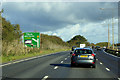
Eastbound A13 near North Stifford
by David Dixon
geograph for square TQ6180
|

|
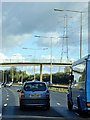
Traffic Cameras on the Eastbound A13
by David Dixon
geograph for square TQ6079
|
|
Footbridge over the Eastbound A13
by David Dixon
geograph for square TQ6079
|
|
Eastbound A13 near to North Stifford
by David Dixon
geograph for square TQ5979
|
|
Sign Gantry over the Eastbound A13 near Lakeside
by David Dixon
geograph for square TQ5879
|
|
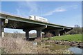
(Covid-19_5 Exercise) Mardike and A13
by Glyn Baker
geograph for square TQ5880
The A13 crossing the River Mardike
To go to the start of this exercise trip see... (more)
|
|
Footbridge over the A13 in East Ham
by Stephen Craven
geograph for square TQ4282
Category: Footbridge
The bridge, with steps for pedestrians and a ramp, crosses the A13 (Newham Way)... (more)
|
|
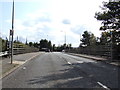
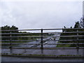
Mar Dyke Interchange
by David Dixon
geograph for square TQ5780
The roundabout at Junction 30 of the M25.
The Mar Dyke Interchange first... (more)
|
|
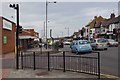
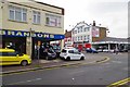
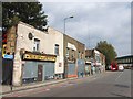
A13 London Road
by Glyn Baker
geograph for square TQ8486
At the junction with Station Rd. The A13 is a ribbon of commerce that cuts... (more)
|
|
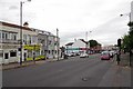
London Rd (A13)
by Glyn Baker
geograph for square TQ8386
The A13 is a ribbon of commerce that cuts through the leafy suburbs of Leigh,... (more)
|
|
Rectory Road, Orsett
by Geographer
geograph for square TQ6481
Category: Road junction
On the A13 flyover looking towards the junction with the A1013 Stanford Road
|
|
Newham Way, looking East
by Stephen Craven
geograph for square TQ4282
Category: Dual carriageway
Newham Way consists of the A13 dual-carriageway with a one-way service road on... (more)
|
|
Houses off Northfield Close
by Stephen Craven
geograph for square TQ4182
Category: Houses
Northfield Close is the nearest named road on the map, and as it serves mainly... (more)
|

|
Canning Town interchange: Jubilee line northwards
by Stephen Craven
geograph for square TQ3981
Category: Transport interchange
Canning Town is a complex transport hub, with the DLR (Docklands Light Railway),... (more)
|
|
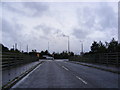
Rectory Road Bridge over the A13
by Geographer
geograph for square TQ6481
|
|
Motor Mania?
by Glyn Baker
geograph for square TQ8486
Along this stretch of the A13 there are more independent used car dealers than... (more)
|
|
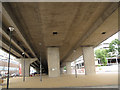
Under Newham Way
by Stephen Craven
geograph for square TQ3981
Photo taken from the cycle route under the A13 viaduct.
|
|
Commercial Road, Limehouse
by Chris Whippet
geograph for square TQ3681
|
|
A13
by John Myers
geograph for square TQ7488
4 lanes eastbound to Pitsea
|
|
A13 East India Dock Road
by David Dixon
geograph for square TQ3881
|
|
Poplar, East India Dock Road (A13)
by David Dixon
geograph for square TQ3881
|
|
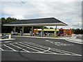
New petrol station
by Roger Jones
geograph for square TQ6681
This petrol station on the A13 was only recently rebuilt.
|
|
The A13
by Geographer
geograph for square TQ6481
Category: A road (Classified A)
Taken from the Rectory Road flyover looking towards the M25
|
|
Newham Way, Beckton
by Chris Whippet
geograph for square TQ4182
|
|
East India Dock Road
by David Dixon
geograph for square TQ3881
Evening commuter traffic heading towards the Blackwall Tunnel.
|
|
Stratford High Street
by Stephen Craven
geograph for square TQ3883
Some older buildings in the foreground, including an engineering works, and... (more)
|