Public Tags
Tag: Base
Showing images tagged with Base tag.
|
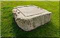
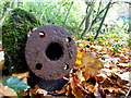
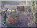
Granite Leather Press Base?
by Mike Lyne for square SW9348 This looks like a granite base for a press of some kind and used to compress... (more)
|
|
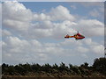
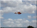
The Essex & Herts Air Ambulance about to land
by Geographer for square TL8427 At Earls Colne Airfield (its base)
Tags:
About to LandX
Agusta Westland 169X
Air AmbulanceX
top:Air, Sky, WeatherX
AirfieldX
Base
it s:BaseX
at:Earls ColneX
Earls Colne AirfieldX
at:Earls Colne AirfieldX
Essex & Herts Air AmbulanceX
type:ExtraX
near:Greenstead GreenX
subject:HelicopterX
The Essex & Herts Air AmbulanceX
top:Village, Rural SettlementX
|
|
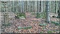
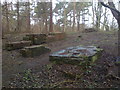
Concrete Bases
by Mick Garratt geograph for square NZ4127 Ten ruined concrete bases. Anyone any idea what they were used for.
|
|
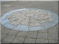
Mosaic of Smeaton's Lighthouse base
by Mike Lyne for square SX4754 This is a mosaic set into the pavement at the junction between Millbay Road and... (more)
|
|
Mystery object, Omagh
by Kenneth Allen for square H4771 The lower part is embedded in a slab of concrete
I think it may have been... (more)
|
|
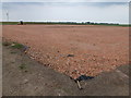
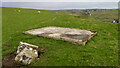
Concrete Base
by Mick Garratt geograph for square NC4267 One of several, more than likely built by the military, and probably used to tie... (more)
|
|
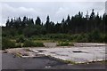
Construction work at Glassmoor Wind Farm near Ramsey Mereside
by Richard Humphrey geograph for square TL2890 Broken and crushed brick rubble is being laid on a weed mat and then rolled and... (more)
|
|
Upleatham Ironstone Mine - Brick Foundations
by Mick Garratt geograph for square NZ6320 A collection of plinths or bases probably used to mount the engine that was used... (more)
|
|
The Essex & Herts Air Ambulance about to land
by Geographer for square TL8427 At Earls Colne Airfield (its base)
Tags:
About to LandX
Agusta Westland 169X
Air AmbulanceX
top:Air, Sky, WeatherX
AirfieldX
its:Base
at:Earls ColneX
Earls Colne AirfieldX
at:Earls Colne AirfieldX
Essex & Herts Air AmbulanceX
type:ExtraX
near:Greenstead GreenX
subject:HelicopterX
The Essex & Herts Air AmbulanceX
top:Village, Rural SettlementX
|
|
Liming, Black Castle
by Richard Webb for square NT5866 Raising the pH of the soil with calcium oxide.
|
|
Foundations for coastguard lookout post
by Mick Garratt geograph for square ND2434 Tags:
Base
Coastguard LookoutX
top:Defence, MilitaryX
top:Derelict, DisusedX
FoundationsX
type:GeographX
subject:RuinX
|
|
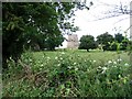
Remains of Harrods
by Richard Webb geograph for square NH5799 The site of the Falls of Shin Visitor Centre which burnt down in 2013. It... (more)
|

|
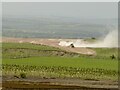
Wind Turbine T16 at Gordonbush Wind Farm
by Andrew Tryon geograph for square NC8615 The scale of the wind turbines can be appreciated from this photo, which shows... (more)
|
|
Remains of Ironstone Workings
by Mick Garratt geograph for square NZ6220 Two brick plinths probably used to mount the hauling engine for bringing the... (more)
Tags:
Base
BrickworkX
top:Derelict, DisusedX
top:Historic Sites and ArtefactsX
former:Ironstone MineX
PlinthX
|
|
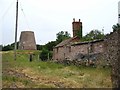
Old windmill and derelict buildings
by E Gammie geograph for square SJ3612 Category: Windmill The old windmill near Loton Park, taken from the track.
|
|
Old windmill - no sails
by E Gammie geograph for square SJ3612 Category: Windmill The stump of an old windmill just outside of Loton Park, taken from the footpath
|
|
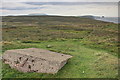
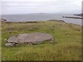
Foundations of RAF Observation Post
by Mick Garratt geograph for square NG8797 Overlooking the entrance to Guinard Bay and the Summer Isles.
|