|
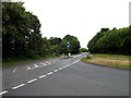
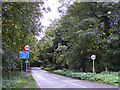
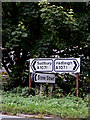
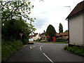
A1071 Boxford Lane, Boxford
by Geographer
geograph for square TL9640
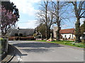
At the junction with the A1071 Hadleigh Road & School Hill
|
|
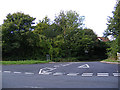
School Hill, Boxford
by Geographer
geograph for square TL9640
At the junction with the A1071 Boxford Lane
|
|
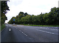
A1071 Boxford Lane, Boxford
by Geographer
geograph for square TL9640
At the junction with School Hill
|
|
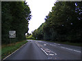
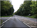
A1071 Boxford Lane, Boxford
by Geographer
geograph for square TL9640
Approaching the junction with School Hill
|
|
Stone Street, Boxford
by Geographer
geograph for square TL9640
At the junction with the A1071 Boxford Lane
|
|
A1071 Boxford Lane, Boxford
by Geographer
geograph for square TL9640
At the junction with Stone Street
|
|
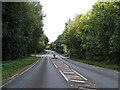
A1071 Boxford Lane, Boxford
by Geographer
geograph for square TL9640
Approaching the junction with Stone Street
|

|
Boxford village sign
by Adrian S Pye
for square TL9640
Boxford village sign is an interesting assortment. At the top we have two apples... (more)
|
|
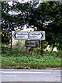
Roadsigns on the A1071 Boxford Lane
by Geographer
for square TL9640
At the junction with Stone Street
|
|
Roadsigns on the A1071 Boxford Lane
by Geographer
for square TL9640
At the junction with Stone Street
|
|
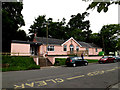
Boxford Village Hall
by Geographer
geograph for square TL9640
Off Stone Street Road near St. Mary's Church
|
|
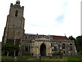
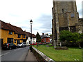
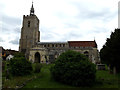
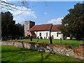
St. Mary's Church, Boxford
by Geographer
geograph for square TL9640
Off Stone Street Road at the junction with Swan & Broad Street... (more)
|
|
St. Mary's Church, Boxford
by Geographer
geograph for square TL9640
Off Stone Street Road at the junction with Swan & Broad Street... (more)
|
|
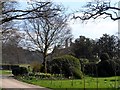
Boxford House behind a screen of trees
by Bikeboy
geograph for square SU4271
The house was built around 1825 and was originally the Rectory. See... (more)
|
|
Broad Street, Boxford
by Geographer
geograph for square TL9640
At the junction with Stone Street Road & Swan Street near St. Mary's Church
|
|
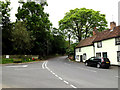
Swan Street, Boxford
by Geographer
geograph for square TL9640
At the junction with Stone Street Road & Broad Street near St. Mary's Church
|
|
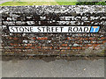
Stone Street Road, Boxford
by Geographer
geograph for square TL9640
At the junction with Swan and Broad Streets near St. Mary's Church.
|
|
St. Mary's Church Notice Board
by Geographer
for square TL9640
Off Stone Street Road at the junction with Swan & Broad Street... (more)
|
|
Sand Hill, Boxford
by Geographer
geograph for square TL9640
At the junction with the A1071 Hadleigh Road
|
|
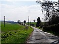
A1071 Hadleigh Road, Boxford
by Geographer
geograph for square TL9640
At the junction with Sand Hill
|
|
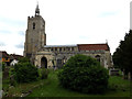
St.Mary's Church, Boxford
by Geographer
geograph for square TL9640
Off Stone Street Road at the junction with Swan and Broad Streets... (more)
|
|
Oliver Sansom's Cottage and St Andrew's church, Boxford
by Bikeboy
geograph for square SU4271
The cottage is C17. See... (more)
|
|
Boxford village sign in Broad Street
by Adrian S Pye
geograph for square TL9640
See a close up and more about the sign here Link |
|
Stone Street Road sign
by Geographer
for square TL9640
On Stone Street Road at the junction with Swan and Broad Streets near... (more)
|
|
Sand Hill, Boxford
by Geographer
geograph for square TL9640
At the junction with the A1071 Hadleigh Road
|
|
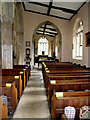
Inside of St.Mary's Church
by Geographer
for square TL9640
Looking towards the Bell Tower
|

|
Stained Glass Window TL9626440491
by Geographer
for square TL9640
|
|
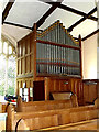
Organ of St. Mary's Church
by Geographer
for square TL9640
|
|
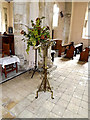
Lectern of St. Mary's Church
by Geographer
for square TL9640
|
|
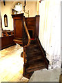
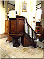
Pulpit of St. Mary's Church
by Geographer
for square TL9640
|
|
Pulpit of St. Mary's Church
by Geographer
for square TL9640
|
|
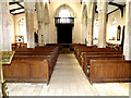
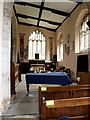
Inside of St. Mary's Church
by Geographer
for square TL9640
|
|
Inside of St. Mary's Church
by Geographer
for square TL9640
|
|
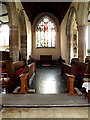
Inside of St. Mary's Church
by Geographer
for square TL9640
|
|
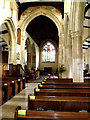
Inside of St. Mary's Church
by Geographer
for square TL9640
|
|
Font of St. Mary's Church
by Geographer
for square TL9640
|
|
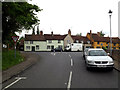
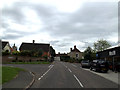
Ellis Street, Boxford
by Geographer
geograph for square TL9640
At the junction with Ash Street & The Causeway near Riddelsdell Garage
|
|
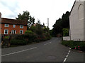
Cox Hill, Boxford
by Geographer
geograph for square TL9640
At the junction with Sand Hill & Ellis Street
|
|
Sand Hill, Boxford
by Geographer
geograph for square TL9640
At the junction with Cox Hill & Ellis Street
|
|
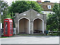
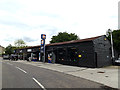
Bus Shelter Former Fire Station
by Keith Evans
for square TL9640
Category: Building
This structure now used as a shelter seen at Boxford Suffolk was a former fire... (more)
|
|
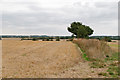
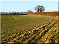
Harvested wheat field, hedgerow and footpath, Boxford
by Roger Jones
geograph for square TL9539
The public footpath runs along the right hand side of the hedgerow.
|
|
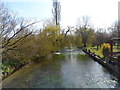
The River Lambourn at Boxford
by Bikeboy
geograph for square SU4271
The River Lambourn eventually runs into the River Kennet between Thatcham and... (more)
|
|
St Andrew's church, Boxford
by Bikeboy
geograph for square SU4271
Built between the C13 and C15. Restored by John Oldrid Scott in 1908.
|
|
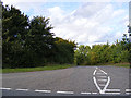
Minor road to Boxford
by Bikeboy
geograph for square SU4374
|
|
Farmland, Boxford
by Andrew Smith
geograph for square SU4273
A cereal crop beside the bridleway that heads northwards from the M4 above Westbrook.
|
|
Riddelsdell Garage
by Geographer
geograph for square TL9640
4, Ellis Street
Link ... ( more) |
|
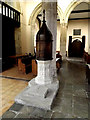
Bell Tower of St. Mary's Church
by Geographer
for square TL9640
|
|
M4 westbound
by Julian P Guffogg
geograph for square SU4373
Plenty of space ahead.
|
|
Tunnel under the M4
by Bikeboy
geograph for square SU4372
|
|
M4 motorway maintenance
by Julian P Guffogg
geograph for square SU4272
A motorway maintenance vehicle stopped at marker 97.6
|