Public Tags
Tag: Braes
Other tags: place:Braes
Showing images tagged with Braes tag.
|
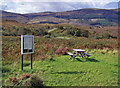
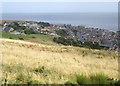
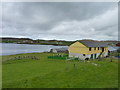
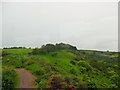
The Gleannan
by Richard Dorrell geograph for square NG4840 Category: Information board A sign board and picnic table near the Braes road.
The information board... (more)
Tags:
place:BraesX
Information BoardX
place:Isle of SkyeX
MoorlandX
top:PathsX
Picnic AreaX
near:PortreeX
place:The BraesX
top:Woodland, ForestX
|
|
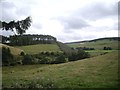
Braes of the Carse
by Mick Garratt geograph for square NO2129 |
|
Brae, Tom na Uan
by Mick Garratt geograph for square NN3230 |
|
Braes of Carn an 'lc Duibhe
by Mick Garratt geograph for square NO0589 |
|
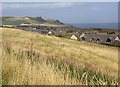
Caldwell Braes and the village of Gourdon
by Stanley Howe geograph for square NO8270 From a layby on the A92.
|
|
The roofs of Gourdon village houses
by Stanley Howe geograph for square NO8270 Below the grassy slopes of Caldwell Braes.
|
|
Danny's Hut
by Rude Health geograph for square HU3769 The Tardis or Danny's Hut beside the main road as you head south towards... (more)
|
|
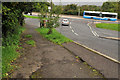
Commons Brae, Belfast (1)
by Albert Bridge geograph for square J3569 A steep stretch of suburban road, running from the (almost as steep) Saintfield... (more)
|
|
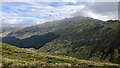
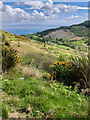
Stùc a'Chròin from the brae of Sgiath a' Chàise
by Mick Garratt geograph for square NN5816 |
|
Hardlaw Brae
by Mick Garratt geograph for square NS2760 |
|
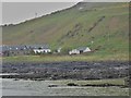
'West Bay' houses, Gourdon
by Stanley Howe geograph for square NO8270 Nestling beneath the Coldwell Braes, with traffic (top of photo) on the A92 seen... (more)
Tags:
A92X
Braes
postcode area:DD10X
top:Estuary, MarineX
type:GeographX
place:GourdonX
Grey HeronX
subject:HousesX
Houses by CoastX
top:Rocks, Scree, CliffsX
|
|
Track along the foot of Channel Brae
by M J Richardson geograph for square NT6573 Following the line of the Cauld Burn.
|
|
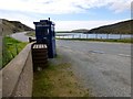
Busta Voe
by James Allan geograph for square HU3567 Seen from near the Brae Hotel.
Tags:
place:BraeX
top:CoastalX
top:Housing, DwellingsX
subject:Sea LochX
Shetland IslandsX
top:Village, Rural SettlementX
|
|
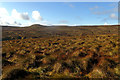
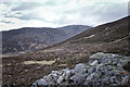
Boulder on the side of Beinn Each with Glen Ample in the background
by Mick Garratt geograph for square NN5916 |
|
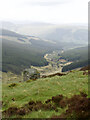
View down the hillside to Lephincorrach
by Mick Garratt geograph for square NR7836 |
|
Coire na Sqreuchaig
by Mick Garratt geograph for square NO1489 |
|
Crossing the Buckie Den (on right)
by Stanley Howe geograph for square NO6952 Over a rail bridge near Braehead of Lunan; a tall military monument in which can... (more)
|
|
The southern end of Drum Wood
by Stanley Howe geograph for square NJ5026 Seen from near Rhynie cemetery. The wind turbine on right hand skyline is on... (more)
|
|
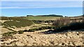
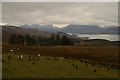
Isle of Raasay, Scotland
by Andrew Tryon geograph for square NG5642 A view from the Isle of Raasay towards the Isle of Skye.
|