|
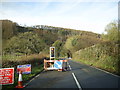
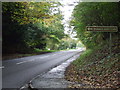
Traffic lights and roadworks near Cenarth
by Martyn Harries
geograph for square SN2642
Category: A road (Classified A)
Temporary traffic lights and roadworks on the A484 near Alltybwla.
|
|
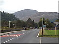
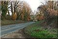
A592 road at Patterdale
by Malc McDonald
geograph for square NY3915
The A592 road passing through Patterdale, in the Lake District.
The leaves on... (more)
|
|
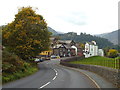
A592 road at Patterdale
by Malc McDonald
geograph for square NY3915
The A592 road at Patterdale, in the Lake District
|
|
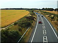
A133 near Weeley Heath
by Malc McDonald
geograph for square TM1520
The A133 to and from Clacton by-passes the villages of Weeley and Weeley Heath... (more)
|
|
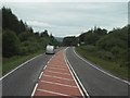
A82 alongside Loch Ness
by Malc McDonald
geograph for square NH5228
The A82 trunk road runs parallel to the western shore of Loch Ness.
This... (more)
|
|
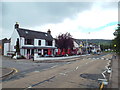
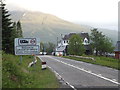
A82 at Drumnadrochit
by Malc McDonald
geograph for square NH5029
The A82 trunk road passing through the village of Drumnadrochit, close to Loch... (more)
|
|
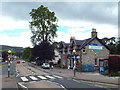
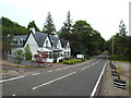
Loch Ness Centre & Exhibition, Drumnadrochit
by Malc McDonald
geograph for square NH5030
The Loch Ness Centre & Exhibition is located in the Drumnadrochit Hotel, on... (more)
|
|
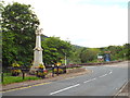
War Memorial at Drumnadrochit
by Malc McDonald
geograph for square NH5030
A war memorial alongside the A82 road at Drumnadrochit.
|
|
A82 at Drumnadrochit
by Malc McDonald
geograph for square NH5030
The A82 trunk road passing through the village of Drumnadrochit, close to Loch Ness.
|
|
A82 passing through Drumnadrochit
by Malc McDonald
geograph for square NH5029
The A82 trunk road passing through the village of Drumnadrochit.
|
|
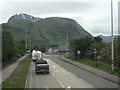
A82 road near Fort William
by Malc McDonald
geograph for square NN1678
|
|
A830 approaching Fort William
by Malc McDonald
geograph for square NN1275
This view, taken from the upper deck of a double-deck bus, is of the A830 road... (more)
|
|
A830 passing Glenfinnan
by Malc McDonald
geograph for square NM8981
The A830 road is also known as the "Road to the Isles". It runs from... (more)
|
|
A830 road passing Glenfinnan
by Malc McDonald
geograph for square NM9080
The A830, from Fort William to Mallaig, is also known as the "Road to the... (more)
|

|
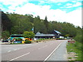
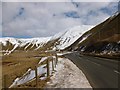
A82 at Bridge of Orchy
by Malc McDonald
geograph for square NN2939
A view south along the A82 at Bridge of Orchy.
The mountain in the background... (more)
|
|
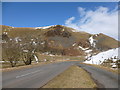
A82 road at Bridge of Orchy
by Malc McDonald
geograph for square NN2939
This view looks south. The building on the other side of the road is the Bridge... (more)
|
|
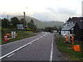
Snow gates on A82 at Bridge of Orchy
by Malc McDonald
geograph for square NN2939
The orange gates can be closed if the A82 trunk road is impassable due to snow.
|
|
Ongar Road, Kelvedon Hatch
by Malc McDonald
geograph for square TQ5798
The A128 Ongar Road passing through Kelvedon Hatch in Essex.
Kelvedon... (more)
|
|
North Cray Road near Bexley
by Malc McDonald
geograph for square TQ4972
The A223 North Cray Road, near Bexley.
This image was taken from the entrance... (more)
|
|
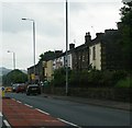
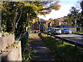
Houses at the bridge at Commins Coch, from the railway
by Christopher Hilton
geograph for square SH8403
|
|
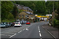
A24 and Washington Bostal at the South Downs Way crossing, near Washington
by Christopher Hilton
geograph for square TQ1111
Washington Bostal, the minor road in the foreground, is the old main road and... (more)
|
|
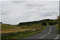
Burnley Road (A646), Friendly
by Christopher Hilton
geograph for square SE0524
|
|
Warley Springs Garage, Burnley Road
by Christopher Hilton
geograph for square SE0624
The ghost-sign advertises a make of crisps, although it is possibly a palimpsest... (more)
|
|
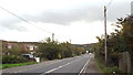
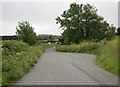
Looking east along the A689 at Woodend Bridge
by Christopher Hilton
geograph for square NY6259
|
|
Pean Hill, near Whitstable
by Malc McDonald
geograph for square TR1162
Pean Hill, on the route of the A290 road between Canterbury and Whitstable,... (more)
|
|
Pean Hill, near Whitstable
by Malc McDonald
geograph for square TR1062
Pean Hill is on the route of the A290 road, linking Whitstable with Canterbury.... (more)
|
|
A289 at Wainscott
by Malc McDonald
geograph for square TQ7471
The A289 road skirts around the northern edge of the Medway Towns.
|
|
A120 road at Standon
by Malc McDonald
geograph for square TL3922
The A120 road passing through Standon in Hertfordshire.
|
|
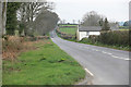
A412 near Iver Heath
by Malc McDonald
geograph for square TQ0384
The A412 road north of Iver Heath.
|
|
Oxford Road, New Denham
by Malc McDonald
geograph for square TQ0484
Oxford Road is part of the A4020 main road which starts nearby and heads into West London.
|
|
A702 road through the Dalveen Pass
by Alan O'Dowd
geograph for square NS8906
Taken from the lay-by west of Dalveen Toll Cottage with Caplaw Rig and Capel... (more)
|
|
Western end of the Dalveen Pass
by Alan O'Dowd
geograph for square NS8806
The A702 road bends round into the main part of the pass, with Dern Craig in the... (more)
|
|
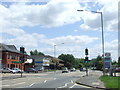
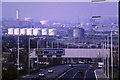
A1 at Highgate
by Malc McDonald
geograph for square TQ2987
A view from a bridge high above the A1 road, looking south-eastwards towards the... (more)
|
|
A102(M) at Blackheath
by Malc McDonald
geograph for square TQ4077
The A102(M) trunk road heading towards Blackwall Tunnel, where it will pass... (more)
|
|
Cromwell Road London - A4
by PAUL FARMER
geograph for square TQ2578
|
|
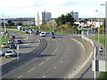
A350 main road, Poole
by Malc McDonald
geograph for square SZ0191
The A350 main road heading away from Poole, Dorset.
|
|
A4012 near Woburn
by Malc McDonald
geograph for square SP9630
The A4012 road near Woburn in Bedfordshire.
This image was taken on an... (more)
|
|
A5130 near Woburn
by Malc McDonald
geograph for square SP9334
The A5130 road near Woburn in Bedfordshire.
|
|
Grosvenor Road, Pimlico
by PAUL FARMER
geograph for square TQ2978
|
|
Warwick Road, Earl's Court
by PAUL FARMER
geograph for square TQ2578
|
|
Main road through Corfe Castle
by Malc McDonald
geograph for square SY9682
The A351 road passes through the village of Corfe Castle.
|
|
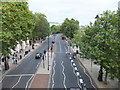
Victoria Embankment, London
by PAUL FARMER
geograph for square TQ3080
|
|
A379 junction ahead
by roger geach
geograph for square SX8955
On the road from Galmpton the A379 road ahead
|
|
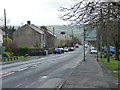
Lanchester Road, Maiden Law
by Christine Johnstone
geograph for square NZ1749
Looking south down the A6076, from the crossroads.
|
|
On the A386 towards Mary Tavy
by roger geach
geograph for square SX5077
|
|
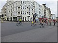
Brighton World Naked Bike Ride 2015
by David Lally
geograph for square TQ3003
Riding along King's Road at the junction with West Street.
|
|
B4022 near Ley's Field Barn
by Derek Harper
geograph for square SP3830
|
|
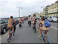
Brighton World Naked Bike Ride 2015
by David Lally
geograph for square TQ2904
On Kingsway passing Brunswick Terrace.
The building on the right (Nos. 7-19)... (more)
|
|
The B4035 near Stretton-on-Fosse
by Philip Halling
geograph for square SP2239
|
|
Stewponey Lights
by Gordon Griffiths
geograph for square SO8684
The view from the Staffs and Worcester Canal bridge of the traffic lights on to... (more)
|