Public Tags
Showing latest 50 of 179,245 images tagged with category:Road tag.
|
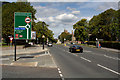
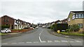
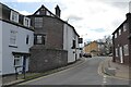
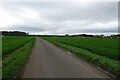
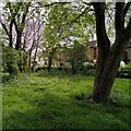
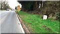
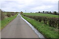
Grosvenor Road
by Mark Anderson geograph for square SJ4065 Category: Road Tags:
category:Road
|
|
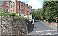
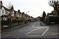
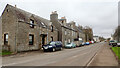
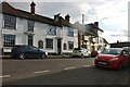
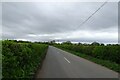
Zetland Road, Malvern
by Bob Embleton geograph for square SO7746 Category: Road Taken from the Bank Street crossroads.
The road is quite narrow at the top and... (more)
Tags:
category:Road
|
|
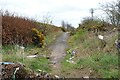
The road to Stroneskar
by Bob Embleton geograph for square NM8601 Category: Road The unfenced road passed Tigh a' Charnain loops around the hills to... (more)
Tags:
category:Road
|
|
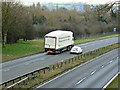
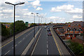
M&S HGV going south, A419, Swindon
by Brian Robert Marshall geograph for square SU1985 Category: Road A Ford Mondeo is overtaking a truck probably on its way to service some of the... (more)
Tags:
A419X
top:Business, Retail, ServicesX
Ford MondeoX
HGVX
category:Road
top:Roads, Road TransportX
top:Suburb, Urban FringeX
TruckX
|
|
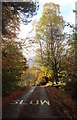
Slow for fallen leaves - don't let the view distract you
by Andy Waddington geograph for square NN2781 Category: Road As it descends into Roybridge, the fell road from Glen Roy turns into a leafy... (more)
Tags:
category:Road
top:Roads, Road TransportX
top:UplandsX
top:Village, Rural SettlementX
top:Woodland, ForestX
|
|
Bargrange Avenue
by Mark Anderson geograph for square SE1436 Category: Road Tags:
category:Road
|
|
Sunny Bank
by Mark Anderson geograph for square SE1437 Category: Road There is a cut bench mark on the gatepost to the right of the photograph and a... (more)
Tags:
category:Road
|
|
Blazefield Bank
by Mark Anderson geograph for square SE1765 Category: Road Tags:
category:Road
|
|
St Martin's Way
by Mark Anderson geograph for square SJ4066 Category: Road Tags:
category:Road
|
|
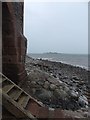
Steps and shore, Roa Island
by Rob Farrow geograph for square SD2364 Steps leading up to a doorway on the seaward side of the SD2364 : Old Customs House, Roa Island on Roa... (more)
|
|
Old Customs House, Roa Island
by Rob Farrow geograph for square SD2364 Described in its EH listing... (more)
|
|
Lifeboat station, Roa Island
by Rob Farrow geograph for square SD2364 The Barrow lifeboat is situated at the end of this jetty which strikes out... (more)
|
|
Boat park, Roa Island
by Rob Farrow geograph for square SD2364 A little spit of land - the thumb of the boxing glove in my metaphor - sticks... (more)
|
|
Village Road, Quatre Bras
by Mick Garratt geograph for square ND2436 The first house is the former police station:
Canmore.org.uk. (2021). Lybster,... (more)
Tags:
Former Police HouseX
type:GeographX
island:RoaX
subject:RoadX
top:Roads, Road TransportX
VillageX
top:Village, Rural SettlementX
|
|
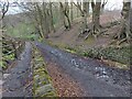
Judy Woods, High Fernley Road
by yorkshirelad geograph for square SE1427 Appears to be a very old road / route through the woods. At the point of taking... (more)
|
|
Abbey Road at The Patch
by David Lally geograph for square TF7525 |
|
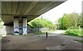
Under the M11
by Des Blenkinsopp geograph for square TQ4191 The M11 goes through the Roding Valley Park along here. Mostly fenced off, but... (more)
Tags:
type:GeographX
road:M11X
top:PathsX
top:Roads, Road TransportX
Roding Valley WayX
View From Underneath a BridgeX
|
|
The A148 at dusk
by David Lally geograph for square TF7425 A lay-by just west of Hillington.
|
|
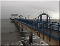
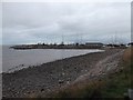
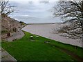
Pier Road Berwick
by Jim Smillie geograph for square NU0052 Mouth of River Tweed at high tide.
Tags:
top:CoastalX
type:GeographX
top:Rivers, Streams, DrainageX
subject:RoadX
top:Roads, Road TransportX
|
|
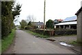
Shaw Clough Road
by Chris Heaton geograph for square SD8323 Heading towards Burnley Road East in Scout
|
|
Housing on Down Green Road
by Kevin Waterhouse geograph for square SD7411 At the junction with South Drive, Bottom o' th' Moor.
Tags:
type:GeographX
top:Housing, DwellingsX
top:LowlandsX
subject:RoadX
top:Roads, Road TransportX
top:Suburb, Urban FringeX
|
|
St James Street, Castle Hedingham
by David Howard geograph for square TL7835 Looking towards The Bell pub.
Tags:
top:Business, Retail, ServicesX
type:GeographX
subject:RoadX
top:Roads, Road TransportX
top:Village, Rural SettlementX
|
|
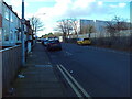
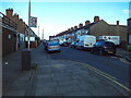
Harrington Street, Cleethorpes (2)
by Richard Vince geograph for square TA2910 Looking towards Grimsby from its junction with Tiverton Street. The great bulk... (more)
Tags:
top:Business, Retail, ServicesX
type:GeographX
top:Housing, DwellingsX
top:RailwaysX
subject:RoadX
top:Roads, Road TransportX
top:Suburb, Urban FringeX
|
|
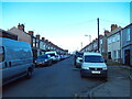
Harrington Street, Cleethorpes (1)
by Richard Vince geograph for square TA2910 Looking towards the town centre from its junction with Tiverton Street, with the... (more)
Tags:
type:GeographX
top:Housing, DwellingsX
top:RailwaysX
subject:RoadX
top:Roads, Road TransportX
top:Suburb, Urban FringeX
|
|
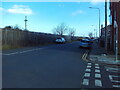
Tiverton Street, Cleethorpes
by Richard Vince geograph for square TA2909 Looking towards Harrington Street from its junction with Grimsby Road.
Tags:
top:Business, Retail, ServicesX
type:GeographX
top:Housing, DwellingsX
subject:RoadX
top:Roads, Road TransportX
top:Suburb, Urban FringeX
|
|
Lovett Street, Cleethorpes
by Richard Vince geograph for square TA2909 Looking towards Harrington Street from its junction with Grimsby Road.
Tags:
type:GeographX
top:Housing, DwellingsX
subject:RoadX
top:Roads, Road TransportX
top:Suburb, Urban FringeX
|
|
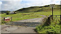
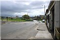
Polmadie Road
by Richard Sutcliffe geograph for square NS5962 |
|
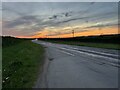
A27 through Shootash
by David Martin geograph for square SU3221 |
|
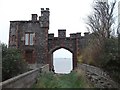
Old Dixton Road
by Philip Halling geograph for square SO5112 Old Dixton Road with the remains of the Dixton Gatehouse on the left to the rear... (more)
Tags:
former:GatehouseX
type:GeographX
top:Historic Sites and ArtefactsX
HousesX
Medieval RemainsX
subject:RoadX
Road
top:Roads, Road TransportX
|
|
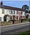
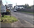
One of two pubs in Alvington, Gloucestershire
by Jaggery geograph for square SO6000 Blacksmiths Arms viewed across the A48 Main Road in April 2024.
The other pub... (more)
Tags:
road:A48X
top:Business, Retail, ServicesX
type:GeographX
PubX
top:Roads, Road TransportX
top:Village, Rural SettlementX
|
|
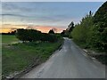
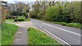
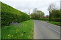
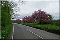
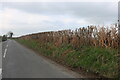
Bluebells beside Braegate Lane
by DS Pugh geograph for square SE5344 Ahead is the turning into Colton.
|
|
Tulips along Acaster Lane
by DS Pugh geograph for square SE5741 The no through road heading into Acaster Selby.
|
|
Road over Acaster Selby Airfield
by DS Pugh geograph for square SE5742 Crossing the former airfield between Acaster Malbis and Acaster Selby.
|
|
Road towards Stonebridge Farm
by DS Pugh geograph for square SE5743 The road heads to Acaster Selby by crossing the airfield.
|
|
Blossom along York Road
by DS Pugh geograph for square SE6047 Passing Naburn sewerage works.
|
|
Directions alongside Main Road, Alvington, Gloucestershire
by Jaggery geograph for square SO6000 Left for the Blacksmiths Arms car park and pub caravan campsite. Right
(across... (more)
Tags:
road:A48X
Direction SignsX
type:GeographX
top:Roads, Road TransportX
top:Village, Rural SettlementX
|
|
Old Church Road in Spring, Bell Green
by A J Paxton geograph for square SP3582 Houses in Old Church Road can be seen from the Wildlife Conservation Area, a... (more)
Tags:
type:GeographX
HouseX
top:Housing, DwellingsX
Nature ReserveX
Road
top:Suburb, Urban FringeX
WoodX
WoodlandX
top:Woodland, ForestX
|
|
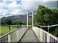
Long Bridge, Portinscale
by Adrian Taylor geograph for square NY2523 Prior to the construction of Portinscale by-pass, the main A594 road from... (more)
Tags:
road:A594X
subject:BridgeX
CumbriaX
Cumbria WayX
ldp:Cumbria WayX
type:GeographX
Lake DistrictX
top:PathsX
near:PortinscaleX
Public FootpathX
River DerwentX
river:River Derwent (Cumbria)X
top:Rivers, Streams, DrainageX
top:Roads, Road TransportX
Suspension FootbridgeX
ldp:The Cumbria WayX
The Cumbria WayX
The Lake District National ParkX
|
|
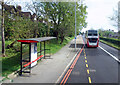
Woodford Avenue at Lord Avenue
by Des Blenkinsopp geograph for square TQ4289 Woodford Avenue, A1400, is a wide dual carriageway crossing TQ4289 in a NW-SE... (more)
Tags:
road:A RoadX
Bus Stop and ShelterX
type:GeographX
top:Roads, Road TransportX
top:Suburb, Urban FringeX
|
|
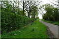
Inkpen Road approaching Hungerford
by David Howard geograph for square SU3565 Tags:
top:Farm, Fishery, Market GardeningX
type:GeographX
subject:RoadX
top:Roads, Road TransportX
top:Village, Rural SettlementX
|
|
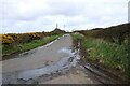
A595 heading southwest passing Newby Cross Farm
by Roger Templeman geograph for square NY3653 There is a milestone NY3653 : Milestone on NW side of A595 at Newby Cross Farm on the right hand verge
|
|
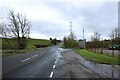
Cairnmuir Road
by Richard Sutcliffe geograph for square NS6357 Looking southwest.
Tags:
Electricity PylonsX
top:Energy InfrastructureX
type:GeographX
subject:RoadX
top:Roads, Road TransportX
|
|
Wellsquarry Road
by Richard Sutcliffe geograph for square NS6255 |
|
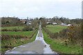
View down Carmunnock Road
by Richard Sutcliffe for square NS6155 Towards East Kittochside and Dykehead Farms.
Tags:
Communications MastX
type:Cross GridX
Farm BuildingsX
top:Farm, Fishery, Market GardeningX
top:GrasslandX
HedgesX
subject:RoadX
top:Roads, Road TransportX
top:Woodland, ForestX
Zoomed PictureX
|
|
Blocked off road
by Richard Sutcliffe geograph for square NS6255 Carmunnock Road originally continued on from here to West Mains Road (B861). It... (more)
Tags:
Blocked Off RoadX
top:CommunicationsX
Communications MastX
type:GeographX
HedgesX
subject:RoadX
top:Roads, Road TransportX
|
|
Portinscale
by Adrian Taylor geograph for square NY2523 This narrow street in Portinscale, urban in appearance, was once the main A594... (more)
Tags:
road:A594X
CumbriaX
long distance path:Cumbria WayX
Cumbria WayX
Former A Classified RoadX
type:GeographX
top:Housing, DwellingsX
near:KeswickX
Lake DistrictX
place:PortinscaleX
top:Roads, Road TransportX
subject:StreetX
long distance footpath:The Cumbria WayX
The Cumbria WayX
ldp:The Cumbria WayX
long distance path:The Cumbria WayX
The Lake District National ParkX
Village StreetX
top:Village, Rural SettlementX
|
|
Blocked off road
by Richard Sutcliffe geograph for square NS6255 Carmunnock Road originally continued on from here to West Mains Road (B861). It... (more)
|
|
Westbrook Road, Godalming
by Stephen McKay geograph for square SU9643 On the right is Vicarage Cottage and to the left is Brook Cottage. Things have... (more)
|
|
Carmunnock Road
by Richard Sutcliffe geograph for square NS6155 Looking towards a communications mast in the distance.
Tags:
top:CommunicationsX
top:Farm, Fishery, Market GardeningX
type:GeographX
HedgesX
subject:RoadX
top:Roads, Road TransportX
|
|
Carmunnock Road
by Richard Sutcliffe for square NS6155 At East Kittochside Farm.
|