Public Tags
Showing latest 50 of 18,271 images tagged with category:Stream tag.
|
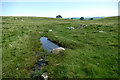
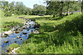
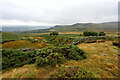
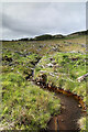
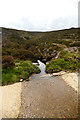
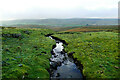
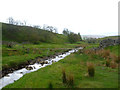
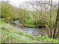
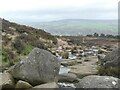
Afon y Cwm
by Andy Waddington geograph for square SH6049 Category: Stream The very generic name for this stream fails to mention that the Cwm in question... (more)
|
|
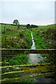
The new path alongside the stream to Fionn Choiren - a tad damp
by Andy Waddington geograph for square NN2426 Category: Footpath |
|
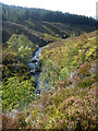
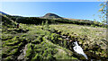
Tiny stream in Gisburn Forest
by Andy Waddington geograph for square SD7356 Category: Stream A public footpath leaves School Lane to head northwest into the forest, but is... (more)
Tags:
type:GeographX
top:PathsX
category:Public FootpathX
top:Rivers, Streams, DrainageX
category:Stream
top:UplandsX
top:Woodland, ForestX
|
|
Looking up Cwm Gelli-Lago towards Cnicht
by Andy Waddington geograph for square SH6347 Category: Geological The path from Gelli-Lago ascends the left bank of the stream directly towards... (more)
Tags:
type:GeographX
category:GeologicalX
top:Rivers, Streams, DrainageX
category:Stream
top:UplandsX
|
|
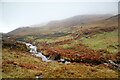
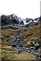
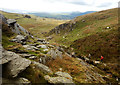
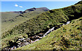
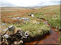
Coire na Ciste
by Andy Waddington geograph for square NN1672 Category: Stream Although it's been a warm couple of days at sea level where we've been... (more)
|
|
Allt a' Bhealaich Mhoir passes through Garbat Forest
by Andy Waddington geograph for square NH4266 Category: Stream Flowing alongside the footpath up and down Ben Wyvis in its lower reaches (below... (more)
Tags:
top:Country EstatesX
category:ForestryX
type:GeographX
top:Rivers, Streams, DrainageX
category:Stream
top:UplandsX
top:Woodland, ForestX
|
|
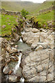
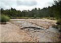
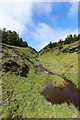
The start of the Coladoir River
by Andy Waddington geograph for square NM6029 Category: Boulder At this point it may not have gathered enough water to be the Coladoir River and... (more)
|
|
Afon Hiraethlyn
by Andy Waddington geograph for square SH7971 Category: Stepping stones The skeletonised leaf on the stepping stone immediately caught my eye and must... (more)
Tags:
AfonX
type:GeographX
top:LowlandsX
top:PathsX
top:Rivers, Streams, DrainageX
top:Sport, LeisureX
category:Stepping StonesX
category:Stream
|
|
Blea Beck
by Andy Waddington geograph for square NY6012 Category: Beck It's a hard life being a stream in Limestone country and Blea Beck is... (more)
|
|
Path to Croesor from Bwlch y Battel
by Andy Waddington geograph for square SH6346 Category: Stream Although not quite where the OS map shows it (and beyond the point where the map... (more)
|
|
Rowan growing above Grains Gill
by Andy Waddington geograph for square NY2310 Category: Tree Rowans seem to manage to set seed into cracks in rock with far greater facility... (more)
|
|
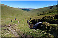
Descending by the Allt Coire Gaothaich
by Andy Waddington geograph for square NN2726 Category: Footpath |
|
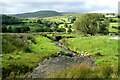
Lyvennet Beck
by Andy Waddington geograph for square NY6212 Category: Beck Lyvennet Beck has very clear water (well, until our collie decided to go... (more)
|
|
Lat Gill drains from Gayle Wolds
by Andy Waddington geograph for square SD8182 Category: Stream Rising at the edge of the limestone outcrop, Lat Gill drains generally southwest... (more)
|
|
Convenient crossing point on Wemmergill Beck
by Andy Waddington geograph for square NY8922 Category: fallen tree A fallen tree has been neatly sawn to just the right length to span the beck and... (more)
Tags:
category:Fallen TreeX
type:GeographX
top:Rivers, Streams, DrainageX
category:Stream
top:UplandsX
top:Woodland, ForestX
|
|
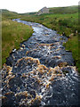
Stonesdale Beck
by Andy Waddington geograph for square NY8802 Category: Kayaks After a number of ledge drops and slides in the first couple of kilometres,... (more)
Tags:
category:KayaksX
top:Rivers, Streams, DrainageX
top:Sport, LeisureX
category:Stream
top:UplandsX
|
|
Stream draining southeast below Tal y Fan
by Andy Waddington geograph for square SH7371 Category: Stream The stream cuts down quickly below the wall forming the lower boundary of CROW... (more)
|
|
Stream flowing off Gale Head Moor
by Andy Waddington geograph for square NY9805 Category: Stream The stream flows alongside the wall separating Faggergill intake (far side,... (more)
Tags:
top:Farm, Fishery, Market GardeningX
type:GeographX
top:Rivers, Streams, DrainageX
category:Stream
top:UplandsX
|
|
Stream flowing off Giob-Bheinn
by Andy Waddington geograph for square NM4627 Category: Stream The day was hot, the weather had been dry for some time, and the breeze was... (more)
|
|
Allt a'Bhreac Achaidh
by Andy Waddington geograph for square NN2988 Category: Stream One of many side-streams carrying snow-melt into the River Roy from the slopes... (more)
|
|
Minor stream in Scoor Forest clearcut
by Andy Waddington geograph for square NM4220 Category: Stream This minor tributary of the Allt an Fhir-eòin has a big jog in its course that... (more)
|
|
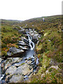
The last braid on Allt Druidh
by Andy Waddington geograph for square NH9307 Category: Stream Upstream from here, a long section of the Allt Druidhe is braided as it flattens... (more)
Tags:
type:GeographX
top:Rivers, Streams, DrainageX
category:Stream
top:UplandsX
top:Woodland, ForestX
|
|
Tributary to Dalton Beck
by Andy Waddington geograph for square NZ4632 Category: Stream Unnamed on the map, this small stream flows to merge with Char Beck at the Howls... (more)
Tags:
top:Farm, Fishery, Market GardeningX
type:GeographX
top:LowlandsX
top:Rivers, Streams, DrainageX
category:Stream
|
|
Stream at Mire Garth
by Andy Waddington geograph for square SD7283 Category: Stream Although this little beck has just come down a hillside punctuated by no less... (more)
|
|
Ash Pot Gutter draining east from the Melbecks Moor track
by Andy Waddington geograph for square NY9500 Category: Stream This track is obviously still of importance to someone long after the demise of... (more)
|
|
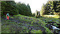
Climbing through forest clearcut towards Fionn Choiren
by Andy Waddington geograph for square NN2427 Category: Footpath |
|
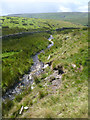
Allt Coire Gaothaich
by Andy Waddington geograph for square NN2727 Category: Stream |
|
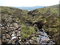
Allt an Fhir above Scoor Forest track
by Andy Waddington geograph for square NM4420 Category: Stream Tags:
type:GeographX
top:Rivers, Streams, DrainageX
category:Stream
top:UplandsX
top:Woodland, ForestX
|
|
The infant Ure from Green Bridge
by Andy Waddington geograph for square SD7896 Category: Stream A far cry from Aysgarth Falls, the infant River Ure has just formed on the... (more)
|
|
Potter Sike
by Andy Waddington geograph for square NY8608 Category: Stream One of the smaller tributaries near the source of the River Belah (whose valley... (more)
Tags:
type:GeographX
top:Lakes, Wetland, BogX
top:Rivers, Streams, DrainageX
top:Sport, LeisureX
category:Stream
top:UplandsX
|

|
Faraday Gill
by Andy Waddington geograph for square NY8106 Category: Stream Faraday Gill starts high on the western slopes of Nine Standards Rigg, not far... (more)
|
|
Arkle Beck from Dale Head New Bridge
by Andy Waddington geograph for square NY9606 Category: Stream Dale Head is connected to the Arkengarthdale road by a track which the public... (more)
Tags:
top:Farm, Fishery, Market GardeningX
type:GeographX
top:Rivers, Streams, DrainageX
category:Stream
top:UplandsX
|
|
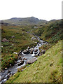
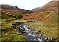
Allt Achadh na Sìne
by Andy Waddington geograph for square NH1559 Category: Stream Fionn Bheinn was always a Munro I had intended to save for a ski ascent, with a... (more)
|
|
Hazard to navigation, Middlehope Burn
by Andy Waddington geograph for square NY9039 Category: Stream Canoeists always see sheep fences as potentially fatal hazards to navigation,... (more)
Tags:
top:Farm, Fishery, Market GardeningX
type:GeographX
top:Rivers, Streams, DrainageX
category:Stream
top:UplandsX
|
|
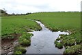
Weisdale Burn
by Andy Waddington geograph for square HU3952 Category: Stream Poor weather for midsummer and a view which excludes trees make this part of... (more)
|
|
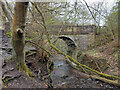
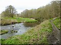
Judy Woods, old bridge
by yorkshirelad geograph for square SE1427 |
|
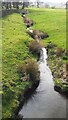
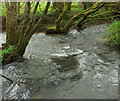
Small stream flowing SW on SW side of Leeds & Liverpool Canal
by Luke Shaw for square SD9453 |
|
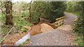
Bend in Bradshaw Brook
by Kevin Waterhouse geograph for square SD7309 Seen from the cycle path in Seven Acres Country Park, Breightmet.
Tags:
type:GeographX
top:LowlandsX
top:Park and Public GardensX
top:PathsX
top:Rivers, Streams, DrainageX
subject:StreamX
top:Suburb, Urban FringeX
|
|
Bradshaw Brook
by Kevin Waterhouse geograph for square SD7310 In Seven Acres Country Park, Breightmet.
|
|
Iron Mill Stream
by Derek Harper geograph for square SS9020 Seen from the first of the footbridges shown in SS9020 : Footbridges over the Iron Mill Stream. so looking... (more)
Tags:
top:Boundary, BarrierX
type:GeographX
stream:Iron Mill StreamX
Island in StreamX
top:LowlandsX
Parish BoundaryX
top:Rivers, Streams, DrainageX
Streamside TreesX
|
|
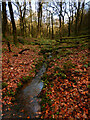
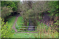
Stream in the woods near Monk's Cottages
by David Martin geograph for square SU3321 |
|
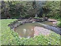
Dam, pool and riffle on Coundmoor Brook
by TCExplorer geograph for square SJ5503 At first I thought this might have been the work of a beaver, as the brook... (more)
|
|
Unnamed tributary of Coundmoor Brook
by TCExplorer geograph for square SJ5503 |
|
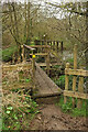
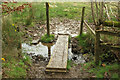
Footbridges over the Iron Mill Stream
by Derek Harper geograph for square SS9020 As it crosses the stream in two goes, the path changes from Oakford footpath 8... (more)
Tags:
top:Boundary, BarrierX
FootbridgesX
type:GeographX
stream:Iron Mill StreamX
Island in StreamX
top:LowlandsX
MudX
Parish BoundaryX
top:PathsX
Public FootpathX
top:Rivers, Streams, DrainageX
Streamside TreesX
fence:TimberX
WoodlandX
top:Woodland, ForestX
|
|
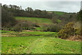
Iron Mill Stream valley near Aldridge Mill
by Derek Harper geograph for square SS9020 A view taken further down Oakford footpath 8 from SS9020 : Path to Oakford, with the Iron... (more)
Tags:
top:Farm, Fishery, Market GardeningX
type:GeographX
plant:GorseX
top:Heath, ScrubX
stream:Iron Mill StreamX
top:LowlandsX
PastureX
Public FootpathX
RushesX
ValleyX
top:Woodland, ForestX
WoodsX
|
|
Backstone Beck, Ilkley Moor
by Christine Johnstone geograph for square SE1246 A 'backstone' was a flat stone on which oatcakes were baked. Plenty of... (more)
Tags:
BeckX
type:GeographX
place:Ilkley MoorX
Open Access MoorlandX
top:Rivers, Streams, DrainageX
subject:StreamX
|
|
Un-named burn
by Richard Sutcliffe geograph for square NS6056 The burn has just flowed under Kittochside Road.
|
|
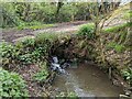
Kettle Brook
by Stephen McKay geograph for square SK2300 The Kettle Brook emerges from under a dam within the Kettle Brook Local Nature Reserve.
|
|
"Footbridge" near Nethercott Farm
by Derek Harper for square SS9020 This gives some idea of the conditions met by those undertaking the 2024 Rotary... (more)
Tags:
top:Air, Sky, WeatherX
type:Close LookX
top:Farm, Fishery, Market GardeningX
FootbridgeX
top:Lakes, Wetland, BogX
MudX
top:PathsX
top:Rivers, Streams, DrainageX
StreamX
Timber PostsX
|
|
Bullhill Brook from the bridge
by TCExplorer geograph for square SJ5501 A view from the road bridge looking north towards the brook.
Tags:
Bullhill BrookX
type:GeographX
top:Rivers, Streams, DrainageX
StreamX
subject:StreamX
top:Woodland, ForestX
|