Public Tags
Showing images tagged with category:Summit tag.
|
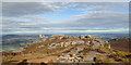
Beinn Bhuidhe summit from the west
by Andy Waddington geograph for square NM8296 Category: Summit Although "only" a Corbett at 855m, Beinn Bhuidhe is a huge broad-based... (more)
|
|
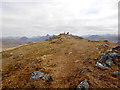
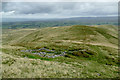
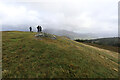
Heading NW from Ben Lui's summit
by Andy Waddington geograph for square NN2626 Category: Summit |
|
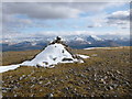
Summit of Beinn Bhàn
by Andy Waddington geograph for square NN1485 Category: Cairn Corbetts have a reputation for good views, partly based on their separation from... (more)
Tags:
top:Barren PlateauxX
category:CairnX
CorbettX
top:Country EstatesX
category:Summit
category:Trig PointX
top:UplandsX
|
|
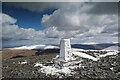
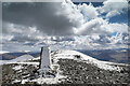
Icy trig point on Skiddaw
by Andy Waddington geograph for square NY2629 Category: Summit It had been wet at home, and not that cold, so we weren't quite expecting... (more)
Tags:
type:GeographX
top:MoorlandX
top:PathsX
top:Rocks, Scree, CliffsX
top:Sport, LeisureX
category:Summit
category:Trig PointX
top:UplandsX
|
|
Knoutberry from the path to Green Bell
by Andy Waddington geograph for square NY7001 Category: Sheepfold Although the map shows the public footpath from Kilnmire and Ravenstonedale... (more)
|
|
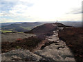
Skiddaw summit ridge
by Andy Waddington geograph for square NY2629 Category: Summit A bridleway runs along Skiddaw's summit ridge, though more often used by... (more)
|
|
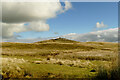
Crag Hill
by Andy Waddington geograph for square NY5606 Category: Summit A tall cairn marks the high point of Crag Hill, at 401m (the OS spot height is... (more)
|
|
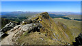
Watch Craig
by Andy Waddington geograph for square NJ6522 Category: Summit Though not quite the furthest west peak of the Bennachie massif, Watch Craig is... (more)
|
|
Not ideal weather for seated Lords
by Andy Waddington geograph for square NY2026 Category: Summit It was a bit of a struggle to get to the top of Lord's Seat and definitely... (more)
|
|
Oxen Craig of Bennachie
by Andy Waddington geograph for square NJ6622 Category: Summit The sun illuminates the granite tor of Oxen Craig, by 11m the highest point of... (more)
|