|
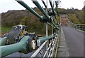
Detail of chain links
by Russel Wills
geograph for square NT9351
On the Union Chain Bridge.
Not sure about the small padlock!
|
|
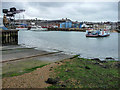
Chain Ferry, East Cowes, Isle of Wight
by Christine Matthews
geograph for square SZ5095
This chain ferry goes from Cowes to East Cowes and vice versa.
|
|
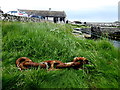
Rusty chain links, Ballintoy
by Kenneth Allen
geograph for square D0345
Very heavy!
|
|
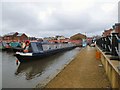
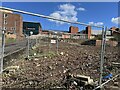
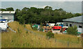
Droylsden Marina
by Gerald England
geograph for square SJ9097
As work continues in the background on new houses there is no access between the... (more)
|
|
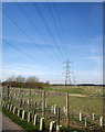
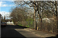
Pylon line, Ingmanthorpe Hill
by Derek Harper
geograph for square SE4151
|
|
Waste ground in Hanley
by Jonathan Hutchins
geograph for square SJ8847
|
|
Public footpath in Alsager
by Jonathan Hutchins
geograph for square SJ7955
This footpath designated Alsager 4 runs in a straight line between Hassall Road... (more)
|
|
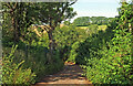
Exe Valley Way approaching Thorverton
by Derek Harper
geograph for square SS9301
|
|
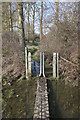
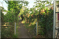
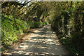
Path, Windmill Hill
by Derek Harper
geograph for square SX9065
A narrow path circumnavigates the recreation ground, separated from it by a... (more)
|
|
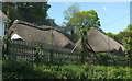
Primary school, Tawstock
by Derek Harper
geograph for square SS5529
The thatched and listed... (more)
|
|
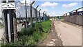
Pengelly Hill
by Derek Harper
geograph for square SX4356
The lane descends from the A374 to Wilcove. The chain link fence is around... (more)
|

|
St Luke's Church, Silverdale from Gorsty Bank
by Jonathan Hutchins
for square SJ8146
|
|
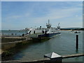
Sandbanks Chain Ferry at Sandbanks, Poole
by Colin Cheesman
geograph for square SZ0387
Sandbanks is a vehicular chain ferry between Sandbanks and Studland which avoids... (more)
|
|
Flooded Footpath with an Unusual Gate
by Des Blenkinsopp
geograph for square SU8871
Along a short, cut the corner footpath towards Warfield Church.
The causeway is... (more)
|
|
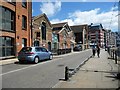
Wherry Quay, Ipswich
by Christine Johnstone
geograph for square TM1644
An imaginative re-use of anchor chain, to prevent pavement parking.
|
|
Blyth's Nursery, Cofton
by Derek Harper
geograph for square SX9679
On the A379. There are some appealing barns and sheds along this stretch of the... (more)
|

|
Buses on William Jessop Way
by Derek Harper
geograph for square ST5967
A 76 service passes a 75 heading into Hartcliffe down a road created a few years... (more)
|
|
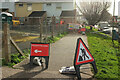
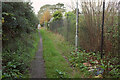
Fence and Footpath
by Bob Harvey
geograph for square TF0820
|
|
Isaacs Road meets Fore Street
by Derek Harper
geograph for square SX9167
By virtue of a short linking road from the section of Isaacs Road shown in... (more)
|
|
Footpath, Stoke Fleming
by Derek Harper
geograph for square SX8648
The coast path follows Stoke Fleming Footpath 4, which links Rectory Lane and... (more)
|
|
Site office, South Devon Link Road
by Derek Harper
geograph for square SX8768
|
|
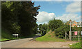
Crossroads, Woldingham Station
by Derek Harper
geograph for square TQ3556
A crossroads by virtue of the left turn into the station car park. Station Road... (more)
|
|
Three Arch, Woldingham
by Derek Harper
for square TQ3655
|
|
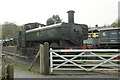
Locomotive, South Devon Railway
by Derek Harper
geograph for square SX7466
|
|
Footpath, Portbury
by Derek Harper
geograph for square ST5074
|
|
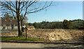
Flats, Audley Redwood retirement village
by Derek Harper
geograph for square ST5371
Seen from the car park for the 'Old Bristolians' playing field .
|
|
Whitehouse Lane, Bedminster
by Derek Harper
geograph for square ST5871
Behind units on the left runs the main railway line to the south-west. Behind... (more)
|
|
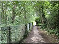
Closed footpath, Barton Road
by Derek Harper
geograph for square SX9065
|
|
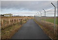
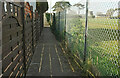
Path to Inverness Airport
by Craig Wallace
geograph for square NH7651
The path from the new station to the airport runs alongside the perimeter fence.... (more)
|
|
Pelican crossing, Totnes
by Derek Harper
geograph for square SX8060
Where Totnes footpath 5 and NCN28 cycle path cross the A381 west of Brutus... (more)
|
|
Footpath, Warberries
by Derek Harper
geograph for square SX9264
|
|
Templer Road
by Derek Harper
geograph for square SX8863
Providing access to a dwelling and a pump house at the top of the Hollicombe... (more)
|
|
Suttons Seeds
by Derek Harper
geograph for square SX8758
|
|
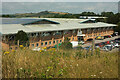
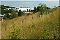
Grass bank, Torbay Business Park
by Derek Harper
geograph for square SX8758
Another view along the hillside that separates Suttons Seeds from the rest of... (more)
|
|
Grass bank, Torbay Business Park
by Derek Harper
geograph for square SX8758
|
|
Entrance to Suttons Seeds
by Derek Harper
geograph for square SX8758
From Woodview Road, and on Torbay Business Park.
|
|
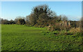
Field, Boohay
by Derek Harper
geograph for square SX8951
With the covered reservoir shown at... (more)
|
|
Bridleway past Barton Hall
by Derek Harper
geograph for square SX8967
Bridleway TQ 8z running between woodland surrounding Barton Hall on the right,... (more)
|
|
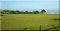
Playing field, Teignmouth
by Derek Harper
geograph for square SX9373
|

|
CEF, Torquay
by Derek Harper
geograph for square SX9066
|
|
Path, Chapel Hill Pleasure Grounds
by Derek Harper
geograph for square SX9064
Footpath TQ 57 runs along the foot of the wooded hillside.
|
|
Edge of playing field, Windmill Hill
by Derek Harper
geograph for square SX9065
|
|
Pavilion near Forches Cross
by Derek Harper
geograph for square SX8473
|
|
Path, Windmill Hill
by Derek Harper
geograph for square SX9065
|
|
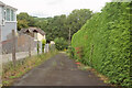
Back lane, Westhill Road, Torquay
by Derek Harper
geograph for square SX9165
|
|
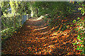
Green Lane near Aish
by Derek Harper
geograph for square SX8458
|
|
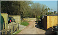
Access road to Smalmstown Farm
by Luke Shaw
geograph for square NY3669
|
|
Lane past sewage works
by Derek Harper
geograph for square SX8551
The lane from Bruckton Cross.
|
|
Path by the reservoirs
by Derek Harper
geograph for square SX9264
|
|
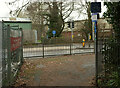
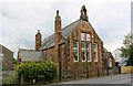
The Old School, Main Street
by Roger Templeman
geograph for square NY1750
|