|
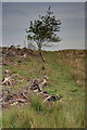
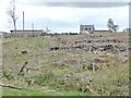
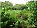
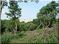
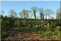
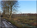
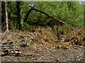
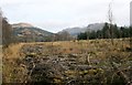
Edge of Cleared Plantation
by Mick Garratt
geograph for square NY9483
Near Lunga Crag.
|
|
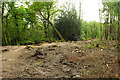
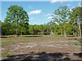
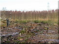
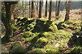
Cleared woodland
by Alex McGregor
geograph for square NH4998
|
|
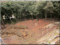
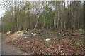
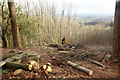
Cleared woodland
by Oliver Dixon
geograph for square NY8475
In what was once named as "Ward Lane Strips".
|
|
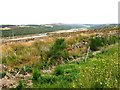
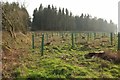
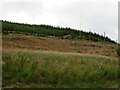
Clear-fell on Legerwood Hill
by M J Richardson
geograph for square NT5841
A pert of the extensive woodland removal on the road between Birkenside and Morriston.
|
|
Molesden Cottage
by Oliver Dixon
geograph for square NZ1384
The wood shown on the map has been cleared and replanted.
|
|
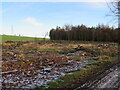
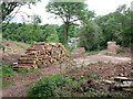
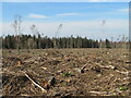
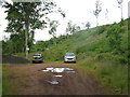
Timber stacks and tree clearance in Sutton's Wood
by Ian Calderwood
geograph for square SK0444
Some of Sutton's Wood has been thinned but some of the woodland overlooking... (more)
|
|
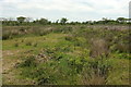
Cleared woodland near Puckland
by Derek Harper
geograph for square SS2907
|
|
Clearing, Stover Country Park
by Derek Harper
geograph for square SX8474
|
|
Public footpath, Bennison Banks
by Christine Johnstone
geograph for square NZ6720
The footpath is used, but is overgrown. The dead bracken shows the way. Other... (more)
|
|
Cleared and replanted woodland near Butterdon
by Derek Harper
geograph for square SX7587
|
|
Cleared and replanted woodland near Butterdon
by Derek Harper
geograph for square SX7587
|
|
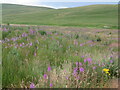
Heather in cleared area, Kerroodhoo Plantation
by Christine Johnstone
geograph for square SC2276
This is mapped as a 'path within plantation - courtesy of the... (more)
|
|
Fenced and cleared area, Hetchell Wood
by Christine Johnstone
geograph for square SE3742
Hetchell Wood is managed by the Yorkshire Wildlife Trust. It supports a range of... (more)
|
|
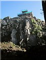
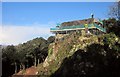
St Michael's Chapel scaffolded
by Derek Harper
geograph for square SX9065
Woodland has been cleared below this rock face, revealing a view of the... (more)
|
|
Upper Honeypig Plantation
by M J Richardson
geograph for square NT9163
Clearfell near Alemill Bridge.
|
|
Greenmoor Plantation
by M J Richardson
geograph for square NT9161
Clear felled, but with new trees planted at the lower end, where the A1 runs alongside.
|
|
Furzebrake Plantation
by Derek Harper
geograph for square SX8966
This northern area of the wood has been cleared in recent years.
|
|
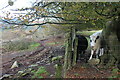
Curious cattle on side of Cwm Gwyddon
by M J Roscoe
geograph for square ST2395
The field with the cattle by a beech tree is next to a track on the edge of... (more)
|
|
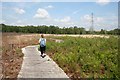
Cleared land east of Pont y Llwyn
by Christine Johnstone
geograph for square SO0516
Seen from the Brecon Mountain Railway.
|
|
Forested area in Yearnor Wood
by Bill Boaden
geograph for square SS8548
Some of the trees have been chopped giving a view of the sea, which itself is... (more)
|
|
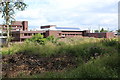
Office of National Statistics, Newport
by M J Roscoe
geograph for square ST2885
Rear of the ONS, viewed from near the edge of the lake across recently cleared... (more)
|
|
Horsell Common
by Alan Hunt
geograph for square TQ0160
A recently cleared area near the A320, Chertsey Road with the Bleak House... (more)
|
|
Log piles below the chapel
by Derek Harper
geograph for square SX9065
Looking down from beside St Michael's Chapel as it undergoes restoration,... (more)
|
|
Cleared Woodland Valley Side
by Tony Atkin
geograph for square SS4617
The tarmac track in the valley bottom is the Tarka Trail cycleway deep in the... (more)
|
|
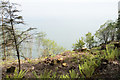
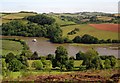
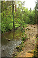
River Dart above Sharpham
by Derek Harper
for square SX8258
|
|
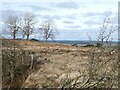
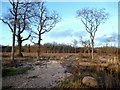
Birch wood on the west side of Legerwood Hill
by M J Richardson
geograph for square NT5841
A survivor of the extensive woodland clearance in the area.
|
|
Evidence of woodland management
by Bill Boaden
geograph for square NZ0160
The woodland has been cut back to ensure that it does not encroach onto the... (more)
|
|
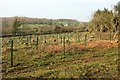
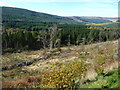
Forestry at Fingland, in Tweeddale
by M J Richardson
geograph for square NT0519
On the slope of Neth Hill. The area in the foreground has been cleared and replanted.
|
|
Track to Birkenside
by M J Richardson
geograph for square NT5841
With trackside Beeches and remains of forestry and a surviving Birch wood.
|
|
Ventiford Brook
by Derek Harper
geograph for square SX8374
Trees have been felled along its north bank.
|
|
Footpath toward A614 at Bracey Bridge
by Martin Dawes
geograph for square TA0762
I gained height by standing on the stump of one of the harvested trees in the... (more)
|
|
Footpath to Kilham. Harvested wood to the right
by Martin Dawes
geograph for square TA0762
Stumps of the felled trees can be seen along with the plastic sleeves protecting... (more)
|
|
A clearance
by Neil Owen
for square ST6564
Some light forestry work here.
|
|
Mossy wall, Bagtor Woods
by Derek Harper
geograph for square SX7674
This wall, heavily reinforced by a stout barbed wire fence by which the picture... (more)
|
|
Boardwalk at Danes Moss
by Dave Dunford
geograph for square SJ9070
Much woodland clearance appears to have gone on in this area of this Cheshire... (more)
|
|
Peatmoor Copse in Winter
by Des Blenkinsopp
geograph for square SU6273
Looking rather drab here in Winter colours after a lot of the trees have been... (more)
|
|
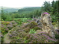
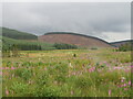
Looking towards Glen Lochy
by Richard Sutcliffe
geograph for square NN1927
Ben Lui has a light covering of snow on the top.
|
|
View East from Hurthill Copse
by Des Blenkinsopp
geograph for square SU9035
Recent clearance has opened up this view eastwards. At around 230 maod it's... (more)
|
|
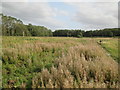
Tweeddale at Badlieu
by M J Richardson
geograph for square NT0518
Grassy hills in Tweeddale, looking across Tweeddale near Badlieu. The conifers... (more)
|
|
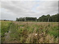
Clearfell in Tweeddale
by M J Richardson
geograph for square NT0518
I recall this area being planted about 50 years ago.
|
|
Car park for Danskine Loch
by M J Richardson
geograph for square NT5667
Where there is a carp fishery and walk round.
|
|
St Michael's Chapel undergoing restoration
by Derek Harper
geograph for square SX9065
The small area of hilltop beside the chapel, and from which the images at... (more)
|
|
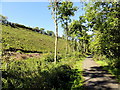
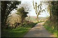
Lane to Butterdon
by Derek Harper
geograph for square SX7487
|