|
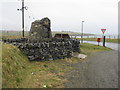
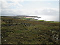
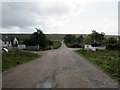
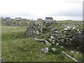
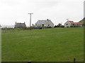
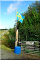
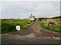
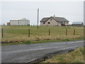
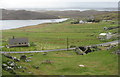
Road junction at Upper Col/Col Uarach
by M J Richardson
geograph for square NB4639
|
|
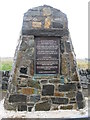
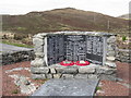
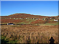
Memorial at Col Uarach
by M J Richardson
for square NB4639
In memory of the men who took possession of Upper Coll in 1921, a township from... (more)
|
|
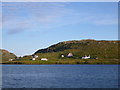
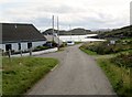
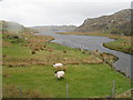
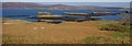
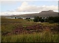
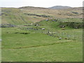
Cairisiadar from Loch Rog
by Andy Waddington
geograph for square NB0933
Category: Crofting community
The northwest end of this small community strung out along the B8011 catches the... (more)
|
|
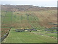
Descending into Opinan
by Martin Dawes
geograph for square NG7472
A sweeping view of the crofting community and beach
|
|
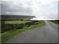
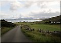
From the B8056 toward Red Point
by Martin Dawes
for square NG7269
Over the crofting community of Redpoint
|
|
South through Cove on B8057
by Martin Dawes
geograph for square NG8090
A small crofting community on Loch Ewe
|
|
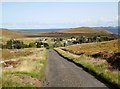
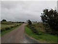
Minor road down to the Achgarve road junction
by Martin Dawes
geograph for square NG8993
Small crofting communities dot the areas below the heather moorland
|
|
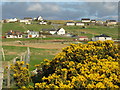
Mellon Udrigle and village sign in sight
by Martin Dawes
geograph for square NG8895
A small crofting community with a wonderful beach, more than five people on the... (more)
|
|
Crossroads at South Erradale
by Martin Dawes
geograph for square NG7471
This is the main road through these crofting community's
|
|
Minor road passing through Ormiscaig
by Martin Dawes
geograph for square NG8590
One of a number of crofting community's along this road
|
|
Down the hill to Badluarach jetty
by Martin Dawes
geograph for square NG9994
The vehicles parked here belong to people who live on the other side of Little... (more)
|

|
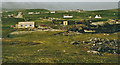
Information board at Keils
by M J Richardson
for square NR5268
On the track to Kilearnadil, Jura's main burial ground, with information... (more)
|

|
Houses at Tunga
by M J Richardson
geograph for square NB4536
Rough grassland in a crofting community by the shore.
|
|
Roofless house at Coig Peighinnean
by M J Richardson
geograph for square NB5364
Also known as Five Penny Ness, part of the crofting community at the north end of Lewis.
|
|
Old houses at Coig Peighinnean
by M J Richardson
geograph for square NB5264
Remains of blackhouses or similar in a crofting community
|
|
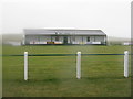
Ness Football Club
by M J Richardson
geograph for square NB5264
Playing field and stand in a crofting community.
|
|
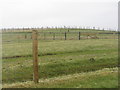
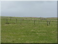
Fencescape at Buaile na Crois
by M J Richardson
geograph for square NB4861
The subdivision of grazings in the crofting community of Dail bho Dheas.
|
|
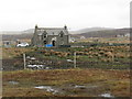
Unloved house at Calanais
by M J Richardson
geograph for square NB2232
Like many deserted houses in the crofting communities, being replaced by new... (more)
|
|
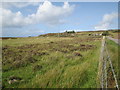
Cnoc Feoal
by M J Richardson
geograph for square NB1937
Part of the crofting community of Tolastadh a' Chaolais on the shores of... (more)
|
|
Loch a' Bhaile
by M J Richardson
geograph for square NB1937
In the crofting community of Tolastadh a' Chaolais.
|
|
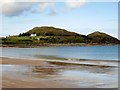
Opinan
by Trevor Littlewood
geograph for square NG7472
Opinan is a crofting community astride the B8056 which is the road at the right... (more)
|
|
Croft houses in Colbost
by Tiger
geograph for square NG2049
Looking across the valley of the Totaig Burn, the old croft house of 20 and 21... (more)
|
|
Folk Museum in decline
by Tiger
geograph for square NG2148
Three years on from the closure enforced by Covid, the restored black house at... (more)
|
|
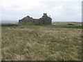
Garrachan ruins
by Tiger
geograph for square NG2446
The old township of Garrachan ceased to be inhabited early in the 20th century... (more)
|
|
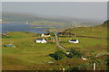
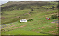
Looking north from Gaineamh Smo
by Martin Dawes
geograph for square NG8188
A croft with a view
|
|
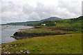
Cottage at Fiskavaig
by Trevor Littlewood
geograph for square NG3233
Fiskavaig is (or was) a crofting settlement at the northern end of the Minginish... (more)
|
|
Colbost Islands
by Tiger
geograph for square NG2149
From the park of Colbost House, the islands in Loch Dunvegan forming part of the... (more)
|
|
South end of Fair Isle 1981
by Greg Fitchett
geograph for square HZ2069
A view north from above Kirki Geo, South harbour, after the fog lifted. The... (more)
|
|
Colbost coastline
by Tiger
geograph for square NG2149
A view along the shore of Loch Dunvegan across the north park of Colbost House.... (more)
|
|
Decline of the Colbost Folk Museum
by Tiger
geograph for square NG2148
Three years on from the closure enforced by Covid, the restored black house is... (more)
|
|
Isle of Skye flag / Bratach an Eilein
by Tiger
geograph for square NG1950
The new island flag flies at the entrance to a croft in Totaig. Unveiled in... (more)
|
|
Over rough grazing to B8056
by Martin Dawes
geograph for square NG7368
To the right has been made a parking area alongside the track to Red Point Farm... (more)
|
|
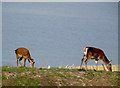
Red Deer grazing, Croft 7 Badluarach
by Martin Dawes
geograph for square NG9994
Taken from the grassed area outside our holiday cottage, The Wee Barn. I got to... (more)
|
|
Track to crofts in Ormiscaig
by Martin Dawes
geograph for square NG8590
The water beyond is Loch Ewe and the land beyond is the Isle of Ewe
|
|
Minor road to crofts
by Martin Dawes
geograph for square NG8491
The fridge at the roadside says Hen, Duck and Quail eggs, I did not investigate
|
|
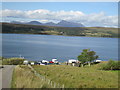
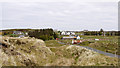
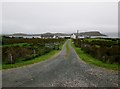
Durnamuck crofts with Little Loch Broom beyond
by Martin Dawes
geograph for square NH0192
|
|
Kinloch War Memorial
by M J Richardson
geograph for square NB3422
'In memory of all those from Kinloch who fought and died for Freedom'... (more)
|
|
In the Colbost Folk Museum (2)
by Tiger
for square NG2148
The display in the byre end of the house includes millstones or querns, riddles... (more)
|
|
Blackhouse remains at Coig Peighinnean
by M J Richardson
geograph for square NB5264
The thick-walled bases of ancient stone croft houses.
|
|
Coig Peighinnean croft houses
by M J Richardson
geograph for square NB5264
Looking across from the B8013 at Ness Football Club - a very rainy day.
|
|
Crofting land at Eòropaidh
by M J Richardson
geograph for square NB5165
Looking west from the road to the Butt of Lewis/Rubha Robhanais.
|
|
Teampall Mholuaidh/St Molveg's Church
by M J Richardson
geograph for square NB5165
A restored church in the crofting township of Eòropaidh.
|
|
Modern croft house at Àird Dhail
by M J Richardson
geograph for square NB4761
A step up from the blackhouse.
|
|
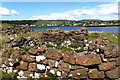
Crofting landscape at Na Gearannan
by M J Richardson
geograph for square NB1944
Small fenced fields and stone-wall enclosures.
|
|
Crofting landscape
by M J Richardson
for square NB1943
At Na Geàrrannan, on the way to the Geàrrannan Blackhouses.
|
|
Croft land at Aiginis
by M J Richardson
geograph for square NB4832
Scattered houses and small fenced fields.
|
|
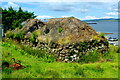
Crofting landscape at Càrlabhaigh
by M J Richardson
geograph for square NB1841
Looking southwest from the broch over the strip fields, to the sea at Loch Rog an Ear.
|
|
Across Glen Dale
by Richard Dorrell
geograph for square NG1749
Category: Glen, Valley or Gorge
This view is from Lephin. The nearest building on the left is the Glendale... (more)
|
|
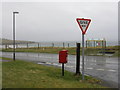
Post Box and bus stop at Col Uarach
by M J Richardson
geograph for square NB4639
|
|
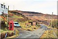
Borreraig road end
by Tiger
geograph for square NG2049
Approaching the junction, the Colbost phone box is seen at the left.
|