Public Tags
Tag: Cycle·Route·Sign
Showing latest 50 of 149 images tagged with Cycle Route Sign tag.
|
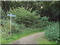
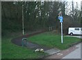
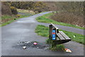
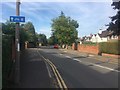
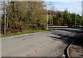
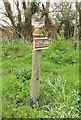
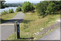
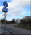
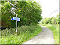
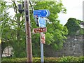
Cycle route near Chiswell Green
by Malc McDonald geograph for square TL1304 The blue direction signs carry route numbers on a red background. These... (more)
Tags:
near:Chiswell GreenX
subject:Cycle RouteX
Cycle Route Sign
Cycle Route SignpostX
Direction SignX
county:HertfordshireX
National Cycle NetworkX
National Cycle Network Route 6X
NCNX
NCN Route 6X
top:PathsX
near:St AlbansX
|
|
Cycle route sign near Saltford
by David Smith geograph for square ST6867 The sign by the Sustrans marker points off the main Bristol and Bath cycle route... (more)
|
|
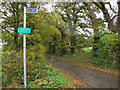
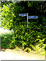
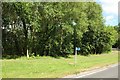
Orchard Drive, How Wood
by Malc McDonald geograph for square TL1304 Orchard Drove at How Wood, near St Albans.
The sign attached to the lamp post... (more)
Tags:
near:Chiswell GreenX
Cycle Route Sign
county:HertfordshireX
place:How WoodX
National Cycle NetworkX
National Cycle Network Route 6X
National Cycle RouteX
National Cycle Route SignX
NCNX
NCN Route 6X
near:St AlbansX
subject:SuburbX
top:Suburb, Urban FringeX
|
|
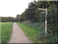
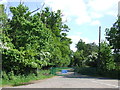
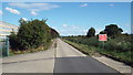
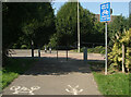
Cycle path near Chiswell Green
by Malc McDonald geograph for square TL1305 This path on the outskirts of St Albans forms part of the National Cycle Network, route 6.
|
|
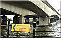
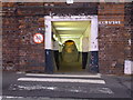
National Cycle Network Route 885 leaving Trews Field Industrial Estate
by eswales geograph for square SS9080 Having passed along much of the Bridgend industrial estate by road, those... (more)
|
|
National Cycle Route 93 sign, Belfast (March 2018)
by Albert Bridge geograph for square J3474 See J3474 : National Cycle Route 93 sign, Belfast (February 2018). A temporary diversion sign, for National Cycle Route no 93,... (more)
|
|
Cycle Route 84 direction sign, Rhyl
by Jaggery geograph for square SJ0080 The sign points towards this Link bridge... (more)
|
|
National Cycle Route 93 sign, Belfast (February 2018)
by Albert Bridge for square J3474 National Cycle Route no 93 sign at the entrance to the Clarendon Dock,... (more)
|
|
Comber Greenway cycle route signs, Dundonald (October 2014)
by Albert Bridge for square J4273 Comber Greenway cycle route signs, on the Comber Road, close to the... (more)
|
|
The start of a path on National Cycle Route 4 near Margam Interchange
by eswales geograph for square SS7986 Situated at the end of a residential cul-de-sac on National Cycle Route 4, this... (more)
Tags:
national cycle route:4X
national cycle route:Celtic TrailX
subject:Cycle RouteX
Cycle Route Sign
type:GeographX
National Cycle Network Route 4X
top:PathsX
SignageX
Wales Coast Path - Alternative RouteX
Wales Coast Path SignsX
|
|
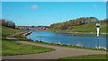
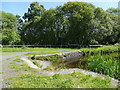
Artificial lake at Silksworth, Sunderland
by Malc McDonald geograph for square NZ3753 This lake is artificial, created on the site of a former colliery in... (more)
|
|
Path to Trews Field Industrial Estate on National Cycle Network Route 885
by eswales geograph for square SS8980 The image shows the northern half of a short (c. 80 metres) path in Bridgend... (more)
Tags:
national cycle route:885X
Cycle and FootpathX
Cycle and Pedestrian PathX
subject:Cycle RouteX
Cycle Route Direction SignX
Cycle Route Sign
FenceX
type:GeographX
National Cycle NetworkX
National Cycle Network Route 885X
top:PathsX
top:Woodland, ForestX
|
|
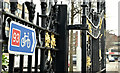
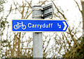
Cycle route signs, Carryduff (February 2015)
by Albert Bridge for square J3764 Two cycle route signs at the Killynure Road end of Killynure Avenue. Both are... (more)
Tags:
place:CarryduffX
subject:Cycle RouteX
Cycle RouteX
Cycle Route SignsX
Road SignX
top:Roads, Road TransportX
|
|
Green Wheel cycle route sign, Glinton
by Paul Bryan for square TF1507 The Green Wheel is a network of cycle routes in the city of Peterborough and the... (more)
Tags:
Cycle Route Sign
Cycle Route SignpostX
Green WheelX
top:Roads, Road TransportX
subject:SignX
top:Village, Rural SettlementX
|
|
National Cycle Route 46, Bryn Bach Park, Tredegar
by M J Roscoe geograph for square SO1210 The joint cycle route and footpath here follows the western edge of the man-made... (more)
Tags:
Cycle RouteX
subject:Cycle RouteX
Cycle Route Sign
Exercise EquipmentX
type:GeographX
top:Lakes, Wetland, BogX
Man-Made LakeX
top:Park and Public GardensX
top:PathsX
top:Sport, LeisureX
top:Suburb, Urban FringeX
place:TredegarX
Trees Along a PathX
|
|
National Cycle Network sign, Belfast (June 2015)
by Albert Bridge for square J3473 Cycle route signs at Alfred Street, close to Russell Street J3473 : View west along Russel Street.
|
|
Bench at cycle lane junction
by M J Roscoe geograph for square ST1189 Merger of National Cycle Route 475 (Aber Valley) with the Aber Cycleway, beyond bench.
|
|
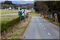
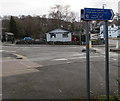
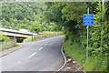
B9153 Kinveachy Junction
by David Dixon geograph for square NH9118 This junction is where the A95 terminated at the former A9 near Kinveachy. When... (more)
|
|
Cycle route to Newport railway station
by Jaggery geograph for square ST3188 Facing a footbridge, the white arrow on a cycle route sign points along Mill Street.
|
|
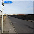
Swansea Bay Cycle Route near Fforest Goch
by Jaggery geograph for square SN7402 The small blue Swansea Bay Cycle Route sign is below a larger cycle
route sign... (more)
|
|
Long Lane, Attenborough
by David Lally geograph for square SK5134 Looking north east from the junction with Attenborough Lane.
|
|
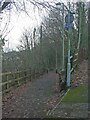
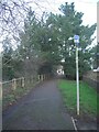
Northern Boundary Route at Downhill
by Malc McDonald geograph for square NZ3560 The Northern Boundary Route forms part of the City of Sunderland's network... (more)
Tags:
top:Boundary, BarrierX
Cycle and FootpathX
Cycle Path SignX
Cycle RouteX
Cycle Route Sign
CyclepathX
Cycleway and FootpathX
subject:PathX
top:PathsX
Shared PathX
Shared Use PathX
near:SunderlandX
county:Tyne & WearX
|
|
Four Castles cycle route sign at the edge of Abergavenny bus station
by Jaggery geograph for square SO3013 The sign shows that you should follow blue signs depicting a bicycle and four... (more)
Tags:
top:City, Town CentreX
Cycle Route Sign
Four Castles Cycle RouteX
type:GeographX
top:Roads, Road TransportX
|
|
Cycle route 467, Cwm Gelli
by M J Roscoe geograph for square ST1798 National Cycle Route 467 heading north to Argoed & Hollybush on the route of... (more)
Tags:
top:Boundary, BarrierX
Cycle Path BarrierX
subject:Cycle RouteX
Cycle Route MarkerX
Cycle Route Sign
Deciduous TreesX
Footpath and CyclewayX
type:GeographX
National Cycle RouteX
place:Near BlackwoodX
top:PathsX
top:Sport, LeisureX
top:Suburb, Urban FringeX
top:Woodland, ForestX
|
|
This sign means cycling permitted!
by Ian Paterson for square SK9135 Clearly cycle signs in Grantham must mean 'No Cycling' is prohibited.... (more)
|
|
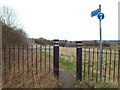
Ingrebourne Way cycle route, near Harold Hill
by Malc McDonald geograph for square TQ5493 The blue sign on the gate indicates that the track is a cycle route, the... (more)
Tags:
Cycle RouteX
Cycle Route Sign
near:Harold HillX
place:North East LondonX
top:Roads, Road TransportX
|
|
Cycle route sign, School Lane
by Stephen Craven geograph for square TQ5805 The sign on the corner of School Lane (foreground) and Station Road points north... (more)
|
|
Path at Wildmill, Bridgend on National Cycle Network Route 885
by eswales geograph for square SS9081 This c. 80 metres long path for pedestrians and off-road stretch of NCN Route... (more)
Tags:
national cycle route:885X
subject:Cycle RouteX
Cycle Route Sign
FootpathX
type:GeographX
National Cycle NetworkX
National Cycle Network Route 885X
top:PathsX
top:Suburb, Urban FringeX
|
|
Cycle route sign, Pillmawr Road, Malpas, Newport
by Jaggery geograph for square ST3190 The white-on-blue sign shows turn left ahead for a cycle route towards Pilton... (more)
|
|
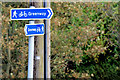
Road and cycle route near Gravesend
by Malc McDonald geograph for square TQ6774 This road is part of the National Cycle Network, forming a section of route 1... (more)
Tags:
Cycle Route 1X
Cycle Route Sign
near:GravesendX
county:KentX
National Cycle NetworkX
National Cycle Route 1X
NCN 1X
top:Roads, Road TransportX
national cycle network:Route 1X
|
|
Cycle route sign
by Stephen Craven geograph for square TQ5805 A signpost on the Cuckoo Trail where it crosses Otham Court Lane near Polegate.... (more)
|
|
Junction of cycle route and Pontddu Road, Aberbeeg
by M J Roscoe geograph for square SO2001 The blue sign marks the end of the off-road section of the new National Cycle... (more)
Tags:
place:AberbeegX
Bilingual SignX
top:Boundary, BarrierX
Cycle Route Sign
type:GeographX
subject:Road JunctionX
top:Roads, Road TransportX
top:Suburb, Urban FringeX
Trees on HillsideX
top:Woodland, ForestX
|
|
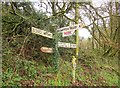
Truncated signpost near Kingsbury Episcopi
by Derek Harper for square ST4320 The sign appears in ST4320 : Junction south of Kingsbury Episcopi. The top has vanished, and the only remaining... (more)
|
|
Chiswick Flyover and Roundabout.
by Nigel Mykura geograph for square TQ1978 Chiswick roundabout, the junction of Chiswick High Road, North Circular Road,... (more)
|
|
Cycle Route signs off Cucumber Lane
by Geographer geograph for square TM4388 Tags:
off:Cucumber LaneX
Cycle RouteX
Cycle Route SignsX
top:PathsX
subject:SignX
subject:SignpostX
near:WestonX
|
|
Western end of cycle route, Broadlands
by eswales geograph for square SS8879 The image shows the end of a cycle path at a spot on Heol Blandy in the north... (more)
Tags:
top:Boundary, BarrierX
Cycle PathX
subject:Cycle RouteX
Cycle Route Sign
type:GeographX
top:PathsX
Road Crossing PointX
top:Roads, Road TransportX
Safety BarriersX
top:Suburb, Urban FringeX
Symbols on Cycle PathX
|
|
National Cycle Route 467, Bryn Bach Park, Tredegar
by M J Roscoe geograph for square SO1309 Cycle route is combined here with the footpath (sometimes to the annoyance of... (more)
Tags:
Cycle RouteX
subject:Cycle RouteX
Cycle Route Sign
type:GeographX
top:Lakes, Wetland, BogX
Man-Made LakeX
OsiersX
top:Park and Public GardensX
top:PathsX
top:Sport, LeisureX
top:Suburb, Urban FringeX
place:TredegarX
|
|
Hiscock's Farm
by Nigel Mykura geograph for square ST8018 This sign post is at the junction of White Way Lane and the minor road from... (more)
|
|
National Cycle Route 492, Elled Road, Pontnewynydd
by M J Roscoe geograph for square SO2701 Junction of cycle route, on former railway track bed, and Elled Road.
Tags:
subject:Cycle RouteX
Cycle Route Sign
type:GeographX
Grass VergesX
Junction of Cycle Lane and RoadX
place:PontypoolX
top:Roads, Road TransportX
top:Suburb, Urban FringeX
|
|
Cycle Route Signs
by Billy McCrorie for square NX4564 National cycle route 7 to the right and the 7 Stanes trail to the left, take your pick.
|
|
Cycle route signs alongside Pillmawr Road, Malpas, Newport
by Jaggery geograph for square ST3190 At the edge of this cycle route Link towards... (more)
|
|
Signpost, Bridge End
by Derek Harper for square SS9928 Getting to the point where a severe prune is required to prevent the placenames... (more)
Tags:
Cycle Route Sign
Hydrant SignX
plant:IvyX
top:Roads, Road TransportX
SignpostX
WoodlandX
top:Woodland, ForestX
|
|
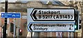
Signage at Trafford Bar
by Gerald England for square SJ8196 Various signage at Trafford Bar including "Railway Station" etched in... (more)
Tags:
road:A5145X
road:B5217X
type:Close LookX
Cycle Route Sign
Direction SignsX
former:Railway StationX
top:RailwaysX
Road SignsX
top:Roads, Road TransportX
place:Trafford BarX
Tram StopX
|
|
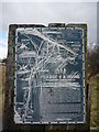
Rural East Renfrewshire : Aged And Worn Sign On The Castburn Path, Uplawmoor
by Richard West for square NS4355 This sign appears to date from the late 1980's and describes the... (more)
|
|
Cycle route sign by Firhill Road bridge
by Stephen Craven geograph for square NS5767 A path from Firhill Road joins the canal towpath here.
|
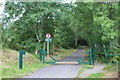
|
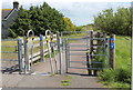
NCR 492 at Blaenafon Road
by M J Roscoe geograph for square SO2111 Squeeze stile and gates before the cycle route crosses Blaenafon Road, B4248... (more)
Tags:
top:Boundary, BarrierX
Cycle and Pedestrian PathX
Cycle Route Sign
type:GeographX
Metal GatesX
Metal Squeeze StileX
National Cycle Route 492X
top:PathsX
subject:StileX
|
|
Sign near Pershore Bridge
by Derek Harper geograph for square SO9544 A reminder for cyclists ("442 alt") that they might want to consider... (more)
Tags:
B Road (Classified B)X
top:Boundary, BarrierX
Cycle Route Sign
type:GeographX
NCN442X
Parish BoundaryX
top:PathsX
top:Roads, Road TransportX
Roadside VergeX
long distance path:Shakespeares Avon WayX
TreesX
long distance path:Wychavon WayX
|
|
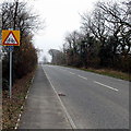
Morecambe Road at Scale Hall
by Ian Taylor geograph for square SD4662 The road signs could do with a clean. The chevrons are redundant when there is a... (more)
|
|
Cycle route signs, Walkerburn
by Jim Barton geograph for square NT3537 Signs at the Walkerburn end of the cyclepath from Innerleithen, along with the... (more)
Tags:
Cycle Route SignsX
CyclepathX
type:GeographX
top:Sport, LeisureX
top:Village, Rural SettlementX
|
|
Slipway on the Union Canal
by Stephen Craven geograph for square NS8679 The widening of the canal at this slipway is all that remains of the top of the... (more)
|