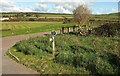
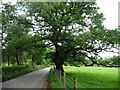
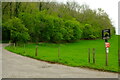
|
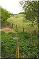
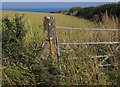
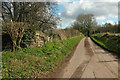
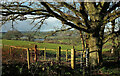
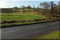
Boundary of Gorsty Hill Quarry
by Jonathan Hutchins
geograph for square SJ8246
|
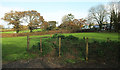
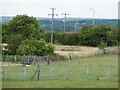
|
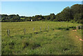
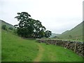
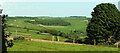
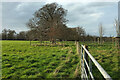
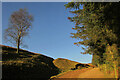
Field by Spurway Hill
by Derek Harper
geograph for square SS8820
The wood is Sam's Copse.
|
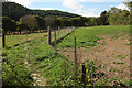
|
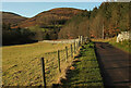
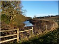
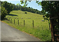
Iron Mill Stream valley at Bellbrook
by Derek Harper
geograph for square SS8920
A view from the lane to Spurway Mill. Behind is East Pinkworthy Wood.
|
|
Edginswell Stream near Parson's Bridge
by Derek Harper
geograph for square SX8866
From footpath TQ/36 where it turns northeast (right), joining its former route... (more)
|
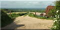
|
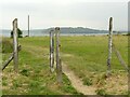
Start of footpath near West Bay
by Derek Harper
geograph for square SY4690
Although the 1:25000 map clearly shows the path leaving Station Road some 80... (more)
|
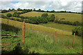
|
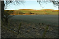
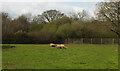
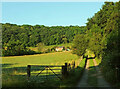
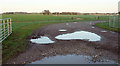
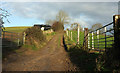
Field by Red Post Cross
by Derek Harper
geograph for square SX8363
|
|
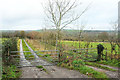
Fenced path to Old Liverton
by Derek Harper
geograph for square SX8074
A little unusual, being fenced in across the middle of a meadow. It was... (more)
|
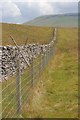
|
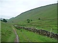
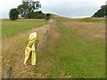
Wall and Fence, Sell Gill Hill
by Mick Garratt
geograph for square SD8174
Looking up towards Plover Hill ( SD8475). |
|
Fields by Crewe's Lane
by Derek Harper
geograph for square TQ3659
|
|
Field near Durl Head
by Derek Harper
for square SX9456
|
|
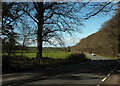
Road to Linhope
by Derek Harper
geograph for square NT9616
The private road from Hartside has Ritto Hill looming ahead for about 750... (more)
|
|
Reaveley Braes
by Derek Harper
geograph for square NU0116
The northeastern end of a linear wood along the slopes of the Breamish valley,... (more)
|
|
Fence above Pudcombe Cove
by Derek Harper
geograph for square SX9150
|
|
Field by Bell Lane
by Derek Harper
geograph for square SX8280
|
|
Fences near Oak Bank Farm
by Derek Harper
geograph for square SE3049
|
|
Fenced hedgerow, north of Blindcrake
by Christine Johnstone
geograph for square NY1535
Protecting the hedge as it grows, or replacing it as it gets gappy?
|
|
Replaced not repaired, north of Blindcrake
by Christine Johnstone
geograph for square NY1535
The broken-down drystone wall has been replaced with two wire fences. The... (more)
|
|
On the Dales Way
by Derek Harper
geograph for square SE0754
In Wandsworth Wood, but looking out (into SE0854) on an open hillside. |
|
Fenced field on the north side of Greenmires Lane
by Christine Johnstone
geograph for square SE2549
Probably carved out of a larger field, as most of the older field boundaries... (more)
|
|
Fencing around the fish pond, west of Stoke Rochford
by Christine Johnstone
geograph for square SK9028
Alongside Grantham Road.
|
|
Gate and post near The Daymark
by Derek Harper
geograph for square SX9050
The military road to the battery on Froward Point is characterised by concrete... (more)
|
|
Bridleway approaching Boredale Head
by Christine Johnstone
geograph for square NY4116
|
|
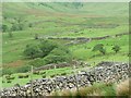
Bridleway down Boredale
by Christine Johnstone
geograph for square NY4116
The drystone field walls are enhanced by tall wire fences, probably against deer.
|
|
Drystone wall built up with wire fencing
by Christine Johnstone
geograph for square NY4216
Along the Angle Tarn path in Bannerdale, home to a herd of red deer.
|
|
Sheep may safely graze near Park Foot
by Christine Johnstone
geograph for square NY4623
With a large tree to shelter under and a barbed wire fence to protect them from... (more)
|
|
Field full of fences and gates
by Christine Johnstone
geograph for square SE3114
North of Low Moor Lane.
|
|
Combe above Blackaller's Cove
by Derek Harper
geograph for square SX9268
|
|
Rousiball Lane
by Derek Harper
geograph for square ST6704
Bridleway S10 44 follows this track to Buckland Newton. There's a fine view.
|
|
Penny Farthing Wood
by Derek Harper
for square ST7003
|
|
Concrete fence posts above Jennycliff
by Alan Murray-Rust
geograph for square SX4952
A reminder of the extent of military works for the protection of the Plymouth... (more)
|
|
Feature, Priory Farm
by Derek Harper
geograph for square TQ3049
Doubtless by the time I am submitting this image, these humps will have been... (more)
|
|
Bridleway, Marden Park
by Derek Harper
geograph for square TQ3555
Woldingham bridleway 30 / NCN21 follow the road towards Woldingham Station. The... (more)
|
|
Entrance to Beechwood Riding School
by Derek Harper
geograph for square TQ3554
The drive, seen leaving the road past Woldingham School, is followed by... (more)
|
|
Godstone Farm
by Derek Harper
geograph for square TQ3550
|
|
Sheep, Occombe Farm
by Derek Harper
geograph for square SX8763
Grey faced Dartmoor sheep, I think, at the northern side of the tourist farm.... (more)
|
|
B3128 near Limekiln Plantation
by Derek Harper
geograph for square ST5072
|
|
Sandy Lane
by Derek Harper
geograph for square ST5373
|
|
Field boundary, Brockley
by Derek Harper
geograph for square ST4767
|
|
Sheep near Cornwall Farm
by Derek Harper
geograph for square SO0924
|
|
Whitman's Hill Farm
by Derek Harper
geograph for square SO7548
With Whitman's Hill Coppice behind. Seen from the B4219.
|
|
View towards the Teign
by Derek Harper
geograph for square SX8870
|

|
Bridleway near East Prawle
by Derek Harper
geograph for square SX7736
Looking in the other direction along Chivelstone bridleway 13 from... (more)
|
|
Bridleway above Linhope
by Derek Harper
geograph for square NT9616
The track by the wood is heading for Linhope Spout; just beyond the central... (more)
|

|
Signs of activity near Higher Rocombe
by Derek Harper
geograph for square SX9169
|
|
Entrance, Chewton Fields Farm
by Derek Harper
geograph for square ST6053
|
|
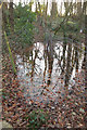
Flooded footpath, Rush Hill Wood
by Derek Harper
geograph for square ST6254
Progress along footpath CL 19/12 is rapidly halted beyond the wall shown in... (more)
|
|
Across Whiteway Road
by Derek Harper
geograph for square ST7164
|
|
Cotswold Way on Dean Hill
by Derek Harper
geograph for square ST7166
The Way follows bridleway BA 5/32 uphill near Pendean Farm, also following the... (more)
|
|
Twin tracks, Tunley
by Derek Harper
geograph for square ST6959
Running side by side away from Blind Lane.
|
|
Left behind
by Alan Murray-Rust
geograph for square SK6353
A discarded coat hung up on a fence post.
|