|
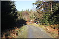
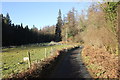
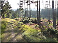
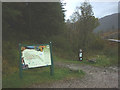
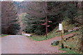
Forest trail near Llwyn Du Bloomery
by Jeff Buck
geograph for square SH7227
Trail through Coed-y-Brenin near Llwyn Du bloomery (medieval iron furnaces).... (more)
|
|
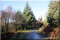
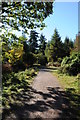
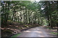
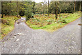
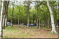
Bike Trail at Coed-y-Brenin
by Jeff Buck
geograph for square SH7226
A footpath and bike trail at Coed-y-Brenin near the visitor centre.
Wikipedia... (more)
|
|
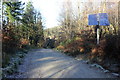
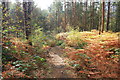
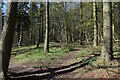
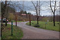
Trail through Coed-y-Brenin
by Jeff Buck
geograph for square SH7226
A footpath and trail at Coed-y-Brenin near the visitor centre.
Wikipedia... (more)
|
|
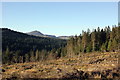
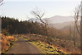
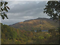
View towards Rhinog Fawr
by Jeff Buck
geograph for square SH7227
View towards Rhinog Fawr from a trail in the north of Coed-y-Brenin.... (more)
|
|
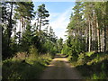
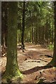
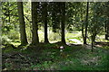
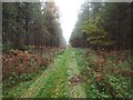
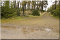
Coed-y-Brenin
by Jeff Buck
geograph for square SH7226
A forest trail in Coed-y-Brenin.
Wikipedia Link |
|
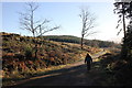
Forest track at Bryn Eden
by Jeff Buck
geograph for square SH7129
Looking north along a forest track at the north of Coed-y-Brenin near Bryn Eden.... (more)
|
|
Coed-y-Brenin Forest Track
by Jeff Buck
geograph for square SH7128
The low winter sun illuminates a clearing in the north west of Coed-y-Brenin.... (more)
|
|
Track through Coed-y-Brenin
by Jeff Buck
geograph for square SH7128
A light dusting of December frost lines a forest track in the north west part of... (more)
|
|
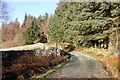
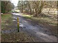
Forest track at Bwlch-y-ffordd
by Jeff Buck
geograph for square SH7228
Heading north at Bwlch-y-ffordd in Coed-y-Brenin.
Wikipedia... (more)
|
|
Track at Bwlch-y-ffordd
by Jeff Buck
geograph for square SH7228
Forest track reaches Bwlch-y-ffordd in Coed-y-Brenin.
Wikipedia... (more)
|
|
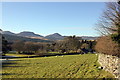
View towards the Rhinogs from Bwlch-y-ffordd
by Jeff Buck
geograph for square SH7228
Looking west towards the Rhinogs from Bwlch-y-ffordd on the edge of... (more)
|
|
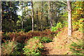
Clearing in Coed-y-Brenin
by Jeff Buck
geograph for square SH7227
A Forestry Commission clearing in Coed-y-Brenin.
Wikipedia... (more)
|
|
View towards Craig-y-cae
by Jeff Buck
geograph for square SH7227
View towards Craig-y-cae at Coed-y-Brenin.
Wikipedia... (more)
|
|
Forest trail
by Philip Halling
geograph for square SO5614
A forest trail near the Forestry Commission Visitor Centre near Symonds Yat.
|
|
Trail markers, Kirkburn
by Jim Barton
geograph for square NT2938
Start of the four marked trails in Cardrona Forest at the Kirkburn car park. In... (more)
|
|
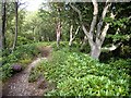
Forest trail at Rosehall
by M J Richardson
geograph for square NC4702
One of several trails through the pine forest
|
|
Changing colours, Glentress waymarks
by Jim Barton
for square NT2839
For some unexplained reason, the waymarks for two of the walking routes are... (more)
|
|
Gruffalo Spotters Trail, Haldon Forest
by Derek Harper
geograph for square SX8885
Using the Haldon Forest Discovery Trail through Haldon Plantation, and virtually... (more)
|
|
Path on Tower Rig
by Jim Barton
geograph for square NT2743
The waymark indicates the Tower Trail, the longest of the marked trails that... (more)
|
|
Delamere Forest
by Jeff Buck
geograph for square SJ5470
One of the many smaller, obscure trails in Delamere Forest. Delamere, which... (more)
|
|
Pine woodland on the side of Ben Bhraggie
by Andrew Tryon
geograph for square NC8201
The eastern slopes of Ben Bhraggie are covered by a network of forest tracks and... (more)
|
|
Picnic spot in the forest
by Graham Horn
geograph for square SD3396
On the various forest trails there are painted mushrooms. These seem to... (more)
|
|
Start of the trail...
by Bill Harrison
geograph for square NO2212
...at Pitmedden Forest near Auchtermuchty.
|
|
Kirkhill Forest trail
by Bill Harrison
geograph for square NJ8512
|
|
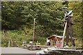
Entrance to Ardmolich Woods
by Karl and Ali
geograph for square NM7171
The start of the forest trail to a fine viewpoint and also the extended... (more)
|
|
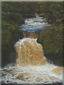
Waterfall and footbridge on the Abhainn Fionain
by Karl and Ali
geograph for square NM9817
A highlight of the Inverinan forest nature trail.
|
|
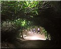
Laurel tunnel, Haldon Plantation
by Derek Harper
geograph for square SX8885
A path, used by the Butterfly and Discovery Trails of Haldon Forest Park, is... (more)
|
|
A forest trail, Cragside
by Stanley Howe
geograph for square NU0801
Leading away from the old dam at Blackburn boathouse.
|
|
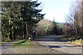
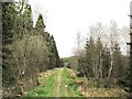
The Dundeugh Trail
by Ann Cook
geograph for square NX6088
The turning to the left leads to a small parking area.
|
|
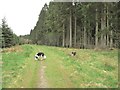
Border Collies on the Dundeugh Trail
by Ann Cook
geograph for square NX6087
|
|
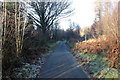
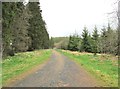
Heading north on the Dundeugh Trail
by Ann Cook
geograph for square NX6088
|
|
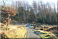
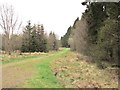
Heading south on the Dundeugh Trail
by Ann Cook
geograph for square NX6088
|
|
Autumn colours at Inverinan Glen
by Karl and Ali
geograph for square NM9917
A glimpse of Loch Awe from the nature trail which loops around the Abhainn Fionain.
|
|
Delamere Forest Park
by Jeff Buck
geograph for square SJ5471
One of the many hidden tracks in the forest. Delamere, which means "forest... (more)
|
|
Forest ride
by David Pashley
for square TL8098
Grassy forest ride leading to country road.
|
|
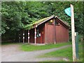
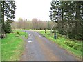
Cardrona Forest Visitor Centre and toilets
by Jim Barton
geograph for square NT2938
At the Kirkburn car park - taken to replicate the first Geograph for this square... (more)
|
|
Path junction in Nevis Forest
by Jim Barton
geograph for square NN1172
The right-hand path ascends to cross the S shoulder of Cow Hill, with a spur to... (more)
|
|
Track junction in Grizedale Forest
by Tom Richardson
geograph for square SD3494
|
|
Car park below Cow Hill, Glen Nevis
by Jim Barton
geograph for square NN1273
A Forestry Commission car park handy for the paths on Cow Hill and in Nevis Forest.
|
|
Go-Ape office and cafe Grizedale Forest Park
by Tom Richardson
geograph for square SD3394
My grand kids persuaded me to do this with them this year I enjoyed... (more)
|
|
Track junction near Goosey Foot tarn
by Tom Richardson
geograph for square SD3396
|
|
Cars and trees
by Bill Harrison
geograph for square NJ8604
Car park for Countesswells Forest walks
|
|
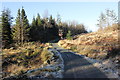
No unauthorised vehicles beyond this point
by Ann Cook
geograph for square NX6088
|