|
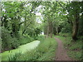
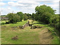
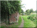
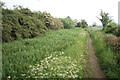
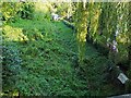
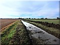
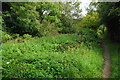
Former Thames & Severn Canal near South Cerney
by Malc McDonald
geograph for square SU0498
The former Thames & Severn Canal, now disused and overgrown.
The path... (more)
|
|
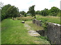
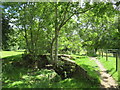
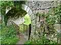
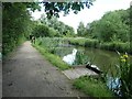
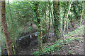
Former canal lock at Siddington
by Malc McDonald
geograph for square SU0399
The remains of a lock on the former Thames & Severn Canal at Siddington, in... (more)
|
|
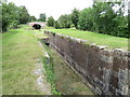
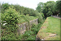
Former canal lock at Siddington
by Malc McDonald
geograph for square SU0399
The remains of a lock on the former Thames & Severn Canal at Siddington,... (more)
|
|
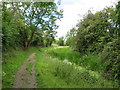
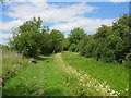
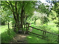
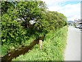
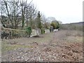
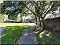
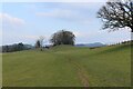
Thames & Severn Way near South Cerney
by Malc McDonald
geograph for square SU0498
This path alongside the former Thames & Severn Canal now forms part of the... (more)
|
|
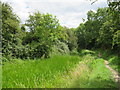
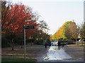
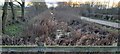
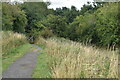
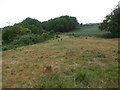
Former Thames & Severn Canal near South Cerney
by Malc McDonald
geograph for square SU0498
A path alongside the former Thames & Severn Canal near South Cerney in... (more)
|
|
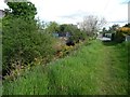
Former Thames & Severn Canal near South Cerney
by Malc McDonald
geograph for square SU0498
The former Thames & Severn Canal, now disused and overgrown, near South... (more)
|
|
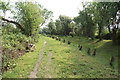
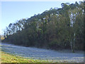
Former Thames & Severn Canal near South Cerney
by Malc McDonald
geograph for square SU0398
The route of the former Thames & Severn Canal near South Cerney in... (more)
|
|
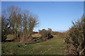
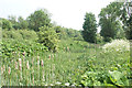
Thames & Severn Canal near Siddington
by Malc McDonald
geograph for square SU0398
The bed of the former Thames & Severn Canal in Gloucestershire countryside.... (more)
|
|
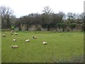
Former canal at Siddington
by Malc McDonald
geograph for square SU0399
The former Thames & Severn Canal at Siddington, near Cirencester in... (more)
|
|
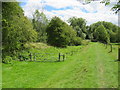
Stile near Siddington
by Malc McDonald
geograph for square SU0398
A stile on the Thames & Severn Way long distance path near Siddington in... (more)
|
|
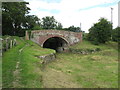
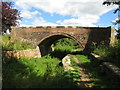
Cowground Bridge near Siddington
by Malc McDonald
geograph for square SU0399
Cowground Bridge crosses the disused Thames & Severn Canal near Siddington... (more)
|
|
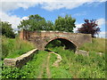
Canal bridge at Siddington
by Malc McDonald
geograph for square SU0399
A bridge over the former Thames & Severn Canal at Siddington, near... (more)
|
|
Remains of a railway bridge, Siddington
by Malc McDonald
geograph for square SU0399
The brick wall is the remains of a bridge which carried a railway over the... (more)
|
|
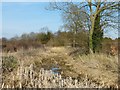
Probable former course of Wendover Arm
by Rob Farrow
geograph for square SP8911
I believe that this boggy, reedy tranche of land was the original course of the... (more)
|
|
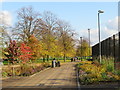
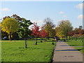
Autumn in Burgess Park
by Malc McDonald
geograph for square TQ3277
An image taken in Burgess Park on a November day. Leaves were turning red and... (more)
|
|
Autumn in Burgess Park, near Camberwell
by Malc McDonald
geograph for square TQ3277
An image taken in Burgess Park on a November day. Leaves were turning red and... (more)
|
|
Autumn colour in Burgess Park, near Camberwell
by Malc McDonald
geograph for square TQ3377
An image taken in Burgess Park on a November day. Leaves were turning red and... (more)
|
|
Sedgwick Hall Bridge
by Adrian Taylor
geograph for square SD5186
Detail of the north face of Sedgwick Hall Bridge on the disused Lancaster Canal.... (more)
|
|
Cowground Bridge near Siddington
by Malc McDonald
geograph for square SU0399
Cowground Bridge crosses the disused Thames & Severn Canal near Siddington... (more)
|
|
The former Woodside Junction
by Christine Johnstone
geograph for square SO9288
The roving bridge carries the Dudley No 1 Canal towpath over the western... (more)
|
|
Former Shrewsbury Canal, looking towards Berwick Wharf
by Christopher Hilton
geograph for square SJ5411
The Shrewsbury Canal was built to join the tub-boat canal network of the... (more)
|
|
Green Lane Bridge over Thames & Severn Canal
by Vieve Forward
geograph for square SU1696
Causeway to the former Green Lane Bridge over the Thames & Severn Canal... (more)
|
|
Retaining wall for the former Chard Canal
by David Smith
geograph for square ST2725
The route of the former Chard branch off the Bridgwater and Taunton Canal at... (more)
|
|
Fishing platforms, north of Newtons Lane
by Christine Johnstone
geograph for square SK4743
The Awsworth Angling Club have over 50 platforms on this stretch of the former... (more)
|
|
Car park on the Jubilee Campus
by Alan Murray-Rust
geograph for square SK5439
The roadway follows the line of the former Nottingham Canal. The rise in the... (more)
|
|
The former Nottingham Canal disappears
by Christine Johnstone
geograph for square SK4744
The northern end of the stretch fished by Awsworth Angling Club.
|
|
Y Cyt / The Cut at Pensyflog, Porthmadog
by Christine Johnstone
geograph for square SH5639
The access road is also a public footpath. The footpath follows the line of the... (more)
|
|
Course of former Shrewsbury and Newport Canal
by David Martin
geograph for square SJ7520
In the trees ahead, the route of the canal is broken by the A41. Adjacent signs... (more)
|
|
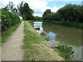
Path by the former Thames & Severn Canal
by Bill Boaden
geograph for square SU0895
The canal was closed in 1933, but the former towpath has remained in use as the... (more)
|
|
The former Thames & Severn Canal
by Bill Boaden
geograph for square SU0697
The canal was closed in 1933, following problems with keeping it topped up with... (more)
|
|
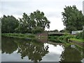
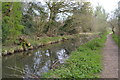
South Cerney Locks
by Bill Boaden
geograph for square SU0597
Part of the former Thames & Severn Canal which was closed in 1933. There are... (more)
|
|
Former Worsbrough branch of the Dearne & Dove Canal
by Christine Johnstone
geograph for square SE3603
The clue is the pub through the trees - called the Boatman's Rest - and... (more)
|
|
Bed of former canal and railway line
by Rose and Trev Clough
geograph for square NY3059
|
|
Footpath at Gorton
by Gerald England
geograph for square SJ8995
This footpath between Reddish Lane on the left and Waterhouse Road on the right... (more)
|
|
The former North Wilts Canal
by Bill Boaden
geograph for square SU0895
A lopping exercise has been undertaken on the trees. This canal linked the River... (more)
|
|
Public footpath alongside Y Cyt / The Cut
by Christine Johnstone
geograph for square SH5639
Looking east towards the Chapel Street bridge. The footpath follows the line of... (more)
|
|
Not the Canal
by Des Blenkinsopp
geograph for square SU4392
This is the course of the former Wilts and Berks canal.
Sadly though, this... (more)
|

|
Stopping at the Town Hall
by Neil Owen
geograph for square ST9970
The Wilts and Berks Canal branched off from Stanley and reached all the way to... (more)
|
|
A balcony view
by Neil Owen
geograph for square ST2937
The former Bridgwater and Taunton canal has seen many changes in its time and... (more)
|
|
Following the Course of the Lancaster Canal below Wellheads Hill
by Chris Heaton
geograph for square SD5086
All evidence of an inland waterway has disappeared at this point, as I follow... (more)
|
|
Some sort of dam structure on old canal
by TCExplorer
geograph for square SJ5411
Some sort of dam structure in the channel of the former Shrewsbury canal
|
|
Grassed over and gone
by Neil Owen
geograph for square ST7059
This piece of landscape appears unremarkable enough but it was the scene of two... (more)
|
|
Former canal at Fishlake Meadows
by David Martin
geograph for square SU3523
|
|
Frost in the shadows of the waters
by Neil Owen
for square ST6857
This simple stretch of land beside the old colliery spoil heaps used to be the... (more)
|
|
The former Thames & Severn Canal
by Bill Boaden
geograph for square SU0796
The canal was closed in 1933. The sound from the nearby A419 is inescapable.
|
|
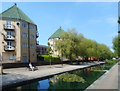
Sitting Out by Albion Water
by Des Blenkinsopp
geograph for square TQ3579
This former canal is now a pleasant open corridor between residential streets.
|
|
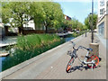
Path beside Albion Water
by Des Blenkinsopp
geograph for square TQ3579
Formerly a commercial canal between docks, Albion Water has been landscaped into... (more)
|
|
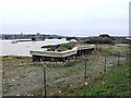
Former entrance to the Thames and Medway Canal
by Chris Whippet
geograph for square TQ7469
|
|
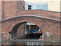
Towpath bridge over infilled canal arm
by Christine Johnstone
geograph for square SP0686
On the north side of Gas Street basin.
|
|
The Itchen Way by the Itchen Navigation
by Bill Boaden
geograph for square SU4517
Although marked as a bit of pond on the OS map, this part of the former canal... (more)
|