|
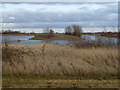
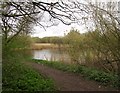
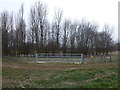
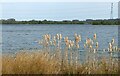
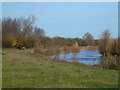
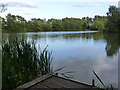
Island in a flooded gravel pit, Langtoft Fen
by Richard Humphrey
geograph for square TF1413
|
|
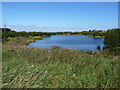
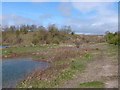
Aggregates factory beside flooded gravel pit
by Vieve Forward
geograph for square SU0495
The aggregates factory in the distance is seen from the other side of a flooded... (more)
|
|
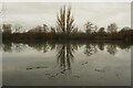
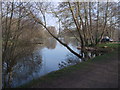
Passing the former gravel pits
by HelenK
geograph for square TL3679
The former gravel pits have now been landscaped into lakes and stocked with... (more)
|
|
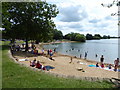
Artificial beach, Cotswold Country Park & Beach
by Vieve Forward
geograph for square SU0295
Artificial beach in disused gravel pit, now billed as the number one attraction... (more)
|
|
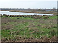
Former sand and gravel pit on Ouse Fen near Over
by Richard Humphrey
geograph for square TL3872
Now being established as a nature reserve, see... (more)
|
|
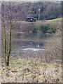
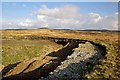
Old gravel pit at Farnley Haughs
by Oliver Dixon
geograph for square NZ0062
The southern of two flooded abandoned gravel pits.
|
|
Old gravel pit at Farnley Haughs
by Oliver Dixon
geograph for square NZ0062
The northern of two flooded abandoned gravel pits.
|
|
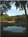
Woodgreen, former gravel pit
by Mike Faherty
geograph for square SU1717
|
|
Reclaimed gravel pit by Hay-a-Park Lane
by Derek Harper
geograph for square SE3657
One of several lakes occupying former gravel workings to the north of Knaresborough.
|
|
Flooded gravel workings at Manor Farm
by Richard Law
geograph for square SJ9403
One of a number of former gravel pits, mostly disused since the late 1980s or... (more)
|
|
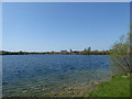
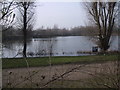
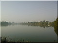
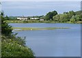
St Chad's Water
by David Lally
geograph for square SK4432
A small lake formed by gravel extraction for the construction of the M1. Now a... (more)
|
|
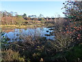
Gravel-pit Ponds, Culbin Forest
by Karl and Ali
geograph for square NH9961
Once used for gravel extraction, now a wildlife and leisure facility.
|
|
New gate to the old gravel pits
by Richard Humphrey
geograph for square TF2601
Gravel excavation took place on Prior's Fen between Thorney and Whittlesey... (more)
|
|
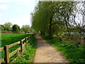
Andover - Anton Lakes
by Chris Talbot
geograph for square SU3646
This former gravel pit is now a park and provides for fishing and walking.
|
|
Andover - Anton Lakes
by Chris Talbot
geograph for square SU3646
This former gravel pit is now a park and provides for fishing and walking.
|
|
Old gravel pit at Farnley Haughs
by Oliver Dixon
geograph for square NZ0063
The northern of two flooded gravel pits.
|
|
Railway Lake (or Railway Pit), Hoveringham
by Alan Murray-Rust
geograph for square SK6847
Former gravel pit, now a nature reserve, the largest of the lakes created from... (more)
|
|
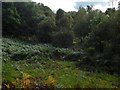
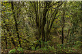
A disused gravel pit in Boathouse Wood
by Lairich Rig
geograph for square NS3981
|
|
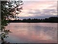
Gravel Pit at dawn
by David Lally
geograph for square SK5031
|
|
Former gravel pit in King's Park
by Lairich Rig
geograph for square NS7893
There is a noticeable hollow here, with a resemblance to a drained body of... (more)
|
|
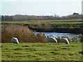
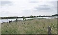
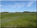
Sheep grazing by the gravel pits near Needingworth
by Richard Humphrey
geograph for square TL3572
There are a number of old sand and gravel pits near Needingworth, some are being... (more)
|
|
Private fishing lake, Lechlade Trout Farm
by Vieve Forward
geograph for square SP2200
Part of an extensive area of old gravel workings flooded and used for private... (more)
|
|
Roughgrounds Lake, near Lechlade
by Vieve Forward
geograph for square SP2101
Carp fishing lake in flooded gravel workings.
|
|
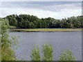
A mere at Brockholes Nature Reserve
by Karl and Ali
geograph for square SD5731
This mere, a flooded gravel extraction pit, is the closest to the M6 and the... (more)
|

|
A family group
by David Lally
geograph for square SK4431
At St Chad's Water.
|
|
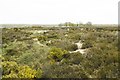
Earthworks, Wolborough
by Derek Harper
geograph for square SX8570
For some reason I got it into my head many years ago that these earthworks were... (more)
|
|
Former gravel pit
by Ian Capper
geograph for square TQ2052
Depression in woodland on Headley Heath, marked on the 1897 1:10,560 map as an... (more)
|
|
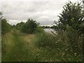
Sailing lake at Papercourt Gravel Pits
by Jonathan Hutchins
geograph for square TQ0456
Looking south-west from the northern bank.
|
|
Former Gravel Pit
by John M
geograph for square SK0017
This appears to have been dug post Second World War as it is not visible on 1947... (more)
|
|
Former sand and gravel pits near Needingworth
by Richard Humphrey
geograph for square TL3572
|
|
Yew Tree Heath, former gravel pit
by Mike Faherty
geograph for square SU3606
Betrayed by shallow sloping sides and patches of exposed gravel.
|
|
Gravel Pit Near Loch Gorm
by Mary and Angus Hogg
geograph for square NR2264
This former gravel pit shows what lies below the moorland here, deposited during... (more)
|
|
Riverslea Lake
by Alan Murray-Rust
geograph for square TF2361
Purchased in 2009 by the Lincolnshire Wildlife Trusts as an extension to the... (more)
|
|
Disused gravel pit
by Ian Calderwood
geograph for square SK2943
Now overgrown with trees, the pit seems to have gone out of use some time in the... (more)
|
|
Pasture and sheep in the old gravel workings
by Richard Humphrey
geograph for square TL3572
There are a number of old sand and gravel pits near Needingworth, some are being... (more)
|
|
Angler at former gravel pit, west of Palmarsh
by Christine Johnstone
geograph for square TR1333
On the south side of the railway line. Also mapped as a sailing club.
|
|
Kirkby Gravel Pits Nature Reserve
by Alan Murray-Rust
geograph for square TF2361
The original part of the site. The low gravel island supports an established... (more)
|
|
Gravel pit near Ashton Keynes
by Vieve Forward
geograph for square SU0394
Flooded gravel pit.
|
|
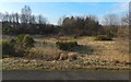
Old gravel pit
by Ian Calderwood
geograph for square SK3241
Now filled with trees
|
|
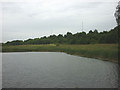
Trent Meadows
by David Lally
geograph for square SK5031
Path along a spit between gravel pits.
|
|
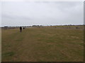
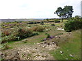
Deadman Hill, former gravel pits
by Mike Faherty
geograph for square SU2016
As shown on old OS maps.
|

|
Sailing dinghies at buoy 12
by Christine Johnstone
geograph for square SU6570
On a flooded gravel pit south of the River Kennet / Kennet & Avon canal.
|
|
Marfield Wetlands
by Oliver Dixon
geograph for square SE2182
Looking north-west along the central spine of these old gravel pits which are... (more)
|
|
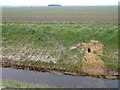
Large hole in the bank, Thorney Dike
by Richard Humphrey
geograph for square TF2601
The underlying sand and gravel is clearly evident at the entrance of this burrow... (more)
|
|
Deeping Lakes: the large lake
by Bob Harvey
geograph for square TF1707
The largest and oldest of the gravel working quarries here, dating back to the... (more)
|
|
New Year at Claymills, 14 years on
by Alan Murray-Rust
for square SK2625
A cold snap again resulted in the freezing over of the adjacent former gravel... (more)
|
|
Former gravel pit near Cossington
by Alan Murray-Rust
geograph for square SK5912
Close to, but not part of, Cossington Meadows nature reserve.
|
|
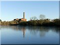
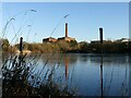
Man and nature at Claymills
by Alan Murray-Rust
geograph for square SK2625
Wild grasses and reedmace frame the pumping station across a frozen gravel pit.
|
|
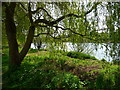
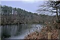
The lake at Nunsmere
by Bob Harvey
geograph for square SJ5968
This tree overhangs the banks of the Nunsmere, a former gravel pit in Cheshire.
|
|
The Nunsmere
by Bob Harvey
geograph for square SJ5968
Described by the hotel (Nunsmere Hall) as a 60-acre lake, I strongly suspect it... (more)
|