Public Tags
Other tags: Wellhead
Showing images tagged with former:Wellhead tag.
|
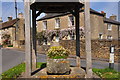
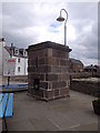
The Wellhead, Acton Turville, Gloucestershire 2020
by Ray Bird geograph for square ST8080 Chestnut house through the Wellhead.
|
|
The New Well
by Lairich Rig for square NS9977 The object in the foreground is an eighteenth-century wellhead, the New Well,... (more)
|
|
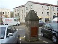
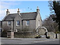
Former Lock-up on Church Lane, Digby
by Dave Hitchborne geograph for square TF0854 This former lock-up, for miscreants, was a wellhead. It dates from the 1600s. It... (more)
|
|
Church Street, Digby
by Dave Hitchborne geograph for square TF0854 This former lock-up, for miscreants, was a wellhead. It dates from the 1600s. It... (more)
Tags:
top:Historic Sites and ArtefactsX
former:Lock-UpX
top:Village, Rural SettlementX
former:Wellhead
|
|
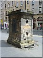
Netherbow Well, Royal Mile
by kim traynor for square NT2673 Category: Water supply One of several communal street wells that once supplied water to the residents... (more)
Tags:
top:City, Town CentreX
former:Wellhead
|
|
Village memorials
by Bill Harrison geograph for square NO5999 To the left. St Erchan's well (B-listed:... (more)
Tags:
Diamond Jubilee 1897X
type:GeographX
top:Historic Sites and ArtefactsX
top:Village, Rural SettlementX
former:Wellhead
|
|
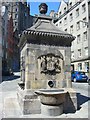
Bowfoot Well, Grassmarket
by kim traynor geograph for square NT2573 Category: Water supply The well stands at what was the foot of the old West Bow (originally pronounced... (more)
Tags:
top:City, Town CentreX
former:Wellhead
|
|
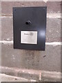
A recent restoration plaque on Duthies Well, Stonehaven
by Stanley Howe for square NO8785 Organised and funded by the local ROTARY.
Tags:
PlaqueX
Restoration ProjectX
subject:Restoration SiteX
place:StonehavenX
top:Water ResourcesX
former:Wellhead
|
|
Duthies Well (restored)
by Stanley Howe geograph for square NO8785 On the Shorehead; near its junction with the Old Pier, Stonehaven. See... (more)
|
|
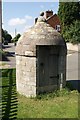
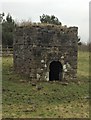
Abandoned well head on the outskirts of Skipton
by Nigel Pepper geograph for square SE0052 Old well head in field on north east edge of Skipton.
|
|
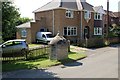
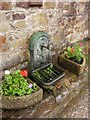
Roadside tap, High Street, Hatherleigh
by Derek Harper for square SS5404 Mapped as a well, this is outside number 5.
|