|
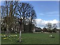
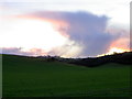
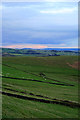
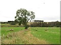
Springtime in Uffington
by Richard Humphrey
geograph for square TF0607
Sheep and lambs in a grassfield next to the church
|

|
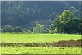
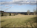
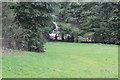
Cows with calves in Shillingthorpe Park, Greatford, Lincolnshire
by Richard Humphrey
geograph for square TF0711
|
|
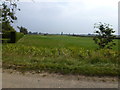
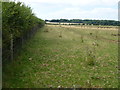
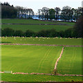
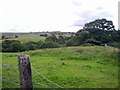
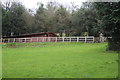
Grassfield near Bank Farm, Quadring Bank
by Richard Humphrey
geograph for square TF2033
Donington South Ing
|
|
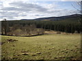
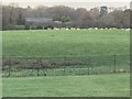
A field of swans, Harbridge
by Maigheach-gheal
geograph for square SU1410
Swans grazing on the lush grassfields of the Avon flood plain.
|
|
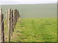
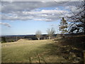
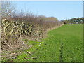
Fence beside the byway, Mere
by Maigheach-gheal
geograph for square ST8134
The barbed wire fence heads north dividing grassfields.
In 1874 Joseph F... (more)
|
|
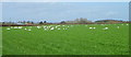
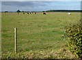
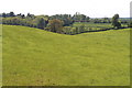
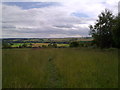
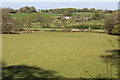
Grassfield, Homington
by Maigheach-gheal
geograph for square SU1326
The large fields in this area are usually grazed by beef cattle.
|
|
Field next to Redpost Cross, looking towards Langmead
by David Gearing
geograph for square SS6202
|
|
A spire over the hill, Caledon
by Kenneth Allen
geograph for square H7545
Looking north-west from Mill Street
|
|
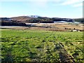
Newly cut grass field next to A390
by David Gearing
geograph for square SX0856
Looking towards Penpell Plantation
|
|
Sunlight on grass and catching a tree
by David Lally
geograph for square NR7776
Fertile valley bottom near Barnlongart House.
|
|
Sheep pasture
by Richard Humphrey
geograph for square TL0391
|
|
Soggy pasture on Broughton Lane
by Richard Humphrey
geograph for square TL2978
To the west of Holborn farm
|
|
Cattle near Hill Top Farm, Coppingford
by Richard Humphrey
geograph for square TL1680
|
|
View south from Cockhouse Lane
by Robert Graham
geograph for square NZ2242
At the west end of the village of Ushaw Moor. The village to the left in the... (more)
|
|
Grass fields near Nursery Plantation
by J.Hannan-Briggs
geograph for square SK8230
|

|
Farmland at Hasfield Ham
by Trevor Rickard
geograph for square SO8425
Looking north-west across the Severn to mainly grazing and hay fields. In the... (more)
|
|
Approach to 'Blairordans'
by Stanley Howe
geograph for square NJ5107
|
|
Field off Sheepstreet Lane
by Julian P Guffogg
geograph for square TQ6928
|
|
Limestone uplands near Newhaven
by David Lally
for square SK1661
|
|
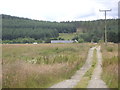
Grass fields between Hill of Bandodle and Backhill
by Stanley Howe
geograph for square NJ6506
|
|
A field below Hill of Bandodle
by Stanley Howe
geograph for square NJ6506
|
|
Grass fields
by Stanley Howe
geograph for square NJ6506
Between Hill of Bandodle and Backhill.
|

|
Looking back East
by Robert Graham
geograph for square NZ1059
Looking along the lane towards Leadgate, from the minor road leading down to... (more)
|
|
View from the road at Cockshot Banks
by Robert Graham
geograph for square NZ0647
Looking southwest towards Waskerley. The Moorcock Inn can be seen on the horizon.
|
|
Hedge, St James's Common
by Maigheach-gheal
geograph for square ST8521
It is difficult to date hedges unless there is documentary evidence as to their... (more)
|
|
View South from the bottom of Templetown
by Robert Graham
geograph for square NZ1149
Looking across the Lanchester Valley Walk towards Knitsley in the distance.
|
|
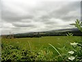
Green fields near Stainby
by Maigheach-gheal
geograph for square SK9023
Longing across the fields from Skillington Road.
|
|
Animal feeder near Chapelton
by Maigheach-gheal
geograph for square NO1145
The feeder appears to have straw in it.
|
|
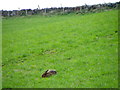
Hare feeding near Craigie
by Maigheach-gheal
for square NO1245
The grace and beauty of the brown hare has become symbolic of the British... (more)
|
|
Drystone wall, Mains of Dalcapon
by Maigheach-gheal
geograph for square NN9754
Sheep graze contentedly in the lush fields that are both sides of the drystone wall.
|
|
Sheep near Dalcapon
by Maigheach-gheal
geograph for square NN9755
Sheep graze on a field that has been recently mown for either hay or silage.
|
|
The view north from Longside
by David Lally
geograph for square SJ9982
I suspect the skyline peak just to the left of centre is Alphin Pike in SE0002. |
|
Tree on Lower Bee Low
by David Lally
geograph for square SK1079
Rough ground to the south of the A623 between Sparrowpit and Peak Forest.
|
|
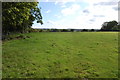
Green field east of Owston Road
by Christine Johnstone
geograph for square SK7895
The River Trent runs just beyond the hedge.
|
|
Hedge near Staindrop
by Maigheach-gheal
geograph for square NZ1321
A walk beside a hedgerow almost anywhere will reveal a rich and flourishing... (more)
|
|
Baled hay at Fellcleugh
by M J Richardson
geograph for square NT7060
Looking soputh to trees lining the Whiteadder Water.
|
|
Former wildflower field
by David Lally
geograph for square TG2403
It appears that with the loss of EU funding the field has reverted to a grass... (more)
|

|
The River Finnan
by M J Richardson
geograph for square NM9081
Looking down from the viaduct carrying the West Highland Line over the river.
|
|
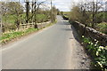
Bridge taking B6478 over Bond Beck
by Roger Templeman
geograph for square SD7655
Ordnance Survey documents indicate that in 1960 a benchmark levelled at 210.240m... (more)
|
|
View across fields to Pentre Farm, Pentre Lane
by M J Roscoe
geograph for square SO3003
Viewed from the canal towpath; the near field borders the Old Abergavenny Road.... (more)
|
|
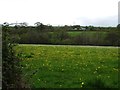
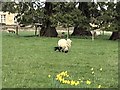
Daffodils and sheep in Uffington
by Richard Humphrey
geograph for square TF0607
|
|
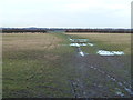
Pasture above National Cycle Route 492 (2)
by M J Roscoe
geograph for square SO2601
|
|
Pasture above National Cycle Route 492
by M J Roscoe
geograph for square SO2601
|
|
Sheep near Castle Hill Farm adjoining Manchester Airport
by Richard Humphrey
geograph for square SJ8083
|

|
A lone poppy in Wolferton, Norfolk
by Richard Humphrey
geograph for square TF6528
|
|
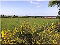
Countryside in Wolferton, Norfolk
by Richard Humphrey
geograph for square TF6528
|
|
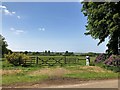
Gate to grassland in Wolferton, Norfolk
by Richard Humphrey
geograph for square TF6528
|
|
A view over the upper Douglas Burn from B993 (Nov 2017)
by Stanley Howe
geograph for square NJ6509
From near Mains of Shiels; towards the snow-capped Green Hill.
|
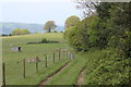
|
Grass track alongside paddock
by M J Roscoe
geograph for square ST1693
Grass track/public footpath, part of the Rhymney Valley Ridgeway Walk, fenced... (more)
|

|
Wooden fence and sheep pasture east of Warkton
by Richard Humphrey
geograph for square SP9080
|