Public Tags
Tag: Iron·Age·Earthworks
Showing latest 50 of 80 images tagged with Iron Age Earthworks tag.
|
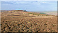
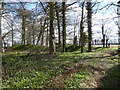
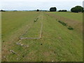
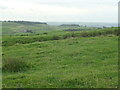
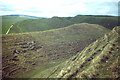
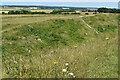
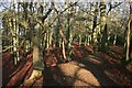
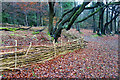
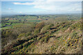
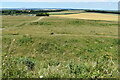
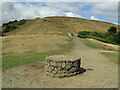
Potters Ridge/Highcliffe Nab
by Mick Garratt for square NZ6113 In search of an Iron Age encampment on Highcliffe Nab
I was intrigued by... (more)
Tags:
type:Cross GridX
EarthworksX
HeatherX
top:Historic Sites and ArtefactsX
subject:HistoricalX
Iron AgeX
period:Iron AgeX
Iron Age Earthworks
top:MoorlandX
MoorlandX
|
|
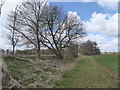
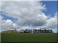
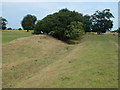
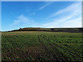
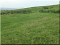
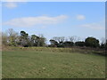
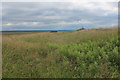
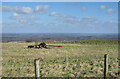
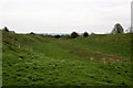
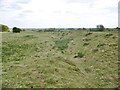
Earthworks, Ranbury Ring
by Vieve Forward geograph for square SP0900 Ranbury Ring consists of the earthwork remains of an Iron Age enclosed... (more)
|
|
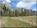
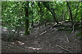
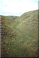
Earthworks, Ranbury Ring
by Vieve Forward geograph for square SP0800 Ranbury Ring consists of the earthwork remains of an Iron Age enclosed... (more)
|
|
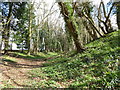
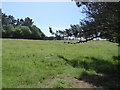
Earthworks, Ranbury Ring
by Vieve Forward geograph for square SP0800 Ranbury Ring consists of the earthwork remains of an Iron Age enclosed... (more)
|
|
Earthworks, Ranbury Ring
by Vieve Forward geograph for square SP0801 Ranbury Ring consists of the earthwork remains of an Iron Age enclosed... (more)
|
|
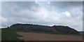
Ranbury Ring
by Vieve Forward geograph for square SP0900 Ranbury Ring (here seen at a distance) consists of the earthwork remains of an... (more)
|
|
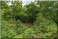
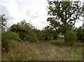
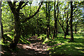
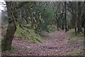
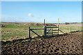
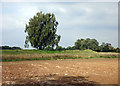
Iron Age earthwork in Mistleberry Wood
by David Martin geograph for square ST9919 Ditch and earthwork of an Iron Age defended settlement, marked on the OS map as... (more)
Tags:
top:Defence, MilitaryX
subject:EarthworkX
type:GeographX
top:Historic Sites and ArtefactsX
Iron Age Earthworks
top:Woodland, ForestX
|
|
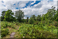
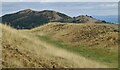
Lower Coxwell Camp hillfort, Onetree Hill
by Vieve Forward geograph for square SU2892 Iron Age hillfort. Link
|
|
Lower Coxwell Camp hillfort, Onetree Hill
by Vieve Forward for square SU2892 Iron Age hillfort. Link
|
|
Rosemarket Rath viewed from the Brunel Trail
by Simon Mortimer geograph for square SM9508 The earthworks are part of a defended enclosure or hill fort dating back to the... (more)
|
|
Iron Age Earth Works
by John P Reeves geograph for square ST1103 The impressive iron age earthworks of Hembury Hill Fort in Devon are becoming... (more)
|
|
Stonea Camp - Bushes on the eastern earthworks
by Richard Humphrey geograph for square TL4493 A large grass-covered site with just earthworks remaining, but a good series of... (more)
|
|
Stonea Camp - South western earthworks
by Richard Humphrey geograph for square TL4492 A large grass-covered site with just earthworks remaining, but a good series of... (more)
|
|
Stonea Camp - Eastern earthworks
by Richard Humphrey geograph for square TL4493 A large grass-covered site with just earthworks remaining, but a good series of... (more)
|
|
Stonea Camp - Central ditch and bank
by Richard Humphrey geograph for square TL4493 A large grass-covered site with just earthworks remaining, but a good series of... (more)
|
|
Stonea Camp - The lowest hill fort in the UK
by Richard Humphrey geograph for square TL4493 A large grass-covered site with just earthworks remaining, but a good series of... (more)
|
|
Stonea Camp - Northern embankment
by Richard Humphrey geograph for square TL4493 A large grass-covered site with just earthworks remaining, but a good series of... (more)
|
|
Liddington Castle
by Vieve Forward geograph for square SU2079 Iron Age hillfort.
Tags:
type:GeographX
subject:Hill FortX
Hill FortX
HillfortX
top:Historic Sites and ArtefactsX
period:Iron AgeX
Iron AgeX
Iron Age Earthworks
Iron Age FortX
Iron Age Hill FortX
Iron Age HillfortX
|
|
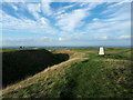
Trig point at Uffington Castle
by Vieve Forward geograph for square SU3086 Uffington Castle is an Iron Age hillfort. Just below it is the famous Uffington... (more)
|
|
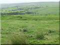
Round Dikes, Counter Hill, east side
by Christine Johnstone geograph for square SE0550 A large oval Iron Age enclosure, one of many prehistoric earthworks around this hill.
|
|
Round Dikes, Counter Hill, north-east side
by Christine Johnstone geograph for square SE0550 A large oval Iron Age enclosure, one of many prehistoric earthworks around this hill.
|
|
Round Dikes, Counter Hill, north-west side
by Christine Johnstone geograph for square SE0550 A large oval Iron Age enclosure, one of many prehistoric earthworks around this hill.
|
|
Iron Age bank and ditch
by Ian Capper geograph for square TQ4163 Iron Age earthworks on Keston Common.
Tags:
type:GeographX
top:Heath, ScrubX
top:Historic Sites and ArtefactsX
Iron Age Earthworks
place:KestonX
place:Keston CommonX
|
|
Iron Age bank and ditch
by Ian Capper geograph for square TQ4163 Path alongside Iron Age earthworks (on the left of the photo) on Keston Common
Tags:
type:GeographX
top:Heath, ScrubX
top:Historic Sites and ArtefactsX
Iron Age Earthworks
place:KestonX
place:Keston CommonX
|
|
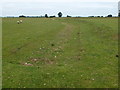
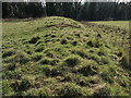
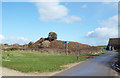
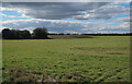
Enclosure on Decoy Road, Newborough
by Richard Humphrey geograph for square TF1907 This is an Iron Age earth works on Peakirk Fen
|
|
Maiden Castle
by Colin Smith geograph for square SY6688 Spectacular Iron Age hillfort near Dorchester, with huge ditch & rampart... (more)
|
|
To keep in or keep out?
by Neil Owen geograph for square ST5578 The Iron Age earthworks on Kingsweston Hill might be defensive or possibly a... (more)
Tags:
subject:EarthworkX
type:GeographX
top:Historic Sites and ArtefactsX
Iron Age Earthworks
top:Suburb, Urban FringeX
top:UplandsX
|
|
Ramparts on Kingsweston Hill
by Neil Owen geograph for square ST5578 Earthworks at the eastern end of the ridge are part of the area's long... (more)
Tags:
subject:EarthworkX
type:GeographX
top:Historic Sites and ArtefactsX
Iron Age Earthworks
top:Suburb, Urban FringeX
top:UplandsX
|
|
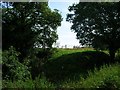
On the Iron Age earthworks at Badbury Rings
by David Martin geograph for square ST9603 Tags:
top:Defence, MilitaryX
subject:EarthworkX
type:GeographX
Hill FortX
top:Historic Sites and ArtefactsX
Iron Age Earthworks
National TrustX
|
|
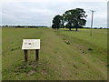
Earthwork by the Visitor Centre
by Des Blenkinsopp geograph for square SZ1691 The Double Dykes are a linear earthwork from the Iron Age which defended the... (more)
|
|
Along the ramparts
by Neil Owen geograph for square SP1721 Part of the large but now heavily overgrown Salmonsbury Iron Age site. These... (more)
Tags:
subject:EarthworkX
top:Historic Sites and ArtefactsX
Iron Age Earthworks
top:Village, Rural SettlementX
|
|
Hesketh Dike
by Chris Heaton geograph for square SE5187 Iron Age or possibly Bronze Age earthworks that stretch from the Hambleton Hills... (more)
|
|
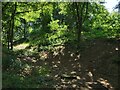
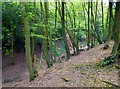
Earth Ramparts, Grimsbury Castle
by Des Blenkinsopp geograph for square SU5172 This Iron Age site is in the middle of woodland, but the sparse undergrowth... (more)
|
|
On top of Walbury Hill
by Des Blenkinsopp geograph for square SU3761 The top of the hill is fairly level with steep slopes north and south. It was... (more)
|
|
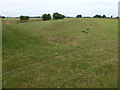
Dead Woman's Ditch
by Chris Heaton geograph for square ST1638 Probably an iron age earthwork and boundary marker.
The macabre name is said to... (more)
|
|
Herefordshire Beacon - Iron Age Ramparts
by Colin Smith geograph for square SO7639 Impressive earthen ditches and ramparts of the British Camp ring the hilltop of... (more)
Tags:
British CampX
Ditch RampartsX
type:GeographX
Herefordshire BeaconX
subject:Hill FortX
top:Historic Sites and ArtefactsX
Iron Age Earthworks
Malvern HillsX
top:UplandsX
|
|
Fence around the Fort
by Des Blenkinsopp geograph for square SP8304 The small Iron Age earthwork on Pulpit Hill is still fairly easy to trace... (more)
|
|
Dyke Hills earthwork
by Graham Hogg geograph for square SU5793 The remains of an Iron Age hill fort form the northern boundary of the site, the... (more)
|
|
Ditch at Maiden Castle
by Colin Smith geograph for square SY6688 Part of the huge Iron Age defensive earthworks in this famous hilltop fort.... (more)
|
|
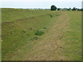
Dead Woman's Ditch
by Stephen McKay geograph for square ST1638 This shallow earthwork is believed to be an Iron Age territorial boundary. The... (more)
|
|
British Camp, Western Ramparts
by Des Blenkinsopp geograph for square SO7539 The southern part of the large Iron Age hill fort around the Herefordshire... (more)
|
|
Woodcutts Common, ditch
by Mike Faherty geograph for square ST9618 Ditch and embankment, part of an extensive Iron Age and Romano-British... (more)
Tags:
Archaeological SiteX
subject:DitchX
type:GeographX
top:GrasslandX
top:Historic Sites and ArtefactsX
Iron Age Earthworks
Iron Age SettlementX
top:LowlandsX
Romano-BritishX
|
|
Sidbury Castle Iron Age Fort
by David Smith for square SY1291 |
|
Alfred's Castle - defended by mud
by Des Blenkinsopp geograph for square SU2782 King Alfred is still a bit of a local hero round here having defeated a Danish... (more)
|
|
Rampart at Cherbury
by Des Blenkinsopp geograph for square SU3796 The earth ramparts of this Iron Age monument are well preserved and easily... (more)
|
|
The Devil's Dyke
by Des Blenkinsopp geograph for square TL1813 The best preserved section of the fortifications surrounding the site of a large... (more)
|
|
Belsar's Hill
by Hugh Venables geograph for square TL4270 Believed to be Iron Age in origin, situated on very slightly higher ground than... (more)
|
|
Belsar's Hill
by Hugh Venables geograph for square TL4270 Believed to be Iron Age in origin, situated on very slightly higher ground than... (more)
|
|
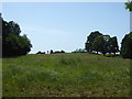
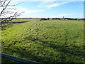
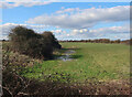
View over the earthworks at Badbury Rings
by David Martin geograph for square ST9603 The National Trust car park is just visible to the left of the small copse.
Tags:
top:Defence, MilitaryX
subject:EarthworkX
top:Farm, Fishery, Market GardeningX
FarmlandX
type:GeographX
top:Historic Sites and ArtefactsX
Iron Age Earthworks
National TrustX
|
|
Malverns - Millennium Hill
by Colin Smith geograph for square SO7639 Iron Age earthen ditches and ramparts at the southern end of the British Camp... (more)
Tags:
CairnX
Ditch RampartsX
type:GeographX
subject:HillX
top:Historic Sites and ArtefactsX
Iron Age Earthworks
Malvern HillsX
Millennium HillX
top:PathsX
top:UplandsX
|