|
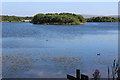
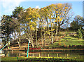
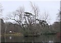
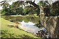
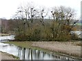
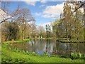
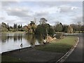
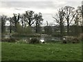
Island, Bryn Bach Park, Tredegar
by M J Roscoe
geograph for square SO1210
The westernmost island in the 36 acre man-made lake in the 340 acres of the... (more)
|
|
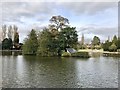
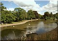
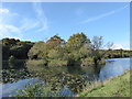
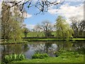
Lake island in Queen's Park, Longton
by Jonathan Hutchins
geograph for square SJ9042
|
|
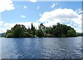
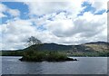
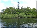
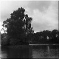
Derwent Isle
by Gerald England
geograph for square NY2622
The only inhabited island in Derwentwater. It is owned and managed by the... (more)
|
|
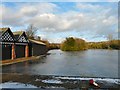
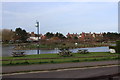
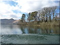
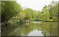
Stamford Park Boating Lake
by Gerald England
geograph for square SJ9599
Looking past the boathouses towards the island in the middle of the frozen lake.
|
|
The Island, Peasholm Lake
by Pauline E
geograph for square TA0389
Peasholm Park replaced an area of swamp, allotments and piggeries, known locally... (more)
|
|
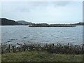
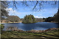
Island, Llynnau Cregennen
by M J Roscoe
for square SH6614
Small wooded island in the northern lake (llyn) of the two lakes.
|
|
Island in Queens Park boating lake
by M J Roscoe
geograph for square TF5184
The island is reserved for the birds, Canada geese that morning. Boats (none... (more)
|
|
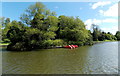
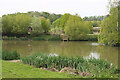
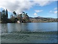
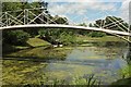
Island in the lake, Warminster
by Jaggery
geograph for square ST8744
The larger of two islands in the lake in Lake Pleasure Grounds.
|
|
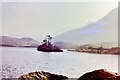
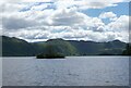
Otterbield Island
by Gerald England
geograph for square NY2521
On Derwentwater.
|
|
On Derwentwater
by Gerald England
geograph for square NY2521
Approaching Otterbield Island.
|
|
Lake, Eastville Park
by Derek Harper
geograph for square ST6175
"The lake is said to be one of the best public park lakes in the country... (more)
|
|
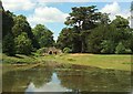
Grotto, Croome Park
by Derek Harper
for square SO8744
|
|
Island of trees, Gosford lake
by Jim Barton
geograph for square NT4578
A small island bursting with trees in the ornamental lake at Gosford Estate. To... (more)
|
|
Wooded island in Bath Pool
by Jonathan Hutchins
geograph for square SJ8352
|
|
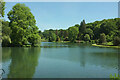
Garden Lake, Stourhead
by Derek Harper
geograph for square ST7733
From near The Pantheon, with a wooded island on the left, and the Stone Bridge... (more)
|
|
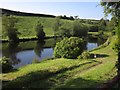
Lake, Priory Farm
by Derek Harper
geograph for square TQ3049
Looking towards its northwest shore with the island on the right.
|
|
St Herbert's Island
by Gerald England
geograph for square NY2521
|
|
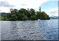
Looking past Derwent Isle
by Gerald England
geograph for square NY2622
The island on the right is St Herbert's Isle.
|
|
Trees on the eastern shore of Derwent Isle
by Christine Johnstone
geograph for square NY2622
Seen from a ferry heading clockwise round Derwentwater.
|
|
Boat houses on the north shore of Derwent Isle
by Christine Johnstone
geograph for square NY2622
Seen from a ferry travelling clockwise round Derwentwater from Keswick.
|
|
Lake at Croome
by Derek Harper
geograph for square SO8744
The artificial Croome River widens into a lake at its northwest corner. This... (more)
|
|
Rouken Glen
by Gerald England
geograph for square NS5557
An island in the lake.
|
|
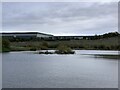
Skelton Lake Circuit 7
by Humphrey Bolton
geograph for square SE3530
There are only two places on the circuit where there is a good view of the lake.... (more)
|
|
Footbridge and lake, Croome Park
by Derek Harper
geograph for square SO8744
The eastern of the two iron bridges, dating from the 1790s, connecting to the... (more)
|
|
Low water in YSP's Lower Lake
by Christine Johnstone
geograph for square SE2812
Never seen the Heronry less of an island. The boundary between Wakefield, West... (more)
|
|
Lake, Priory Farm
by Derek Harper
geograph for square TQ3049
On the northwest shore, with a landing stage.
|
|
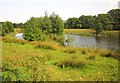
Island on lake near Loomer Road
by Jonathan Hutchins
geograph for square SJ8247
|
|
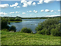
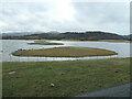
Islands in Astley Lake, RSPB St Aidan's
by Christine Johnstone
geograph for square SE3828
Full of black headed gulls.
|
|
Lake by Common Water Lane
by Derek Harper
geograph for square ST4402
The Monarch's Way used to come this way, following footpath W23/2, and it... (more)
|
|
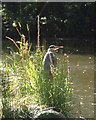
Heron in Eastville Park
by Derek Harper
for square ST6175
On a recently-created island at the east end of the lake.
|
|
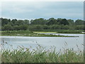
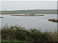
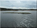
Small island, Main lake, RSPB St Aidan's
by Christine Johnstone
geograph for square SE3927
Seen from the southern lakeshore.
|
|
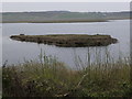
Large island, Main lake, RSPB St Aidan's
by Christine Johnstone
geograph for square SE3927
Home to hundreds, maybe thousands, of black-headed gulls.
|
|
Lake in Queen's Park, Longton
by Jonathan Hutchins
geograph for square SJ9042
|
|
Island in the eastern lagoon, RSPB Conwy
by Christine Johnstone
geograph for square SH8076
Seen from the Vardre viewpoint.
|
|
Island in the eastern lagoon, RSPB Conwy
by Christine Johnstone
geograph for square SH8077
Seen from the Carneddau hide.
|
|
Island in the western lagoon, RSPB Conwy
by Christine Johnstone
geograph for square SH7977
Seen from a viewing screen at the end of a boardwalk.
|
|
Mute Swans on a pool at Longleat
by Jonathan Hutchins
geograph for square ST8043
Longleat Park is Grade I listed, see... (more)
|
|
Lake by Common Water Lane
by Derek Harper
geograph for square ST4402
|
|
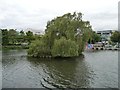
Island in Brayford Pool
by Christine Johnstone
geograph for square SK9771
With its new-ish willow tree. Seen from the Brayford Belle trip boat.
|
|
Artificial lake, Parkhill Estate
by Bill Harrison
geograph for square NJ8914
As pointed out by David Robinson ( Link )... ( more) |
|
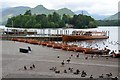
Landing stages on Derwentwater shore, Keswick
by Jim Barton
geograph for square NY2622
Boats for hire and trips on the lake. Derwent Isle is ahead, beyond is the ridge... (more)
|
|
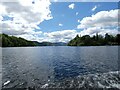
Derwent Water
by Gerald England
geograph for square NY2622
Looking down the length of the lake with Derwent Isle on the right.
|
|
Lake near Landkey
by Derek Harper
geograph for square SS5830
|
|
Drakelands Trout Lake
by Derek Harper
geograph for square SX5758
On the Smallacombe brook just below Drakeland Corner, and seen from Galva Road.
|
|
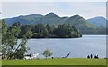
Derwentwater from Crow Park, Keswick
by Jim Barton
geograph for square NY2622
The classic view to Catbells and Derwent Isle.
|