Public Tags
Tag: Lane·and·Track·Junction
Showing images tagged with Lane and Track Junction tag.
|
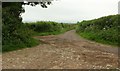
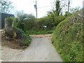
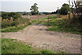
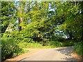
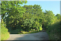
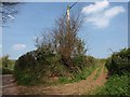
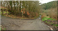
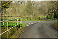
Track junction, Wood Lane
by Derek Harper geograph for square ST5126 Wood Lane (foreground), carrying bridleway 40UD062 L 18/11, becomes Quarry Road... (more)
Tags:
type:GeographX
Lane and Track Junction
top:LowlandsX
No Through RoadX
top:PathsX
top:Roads, Road TransportX
Roadside HedgesX
TracksX
TreeX
|
|
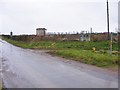
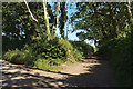
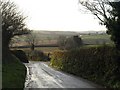
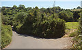
Fenn Gate Junction
by Gordon Griffiths geograph for square SO7394 The view of the junction with the Woodside Farm track on the lane near Bridgnorth.
Tags:
place:BridgnorthX
LaneX
Lane and Track Junction
subject:Lane JunctionX
top:Roads, Road TransportX
ShropshireX
|
|
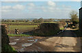
Track and lane junction north of Burlestone
by Derek Harper geograph for square SX8248 Close to the gateway where SX8248 : Maize near Burlestone and SX8248 : Towards Blackawton were taken. The green... (more)
|
|
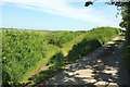
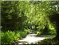
Track and lane, Pound Rock
by Derek Harper geograph for square SX7384 Part of the junction at SX7384 : Pound Rock, North Bovey. The lane from Moretonhampstead drops into... (more)
|
|
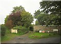
Lane's end
by Anthony Vosper geograph for square ST1200 Cabbage Lane joins an unmetalled trackway in the village of Buckerell.
|
|
Lane Junction
by Gordon Griffiths geograph for square SO8483 The view of the lane junction on The Compa above Kinver Village.
Tags:
place:KinverX
LaneX
Lane and Track Junction
subject:Lane JunctionX
place:StaffordshireX
top:Village, Rural SettlementX
|
|
End of the lane
by Jonathan Kington geograph for square SJ9457 The short lane ends here behind the church and turns into a track. There is also... (more)
|
|
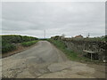
Junction of track to Ingber House with track into field
by Roger Templeman geograph for square SD9053 Tags:
top:Farm, Fishery, Market GardeningX
Field Access TrackX
type:GeographX
Lane and Track Junction
top:PathsX
top:Roads, Road TransportX
|
|
Keep Out! Track junction on Crabhill Lane
by Roger Templeman geograph for square SU4189 |
|
Jackman's Lane
by Derek Harper geograph for square SX7859 A real green lane / route with public access turning off "Green Lane"... (more)
|
|
Track towards Stonepit Hills, by Stonehouse Farm
by Christopher Hilton geograph for square SP5119 Tags:
Gas Pipeline MarkerX
LaneX
Lane and Track Junction
top:PathsX
top:Roads, Road TransportX
subject:TrackX
TrackX
|
|
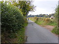
Junction of Sunny Bank Road and Bank Lane
by Steve Fareham geograph for square SK2896 Bank Lane turns into a byway.
|
|
Yard Hill
by Derek Harper geograph for square SX7383 The track / lane junction (with a shady bench) from which SX7383 : Woodland path near North Bovey was taken,... (more)
|
|
Hollycombe Green
by Derek Harper geograph for square SX8065 Category: Lane junction The point where Hollycombe Lane (a green lane) crosses the lane from... (more)
|
|
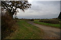
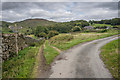
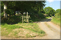
Greengate Lane junction
by Martin Dawes geograph for square SE8283 Access to farms and fields
|
|
Track and lane near Allaleigh
by Derek Harper geograph for square SX8153 A route with public access veers away from Allaleigh Lane east of the hamlet,... (more)
|
|
Footpath Junction
by Gordon Griffiths geograph for square SO7597 The view from the path down the lane near Cranmere Farm, Shropshire.
|
|
Lane to Luscombe #9
by Derek Harper geograph for square SX7957 With the turning into the track shown in SX7957 : Track to New Barn and SX7957 : Track to New Barn on the right.
Tags:
type:GeographX
Grass FieldX
HedgebanksX
Lane and Track Junction
top:LowlandsX
top:Roads, Road TransportX
Roadside TreesX
gate:SteelX
|
|
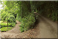
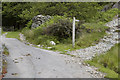
Path and Lane Junction near Hawes
by Tom Richardson geograph for square SD2590 Tags:
top:Farm, Fishery, Market GardeningX
FingerpostX
top:GrasslandX
Lane and Track Junction
top:Roads, Road TransportX
top:UplandsX
|
|
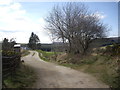
Track Junction at Birks
by Tom Richardson geograph for square SD2092 |
|
Geopark Way leaves Birchwood Lane
by Derek Harper geograph for square SO7550 Larger sizes of this may reveal the pencil of light coming through the... (more)
Tags:
type:GeographX
long distance path:Geopark WayX
Lane and Track Junction
top:LowlandsX
top:PathsX
top:Roads, Road TransportX
Roadside HedgesX
Roadside TreesX
WoodX
top:Woodland, ForestX
|
|
Catstree Footpath
by Gordon Griffiths geograph for square SO7496 The view along the path near Catstree Farm, Shropshire.
Tags:
FootpathX
type:GeographX
LaneX
Lane and Track Junction
subject:Path JunctionX
top:PathsX
ShropshireX
|
|
Lane junction at Milton of Lesmore
by Stanley Howe for square NJ4628 Access to Brae of Scurdargue, et al, up left.
|
|
Lane past Rexton
by Derek Harper geograph for square SX3989 The beech trees on the right appear in SX4089 : Farm road, Rexton; at this point... (more)
|
|
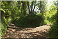
Green lane near Pennymoor
by Derek Harper geograph for square SS8610 A green lane shown as a route with public access, leaving the road south of... (more)
|
|
Long Road
by Derek Harper geograph for square SX8658 Passing Whitehill Lane on the right as it drops to the Yalberton Stream.
|
|
Lane Scene
by Gordon Griffiths geograph for square SO8381 The view of a cyclist on his way to Blakeshall.
Tags:
CyclistX
subject:LaneX
Lane and Track Junction
top:Roads, Road TransportX
county:WorcestershireX
|
|
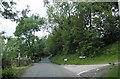
Lane divide at Backhill corner
by Stanley Howe geograph for square NJ6607 |
|
Track and lane junction
by Derek Harper geograph for square SS8920 The lane up the Iron Mill Stream valley passes a public access route up Coleford... (more)
Tags:
type:GeographX
Lane and Track Junction
top:LowlandsX
top:PathsX
top:Roads, Road TransportX
Roadside HedgesX
gate:TimberX
fence:TimberX
top:Woodland, ForestX
WoodsX
|
|
Stratford Lane
by Derek Harper geograph for square ST5557 Following the line of a Roman road, and followed by the parish boundary between... (more)
|
|
Hudley Mill Hill
by Derek Harper geograph for square SS6832 Near Walland, on a steady descent to the mill which becomes steeper soon.
Tags:
type:GeographX
LaneX
Lane and Track Junction
top:LowlandsX
top:Roads, Road TransportX
WoodlandX
top:Woodland, ForestX
|
|
Manna Park
by Derek Harper geograph for square SS4309 At some stage the name has changed from Manorpark, which is what appears on the... (more)
|
|
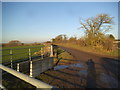
Junction near Spurway Mill
by Derek Harper geograph for square SS8920 The lane from Bellbrook crosses the Iron Mill Stream and turns past a public... (more)
Tags:
stream:Combe WaterX
top:Farm, Fishery, Market GardeningX
type:GeographX
Lane and Track Junction
top:LowlandsX
Pedestrian HandrailX
top:Rivers, Streams, DrainageX
bridge:Road Over StreamX
top:Roads, Road TransportX
Roadside HedgeX
Streamside TreesX
gate:TimberX
top:Woodland, ForestX
WoodsX
|