Public Tags
Other tags: Deeside Way
long distance path:Deeside Way
Showing latest 50 of 53 images tagged with ldp:Deeside Way tag.
|
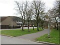
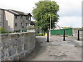
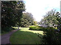
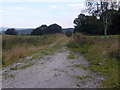
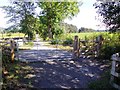
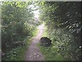
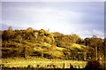
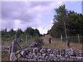
Deeside Way, Ballater
by Malc McDonald geograph for square NO3796 Deeside Way leaving the town of Ballater in Royal Deeside. Ballater lies within... (more)
Tags:
place:BallaterX
place:Cairngorms National ParkX
Cairngorms National ParkX
Cycling and Walking TrailX
ldp:Deeside Way
Deeside Way
long distance path:Deeside Way
type:GeographX
National Cycle NetworkX
National Cycle RouteX
NCNX
PathX
subject:PathX
Path on Dismantled RailwayX
Path on Disused RailwayX
top:PathsX
national cycle network:Route 195X
place:Royal DeesideX
country:ScotlandX
Shared PathX
Shared Use PathX
top:Suburb, Urban FringeX
|
|
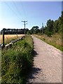
Footpath by A93 at Milton of Crathes
by Stanley Howe geograph for square NO7496 Now part of the Deeside Way (ldp).
Tags:
postcode area:AB31X
ldp:Deeside Way
Former Railway TrackbedX
type:GeographX
LamppostX
place:Milton of CrathesX
subject:PathX
top:PathsX
|
|
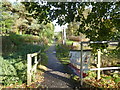
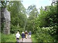
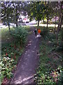
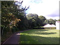
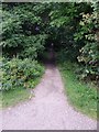
Deeside Way, Glebe Park
by Colin Smith geograph for square NO7095 Four ways come together beneath an old railway bridge on the eastern side of... (more)
|
|
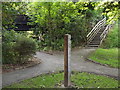
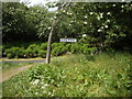
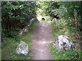
Crossroads on Deeside Way
by Stanley Howe geograph for square NJ5700 Where a new section of the Deeside Way crosses a track from Dess House (off... (more)
|
|
Path over the Deeside Way
by M J Richardson geograph for square NJ9203 A footbridge and path connecting Auchinyell Road and Broomhill Road, passing... (more)
|
|
The Deeside Way, Peterculter
by Stanley Howe geograph for square NJ8400 Passing between the abutments which are all that remain of the road bridge which... (more)
|
|
Deeside Way, Peterculter
by Stanley Howe geograph for square NJ8400 With the remains of Culter Station platform alongside, reminding us that... (more)
|
|
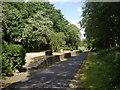
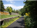
Deeside Way, Banchory
by Colin Smith geograph for square NO7095 Heading eastwards, away from Banchory, towards Crathes. This follows the... (more)
|
|
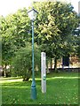
Aberdeen - Deeside Way
by Colin Smith for square NJ9204 Waymarker on the long distance path Aberdeen - Ballater following the old... (more)
Tags:
place:AberdeenX
type:Close LookX
ldp:Deeside Way
subject:PathX
top:PathsX
top:Sport, LeisureX
WaymarkerX
|
|
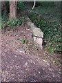
Railway memorabilia?
by Stanley Howe for square NO7095 This modest piece of ironmongery sits beside a low stone wall, where the wall... (more)
|
|
Former Deeside Railway route
by Stanley Howe geograph for square NO7095 Upline to Aberdeen, and now part of The Deeside Way (which however bears right... (more)
|
|
Former Deeside Railway track bed
by Stanley Howe geograph for square NO7095 Downline towards Aboyne; from a road bridge over the line near Glebe Park. Now... (more)
|
|
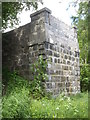
A road bridge abutment by the Old Deeside Railway track
by Stanley Howe geograph for square NJ8400 The rail track is now the Deeside Way path.
Tags:
ldp:Deeside Way
Old Bridge AbutmentsX
top:PathsX
place:PeterculterX
top:RailwaysX
Road Bridge Over a RailwayX
|
|
An extant relic of the former Deeside Railway
by Stanley Howe geograph for square NJ8400 A station platform name sign still in place by the Deeside Way path, which now... (more)
Tags:
ldp:Deeside Way
Former RailtrackX
top:PathsX
place:PeterculterX
top:RailwaysX
Station Platform Name SignX
|
|
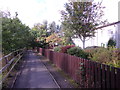
Deeside Way
by Colin Smith geograph for square NJ9304 Long distance walkway following the route of the old Deeside Railway. Seen here... (more)
|
|
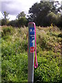
Deeside Way below Morrisons in Banchory
by Stanley Howe for square NO7095 Route 195 sign, with psychadelic dog lead. Looks like the dog went one way, and... (more)
Tags:
postcode area:AB31X
place:BanchoryX
ldp:Deeside Way
Long Distance Path SignX
subject:Path JunctionX
top:PathsX
|
|
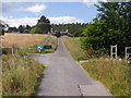
Deeside Way in east Banchory
by Stanley Howe geograph for square NO7095 |
|
Deeside Way leaving Glebe Park
by Stanley Howe geograph for square NO7095 Towards the Dee Bridge in Banchory.
|
|
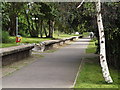
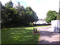
Deeside Way through Glebe Park, Banchory
by Stanley Howe geograph for square NO7095 Tags:
postcode area:AB31X
place:BanchoryX
Bench SeatX
ldp:Deeside Way
top:Park and Public GardensX
subject:PathX
|
|
Deeside Way, Banchory
by Stanley Howe geograph for square NO7095 Passing between St Ternan's cemetery (off right) and the River Dee (off left).
|
|
A riverside hut by the Dee
by Stanley Howe geograph for square NO7095 By the Deeside Way through Banchory
|
|
Access path to Morrison's supermarket
by Stanley Howe geograph for square NO7095 From the Deeside Way.
|
|
A gated track towards Townhead
by Stanley Howe geograph for square NJ5700 North from a new section of the Deeside Way.
Tags:
postcode area:AB34X
ldp:Deeside Way
place:Kincardine O NeilX
top:Roads, Road TransportX
subject:TrackX
Woodland TrackX
|
|
A small stone building by Deeside Way
by Stanley Howe geograph for square NJ5700 Purpose unidentified; a boathouse perhaps. Help please?
Tags:
postcode area:AB34X
subject:BuildingX
ldp:Deeside Way
top:Farm, Fishery, Market GardeningX
place:Kincardine O NeilX
Ruined Stone BuildingX
|
|
Track from the Deeside Way
by Stanley Howe geograph for square NJ5700 South to Dess House.
Tags:
postcode area:AB34X
ldp:Deeside Way
place:Kincardine O NeilX
top:Roads, Road TransportX
subject:TrackX
TrackX
|
|
The Deeside Way - east from the Westerton road
by Stanley Howe geograph for square NJ5700 Leading to Kincardine O'Neil village.
|
|
The Deeside Way - west from the Westerton road
by Stanley Howe geograph for square NJ5700 |
|
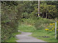
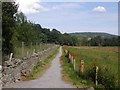
Deeside Way
by Stanley Howe geograph for square NJ5700 Turning towards Westerton.
|
|
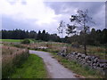
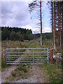
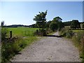
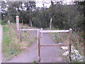
Farm and pedestrian gates on the Deeside Way
by Stanley Howe geograph for square NJ5800 Looking towards Kincardine O'Neil.
|
|
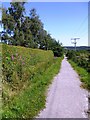
Deeside Way Heading WNW
by Stanley Howe geograph for square NJ5800 |
|
Deeside Way towards Westerton
by Stanley Howe geograph for square NJ5800 From Kincardine O'Neil.
|
|
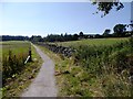
Deeside Way towards Kincardine O'Neil
by Stanley Howe geograph for square NJ5800 A newly resurfaced section of this long-distance path.
Tags:
postcode area:AB34X
ldp:Deeside Way
place:Kincardine O NeilX
subject:PathX
top:Village, Rural SettlementX
|
|
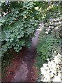
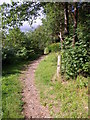
The Deeside Way long distance footpath
by Stanley Howe geograph for square NO7496 Heading west from the Burn of Coy.
|
|
Stone footbridge over the Burn of Coy
by Stanley Howe geograph for square NO7496 Along the Deeside Way.
|
|
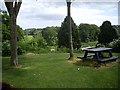
A picnic spot by the Deeside Way
by Stanley Howe geograph for square NJ8400 Overlooking Peter's Pot at Peterculter.
|
|
Deeside Way, Peterculter
by Stanley Howe geograph for square NJ8400 By the eastern end of the old Culter Station platform.
Tags:
ldp:Deeside Way
top:PathsX
place:PeterculterX
Railway Station Platform (Disused)X
top:RailwaysX
|
|
Monaltrie Monument (1987)
by Stanley Howe geograph for square NO3997 Seen from the Deeside Way. Erected 1837.
|
|
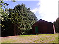
Milton Art and Craft Centre
by Stanley Howe for square NO7496 A Crathes Castle estate lamplight, and Deeside Way signpost.
Tags:
postcode area:AB31X
Arts and Crafts CentreX
type:Close LookX
top:Country EstatesX
ldp:Deeside Way
LamppostX
subject:LamppostX
place:Milton of CrathesX
top:PathsX
|
|
Deeside Way approaching Glebe Park
by Stanley Howe geograph for square NO7095 East Banchory.
|
|
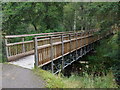
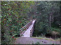
A new wood and steel bridge over the Dess Burn
by Stanley Howe geograph for square NJ5600 Facilitating the Deeside Way crossing the burn downstream of the Sloc waterfall.
Tags:
postcode area:AB34X
subject:BridgeX
Bridge Over a BurnX
ldp:Deeside Way
place:DessX
top:PathsX
top:Rivers, Streams, DrainageX
|
|
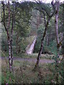
A fruiting rowan guards access to the Dess Burn bridge
by Stanley Howe geograph for square NJ5600 A new section of the Deeside Way in 2014.
Tags:
postcode area:AB34X
Bridge Over a BurnX
ldp:Deeside Way
place:DessX
subject:PathX
top:PathsX
top:Rivers, Streams, DrainageX
Rowan BerriesX
|
|
A Deeside Way bridge over the Dess Burn
by Stanley Howe geograph for square NJ5600 A new constructure over Dess Burn below the Sloc waterfall. Not yet mapped by... (more)
Tags:
postcode area:AB34X
subject:BridgeX
Bridge Over a BurnX
ldp:Deeside Way
place:DessX
top:PathsX
top:Rivers, Streams, DrainageX
|
|
A Deeside Way access
by Stanley Howe geograph for square NJ5600 From a minor road at Dess.
Tags:
postcode area:AB34X
Access PointX
ldp:Deeside Way
place:DessX
Minor RoadX
subject:PathX
top:PathsX
top:Roads, Road TransportX
|
|
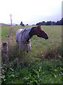
Horses in the upper paddock, Dess Home Farm
by Stanley Howe geograph for square NJ5700 The one in the foreground anxious to make friends with passers-by on the Deeside Way.
Tags:
postcode area:AB34X
ldp:Deeside Way
top:Farm, Fishery, Market GardeningX
Horses in FieldX
place:Kincardine O NeilX
subject:PaddockX
PaddockX
top:PathsX
|
|
Firebreak through trees near Westerton
by Stanley Howe geograph for square NJ5700 North from the Deeside Way.
Tags:
postcode area:AB34X
ldp:Deeside Way
Fire BreakX
place:Kincardine O NeilX
top:PathsX
WoodlandX
top:Woodland, ForestX
|
|
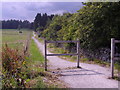
New crossroads
by Stanley Howe geograph for square NJ5700 Where the recent addition to the Deeside Way crosses the minor road to Westerton.
Tags:
postcode area:AB34X
subject:CrossroadX
ldp:Deeside Way
FarmX
Farm Access RoadX
top:Farm, Fishery, Market GardeningX
place:Kincardine O NeilX
top:PathsX
top:Roads, Road TransportX
|
|
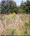
Summer flora alongside the Deeside Way
by Stanley Howe geograph for square NJ5800 WNW of Kincerdine O'Neil.
Tags:
postcode area:AB34X
ldp:Deeside Way
subject:FloraX
place:Kincardine O NeilX
top:PathsX
top:Wild Animals, Plants and MushroomsX
Wild FlowersX
|
|
Field boundary north of Deeside Way
by Stanley Howe geograph for square NJ5800 Up towards Hill of Dess.
Tags:
postcode area:AB34X
subject:BoundaryX
ldp:Deeside Way
Field BoundaryX
top:GrasslandX
place:Kincardine O NeilX
TreeX
|
|
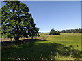
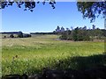
A view north from the Deeside Way
by Stanley Howe geograph for square NJ5800 Across fields towards Hill of Dess farm.
Tags:
postcode area:AB34X
ldp:Deeside Way
top:Farm, Fishery, Market GardeningX
FarmlandX
subject:FarmlandX
place:Kincardine O NeilX
ViewX
|
|
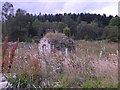
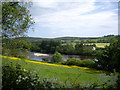
Shingle bank in the River Dee
by Stanley Howe geograph for square NJ8400 Seen from close to a former bridge over the Old Deeside Railway at Pittengullies Circle.
Tags:
river:Dee(Aberdeenshire)X
ldp:Deeside Way
top:PathsX
place:PeterculterX
top:Rivers, Streams, DrainageX
Shingle BankX
|