Public Tags
Other tags: Monarchs Way
long distance path:Monarchs Way
Showing latest 50 of 359 images tagged with ldp:Monarchs Way tag.
|
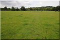
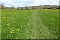
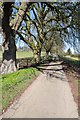
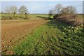
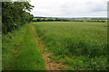
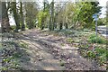
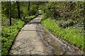
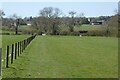
Long distance footpaths and farmland
by Philip Halling geograph for square SP1723 Four Long Distance Footpaths: The Gloucestershire Way, The Heart of England Way,... (more)
Tags:
top:Farm, Fishery, Market GardeningX
FarmlandX
FootpathX
ldp:Gloucestershire WayX
ldp:Heart of England WayX
ldp:Macmillan WayX
ldp:Monarchs Way
top:PathsX
|
|
Bridge over the River Dikler
by Philip Halling geograph for square SP1724 This farm bridge over the River Dikler, a tributary of the River Windrush and... (more)
Tags:
BridgeX
river:DiklerX
ldp:Gloucestershire WayX
ldp:Heart of England WayX
ldp:Macmillan WayX
ldp:Monarchs Way
top:PathsX
RiverX
top:Rivers, Streams, DrainageX
|
|
The Monarch's Way and Shakespeare's Avon Way
by Philip Halling geograph for square SP1852 The Monarch's Way following the Greenway, the trackbed of the former... (more)
|
|
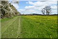
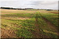
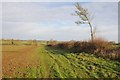
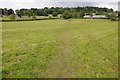
Farmland near Lower Slaughter
by Philip Halling geograph for square SP1623 A footpath between Lower Slaughter and Stow-on-the-Wold. The footpath is... (more)
Tags:
top:Farm, Fishery, Market GardeningX
subject:FarmlandX
FarmlandX
FieldX
type:GeographX
ldp:Gloucestershire WayX
ldp:Macmillan WayX
ldp:Monarchs Way
top:PathsX
|
|
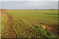
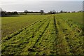
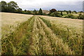
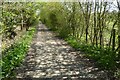
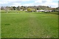
Footpath near Lower Swell
by Philip Halling geograph for square SP1724 Three long distance footpaths follow this route across this field near Lower... (more)
Tags:
top:Farm, Fishery, Market GardeningX
FarmlandX
subject:FieldX
FieldX
FootpathX
type:GeographX
ldp:Gloucestershire WayX
ldp:Macmillan WayX
ldp:Monarchs Way
top:PathsX
|
|
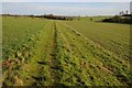
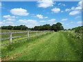
The Macmillan Way and Monarch's Way
by Philip Halling geograph for square SP0310 Two long distance paths follow the track and path across this field, the paths... (more)
|
|
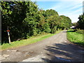
The Monarch's Way
by Philip Halling geograph for square ST9193 The Monarch's Way between Long Newnton and Ashley, this footpath is also... (more)
Tags:
top:Farm, Fishery, Market GardeningX
FarmlandX
ldp:Monarchs Way
ldp:Palladian WayX
subject:PathX
top:PathsX
|
|
The Monarch's Way near Nunnery Farm
by Philip Halling geograph for square SO8764 The Monarch's Way and Wychavon Way near Nunnery Farm.
|
|
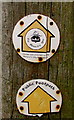
Monarch's Way public footpath sign, Bromsgrove
by Jaggery for square SO9669 Located on a post here, Link the sign... (more)
Tags:
type:Close LookX
long distance path:Monarchs Way
ldp:Monarchs Way
top:PathsX
sign:Public FootpathX
|
|
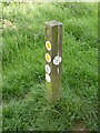
Monarch Way sign, Waseley Hills
by Jeff Gogarty for square SO9777 It also shows that it is on the North Worcestershire Way.
|
|
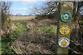
Footpath sign, Long Marston
by Philip Halling geograph for square SP1648 Markers for both the Monarch's Way and The Heart of England Way on a post... (more)
|
|
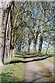
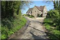
Drive to Mickleton Hills Farm
by Philip Halling geograph for square SP1640 Tree-lined drive to Mickleton Hills Farm, two long distance paths follow this... (more)
|
|
Tree-lined drive, Mickleton Hills Farm
by Philip Halling geograph for square SP1640 Tree-lined drive to Mickleton Hills Farm, two long distance paths follow this... (more)
|
|
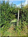
Kissing Gate
by Philip Halling geograph for square SP1748 Kissing Gate on the route of two long distance footpaths, The Monarch's Way... (more)
|
|
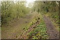
Footpath at Long Marston
by Philip Halling geograph for square SP1648 This footpath passes to the south of the former RAF Long Marston airfield, it is... (more)
Tags:
top:Farm, Fishery, Market GardeningX
FarmlandX
FootpathX
ldp:Heart of England WayX
ldp:Monarchs Way
subject:PathX
top:PathsX
|
|
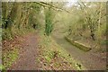
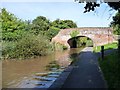
The Thames and Severn Canal
by Philip Halling geograph for square SO9600 The Thames and Severn Canal near Tarlton Bridge. The towpath is also the route... (more)
|
|
The Thames and Severn Canal
by Philip Halling geograph for square SO9600 The Thames and Severn Canal near Tarlton Bridge. The towpath is also the route... (more)
|
|
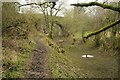
Railway bridge crossing Thames and Severn Canal
by Philip Halling geograph for square SO9700 The towpath beside the disused Thames and Severn Canal approaching the railway... (more)
|
|
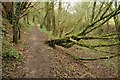
The disused Thames and Severn Canal
by Philip Halling geograph for square SO9700 The towpath beside the disused Thames and Severn Canal near Thames Head and the... (more)
|
|
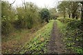
Towpath, Thames and Severn Canal
by Philip Halling geograph for square SO9700 The towpath beside the disused Thames and Severn Canal near Thames Head and the... (more)
|
|
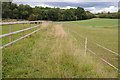
Footpath to Ashley
by Philip Halling geograph for square ST9293 This footpath between Long Newnton and Ashley is followed by two long distance... (more)
Tags:
top:Farm, Fishery, Market GardeningX
FarmlandX
subject:FarmlandX
FootpathX
ldp:Monarchs Way
ldp:Palladian WayX
top:PathsX
|
|
Headland footpath
by Philip Halling geograph for square ST9193 This headland footpath is also followed by two long distance paths, the... (more)
Tags:
top:Farm, Fishery, Market GardeningX
subject:FarmlandX
FarmlandX
FootpathX
ldp:Monarchs Way
ldp:Palladian WayX
top:PathsX
|
|
Footpath to Long Newnton
by Philip Halling geograph for square ST9294 This footpath between Long Newnton and Ashley is followed by two long distance... (more)
Tags:
top:Farm, Fishery, Market GardeningX
subject:FarmlandX
FarmlandX
FootpathX
ldp:Monarchs Way
ldp:Palladian WayX
top:PathsX
|
|
Footpath to Ashley
by Philip Halling geograph for square ST9294 This footpath between Long Newnton and Ashley is followed by two long distance... (more)
Tags:
top:Farm, Fishery, Market GardeningX
FarmlandX
FootpathX
ldp:Monarchs Way
ldp:Palladian WayX
subject:PathX
|
|
Headland and field of wheat
by Philip Halling geograph for square SP1417 This field headland is the route of two long distance footpaths, the... (more)
Tags:
Arable LandX
ldp:Diamond WayX
top:Farm, Fishery, Market GardeningX
ldp:Monarchs Way
top:PathsX
|
|
Footpath approaching Hill Barn
by Philip Halling geograph for square SP1517 Both the Diamond Way and the Monarch's Way follow this footpath crossing... (more)
Tags:
Arable LandX
Barley FieldX
ldp:Diamond WayX
top:Farm, Fishery, Market GardeningX
ldp:Monarchs Way
top:PathsX
|
|
Guidance for cyclists east of bridge 5
by Christine Johnstone geograph for square SO8660 The stickers on the back of the road sign tell cyclists using route 46 to turn... (more)
Tags:
FarmlandX
Minor RoadX
long distance path:Monarchs Way
Monarchs WayX
ldp:Monarchs Way
National Cycle Route 46X
top:Roads, Road TransportX
|
|
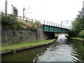
Bridge 14, from the west
by Christine Johnstone geograph for square SO8556 The Worcester and Birmingham Canal's towpath is also the route of the... (more)
Tags:
building material:BrickX
Canal BridgeX
Canal TowpathX
top:CanalsX
ldp:Monarchs Way
long distance path:Monarchs Way
Monarchs WayX
top:PathsX
Recreational RouteX
TowpathX
Worcester & Birmingham CanalX
|
|
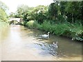
Swan and cygnet west of Bridge 17
by Christine Johnstone geograph for square SO8657 From Bridge 17 to Diglis Basin by the Severn, the Worcester and Birmingham... (more)
Tags:
Canal TowpathX
top:CanalsX
bird:CygnetX
ldp:Monarchs Way
long distance path:Monarchs Way
Monarchs WayX
top:PathsX
Recreational RouteX
bird:SwanX
SwansX
TowpathX
Worcester & Birmingham CanalX
|
|
Railway crossing the New Main Line
by Christine Johnstone geograph for square SO9890 Railway engineers often used the routes surveyed by canal engineers. The right... (more)
Tags:
canal:BCNX
Canal TowpathX
top:CanalsX
Monarchs WayX
ldp:Monarchs Way
long distance path:Monarchs Way
canal:New Main LineX
Railway BridgeX
Railway Bridge Over CanalX
top:RailwaysX
Recreational RouteX
TowpathX
|
|
Two bridges over the Dudley No 2 Canal
by Christine Johnstone geograph for square SO9588 The line to Hawne Basin [and originally, Selly Oak] at Windmill End Junction.... (more)
Tags:
building material:Brick and IronX
Canal BridgeX
Canal TowpathX
top:CanalsX
canal:DudleyX
long distance path:Monarchs Way
Monarchs WayX
ldp:Monarchs Way
Recreational RouteX
Roving BridgeX
TowpathX
Towpath BridgeX
|
|
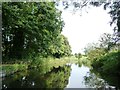
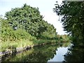
The Stourbridge canal, near Bellsmill
by Christine Johnstone geograph for square SO8885 The towpath here forms part of the Monarch's Way.
Tags:
Canal TowpathX
top:CanalsX
Canalside TreesX
Deciduous TreesX
Monarchs WayX
ldp:Monarchs Way
long distance path:Monarchs Way
top:PathsX
Recreational RouteX
ReflectionsX
Reflections in the WaterX
canal:StourbridgeX
TowpathX
|
|
The Stourbridge canal and the Monarch's Way
by Christine Johnstone geograph for square SO8685 Above lock 17.
Tags:
Canal TowpathX
top:CanalsX
Canalside TreesX
Deciduous TreesX
Monarchs WayX
ldp:Monarchs Way
long distance path:Monarchs Way
top:PathsX
Recreational RouteX
ReflectionsX
Reflections in the WaterX
canal:StourbridgeX
TowpathX
|
|
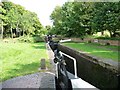
Locks 19 and 20, the Stourbridge canal
by Christine Johnstone geograph for square SO8685 Lock 20 is the nearest. Also known as Bottom Lock, as it lowers the canal down... (more)
Tags:
Canal TowpathX
top:CanalsX
canal:LockX
LocksX
ldp:Monarchs Way
long distance path:Monarchs Way
Monarchs WayX
top:PathsX
Recreational RouteX
canal:StourbridgeX
TowpathX
|
|
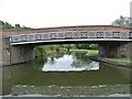
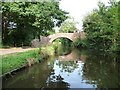
Bellsmill Bridge
by Christine Johnstone geograph for square SO8885 Carrying a track and two footpaths over the Stourbridge canal and the Monarch's Way.
Tags:
building material:BrickX
Bridge Over CanalX
Canal BridgeX
Canal TowpathX
top:CanalsX
Canalside TreesX
Deciduous TreesX
ldp:Monarchs Way
long distance path:Monarchs Way
Monarchs WayX
top:PathsX
Recreational RouteX
ReflectionsX
Reflections in the WaterX
canal:StourbridgeX
TowpathX
|
|
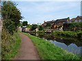
The Monarch's Way, below lock 17
by Christine Johnstone geograph for square SO8685 Aka the Stourbridge canal towpath, opposite Stourton Crescent.
Tags:
Back GardensX
Canal BankX
Canal MooringsX
Canal TowpathX
top:CanalsX
housing:Detached HouseX
Detached HousesX
top:Housing, DwellingsX
canal:LockX
ldp:Monarchs Way
long distance path:Monarchs Way
Monarchs WayX
Mooring BollardX
top:PathsX
Recreational RouteX
canal:StourbridgeX
TowpathX
top:Village, Rural SettlementX
|
|
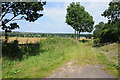
The Monarch's Way
by Philip Halling geograph for square SP2026 The Monarch's Way between Broadwell and Stow-on-the-Wold.
|
|
The Monarch's Way
by Philip Halling geograph for square SP1728 The Monarch's Way following a bridleway between Longborough and Donnington.
|
|
Monarch's Way
by Vieve Forward geograph for square ST8691 |
|
Monarch's way at Bryan's Green
by Jeff Gogarty geograph for square SO8868 |
|
The Monarch's Way crosses Broad Alley, Cutnall Green
by Jeff Gogarty for square SO8867 |
|
The Monarch's Way, Rushock
by Philip Halling geograph for square SO8871 This footpath below Rushock church is part of the Monarch's Way, a long... (more)
|
|
The Monarch's Way near Stow on the Wold
by Philip Halling geograph for square SP1824 This footpath is the route of the Monarch's Way as it approaches Stow on... (more)
|
|
The Monarch's Way
by Philip Halling geograph for square SP1824 The Monarch's Way approaching Netherswell Manor Farm. I took an almost... (more)
|
|
The Monarch's Way
by Philip Halling geograph for square SP1926 The Monarch's Way follows this no through road into Stow-on-the-Wold.
|
|
House beside the Monarch's Way
by Philip Halling geograph for square SP1926 House beside the Monarch's Way near Stow-on-the-Wold.
|
|
The Monarch's Way and Donnington Manor
by Philip Halling geograph for square SP1928 The Monarch's Way passing the entrance to Donnington Manor.
|
|
The Monarch's Way
by Philip Halling geograph for square SP1830 The Monarch's Way between Moreton-in-Marsh and Longborough.
|
|
The Monarch's Way
by Philip Halling geograph for square SP1830 The Monarch's Way approaching Longborough. The church tower can be seen to... (more)
|
|
The Monarch's Way
by Philip Halling geograph for square SP1830 The Monarch's Way approaching a gate between Moreton-in-Marsh and Longborough.
|