Geograph - photograph every grid square
About tags on Geograph
Tags
Geographical Context
Subjects
Types
Other Prefixes
Public Tags
Related Tags
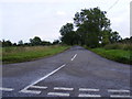
|
Coverage Map
Prefix:
looking towards
Tag:
Leiston
Other tags:
Leiston
at:
Leiston
near:
Leiston
place:
Leiston
to:
Leiston
Showing images tagged with
looking towards:
Leiston
tag.
View all tagged images
-
In Browser
Search within these images
:
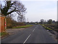
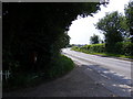
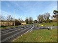
B1119 Saxmundham Road & Saxmundham Road Victorian Postbox
by
Geographer
geograph for square
TM4262
Looking towards Leiston at the entrance to Leiston House Farm Postbox No.IP16 4610
Tags:
B Road (Classified B)
X
B1119
X
B1119 Saxmundham Road
X
top:
Business, Retail, Services
X
Farm Entrance
X
at:
Knodishall
X
looking towards:
Leiston
near:
Leiston
Leiston House Farm
X
subject:
Road
X
top:
Roads, Road Transport
X
Saxmundham Road
X
postbox:
Victorian
X
postbox:
VR
X
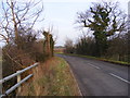
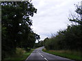
B1122 Aldeburgh Road, Leiston
by
Geographer
geograph for square
TM4462
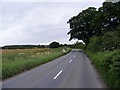
Looking towards Leiston at the junction with Red House Lane
Tags:
Aldeburgh Road
X
B1122
X
B1122 Aldeburgh Road
X
at:
Leiston
looking towards:
Leiston
Red House Lane
X
subject:
Road Junction
X
top:
Roads, Road Transport
X
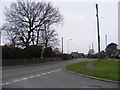
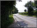
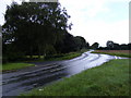
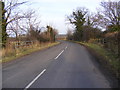
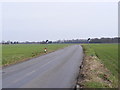
Valley Road, Leiston
by
Geographer
geograph for square
TM4563
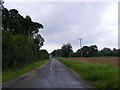
Looking towards Leiston Road No.U2826
Tags:
at:
Leiston
looking towards:
Leiston
subject:
Road
X
top:
Roads, Road Transport
X
U Classified Road
X
U Road (Classified U)
X
Valley Road
X
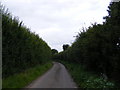
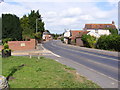
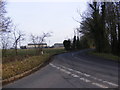
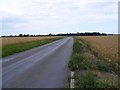
Buckleswood Road, Leiston
by
Geographer
geograph for square
TM4363
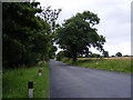
Looking towards Leiston near the footpath to Fisher's Farm & Abbey Lane... (
more
)
Tags:
Abbey Lane
X
Buckleswood Road
X
Fishers Farm
X
Footpath
X
at:
Leiston
looking towards:
Leiston
subject:
Road
X
top:
Roads, Road Transport
X
near:
The Footpath to Fishers Farm & Abbey Lane
X
U Classified Road
X
U Road (Classified U)
X
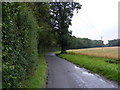
B1122 Abbey Road, Leiston
by
Geographer
geograph for square
TM4464
Looking towards Leiston near the entrance to Old Abbey Farm
Tags:
Abbey Road
X
B Road (Classified B)
X
B1122
X
B1122 Abbey Road
X
near:
Eastbridge
X
Farm Entrance
X
looking towards:
Leiston
at:
Leiston
Old Abbey Farm
X
subject:
Road Junction
X
top:
Roads, Road Transport
X
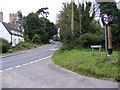
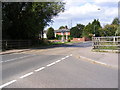
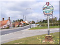
B1122 Leiston Road & Theberton Village Sign
by
Geographer
geograph for square
TM4365
Category: B road (Classified B)
On the B1121 Leiston Road at the junction with Pretty Road looking towards Leiston
Tags:
B Road (Classified B)
X
B1121
X
B1122 Leiston Road
X
looking towards:
Leiston
Leiston Road
X
Pretty Road
X
subject:
Road Junction
X
Road Name Sign
X
top:
Roads, Road Transport
X
at:
Theberton
X
Theberton Village Sign
X
Village Sign
X
top:
Village, Rural Settlement
X
B1122 Leiston Road
by
Geographer
geograph for square
TM4464
Looking towards Leiston at the junction with Potter's Street
Tags:
B Road (Classified B)
X
B1122
X
B1122 Leiston Road
X
near:
Eastbridge
X
looking towards:
Leiston
Leiston Road
X
Potters Street
X
subject:
Road
X
Road Junction
X
top:
Roads, Road Transport
X
at:
Theberton
X
B1122 Abbey Road & Old Abbey Gate Postbox
by
Geographer
geograph for square
TM4464
Looking towards Leiston near Old Abbey Farm Postbox No.IP16 4640
Tags:
Abbey Road
X
B Road (Classified B)
X
B1122
X
B1122 Abbey Road
X
top:
Business, Retail, Services
X
postbox:
E II R
X
near:
Eastbridge
X
Farm Entrance
X
looking towards:
Leiston
at:
Leiston
near:
Old Abbey Farm
X
Postbox
X
subject:
Road
X
top:
Roads, Road Transport
X
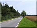
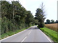
B1119 Saxmundham Road
by
Geographer
geograph for square
TM4262
Category: B road (Classified B)
Looking towards Leiston at the junction with Church Road
Tags:
B Road (Classified B)
X
B1119
X
B1119 Saxmundham Road
X
Church Road
X
near:
Knodishall
X
looking towards:
Leiston
at:
Leiston
subject:
Road Junction
X
top:
Roads, Road Transport
X
Saxmundham Road
X
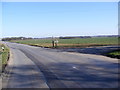
B1069 Leiston Road, Coldfair Green
by
Geographer
geograph for square
TM4360
Category: B road (Classified B)
Looking towards Leiston near Knodishall Village Sign
Tags:
B Road (Classified B)
X
B1069
X
B1069 Leiston Road
X
at:
Coldfair Green
X
Knodishall Village Sign
X
near:
Knodishall Village Sign
X
looking towards:
Leiston
Leiston Road
X
subject:
Road
X
top:
Roads, Road Transport
X
Village Sign
X
B1122 Leiston Road
by
Geographer
geograph for square
TM4465
Looking towards Leiston at the junction with Moat Road
Tags:
B Road (Classified B)
X
B1122
X
B1122 Leiston Road
X
looking towards:
Leiston
Moat Road
X
subject:
Road Junction
X
top:
Roads, Road Transport
X
at:
Theberton
X
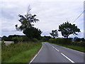
Abbey Lane
by
Geographer
geograph for square
TM4164
Category: Road
Looking towards Wheathouse Cottage & Leiston near the Cemex Concrete Plant
Tags:
Abbey Lane
X
near:
Carlton
X
Carlton
X
Cemex Concrete Plant
X
at:
Clay Hills
X
Clay Hills
X
looking towards:
Leiston
Leiston
top:
Roads, Road Transport
X
Saxmundham Plant
X
near:
The Cemex Concrete Plant
X
near:
Theberton
X
Theberton
X
looking towards:
Wheathouse Cottage
X
Wheathouse Cottage
X
B1122 Aldeburgh Road, Aldringham
by
Geographer
geograph for square
TM4461
Looking towards Leiston at the junction with Aldringham Park
Tags:
Aldeburgh Road
X
at:
Aldringham
X
Aldringham Park
X
B Road (Classified B)
X
B1122
X
B1122 Aldeburgh Road
X
near:
Leiston
looking towards:
Leiston
subject:
Road Junction
X
top:
Roads, Road Transport
X
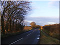
B1119 Saxmundham Road at the Hundred River
by
Geographer
geograph for square
TM4262
Looking towards Leiston
Tags:
B Road (Classified B)
X
B1119
X
B1119 Saxmundham Road
X
Hundred River
X
at:
Knodishall
X
looking towards:
Leiston
near:
Leiston
subject:
Road
X
top:
Roads, Road Transport
X
B1119 Saxmundham Road at the Hundred River
by
Geographer
geograph for square
TM4262
Looking towards Leiston
Tags:
B Road (Classified B)
X
B1119
X
B1119 Saxmundham Road
X
at:
Knodishall
X
looking towards:
Leiston
near:
Leiston
top:
Rivers, Streams, Drainage
X
subject:
Road
X
top:
Roads, Road Transport
X
at:
The Hundred River
X
B1119 Saxmundham Road
by
Geographer
geograph for square
TM4263
Looking towards Leiston at the junction with Abbey Lane at Saxmundham Road Crossing
Tags:
Abbey Lane
X
B1119
X
B1119 Saxmundham Road
X
at:
Knodishall
X
looking towards:
Leiston
near:
Leiston
subject:
Road Junction
X
top:
Roads, Road Transport
X
Saxmundham Road
X
at:
Saxmundham Road Crossing
X
B1119 Saxmundham Road
by
Geographer
geograph for square
TM4262
Looking towards Leiston near the footpath to the U2303
Tags:
B Road (Classified B)
X
B1119
X
B1119 Saxmundham Road
X
Footpath
X
at:
Knodishall
X
looking towards:
Leiston
near:
Leiston
subject:
Road
X
top:
Roads, Road Transport
X
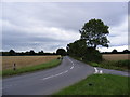
Abbey Lane
by
Geographer
geograph for square
TM4064
Category: Road
Looking towards Leiston at the junction with Hawthorn Road by the Crossways
Tags:
Abbey Lane
X
By the Crossways
X
Carlton
X
near:
Carlton
X
Crossways
X
Hawthorn Road
X
Leiston
looking towards:
Leiston
Road Junction
X
top:
Roads, Road Transport
X
at:
The Junction with Hawthorn Road
X
B1069 Leiston Road & Knodishall Village Sign
by
Geographer
geograph for square
TM4360
Category: B road (Classified B)
At the junction with Judith Avenue
Tags:
B Road (Classified B)
X
B1069
X
B1069 Leiston Road
X
Coldfair Green
X
at:
Coldfair Green
X
Judith Avenue
X
Knodishall Village Sign
X
looking towards:
Leiston
Leiston Road
X
Road Junction
X
top:
Roads, Road Transport
X
at:
The Junction with Judith Avenue
X
Village Sign
X
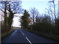
B1119 Saxmundham Road & Friston footpath no.20
by
Geographer
geograph for square
TM4062
Looking towards Leiston near Meadow Farm
Tags:
B Road (Classified B)
X
B1119
X
B1119 Saxmundham Road
X
Footpath
X
looking towards:
Leiston
near:
Meadow Farm
X
top:
Paths
X
subject:
Road
X
top:
Roads, Road Transport
X
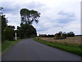
Harrow Lane
by
Geographer
geograph for square
TM4264
Looking towards Leiston near Harrow Farm Road No.U2407
Tags:
near:
Harrow Farm
X
Harrow Lane
X
looking towards:
Leiston
subject:
Road
X
top:
Roads, Road Transport
X
near:
Theberton
X
U Classified Road
X
U Road (Classified U)
X
B1119 Saxmundham Road
by
Geographer
geograph for square
TM4262
Looking towards Leiston near the footpaths to Church Road & Knodishall Green
Tags:
B Road (Classified B)
X
B1119
X
B1119 Saxmundham Road
X
Church Road
X
Footpaths
X
near:
Knodishall
X
looking towards:
Leiston
top:
Paths
X
subject:
Road
X
top:
Roads, Road Transport
X
B1119 Saxmundham Road
by
Geographer
geograph for square
TM4062
Looking towards Leiston near Meadow Farm
Tags:
B Road (Classified B)
X
B1119
X
B1119 Saxmundham Road
X
near:
Knodishall
X
looking towards:
Leiston
near:
Meadow Farm
X
subject:
Road
X
top:
Roads, Road Transport
X
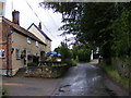
The road in front of Eels Foot Public House
by
Geographer
geograph for square
TM4566
Looking towards Leiston Road No.U2831
Tags:
at:
Eastbridge
X
Eels Foot Public House
X
looking towards:
Leiston
Public House
X
subject:
Road
X
top:
Roads, Road Transport
X
U Classified Road
X
U Road (Classified U)
X
Village Street
X
B1122 Abbey Road
by
Geographer
geograph for square
TM4464
Looking towards Leiston near the footpath to Abbey Lane
Tags:
Abbey Road
X
B Road (Classified B)
X
B1122
X
B1122 Abbey Road
X
near:
Eastbridge
X
Footpath
X
looking towards:
Leiston
subject:
Road
X
top:
Roads, Road Transport
X
B1119 Saxmundham Road & Wood Farm entrance
by
Geographer
geograph for square
TM3963
Category: B road (Classified B)
Looking towards Leiston Also Coltsclose Pickle footpath
Tags:
B1119
X
B1119 Saxmundham Road
X
Coltsclose Pickle
X
Farm Entrance
X
Farm Entrance Road
X
top:
Farm, Fishery, Market Gardening
X
Footpath
X
looking towards:
Leiston
top:
Paths
X
top:
Roads, Road Transport
X
at:
Saxmundham
X
Saxmundham Road
X
Wood Farm
X
B1122 Yoxford Road
by
Geographer
geograph for square
TM4168
Category: B road (Classified B)
Looking towards Leiston near Moor Cottage
Tags:
B Road (Classified B)
X
B1122
X
B1122 Yoxford Road
X
looking towards:
Leiston
near:
Middleton
X
near:
Moor Cottage
X
subject:
Road
X
top:
Roads, Road Transport
X
Yoxford Road
X
B1119 Saxmundham Road
by
Geographer
geograph for square
TM4162
Category: B road (Classified B)
Looking towards Leiston at the junction with Grove Road (U2329)
Tags:
B Road (Classified B)
X
B1119
X
B1119 Saxmundham Road
X
near:
Knodishall
X
looking towards:
Leiston
Road Junction
X
subject:
Road Junction
X
top:
Roads, Road Transport
X
Aldringham Village Sign & B1122 Aldeburgh Road
by
Geographer
geograph for square
TM4460
Category: Village sign
Looking towards Leiston at the junction with the B1353 Thorpeness Road.
Tags:
Aldeburgh Road
X
at:
Aldringham
X
Aldringham Village Sign
X
B1122
X
B1122 Aldeburgh Road
X
B1353
X
B1353 Thorpeness Road
X
looking towards:
Leiston
Road Junction
X
top:
Roads, Road Transport
X
subject:
Sign
X
Thorpeness Road
X
Village Sign
X
top:
Village, Rural Settlement
X
B1119 Saxmundham Road
by
Geographer
geograph for square
TM3963
Category: B road (Classified B)
Looking towards Leiston
Tags:
B Road (Classified B)
X
B1119
X
B1119 Saxmundham Road
X
looking towards:
Leiston
subject:
Road
X
top:
Roads, Road Transport
X
at:
Saxmundham
X
Saxmundham Road
X
B1119 Saxmundham Road
by
Geographer
geograph for square
TM3963
Category: B road (Classified B)
Looking towards Leiston
Tags:
B Road (Classified B)
X
B1119
X
B1119 Saxmundham Road
X
looking towards:
Leiston
subject:
Road
X
top:
Roads, Road Transport
X
at:
Saxmundham
X
Saxmundham Road
X
B1122 Yoxford Road
by
Geographer
geograph for square
TM4168
Category: B road (Classified B)
Looking towards Yoxford near Moor Cottage
Tags:
B Road (Classified B)
X
B1122
X
B1122 Yoxford Road
X
looking towards:
Leiston
near:
Middleton
X
near:
Moor Cottage
X
subject:
Road
X
top:
Roads, Road Transport
X
Yoxford Road
X
View more in the Image Search
or
in Browser
View images matching 'Leiston' anywhere
in
the tags
Don't click these:
PotMel 1
PotMel 2
☰
Home
View
Search
Marked Images
Maps
Browser
Explore
Showcase
New Images
Collections
Interact
Games
Discussions
Blog
Contributors
Submit
Statistics
Leaderboards
General
FAQ
Help Pages
Sitemap
Contact Us
Support Us
sponsored by
🔍
What to search:
Photos
Enter keywords or a location/postcode to search nearby images
Enter a Grid Reference
Placenames
Collections
Website Pages
Everything
Others:
Advanced Search
|
Image Browser
Or:
Coverage Map
|
Searchable Map
You are not logged in
login
|
register