|
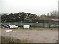
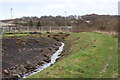
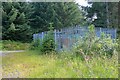
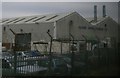
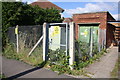
Material awaiting recycling
by Adrian Taylor
geograph for square SK3735
Road construction materials heaped up awaiting recycling.
The green palisade... (more)
|
|
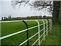
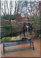
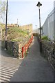
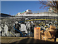
Metal fence and gates
by Richard Sutcliffe
geograph for square NS5189
On one of the woodland walks near Balfunning House.
|
|
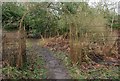
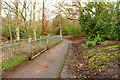
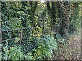
Heol-y-Sheet public footpath, North Cornelly
by eswales
geograph for square SS8281
A public footpath which connects the two parts of the road Heol-y-Sheet which... (more)
|
|
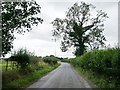
Bitterley Lane
by Christine Johnstone
geograph for square SO5677
The church is in the grounds of Bitterley Court, far from the village centre.... (more)
|
|
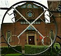
Church of Our Lady and St Peter - fence detail
by Stephen Craven
for square SE1832
The metal fence is fabricated to incorporate repeated motifs of the cross keys... (more)
|

|
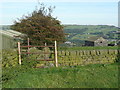
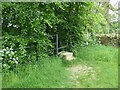
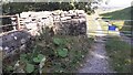
A barrier across a public footpath south west of Laleston
by eswales
geograph for square SS8679
This barrier prevented further progress along a public footpath which Ordnance... (more)
|
|
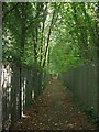
From fence to wall, St Anne's Terrace, Tonna
by Jaggery
geograph for square SS7798
The barrier on the north side of the B4434 St Anne's Terrace is a metal... (more)
|
|
Footpath at Rozelle Pond
by Billy McCrorie
geograph for square NS3319
Fence with metal gate.
|
|
Metal fence, Heveningham
by nick macneill
geograph for square TM3473
The hall is in the background.
|
|
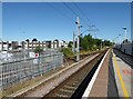
Platform 2, Retford Station
by Adrian Taylor
geograph for square SK7080
The platform starting signal is set for the 09.12 train from Retford to... (more)
|
|
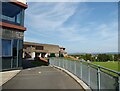
Ulverston Victoria High School
by Adrian Taylor
geograph for square SD2877
|
|
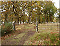
Gateposts, Aldourie
by Craig Wallace
geograph for square NH5937
A pair of old stone gateposts, with a metal fence and gate.
|
|
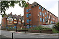
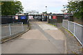
Disused hospital, Stoney Stanton Road
by Luke Shaw
geograph for square SP3379
|
|
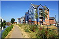
Apartments beside the Coventry Canal at The Moorings
by Roger Templeman
geograph for square SP3380
The wall beside the towpath has been replaced by a metal fence
|
|
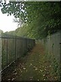
Path alongside the playing fields
by Robert Graham
geograph for square NZ1151
These are the playing fields of Consett Rugby Club, behind the metal fence.... (more)
|

|
Train approaching Langton Court Road railway bridge
by Roger Templeman
for square ST6172
The train seen through the metal fence is a Class 150 diesel multiple unit.... (more)
|
|
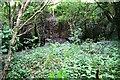
Wildlife area (south), Blaina Scouts HQ
by M J Roscoe
geograph for square SO2009
Part of the grass has just been cut and cleared by a Gwent Wildlife Trust... (more)
|
|
Sowerby Bridge FP98 (4) - Stile
by Humphrey Bolton
geograph for square SE0224
This is a length of metal fence across a broken-down wall, where there was... (more)
|
|
Drain, edge of Plateau 1, Oakdale Business Park
by M J Roscoe
geograph for square ST1999
The plateau consists mainly of landscaped colliery waste. The metal fencing is... (more)
|

|
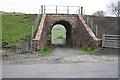
Aireworth Bridge
by Roger Templeman
geograph for square SE0741
The bridge takes Aireworth Road over the River Worth. There is an OS benchmark... (more)
|
|
Flats #19-24 Dorrit House, St Anns Road
by Roger Templeman
for square TQ2380
|
|
Footpath and Trail Signs
by Mick Garratt
geograph for square SK0598
So many signs.
|
|
Heol-y-Sheet public footpath, North Cornelly (2)
by eswales
geograph for square SS8281
A view from a spot approximately 100 metres to the east of the one where... (more)
|
|
Elegant metal stile, near Highfield House
by Christine Johnstone
geograph for square SE0650
One of two here, on the public footpath from Addingham to Highfield Farm.
|
|
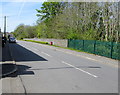
Rusting estate fencing, Old Warwick Road, Royal Leamington Spa
by Robin Stott
geograph for square SP3165
Over the fence a bank drops down to the canal towpath.
|
|
Bridge taking lifted railway over access road to Davy Bank
by Roger Templeman
geograph for square SD6196
|
|
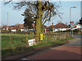
North corner of Gorsey Lane and Station Road, Wythall
by Robin Stott
geograph for square SP0875
Station Road runs across the picture. It's a shame to see an old fence... (more)
|
|
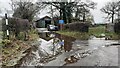
Fence Enclosure, near Deer Craig
by Mick Garratt
geograph for square NS5199
For some sort of tank.
|
|
New fencing alongside Weardale Railway
by Trevor Littlewood
geograph for square NZ0836
The Weardale Railway to the east seen from a level crossing at Wolsingham.
The... (more)
|
|
Fencing around the Cross Kirk, Peebles
by Jim Barton
for square NT2540
The tower has been fenced off and a sign 'Dangerous masonry Keep out'... (more)
|
|
Fortified Footpath
by Des Blenkinsopp
geograph for square TQ2485
A public footpath runs between two sports fields, with heavy duty fencing all along.
|
|
Telford Copper Cylinders Ltd., Haybridge Road Industrial Estate
by Christopher Hilton
geograph for square SJ6611
Seen from the railway line.
|
|
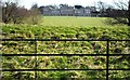
'Estate fencing' at Fourlane-ends
by Christine Johnstone
geograph for square SJ7874
With every fourth upright painted black.
|
|
Roadside tree on the lane to Henley
by Christine Johnstone
geograph for square SO5577
A strong wind is exposing the structure of the tree, even in summer.
|
|
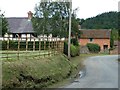
Houses in Aston
by Christine Johnstone
geograph for square SO4671
The hamlet is Aston, the parish is Pipe Aston. Pipe presumably comes from parva... (more)
|
|
Seat beside the fish ladder
by Richard Sutcliffe
geograph for square NS5574
The seat overlooks the fish ladder on the Allander Water. The sign, which should... (more)
|
|
Track to Eller Beck Nursery from north side of A684
by Roger Templeman
geograph for square SD8989
|
|
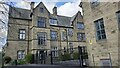
East face of Ermysted's Grammar School
by Luke Shaw
geograph for square SD9851
|
|
Culvert and gate to former sports ground from Firth Wood
by Luke Shaw
geograph for square SK3678
Ordnance Survey records indicate that in 1961 a benchmark levelled at 122.045m... (more)
|
|
Junction of footpath to station and Back Station Road
by Roger Templeman
geograph for square SE2423
Ordnance Survey documents indicate that in 1962 a benchmark levelled at 58.217m... (more)
|
|
Entrance to Beanfield Primary School from Farmstead Road
by Phil Richards
geograph for square SP8688
Ordnance survey records indicate that in 1983 there was a benchmark levelled at... (more)
|
|
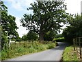
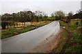
Minor road heading NW passing Thorn Bank
by Roger Templeman
geograph for square NY5633
|
|
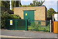
Electricity substation next to #399 Park Road
by Roger Templeman
geograph for square SK5317
|
|
Electricity substation, Broadway
by Roger Templeman
geograph for square SK5317
|
|
Spray-painted screen, outdoor market, Bullring
by Robin Stott
for square SP0786
At the busy corner of Upper Dean Street and Moat Lane is this metal,... (more)
|
|
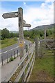
Road junction at West Fitz
by Roger Templeman
geograph for square NY1540
There is a Cumbria finger signpost on the left hand verge
|
|
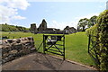
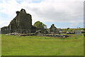
Glenluce Abbey Entrance
by Billy McCrorie
geograph for square NX1858
Pity only the grounds and shop are open to-day May 16th. Abbey was well fenced off.
|
|
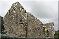
Glenluce Abbey
by Billy McCrorie
for square NX1858
Pity only the grounds and shop are open. viewed in mid May (16th). Bottom of... (more)
|
|
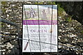
Brotherhood of Men
by Billy McCrorie
for square NX1858
Information panel at Glenluce Abbey. Viewed through the fence as the Abbey was... (more)
|
|
Glenluce Abbey
by Billy McCrorie
geograph for square NX1858
Well fenced off, only the grounds and shop are open, viewed on May 16th.
|