|
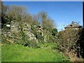
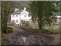
Ruined cottage by Penpoll Mill
by Derek Harper
geograph for square SX1454
The listed building description for the mill on the right... (more)
|
|
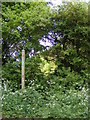
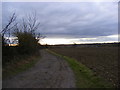
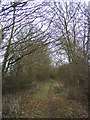
Mill Green
by Geographer
geograph for square TM3161
Looking towards Mill Cottage near the footpaths to Stone Farm & North Green Road
|
|
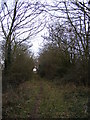
Mill Green
by Geographer
geograph for square TM3161
Looking towards Mill Cottage near the footpaths to Stone Farm & North Green Road
|
|
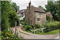
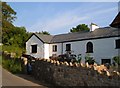
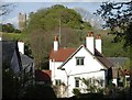
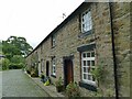
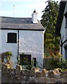
Mill Cottage and Upper House
by Ian Capper
geograph for square SO5874
Houses in Hope Bagot, with Mill Cottage nearest. Upper House, in the... (more)
|
|
Bridge and cottage, Ideford Combe
by Derek Harper
geograph for square SX8876
Ideford Bridleway 21 crosses the stream down the combe and then passes Ideford... (more)
|
|
New Mill, North Bovey
by Derek Harper
geograph for square SX7383
|
|
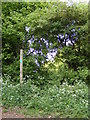
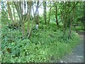
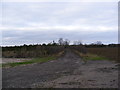
Footpath to Mill Cottage
by Geographer
geograph for square TM2567
Category: Footpath
|
|
Footpath to Mill Cottage
by Geographer
geograph for square TM2567
Category: Footpath
|
|
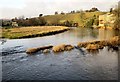
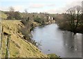
River Wharfe at Low Mill
by Derek Harper
geograph for square SE0063
|
|
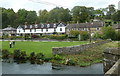
Lumford Cottages from the River Wye footbridge
by Andrew Hill
geograph for square SK2169
A line of former mill cottages set behind a riverside green.
|
|
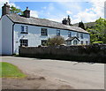
Mill Cottage in Felindre near Cwmdu, Powys
by Jaggery
geograph for square SO1723
The whitewashed cottage is on the west bank of the river named Rhiangoll.... (more)
|
|
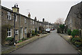
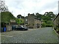
Low Mill Village
by Bill Boaden
geograph for square SE0949
A village comprised almost entirely of mill cottages, with little provision for... (more)
|
|
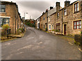
Entering North Bovey
by Derek Harper
geograph for square SX7383
Yard Hill passes the old corn mill and its cottages... (more)
|
|
Cottages at Hackpen Mill
by Derek Harper
geograph for square ST0911
The backlane between Ashill and Craddock swings left here. On the left of the... (more)
|
|
Site of Hirst Mill Cottages, Longwood
by Humphrey Bolton
geograph for square SE0917
There were two cottages here until the 1950s. Now all that is left is what looks... (more)
|
|
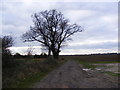
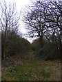
Mill Green
by Geographer
geograph for square TM3161
Looking towards Mill Green near the footpaths
|
|
Narrowgates, Barley (2)
by Stephen Craven
geograph for square SD8240
Former millworkers' cottages associated with a nearby cotton mill.
|
|
Narrowgates, Barley (1)
by Stephen Craven
geograph for square SD8240
Former millworkers' cottages associated with a nearby cotton mill. There... (more)
|
|
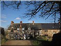
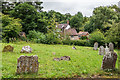
Graveyard, Church of St John the Baptist
by Ian Capper
geograph for square SO5874
Graveyard by Hope Bagot church, with Mill Cottage and Upper House in the background.
|
|
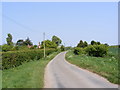
Narford Road, West Acre
by Geographer
geograph for square TF7815
Near Mill Cottages
|
|
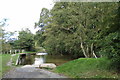
Ford off Narford Road
by Geographer
geograph for square TF7815
Near Mill Cottages
|
|
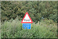
Ford sign off Narford Road
by Geographer
for square TF7815
Near Mill Cottages
|
|
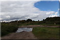
Track off Narford Road
by Geographer
geograph for square TF7815
Near Mill Cottages
|
|
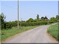
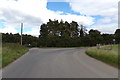
Narford Road, West Acre
by Geographer
geograph for square TF7814
Near Mill Cottages
|
|
Summerseat, Hill Street
by David Dixon
geograph for square SD7915
Former mill workers' cottages on Hill Street at Brooksbottoms.
|
|
Ideford Mill Cottage
by Derek Harper
geograph for square SX8876
Looking down the combe from the lane that leads from Larcombe Bridge to the bridleway.
|
|
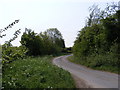
Kings Lane Bridleway to Mill Cottage
by Geographer
geograph for square TM2668
Approaching junction with the footpath to the B1118
|
|
Wharfe by Fletcher Brow
by Derek Harper
geograph for square SE0063
|
|
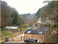
Pump at New Mill, North Bovey
by Derek Harper
geograph for square SX7383
|
|
Kings Lane Bridleway to Tannington Long Lane
by Geographer
geograph for square TM2668
|
|
Kings Lane Bridleway to Tannington Long Lane
by Geographer
geograph for square TM2668
|
|
Footpath to the B1118
by Geographer
geograph for square TM2668
At the junction with the Kings Lane Bridleway
|
|
Kings Lane Bridleway to Tannington Long Lane
by Geographer
geograph for square TM2668
Looking back to the B1118
|
|
Kings Lane Bridleway to Tannington Long Lane
by Geographer
geograph for square TM2668
|
|
Kings Lane Bridleway to Tannington Long Lane
by Geographer
geograph for square TM2768
|