|
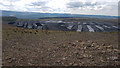
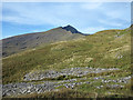
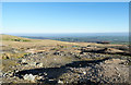
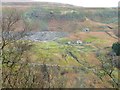
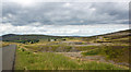
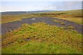
Aber-Pergwm Mine Spoil Tips
by Stephen Rees
geograph for square SN8407
Spoil Tips from the Aber-Pergwm Mine which is located opposite the New Vale of... (more)
|
|
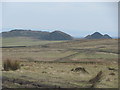
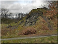
Spoil from the Blairlogie copper mine
by Doug Lee
geograph for square NS8297
This is the spoil heap from the Blairlogie copper mine. The mine's adit,... (more)
|
|
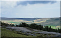
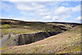
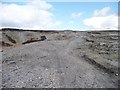
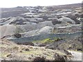
Mine spoil across mouth of valley - 2
by Trevor Littlewood
geograph for square NZ0033
The valley in the foreground is drained by the Hawkwood Burn. It appears to be... (more)
|
|
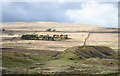
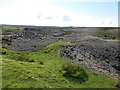
Mine spoil across mouth of valley
by Trevor Littlewood
geograph for square NZ0033
The large sunlit mass of material in the bottom right quarter of the image is... (more)
|
|
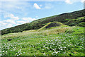
Mine spoil heap
by Trevor Littlewood
geograph for square ST2190
An immense spoil heap lying to the west of the hill, Mynydd Machen. Embedded in... (more)
|
|
Twice-mined spoil above Bollihope Burn
by Trevor Littlewood
geograph for square NZ0134
There's been a great deal of excavation along the slopes above Bollihope... (more)
|
|
Mine spoil at Scargill Mine
by Trevor Littlewood
geograph for square NZ0009
Scargill Mine lies near the north-western corner of Stang Forest; the spoil is... (more)
|
|
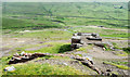
The site of Old Gang Smelting Mill
by Christine Johnstone
geograph for square NY9700
The ruins are dwarfed by the embankments of waste stone.
|
|
Mine spoil and trees above Arkengarthdale
by Trevor Littlewood
geograph for square NY9802
The mine spoil appears to be finally divided and might be crushed material,... (more)
|
|
Spoil heap from Rotherhope Fell Mine
by Trevor Littlewood
geograph for square NY6942
The spoil heap here is from the Middle Level entrance. The mine's main... (more)
|
|
Probable mine spoil close to Embley Burn
by Trevor Littlewood
geograph for square NY9253
Embley Burn is a tributary of Devil's Water, itself a feeder of the River... (more)
|
|
Mine spoil and railway sleepers on Flinty Fell
by Trevor Littlewood
geograph for square NY7742
Flinty Fell is a moorland hill close to Nenthead. The mound in which the... (more)
|
|
Eroding mine spoil in Great Eggleshope
by Trevor Littlewood
geograph for square NY9730
The main mine spoil in the valley has Great Eggleshope Beck flowing, (unseen in... (more)
|
|
Bog and mine spoil
by Trevor Littlewood
geograph for square NY3518
The view is from the Sticks Pass path, looking south across an area of bog... (more)
|
|
Mining spoil on Conistone Moor
by Graham Robson
geograph for square SE0070
A result of local mining activity in the past, piles of spoil litter the area... (more)
|
|
Spoil heap of Sharnberry High Level
by Trevor Littlewood
geograph for square NZ0131
The extensive mine spoil is on moorland above Sharnberry Gill. Trees at the... (more)
|
|
Mine spoil on slope of Yr Aran
by Trevor Littlewood
geograph for square SH5951
The summit ridge of Yr Aran merges into the general western slope of the... (more)
|
|
Estate/farm road with elongated bank of mine spoil
by Trevor Littlewood
geograph for square NZ0624
The road runs at the edge of woodland lining the north side of the trough Arn... (more)
|
|
Oxlow Rake
by Stephen Burton
geograph for square SK1380
Spoil heaps from lead mining The site is a Scheduled Monument... (more)
|
|
Mine spoil alongside hill road
by Trevor Littlewood
geograph for square SD9595
The road crosses the moorland of Summer Lodge Moor and here is close to Summer... (more)
|
|
Desolation at location of Sandbeds Mine
by Trevor Littlewood
geograph for square NY3336
Mine spoil distributed widely below a mine road at the Sandbeds Mine which was... (more)
|
|
Mine spoil heap near Howgill
by Trevor Littlewood
geograph for square NY5957
The spoil heap is on a hill slope east of the house(s) at Howgill, south of... (more)
|
|
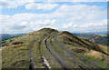
Cycle tracks on Forefield Rake
by Christine Johnstone
geograph for square NY9602
The former lead mining spoil heaps make a good adventure playground for mountain bikers.
|
|
Windegg Mine
by Trevor Littlewood
geograph for square NZ0105
The spoil from the level of the Windegg Mine is in the centre of the image, it... (more)
|
|
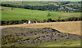
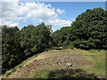
Crackpot Hall
by Christine Johnstone
geograph for square NY9000
Seen from the Pennine Way.
|
|
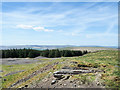
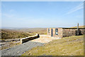
Shooting hut at Cashwell Mine
by Trevor Littlewood
geograph for square NY7136
The hut is close to the site of one of the levels of the Cashwell Mine;... (more)
|
|
Disused Mine Shaft
by Graham Loveland
geograph for square SW7442
A poor picture, with the flare on the lens, but included because it shows not... (more)
|
|
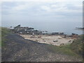
South West Coast Path, Blue Hills
by David Dixon
geograph for square SW7251
The area between St Agnes and Trevellas Cove was dominated by the Blue Hills... (more)
|
|
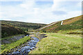
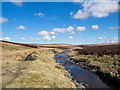
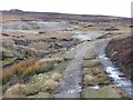
Great Eggleshope Beck
by Trevor Littlewood
geograph for square NY9730
Great Eggleshope Beck drains Great Eggleshope. The view is upstream from the... (more)
|
|
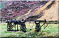
Sheave wheel assembly Cwm Bychan
by Trevor Littlewood
geograph for square SH6047
The sheave wheel, effectively a pulley, is mounted to rotate about a vertical... (more)
|
|
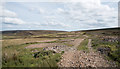
Mine spoil on moorland near Little Eggleshope
by Trevor Littlewood
geograph for square NY9831
The brown material is quite finely divided suggesting that it isn't in the... (more)
|
|
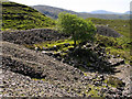
Tree growing among mine spoils
by Trevor Littlewood
geograph for square NM8566
The site is that of the Fee Donald Mine close to the Allt Féith Dhomhnuill.... (more)
|
|
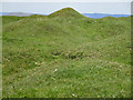
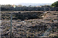
Mound in field on a slope
by Trevor Littlewood
geograph for square NY7446
The mound is surely the grassed over spoil of a mine excavation; by its size it... (more)
|
|
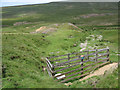
Path alongside Trout Beck
by Trevor Littlewood
geograph for square NY7533
The path runs along a tract of flat ground beside the beck but that ground is in... (more)
|
|
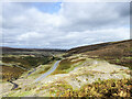
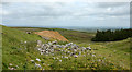
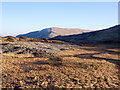
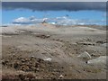
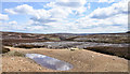
Moonscape on Melbecks Moor
by Karl and Ali
geograph for square NY9401
Spoil from the lead workings between Gunnerside and Hard Level Gills has been... (more)
|
|
Capped Mine Shaft, Wheal Maid Valley
by Graham Loveland
geograph for square SW7442
Numerous different ways of capping old shafts are used in the Poldice/Wheal Maid... (more)
|
|
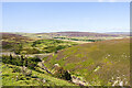
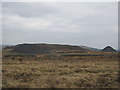
Looking down on the spoil from the old mines
by Ian Greig
geograph for square NS8813
|
|
Llanbradach spoil tips from Mynydd Eglwysilan
by John Light
geograph for square ST1292
Looking across the moorland - the view is dominated to the south east by the... (more)
|
|
Bridleway skirting a lead mining tip
by Christine Johnstone
geograph for square NY9601
Alongside Flincher Gill.
|
|
Spoil heap, iron ore mine near Gullane
by Richard Webb
for square NT4683
|
|
Bridleway on Forefield Rake
by Christine Johnstone
geograph for square NY9602
Lead mining has created a lunar landscape on the moors.
|
|
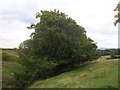
Limb Brook or Fenny Brook
by Martin Speck
geograph for square SK2983
Category: Brook
Limb Brook where it passes through Barber Fields. Sidney Addy, in his 1888 book... (more)
|
|
Llanbradach Tips
by John Light
geograph for square ST1391
Spoil deposited onto the hillside. Mynydd y Grug and Mynydd Machen nearby are... (more)
|
|
Ruins at Coldberry Mine
by Trevor Littlewood
geograph for square NY9429
The workings at Coldberry Mine on the western side of Hudes Hope cover a large... (more)
|
|
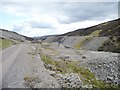
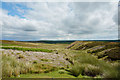
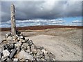
Bridleway heading to Surrender Ground
by Christine Johnstone
geograph for square NY9702
With fine views opening up to the south-east.
|
|
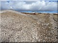
Eastern end of Forefield Rake
by Christine Johnstone
geograph for square NY9602
Looking towards Great Pinseat.
|
|
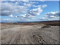
Rocky ground, cloudy sky
by Christine Johnstone
geograph for square NY9602
Bridleway climbing Forefield Rake.
|
|
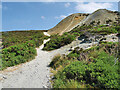
Bridleway climbing up to Forefield Rake
by Christine Johnstone
geograph for square NY9602
With the cyclists' heaven [disused tips] in the distance.
|
|
Spoil Tip, near Dane Head
by Mick Garratt
geograph for square SK0270
Evidence of some extraction industry.
|
|
Outwood Country Park
by David Dixon
geograph for square SD7706
The site of the former Outwood colliery consisted of 13 hectares of derelict... (more)
|