|
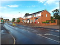
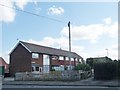
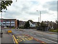
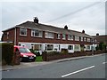
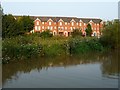
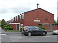
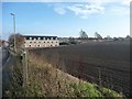
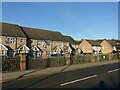
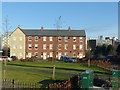
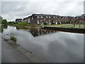
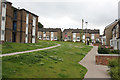
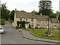
Springfield Street, Market Harborough
by Malc McDonald
geograph for square SP7387
Springfield Street in Market Harborough, Leicestershire.
July 2018 was... (more)
|
|
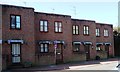
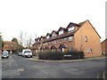
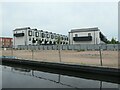
Houses on the south side of Park Lane, Richmond
by Christine Johnstone
geograph for square TQ1775
A modern stepped terrace, backing onto the railway line.
|
|
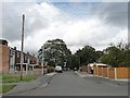
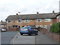
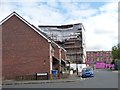
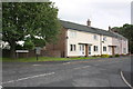
Gothic Mount, Ackton
by Christine Johnstone
geograph for square SE4121
A surprisingly normal scene, given the name of this street.
|
|
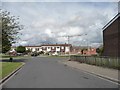
West End Avenue and Ackton Hall Crescent
by Christine Johnstone
geograph for square SE4121
Houses in Ackton.
|
|
Broom Close, off Broom Mount
by Christine Johnstone
geograph for square SE3129
More modern houses than those in Broom Terrace, Road and Place.
|
|
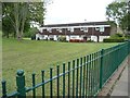
Stepped terrace, Nesfield Crescent, Belle Isle
by Christine Johnstone
geograph for square SE3128
More modern than most of the Nesfield housing.
|
|
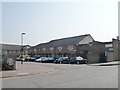
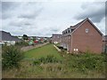
Houses on Green Farm Close, Chesterfield
by Christine Johnstone
geograph for square SK3672
As estate on the west side of Loundsley Green Road [B6150]
|
|
Newish houses on the Cromford Road, Wirksworth
by Christine Johnstone
geograph for square SK2854
Looking south from the railway bridge.
|
|
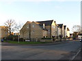
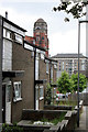
The end of Talbot Road
by Gerald England
geograph for square SJ9696
The house across the roundabout at the end of Talbot Road is called Chapel Hill... (more)
|
|
Haldane Road, Thamesmead
by Malc McDonald
geograph for square TQ4780
Terraced housing on Haldane Road, in Thamesmead.
|
|
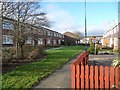
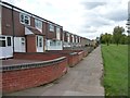
Houses on Huntwick Crescent
by Christine Johnstone
geograph for square SE4119
Most of the verges along these narrow roads have been converted for car parking.
|
|
Houses in Priordale Road
by Christine Johnstone
geograph for square SE4119
Seen from Southfield Avenue.
|
|
Houses opposite the Royal Oak
by Christine Johnstone
geograph for square SE6124
On Main Street, Hirst Courtney.
|
|
Old and new on Lion Hill
by Christine Johnstone
geograph for square SO8171
Someone has made an effort to make the new homes [right] fit in with the old... (more)
|
|
Hebden Terrace, off Bull Lane
by Christine Johnstone
geograph for square TQ3391
A row of houses squeezed in at the edge of an industrial area.
|
|
Houses facing each other on Durham Drive, Fellgate
by Christine Johnstone
geograph for square NZ3361
Durham Drive is the peripheral road round the estate. Vehicle access to these... (more)
|
|
Houses in Hadrian Way catching the afternoon sun
by Christine Johnstone
geograph for square SJ7066
Looking east from the Trent & Mersey Canal in Middlewich.
|
|
Modern Houses
by Nigel Mykura
geograph for square SP0958
These modern houses are on the north western outskirts of the small town of... (more)
|
|
Terraced houses, south side of Fearnville Road
by Christine Johnstone
geograph for square SE3435
Council housing on the south side of the road faces private housing on the north... (more)
|
|
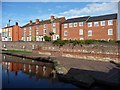
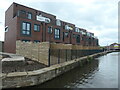
Terrace of three-storey canalside houses
by Christine Johnstone
geograph for square SO8277
Part of Bellway Homes' Keepers Lock development, on the east bank of the... (more)
|
|
Terraced houses, east side of Mackadown Lane
by Christine Johnstone
geograph for square SP1586
At the junction with Richford Grove.
|
|
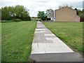
Eastern-most block, Radleys Walk
by Christine Johnstone
geograph for square SP1585
Built with only a path outside their front gardens, and an uninterrupted view of... (more)
|
|
North-facing block, Radleys Walk
by Christine Johnstone
geograph for square SP1585
Built with only a path outside their front gardens, and an uninterrupted view of... (more)
|
|
Western-most block, Radleys Walk
by Christine Johnstone
geograph for square SP1585
Built with only a path outside their front gardens, and an uninterrupted view of... (more)
|
|
Waterside Gardens, Wigan
by Christine Johnstone
geograph for square SD5705
Eight new three-bedroomed townhouses on the bank of the Leeds & Liverpool canal.
|
|
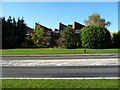
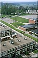
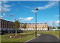
Alton West Estate, Roehampton, 1966 12
by Alan Murray-Rust
geograph for square TQ2173
|
|
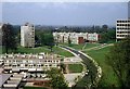
Alton West Estate, Roehampton, 1966 11
by Alan Murray-Rust
for square TQ2174
|
|
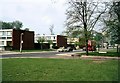
Alton West Estate, Roehampton, 1966 10
by Alan Murray-Rust
geograph for square TQ2173
|
|
Miners Mews, Pit Lane, Micklefield
by Christine Johnstone
geograph for square SE4432
New homes on the west side of the Great North Road.
|
|
Houses in Somersal Close
by Christine Johnstone
geograph for square SK3731
Off Sinfin Avenue, in the Derby suburb of Shelton Lock.
|
|
South Loop Green, Port Loop
by Christine Johnstone
geograph for square SP0587
Part of the Port Loop housing development by Urban Splash and other partners, on... (more)
|
|
Houses on Humber Road, Lower Stoke, Coventry
by Christine Johnstone
geograph for square SP3477
Newish development on the site of the Humber & Hillman car factories.
|
|
Modern housing on Vale Road
by Alan Murray-Rust
geograph for square SK6140
Late 20th century housing on a former industrial site.
|
|
St Michael's Avenue housing
by Alan Murray-Rust
geograph for square SK6142
Mid 20th century terraced housing, dating from the late 1960s, in a distinctive... (more)
|
|
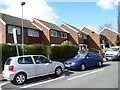
Houses on Union Road 2
by Alan Murray-Rust
geograph for square TL4659
Typical early 21st century semi-terraced houses
|
|
Campkin Road, Cambridge
by Alan Murray-Rust
geograph for square TL4661
Late 20th century terraced housing.
|
|
Housing on Holts Crest Way
by Alan Murray-Rust
geograph for square SE2833
Modern housing development on the site of a former chemical works, which in turn... (more)
|
|
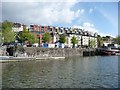
Colourful houses above Mardyke Wharf
by Christine Johnstone
geograph for square ST5772
In Old School Lane, on the north side of Bristol's Floating Harbour.
|
|
Three types of housing, Delverton Road, Kennington
by Christine Johnstone
geograph for square TQ3178
Modern and lived in at the corner of Tarver Road. Older and being repaired or... (more)
|
|
New houses off Hamlet Way
by Christine Johnstone
geograph for square SP1955
Seen from a northbound train.
|
|
Houses on Corston Walk, Newton Heath
by Christine Johnstone
geograph for square SD8700
On the north bank of the Rochdale Canal.
|
|
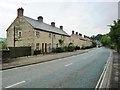
Old Park Avenue, Hillside Gardens
by Christine Johnstone
geograph for square SX9695
This new housing development is mapped on the Exeter street plan, but not yet on the OS.
|
|
Harris Place, Hillside Gardens
by Christine Johnstone
geograph for square SX9695
This new housing development is mapped on the Exeter street plan, but not yet on the OS.
|
|
2 to 12 Mill Gate
by Alan Murray-Rust
geograph for square SK7953
An attractive set of modern houses which blend with the existing older buildings.
|
|
Thornbank, off Wigan Road
by Alan Murray-Rust
geograph for square SD7008
Typical 1960s/70s housing development incorporating pedestrian routes and green... (more)
|
|
Langley Drive
by Alan Murray-Rust
geograph for square SD7008
1970s housing development adjacent to Croal Mill. Mainly replacing late 19th... (more)
|
|
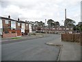
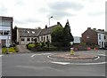
Chapel Hill
by Gerald England
geograph for square SJ9696
|
|
Kingsbrook Park
by Des Blenkinsopp
geograph for square TR1558
Bath comes to Canterbury. It doesn't seem quite right to tag this as... (more)
|
|
John Phillips Millennium Green, Tetbury
by Alan Murray-Rust
geograph for square ST8993
Created on the site of the town's cattle market. The houses fronting the... (more)
|
|
Friars Terrace at junction with Friars Rise
by Roger Templeman
geograph for square NY5230
|