Public Tags
Other tags: place:Stanmer
Showing images tagged with near:Stanmer tag.
|
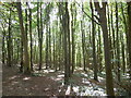
Millbank Woods
by Paul Gillett geograph for square TQ3310 At the north of Stanmer Park
|
|
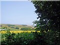
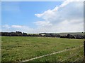
Fields West of Stanmer Park
by Paul Gillett for square TQ3410 Tags:
top:Farm, Fishery, Market GardeningX
FieldsX
top:Park and Public GardensX
near:Stanmer
top:Woodland, ForestX
|
|
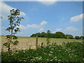
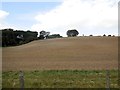
Fields north of Stanmer Park
by Paul Gillett geograph for square TQ3309 |
|
Farm near Moon's Corner
by Paul Gillett geograph for square TQ3410 |
|
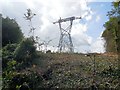
Pylon near Millbank Wood
by Paul Gillett geograph for square TQ3310 |
|
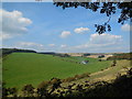
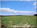
Downland near Bow Hill
by Paul Gillett geograph for square TQ3311 |
|
View from Bow Hill
by Paul Gillett geograph for square TQ3411 |
|
Shambledean Bottom
by Paul Gillett geograph for square TQ3411 viewed from Bow Hill
|