|
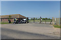
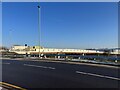
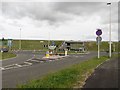
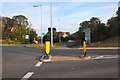
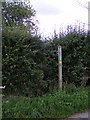
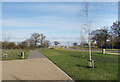
Entrance of New Road Sports & Leisure Centre
by Geographer
geograph for square TG4903
At the entrance to New Road Sports & Leisure Centre off New Road... (more)
|

|
New Road Sports & Leisure Centre sign
by Geographer
for square TG4903
At the entrance to New Road Sports & Leisure Centre off New Road... (more)
|

|
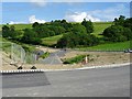
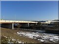
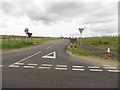
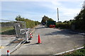
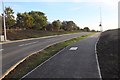
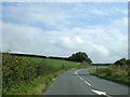
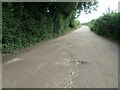
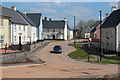
New road
by Richard Croft
geograph for square SK8051
New road between Bowbridge Lane and Staple Lane with a new inviting cycle path... (more)
|
|
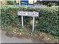
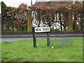
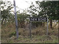
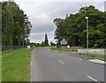
New Road sign
by Geographer
for square TM1131
On New Road near the former Mistley Clinic
|
|
The old and the new road
by Philip Halling
geograph for square SO1291
The old A489 can be seen to the left with the new road approaching the new... (more)
|
|
New Road, Bradwell
by Geographer
geograph for square TG4903
At the entrance to New Road Sports & Leisure Centre
Road No.C620... (more)
|
|
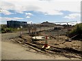
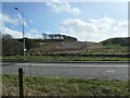
Construction site access, Morpeth Northern Bypass works
by Graham Robson
geograph for square NZ1786
An access off a minor road into one of the route of the new Morpeth Northern... (more)
|
|
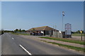
New Road sign
by Geographer
for square TL2211
On New Road at the junction with the B653 Brocket Road
|
|
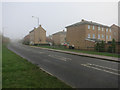
Cam Drive
by Hugh Venables
geograph for square TL5381
New road on the north side of Ely, with some new housing to the south. More new... (more)
|

|
New Road sign
by Geographer
for square TG1821
On New Road at the junction with The Heath & Church Lane near Mission Cottage
|
|
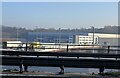
Etruria Valley Link Road two days before opening
by Jonathan Hutchins
geograph for square SJ8648
Seen from the far side of the A500, this is the western end of this 1km stretch... (more)
|
|
Etruria Valley Link Road two days before opening
by Jonathan Hutchins
geograph for square SJ8648
The western end of this 1km stretch of new road linking Festival Park and the... (more)
|
|
Etruria Valley Link Road two days before opening
by Jonathan Hutchins
geograph for square SJ8648
The western end of this 1km stretch of new road linking Festival Park and the... (more)
|
|
White Horse View, Fernham
by Vieve Forward
geograph for square SU2991
New houses in a new road.
|
|
Kings Farm Close, Longcot
by Vieve Forward
geograph for square SU2791
New houses on a new street.
|
|
New roundabout, Morpeth Northern Bypass
by Graham Robson
geograph for square NZ1786
One of two new roundabouts built at the western end of the new Morpeth Northern... (more)
|
|
New connecting road off St Leonard's Lane
by Graham Robson
geograph for square NZ1786
A new road built to connect St Leonard's Lane to the new road junction... (more)
|
|
New Road sign
by Geographer
for square TM1685
On New Road at the junction with Gissing Road
|
|
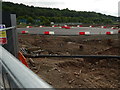
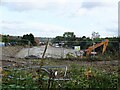
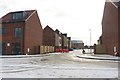
Excavations, Kirkstall Forge
by Rich Tea
geograph for square SE2436
Parts of the ground have been excavated, presumably to remove contaminations... (more)
|
|
The new road into the Kirkstall Forge site from Abbey Road
by Rich Tea
geograph for square SE2436
This new road was opened to traffic on 16th or 17th June 2016, giving access to... (more)
|
|
New road, Kingskerswell
by Derek Harper
geograph for square SX8767
Leaving Greenhill Road in the foreground, this new road cuts across the line of... (more)
|
|
New road near Kingskerswell
by Derek Harper
geograph for square SX8767
Replacing Yon Street, which has removed to make way for the new link road, being... (more)
|
|
New road, Kingskerswell
by Derek Harper
geograph for square SX8767
Not the link road itself, which is being prepared on the right, but a... (more)
|
|
New Road now Old Road
by Julian P Guffogg
geograph for square TQ5811
The western end of New Road has been abandoned for a real new road a few hundred... (more)
|
|
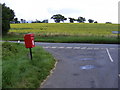
New Road & New Road Corner Postbox
by Geographer
geograph for square TM1958
Category: Road junction
At the junction with the B1077
Postbox No. IP14 8045
|
|
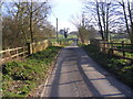
Hollow Lane (New Road) Bridge, Sibton
by Geographer
geograph for square TM3769
Category: Bridge
Looking towards the A1120 Yoxford Road
Road No.2607
|

|
New road & new housing
by Richard Croft
geograph for square SK8051
View NW from NCN Route 64 overbridge
|
|
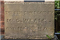
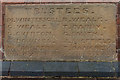
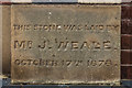
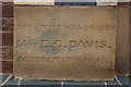
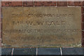
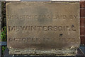
Foundation stone, former Zion Methodist Chapel, New Road
by Ian Capper
for square SO5175
One of six foundation stones dated 17 October 1878 on the former Zion Methodist... (more)
|
|
Foundation stone, former Zion Methodist Chapel, New Road
by Ian Capper
for square SO5175
One of six foundation stones dated 17 October 1878 on the former Zion Methodist... (more)
|
|
Foundation stone, former Zion Methodist Chapel, New Road
by Ian Capper
for square SO5175
One of six foundation stones dated 17 October 1878 on the former Zion Methodist... (more)
|
|
Foundation stone, former Zion Methodist Chapel, New Road
by Ian Capper
for square SO5175
One of six foundation stones dated 17 October 1878 on the former Zion Methodist... (more)
|
|
Foundation stone, former Zion Methodist Chapel, New Road
by Ian Capper
for square SO5175
One of six foundation stones dated 17 October 1878 on the former Zion Methodist... (more)
|
|
Foundation stone, former Zion Methodist Chapel, New Road
by Ian Capper
for square SO5175
One of six foundation stones dated 17 October 1878 on the former Zion Methodist... (more)
|

|
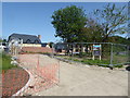
Too new for the map (September 2016)
by Bill Harrison
geograph for square NJ8911
New roads and houses at the Stoneywood Park development.
|
|
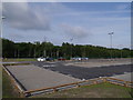
Car park for the new Kirkstall Forge Station
by Rich Tea
geograph for square SE2436
This is one of 2 car parks for the new Kirkstall Forge station. The picture is... (more)
|
|
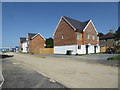
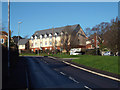
New residential development, east end of New Road, Teignmouth
by Robin Stott
geograph for square SX9474
Bovis is developing hillside fields for its Marine View housing estate north of... (more)
|
|
New road at Straiton (2)
by Jim Barton
geograph for square NT2766
The new Edgefield Relief Road seen from the junction with the B702 at Straiton.
|
|
New road at Straiton
by Jim Barton
geograph for square NT2766
A new junction at the roundabout on the B702 at Straiton. The notice announces... (more)
|
|
New Road, north of Seavington St Mary
by David Smith
geograph for square ST4014
The road on the right is Church Lane to the village. The road is marked as... (more)
|
|
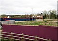
Former Bond Worth carpet factory site, Severn Road, Stourport-on-Severn, Worcs
by P L Chadwick
geograph for square SO8171
This was the site of Bond Worth's Stourport-on-Severn carpet factory which... (more)
|
|
New road link, Coneygrey Spinney
by Alan Murray-Rust
geograph for square SK7346
The access to the housing estate was severed by the widening of the A46 and a... (more)
|
|
Footpath to the B1077
by Geographer
for square TM1958
Category: Footpath
Off New Road near New Road Corner Postbox
|
|
New Road, a byway on the Writers Walk
by Christine Johnstone
geograph for square SU7035
Connecting Upper Farringdon and the A32. Like many roads that are... (more)
|

|
A New Road
by Des Blenkinsopp
geograph for square SU1282
A brand new road goes through fields to end at a roundabout by a derelict... (more)
|
|
A487, old and new
by Christine Johnstone
geograph for square SH5065
In the foreground, the old A487 from Y Felinheli to Caernarfon [now the A4871].... (more)
|
|
New link road in an old cutting
by Ian Calderwood
geograph for square SK3120
This old cutting on the former Midland Railway Swadlincote and Woodville... (more)
|
|
View along Franklin Gardens
by Des Blenkinsopp
geograph for square SU5391
What will be the main road through a large area of new housing north of the... (more)
|

|
The new road layout on the A1079 at Shiptonthorpe roundabout
by Martin Dawes
geograph for square SE8542
This new road has swung over a field northeast of the original and in effect has... (more)
|
|
Ffordd Tir Brychiad, Edlogan Wharf estate
by M J Roscoe
geograph for square ST2997
Newly completed residential road on new large housing development. Notice lack... (more)
|
|
New Road, Ascent Homes development, Ellington
by Graham Robson
geograph for square NZ2891
A new road built as part of the Wayside Point housing development by Ascent... (more)
|