Public Tags
Tag: Oxfordshire·Way
Other tags: long distance path:Oxfordshire Way
Showing latest 50 of 138 images tagged with Oxfordshire Way tag.
|
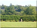
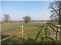
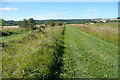
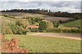
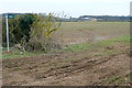
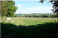
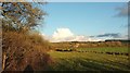
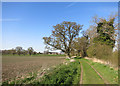
Corn Rows by the Oxfordshire Way
by Colin Smith geograph for square SP3320 Harvested cereal rows are visible on the rolling farm land beside Catsham Lane.... (more)
|
|
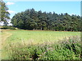
Greenhill Copse
by Colin Smith geograph for square SP3321 Pine wood beside the Oxfordshire Way; seen from Little Wood.... (more)
|
|
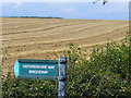
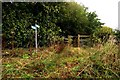
Oxfordshire Way, West of Dean Grove
by Colin Smith geograph for square SP3321 Path following a hedgerow and field boundary. The sign was informing walkers of... (more)
Tags:
Oxfordshire Way
top:PathsX
|
|
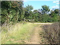
Oxfordshire Way by Grove Lane
by Colin Smith geograph for square SP3421 At the southern end of grove Lane, the path takes a right angled bend at Dean... (more)
Tags:
Oxfordshire Way
top:PathsX
|
|
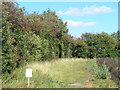
Oxfordshire Way by Dean Grove
by Colin Smith geograph for square SP3421 Passing between a bean field and a dense piece of deciduous woodland.... (more)
Tags:
Oxfordshire Way
top:PathsX
|
|
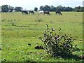
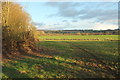
Grazing in the Evenlode Valley
by Colin Smith geograph for square SP3420 Bucolic scene on the Oxfordshire Way, west of Charlbury.... (more)
|
|
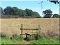
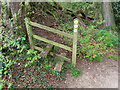
Stile on the Oxfordshire Way
by Colin Smith geograph for square SP3420 Beside a stubbly field in the Evenlode Valley, west of Charlbury.... (more)
|
|
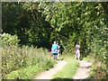
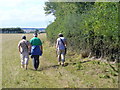
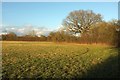
Rambling on the Oxfordshire Way
by Colin Smith geograph for square SP3420 Crossing a grassy field with sheep grazing on it, Evenlode Valley, west of... (more)
|
|
Oxfordshire Way, Evenlode Valley
by Colin Smith geograph for square SP3520 Pastoral scene with hedgerow and tall hedgerow, west of Charlbury.... (more)
|
|
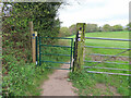
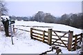
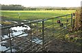
Gate on Oxfordshire and Chiltern Way footpaths
by David Hawgood geograph for square SU7291 AS well as signs for Oxfordshire Way and Chiltern Way where they cross... (more)
Tags:
brewer:BrakspearX
Chiltern SocietyX
long distance path:Chiltern WayX
Footpath SignX
subject:GateX
type:GeographX
top:LowlandsX
long distance path:Oxfordshire WayX
top:PathsX
Public FootpathX
Restricted Byway SignX
|
|
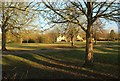
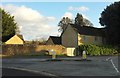
Green, Wyck Rissington
by Derek Harper geograph for square SP1821 From the Oxfordshire Way and Diamond Way a few metres from where they meet the... (more)
Tags:
Access LandX
Common LandX
CottagesX
long distance path:Diamond WayX
type:GeographX
top:Housing, DwellingsX
top:LowlandsX
long distance path:Oxfordshire WayX
top:Park and Public GardensX
TreesX
Unfenced RoadX
Village GreenX
top:Village, Rural SettlementX
|
|
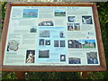
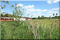
Information Board at Bix Bottom
by David Hillas for square SU7286 This photo shows the information board which has been sponsored by Bix &... (more)
Tags:
Bix ValleyX
type:Close LookX
Information BoardX
long distance path:Oxfordshire WayX
Oxfordshire Way
church:St JamesX
St James ChurchX
top:Village, Rural SettlementX
|
|
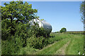
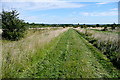
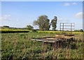
Tank by the Oxfordshire Way
by Des Blenkinsopp geograph for square SP6009 The Oxfordshire Way is a well defined grassy farm track along here.
The tank... (more)
|
|
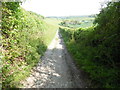
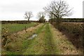
Oxfordshire Way at Danesbrook Farm
by Des Blenkinsopp geograph for square SP5910 Leaving the neat tarmac drive to Danesbrook Farm, the Oxfordshire Way quickly... (more)
|
|
The Oxfordshire Way near Bix Bottom
by David Hillas geograph for square SU7287 This photo shows the Oxfordshire Way track looking south towards Bix Bottom,... (more)
|
|
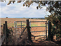
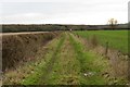
Gate on the Oxfordshire Way
by Des Blenkinsopp geograph for square SP5313 The Oxfordshire Way leaves Noke and heads in more or less a straight line over... (more)
|
|
The Oxfordshire Way at Albury
by Des Blenkinsopp geograph for square SP6505 The Oxfordshire Way goes through the hamlet of Albury. Just a few houses and a... (more)
|
|
The Oxfordshire Way on High Street
by Steve Daniels geograph for square SP5611 The Oxfordshire Way runs up this extended High Street in Beckley.
|
|
Oxfordshire Way towards Bledington
by Graham Horn geograph for square SP2121 From the higher land at Gawcombe there is a great view eastwards. Here, you can... (more)
|
|
Oxfordshire Way towards Bledington
by Graham Horn geograph for square SP2221 Even though we are in Gloucestershire, the Oxfordshire Way long distance path... (more)
|
|
Oxfordshire Way towards Gawcombe
by Graham Horn geograph for square SP2222 Even though we are now in Gloucestershire the Oxfordshire Way long distance path... (more)
|
|
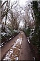
Stile on Oxfordshire Way public footpath near Hollandridge Farm
by David Hawgood for square SU7291 Leaving a field the path goes down steeply through a beech wood to a bridleway... (more)
Tags:
Chiltern SocietyX
type:Close LookX
top:LowlandsX
long distance path:Oxfordshire WayX
top:PathsX
Public FootpathX
subject:StileX
top:Woodland, ForestX
|
|
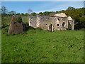
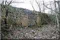
Remains of St James' Church, Bix Bottom
by David Hillas geograph for square SU7286 This photo shows the remains of the Norman St James' Church on the... (more)
Tags:
Bix ValleyX
Chapel (Remains Of)X
Chapel (Ruined)X
type:GeographX
long distance path:Oxfordshire WayX
Oxfordshire Way
Ruined ChapelX
St. James ChurchX
top:Village, Rural SettlementX
|
|
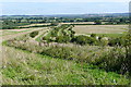
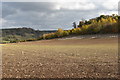
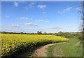
Autumn-sown cereal crop below Pishillbury Wood
by Simon Mortimer geograph for square SU7289 Looking south-east from the Oxfordshire Way. A strip of game cover runs along... (more)
Tags:
place:ChilternsX
ChilternsX
top:Farm, Fishery, Market GardeningX
subject:FieldX
top:Flat LandscapesX
type:GeographX
Newly-Sown FieldX
long distance path:Oxfordshire WayX
Oxfordshire Way
Recently Sown CropX
Recently Sown FieldX
Winter Sown CropsX
|
|
Fields in the dry valley below Pishill church
by Simon Mortimer geograph for square SU7289 Looking north east from the Oxfordshire Way long distance path on the lane... (more)
|
|
Gate to the bridleway and Oxfordshire Way
by Steve Daniels geograph for square SP5511 The Oxfordshire Way runs across the Common to Noke.
|
|
Former park exit
by Graham Horn geograph for square SP4117 Three long distance paths, Oxfordshire Way, Wychwood Way and Shakespeare's... (more)
|
|
Approaching Blenheim Park
by Graham Horn geograph for square SP4117 Four long distance routes use this footpath (to the left of the hedge), all... (more)
|
|
Akeman Street
by Graham Horn geograph for square SP4117 The Roman Road Akeman Street is now used by this footpath, the Oxfordshire Way.... (more)
Tags:
roman road:Akeman StreetX
top:Farm, Fishery, Market GardeningX
FarmlandX
Long Distance PathX
Oxfordshire Way
top:PathsX
Shakespeare WayX
|
|
Station Road, Bourton-On-The-Water
by Derek Harper geograph for square SP1620 Followed by the Oxfordshire Way, although neither are we in Oxfordshire, nor is... (more)
|
|
Four Way Footpaths
by Des Blenkinsopp geograph for square SU7291 The Oxfordshire Way and the Chiltern Way cross over here.
|
|
Boot-washing, River Eye
by Derek Harper geograph for square SP1721 Alas, whichever way you are travelling along this stretch of the Oxfordshire Way... (more)
|
|
Greystones Farm nature reserve
by Graham Horn geograph for square SP1721 This is the route through the nature reserve followed by the Oxfordshire Way and... (more)
|
|
Broken wall, Station Road, Bourton-on-The-Water
by Derek Harper geograph for square SP1620 The tree roots have effectively destroyed the roadside wall. This is on the... (more)
Tags:
top:City, Town CentreX
Damaged WallX
long distance path:Diamond WayX
type:GeographX
top:LowlandsX
long distance path:Oxfordshire WayX
Recreation GroundX
top:Roads, Road TransportX
top:Sport, LeisureX
TreeX
|
|
Difficulties on the Oxfordshire Way
by Derek Harper geograph for square SP1821 And the Diamond Way, as both trails use this double gate to access bridleway HRW... (more)
Tags:
top:Boundary, BarrierX
BridlewayX
long distance path:Diamond WayX
top:Farm, Fishery, Market GardeningX
type:GeographX
top:LowlandsX
MudX
long distance path:Oxfordshire WayX
top:PathsX
PuddlesX
Sheep PastureX
gates:SteelX
Trees on Field BoundariesX
|
|
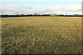
Field and boundary near Wyck Rissington
by Derek Harper geograph for square SP1821 Looking southeast from the Oxfordshire Way and Diamond Way.
Tags:
long distance path:Diamond WayX
top:Farm, Fishery, Market GardeningX
type:GeographX
Grass FieldX
HedgeX
top:LowlandsX
long distance path:Oxfordshire WayX
gate:SteelX
Trees on Field BoundaryX
|
|
Oxfordshire Way nearing Wyck Rissington
by Derek Harper geograph for square SP1821 Plus the Diamond Way, a little further along bridleway HRW 7/2 from SP1821 : Oxfordshire Way nearing Wyck Rissington.
Tags:
BridlewayX
long distance path:Diamond WayX
top:Farm, Fishery, Market GardeningX
FarmlandX
type:GeographX
HouseX
top:Housing, DwellingsX
top:LowlandsX
long distance path:Oxfordshire WayX
top:PathsX
fence:Post and WireX
TreeX
|
|
Oxfordshire Way nearing Wyck Rissington
by Derek Harper geograph for square SP1821 Along with the Diamond Way, following bridleway HRW 7/2 round to the left side... (more)
Tags:
BridlewayX
long distance path:Diamond WayX
top:Farm, Fishery, Market GardeningX
FarmlandX
type:GeographX
HedgeX
top:LowlandsX
long distance path:Oxfordshire WayX
top:PathsX
fence:Post and WireX
top:Village, Rural SettlementX
|
|
Field and boundary near Wyck Rissington
by Derek Harper geograph for square SP1821 An eastern corner of the large triangular field that is shown in SP1821 : Oxfordshire and Diamond Ways... (more)
Tags:
long distance path:Diamond WayX
top:Farm, Fishery, Market GardeningX
type:GeographX
HedgeX
top:LowlandsX
long distance path:Oxfordshire WayX
PastureX
Trees on Field BoundaryX
|
|
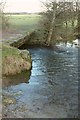
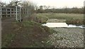
River Dikler
by Derek Harper geograph for square SP1821 A close view of the river crossing shown in SP1821 : Sleeper footbridge, with both the... (more)
Tags:
BridlewayX
long distance path:Diamond WayX
river:DiklerX
top:Farm, Fishery, Market GardeningX
FootbridgeX
type:GeographX
top:LowlandsX
long distance path:Oxfordshire WayX
PastureX
top:PathsX
top:Rivers, Streams, DrainageX
TreesX
|
|
Ford on the Eye
by Derek Harper geograph for square SP1721 Shown in a better light in SP1721 : Rocks in the River (alas, the sun has retreated for us,... (more)
Tags:
BridlewayX
Debris ScreenX
long distance path:Diamond WayX
river:EyeX
top:Farm, Fishery, Market GardeningX
FootbridgeX
FordX
type:GeographX
top:LowlandsX
long distance path:Oxfordshire WayX
PastureX
top:PathsX
top:Rivers, Streams, DrainageX
|
|
Oxfordshire and Diamond Ways
by Derek Harper geograph for square SP1821 Rising slightly as they follow bridleway HRW 7/3 across the field shown in... (more)
|
|
Road junction, Bourton-On-The-Water
by Derek Harper geograph for square SP1720 On the right, Station Road swings around a bend; to the left, Roman Way heads... (more)
Tags:
BollardsX
type:GeographX
top:Historic Sites and ArtefactsX
top:Housing, DwellingsX
Listed BuildingX
OutbuildingsX
long distance path:Oxfordshire WayX
top:PathsX
Road JunctionX
top:Roads, Road TransportX
gate:TimberX
WallX
|
|
The Oxfordshire Way, Ascott under Wychwood
by Des Blenkinsopp geograph for square SP3019 Follow the yellow crop road.
Tags:
Oxfordshire Way
top:PathsX
|
|
Beside the Oxfordshire Way
by Des Blenkinsopp geograph for square SP3019 Tags:
Oxfordshire Way
top:PathsX
|
|
The Oxfordshire Way near Shirburn
by Des Blenkinsopp geograph for square SU6996 Tags:
Oxfordshire Way
top:PathsX
|
|
The Oxfordshire Way to Beckley
by Steve Daniels geograph for square SP6009 |
|
The Oxfordshire Way to Waterperry
by Steve Daniels geograph for square SP6009 |
|
The Oxfordshire Way near Tackley
by Steve Daniels geograph for square SP4719 Tags:
Oxfordshire Way
top:PathsX
|
|
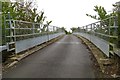
Bridge over the M40 to Waterperry
by Steve Daniels geograph for square SP6107 The Oxfordshire Way crosses this bridge.
|