|
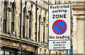
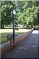
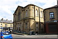
"Restricted parking zone" sign, Belfast (February 2018)
by Albert Bridge
for square J3474
|
|
Parking sign
by Bob Harvey
for square NY7064
|
|
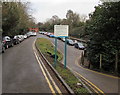
No Parking on Harmondsworth Lane
by Des Blenkinsopp
geograph for square TQ0677
Harmondsworth Lane is long, straight, a bit middle of nowhere-ish and,... (more)
|
|
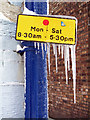
A frozen parking restriction sign
by Walter Baxter
for square NT4936
Icicles hang from this sign at Market Street in Galashiels.
|
|
Boundary wall of Stanhope Gardens, Stanhope Road North
by Roger Templeman
geograph for square NZ2814
|
|
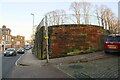
Abutment of bridge of dismantled railway at east end of Port Road
by Roger Templeman
geograph for square NY3955
|
|
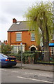
#77 Appleton Gate
by Roger Templeman
geograph for square SK8054
|
|
Parking restrictions notice at the entrance to Llanishen railway station car park, Cardiff
by Jaggery
geograph for square ST1882
The long narrow car park on the west side of the station is for Arriva Trains... (more)
|
|
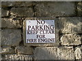
Beware of parked fire engines
by Neil Owen
for square ST7960
Until recently, this section of The Hill had standard 'No Parking'... (more)
|
|
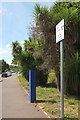
Parking meter, Newton Road
by Derek Harper
geograph for square SX8966
This stretch of the former main road finds itself between the hospital and a new... (more)
|
|
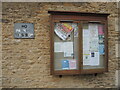
Notices for pedestrians only
by Neil Owen
for square ST9077
The board in Kington St Michael has parking restrictions.
|
|
Public Toilets, The Gill, Ulverston
by Adrian Taylor
geograph for square SD2878
These pay to enter toilets are conveniently placed for walkers starting out on... (more)
|
|
#15 St Peters Road at Avon Street junction
by Phil Richards
geograph for square SK5903
|
|
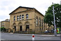
Former YMCA, Little Horton Lane at Trinity Road junction
by Roger Templeman
geograph for square SE1532
|
|
Houses of Wellington Road at Sleaford Road junction
by Roger Templeman
geograph for square SK8054
|
|
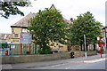
Whetley Academy, Whetley Lane
by Roger Templeman
geograph for square SE1433
|
|
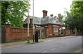
Former Council Office at junction of Carlisle Road and Lumb Lane
by Roger Templeman
geograph for square SE1534
|

|
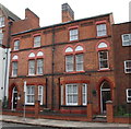
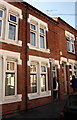
#26 Whitfield Street at New Street junction
by Roger Templeman
geograph for square SK8053
|
|
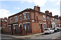
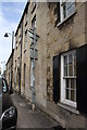
St Leonard's Street houses
by Roger Templeman
geograph for square TF0307
|

|
A faded prohibition
by Bob Harvey
for square TF2035
Long lost parking prohibition in the market place in Donington
|
|
No. 42 Filbert Street East
by Phil Richards
for square SK5803
|
|
Nos. 199 and 201 (Englefield) Bradford Road
by Roger Templeman
geograph for square SE1436
Ordnance Survey records indicate that in 1957 a benchmark levelled at 101.489m... (more)
|
|
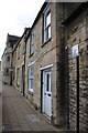
Nos. 63 and 65 Crown Street
by Phil Richards
geograph for square TF1801
|
|
Nos. 33 and 31 Belham Road
by Phil Richards
geograph for square TF1801
|
|
#40 Park Road, Nene Valley Day Nursery
by Phil Richards
geograph for square TL1999
|
|
#16 High Street
by Roger Templeman
for square SE1423
|
|
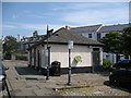
Fire Engine parking?
by Neil Owen
for square ST7960
This section of road and pavement close to the bottom of The Hill have some new... (more)
|
|
#104 and development site on west side of St George's Road
by Luke Shaw
geograph for square SP3478
Ordnance Survey documents indicate that in 1959 a benchmark levelled at 86.688m... (more)
|
|
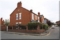
Nos.112,110 & 108 Thornton Road
by Roger Templeman
geograph for square SE1533
|
|
#52 Bargrange Avenue and #119 Bradford Road
by Roger Templeman
geograph for square SE1436
|
|
No. 412 Lincoln Road
by Phil Richards
geograph for square TF1800
|
|
Outbuilding and Nos. 1 and 3 St James Road
by Phil Richards
geograph for square SK6003
Ordnance Survey documents indicate that in 1965 a benchmark levelled at 84.704m... (more)
|
|
Nos. 46 and 48 Highfield Street (Elliot Residential Care Home)
by Phil Richards
geograph for square SK5903
|
|
#138 Westcotes Drive, a care home
by Roger Templeman
geograph for square SK5703
|
|
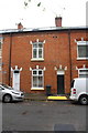
Houses on Skipworth Street
by Roger Templeman
for square SK6003
|
|
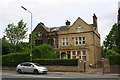
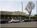
Worthing Hospital
by Peter Holmes
geograph for square TQ1503
Viewed from Homefield Road.
|
|
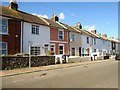
Cranworth Road BN11 2JE
by Peter Holmes
geograph for square TQ1503
Terraced cottages.
|
|
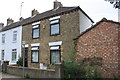
Houses on St Leonard's Street
by Roger Templeman
for square TF0307
|